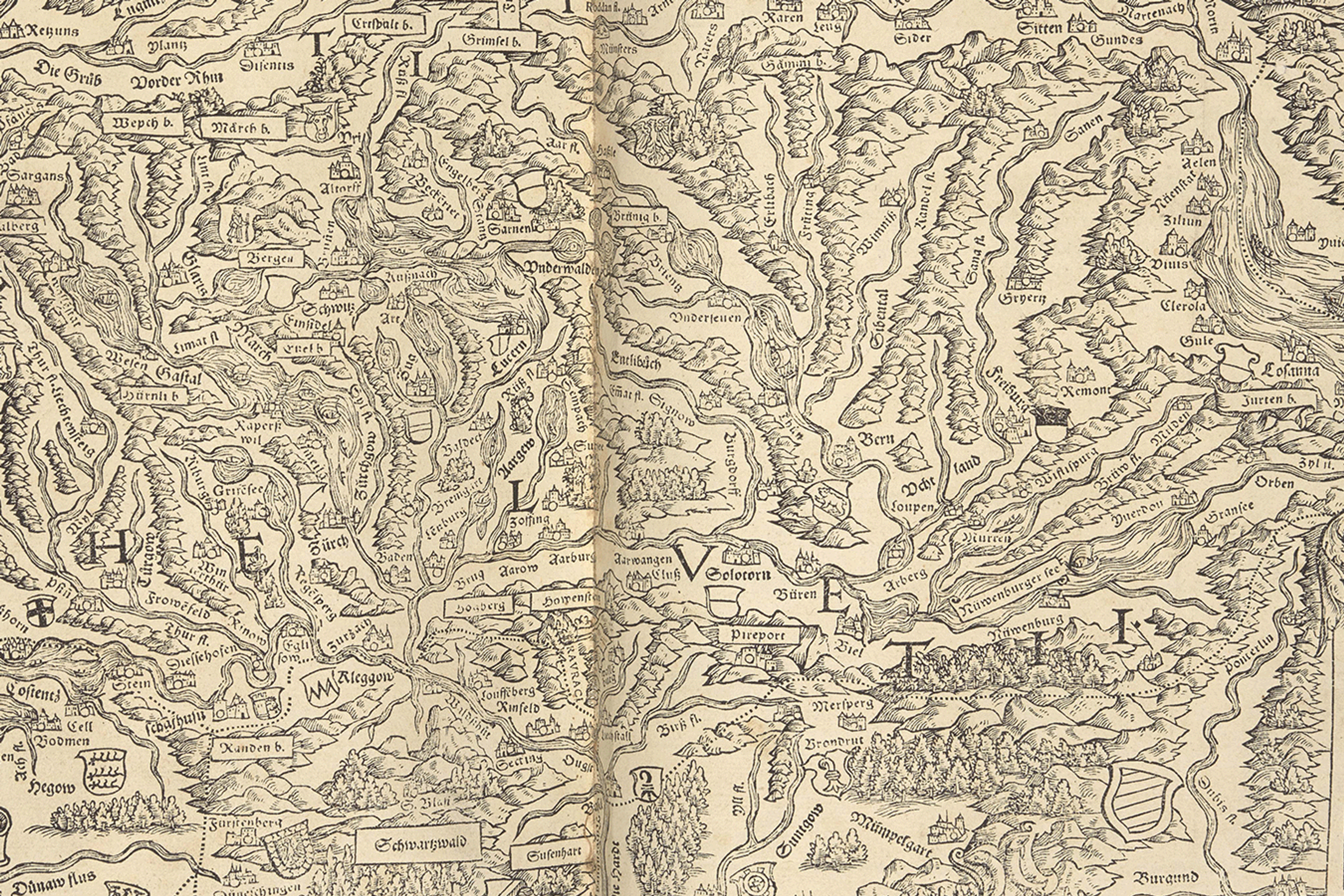
Helvetia!
This page celebrates the small but beautiful country of Switzerland, home of The Sunderland Collection. Join us as we discover some of the magnificent maps that depict Switzerland over time, including from one of the earliest European national atlases.
Introduction
A landlocked European nation, Switzerland is made up of 26 cantons, four languages, and diverse landscapes.
Before it was conquered by the ancient Roman empire in the second century BCE, the Celtic Helvetii tribe inhabited the region, eventually inspiring the name Helvetia - or the Confoederatio Helvetica (Swiss Confederation).
Switzerland was officially founded in 1291, when three cantons - Uri, Schwyz, and Unterwalden - forged an alliance, and swore the Rütli Oath join forces against the encroaching Habsburg Dynasty. Learn more about this legendary origin story below.
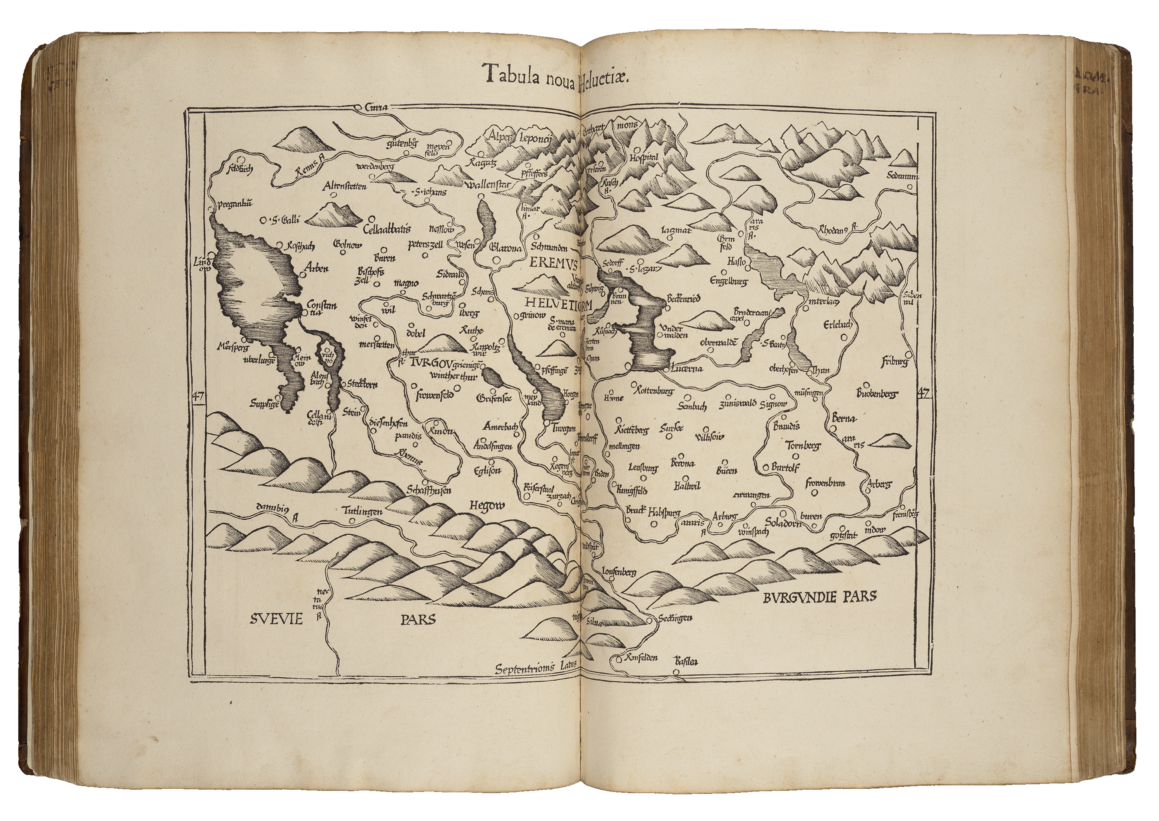
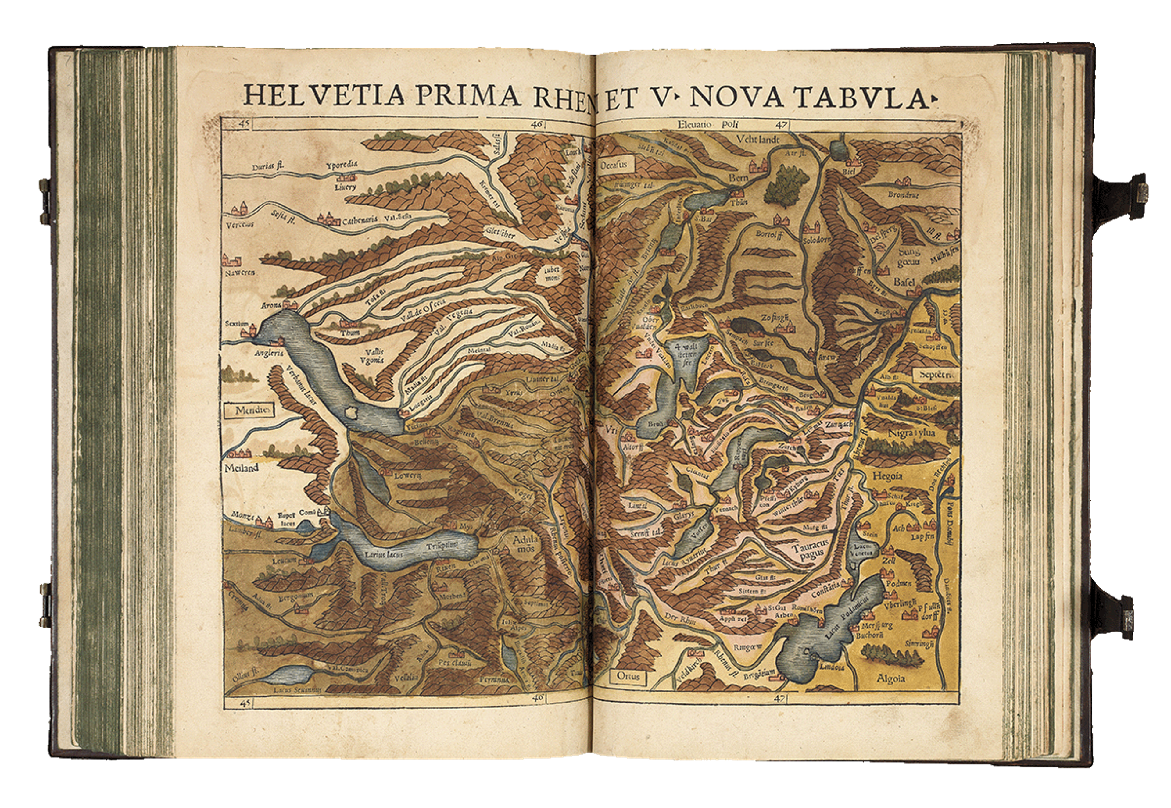
Switzerland from Servetus’s edition of Fries’s Geographia (1541), one of the earliest printed maps of the country.
By the fifteenth century, the Swiss Confederation transitioned from a military alliance into a cultural and intellectual sanctuary for followers of humanism - an ethos focusing on human connection, science, and reason.
The Reformation of the European Christian church - which challenged the Catholic church and gave rise to Protestantism - was sparked in Switzerland by Huldrych Zwingli (1484–1531). Not long after, John Calvin established his reformed leadership in Geneva in 1541.
The Reformation further drove Switzerland’s transformation into a centre for religious and secular ideas, finance, and governance.
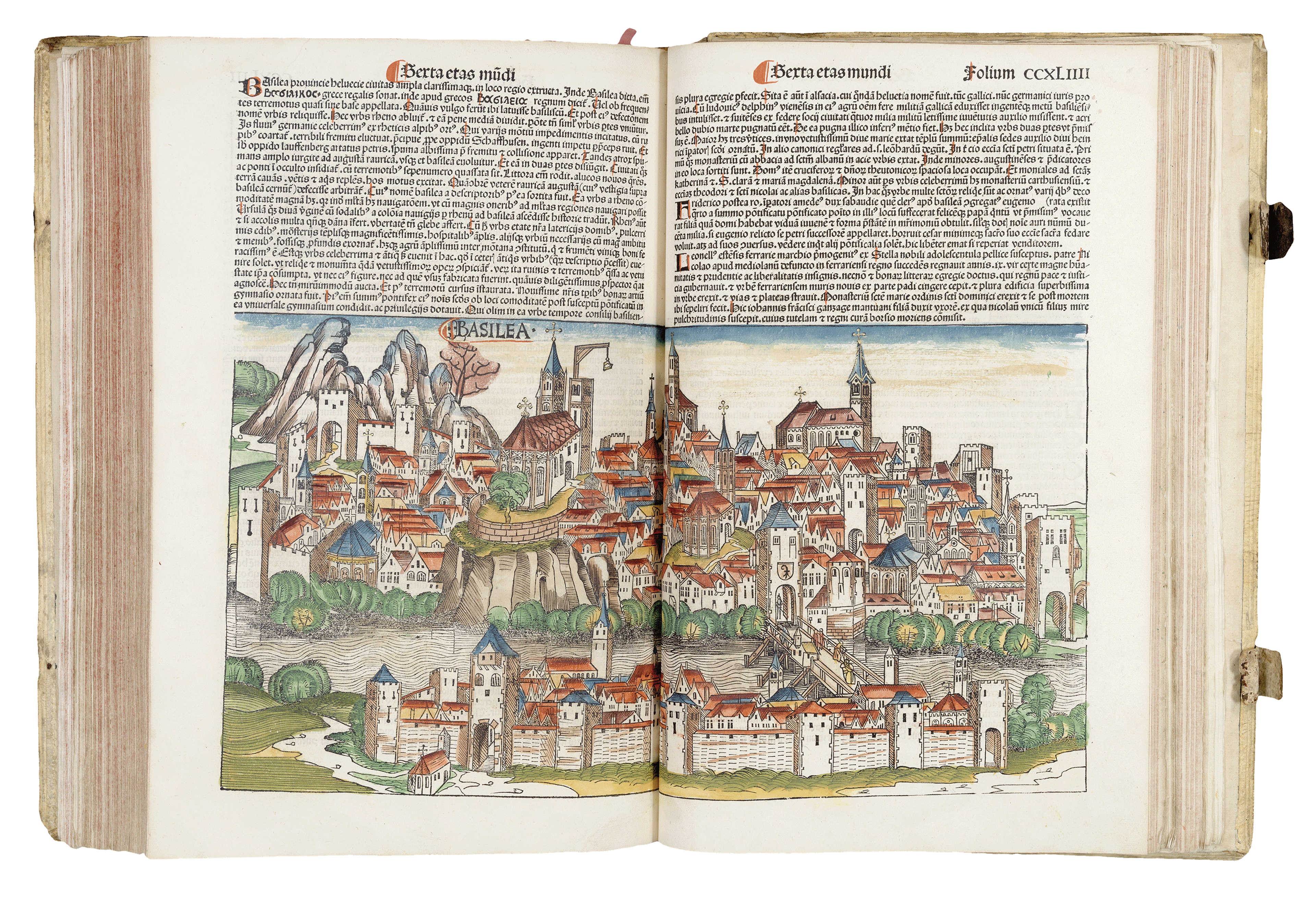
Panorama of Basel from Hartman Schedel’s Nuremberg Chronicle (1493)
At the heart of these developments was the University of Basel, founded in 1460 by Pope Pius II (1405-1464).
While many European universities censored new ideas, Basel established was known for allowing open discourse and debate on the latest theories about the cosmos and religion.
The city of Basel also earned fame as a printing capital following Johannes Gutenberg's ground-breaking invention of the printing press and moveable type in 1440. You can find out more about the history of early book printing in Europe here.
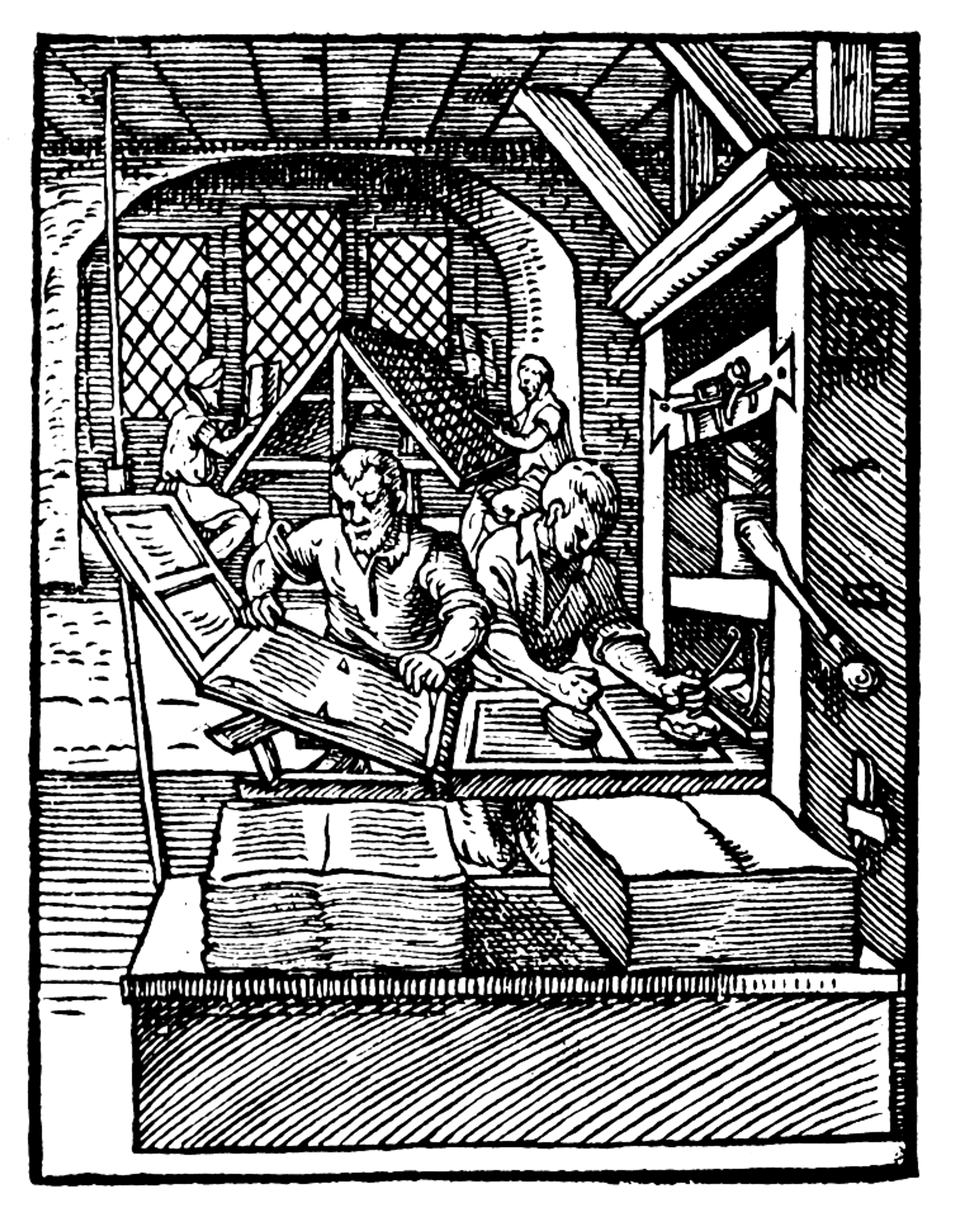
Woodcut from 'Das Ständebuch' (1586) by Jost Amman. Public Domain, via Wikimedia Commons
The printing press offered a faster, cheaper, and more accurate means of reproducing texts; it also helped to standardise spelling, grammar, and terminology. This technological leap enabled scholars across Europe to access texts and foster communities, encouraging debate and collaboration. As books became more affordable, works on theology and science reached audiences beyond elite circles.
Just twenty years later, Basel had grown into a paper-making and publishing powerhouse, rivalling the output of Venice, Lyon, and Strasbourg.
This prosperous environment attracted iconic Swiss artists like Hans Holbein the Younger (c1497-1543) to collaborate with regional printers.
From the sixteenth century to the present day, Switzerland’s cultural reach and success has flourished in part due to by significant universities and libraries, a thriving local paper and publishing industry, and a strategic position at the heart of Europe.
You can find out more about the history of Switzerland here.
The First Swiss National Atlas
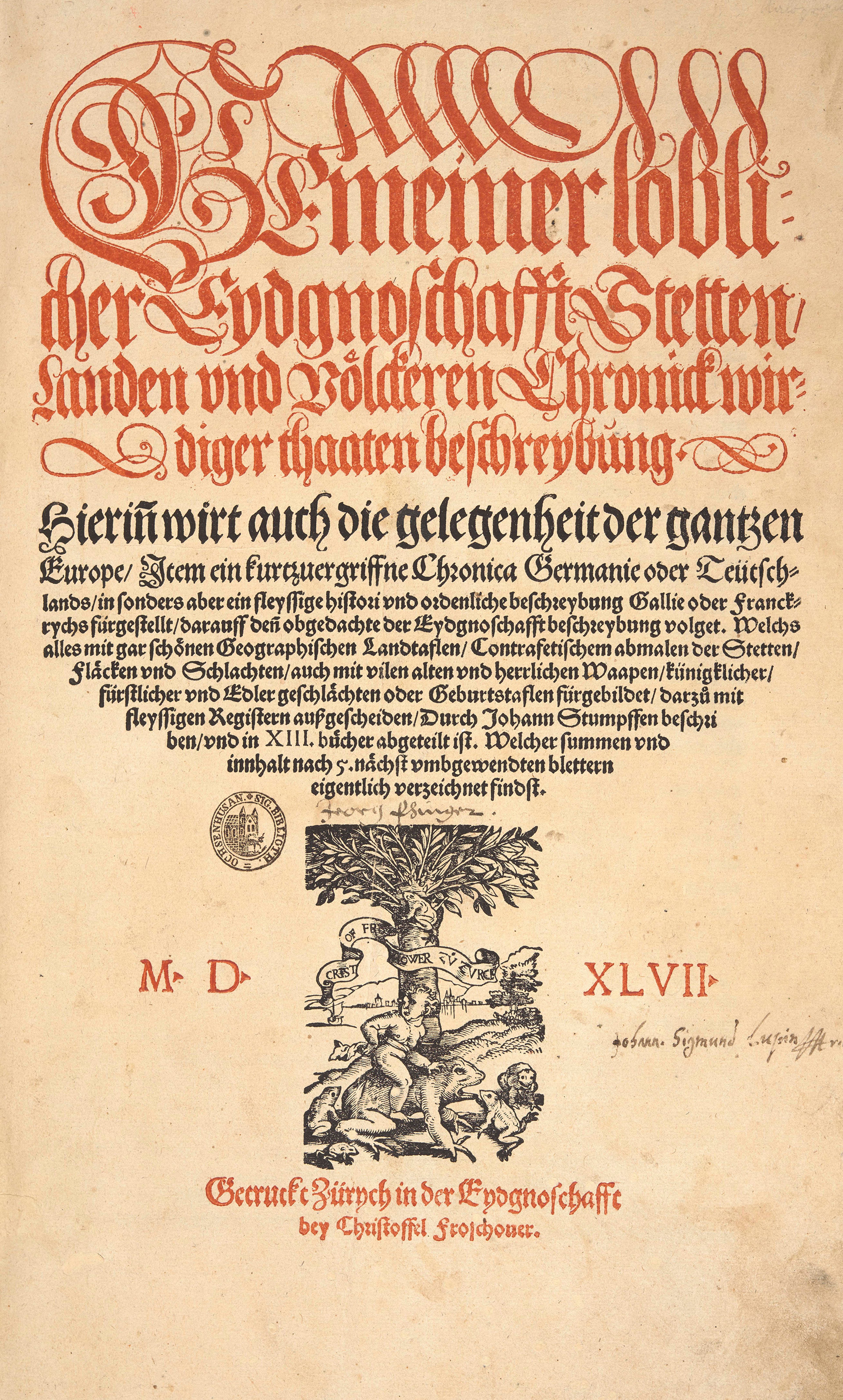
One of the important early books produced in Switzerland is Johann Stumpff’s Chronik der Eidgenossenschaft or Chronicle of the Confederation (1547, Zürich).
It is cited as the first 'national' atlas in Europe, due to its detailed and exhaustive series of Swiss maps. It is also famous for being the first atlas of Switzerland, and the first Protestant chronicle of the world.
The Sunderland Collection is proud to own a presentation copy of this beautiful volume, which was intended for gifting to influential patrons.
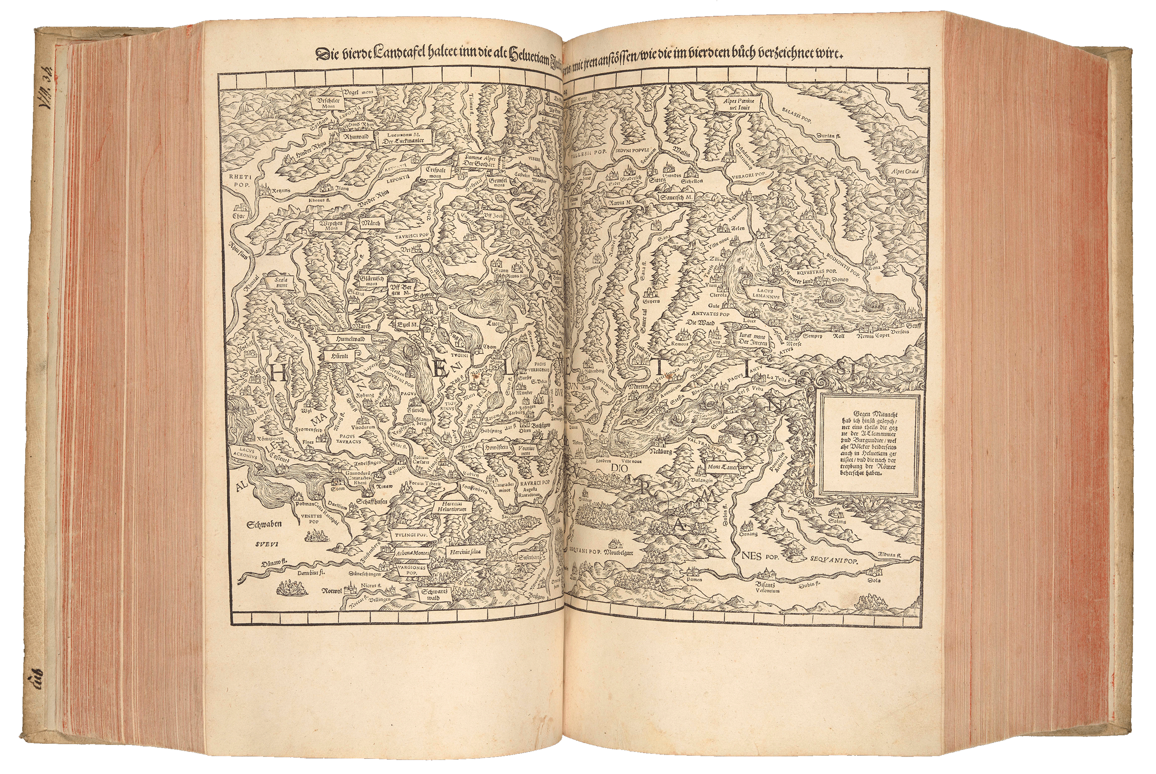
Map of Helvetii from Stumpff’s Chronik (1547)
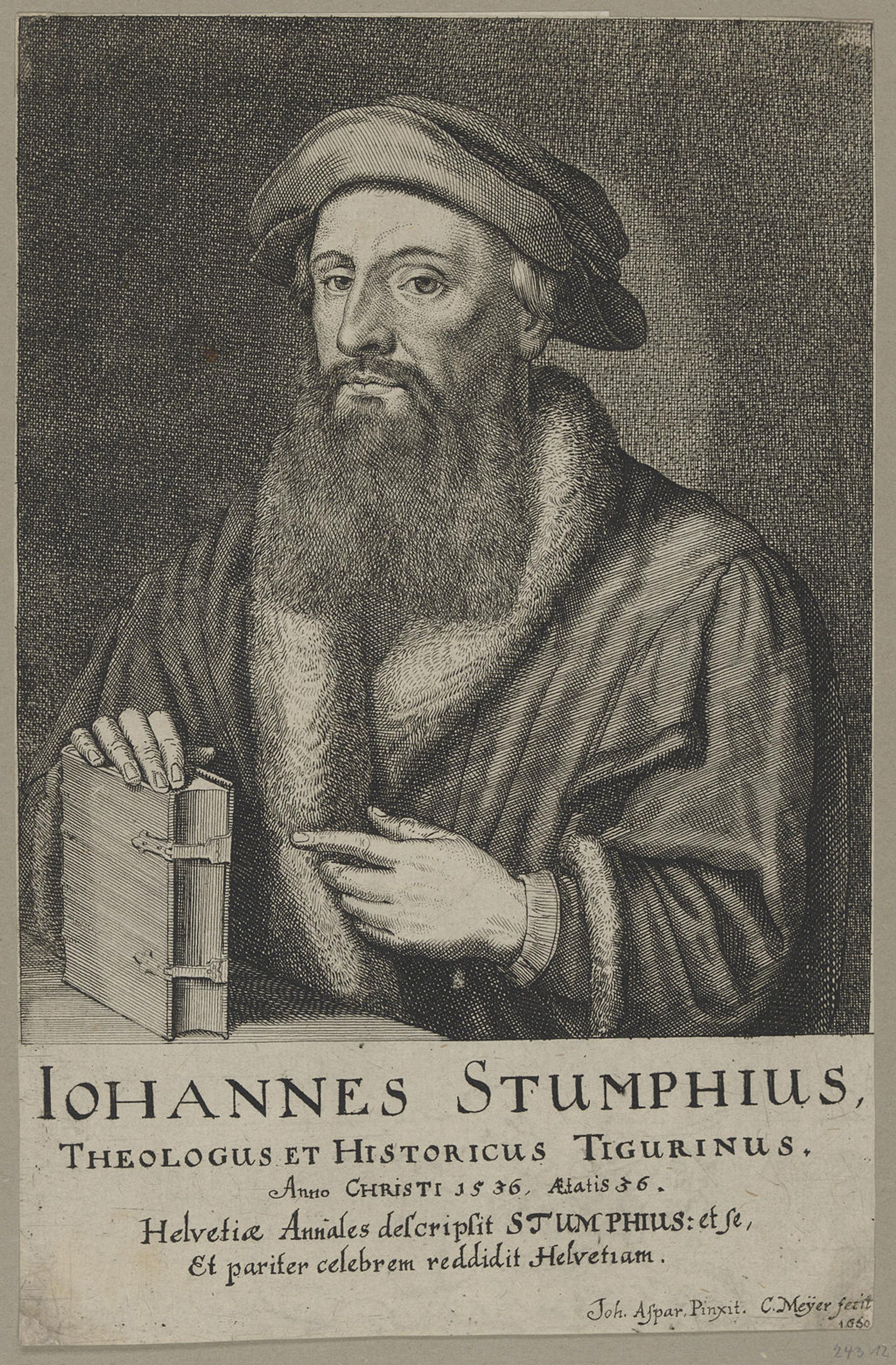
Portrait of Johannes Stumpff (c.1536). Public Domain.
Johann Stumpff (1500-c.1578) was a theologian, cartographer and historian. He was born in Bruchsal, Germany, and educated in Strasbourg and Heidelberg.
In 1520, he joined the Catholic military order of the Knights Hospitaller. He was later ordained as a priest in Basel, and made responsible for the diocese of Bubikon in the canton of Zürich.
The full title of Stumpff’s major work is the Chronicle of the Confederation: A Description of the Cities, Regions and People of the Laudable Confederation as well as a Chronicle of the Worthy Deeds.
This huge book was first officially published in 1548, but preceded by a run of 30 presentation copies in 1547. A second edition was published by Stumpff's son, Johann Rudolf in 1586, and a smaller third edition was released twenty years later under the updated title Schweytzer Chronick.
The example held by The Sunderland Collection is one of the few dedication copies that have survived. This limited run was pre-circulated to representatives of the Thirteen Old Cantons to promote the book, and was possibly also intended for the famous Frankfurt Book Fair.
The Chronicle contains twenty-three maps; thirteen of which were brand new and created in partnership with the Swiss historian and statesman Aegidius Tschudi (1505–1572). A further ten regional maps were made with the theologian and cartographer Johannes Honter (1498–1549).
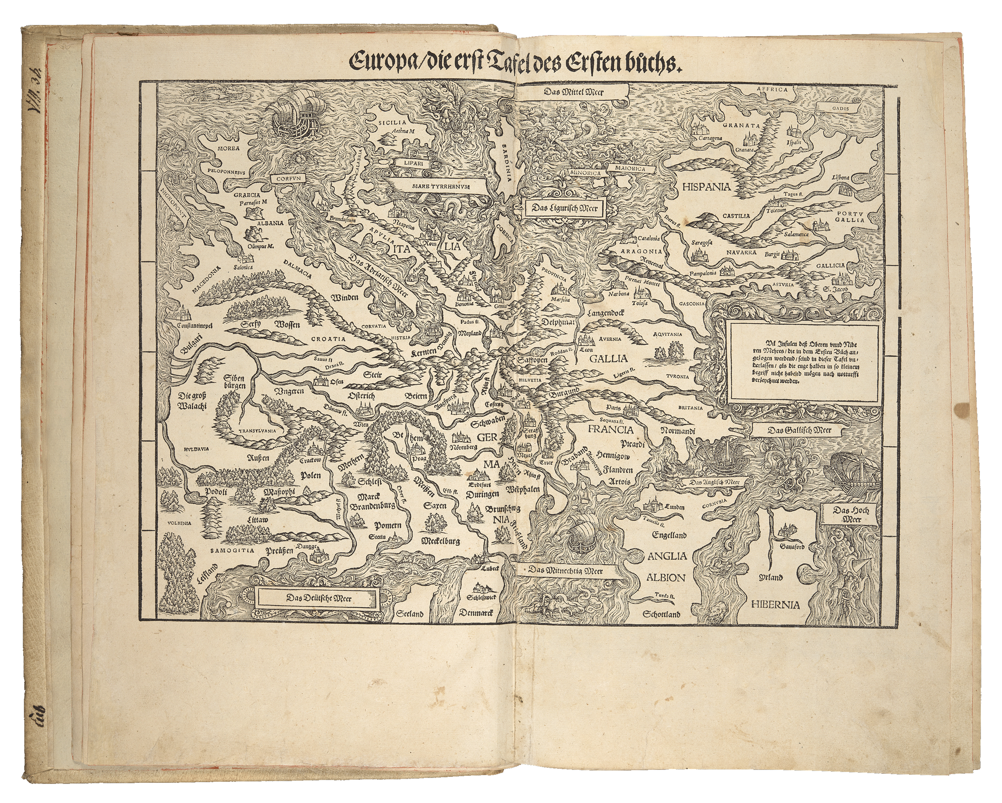
As an atlas, the Chronicle sought to position Switzerland in the context of Europe, asserting the country’s importance and long-standing history.
There are five double-page maps of Europe, Germany, France, historical “Hevetii” and contemporary Switzerland; and eight full-page regional maps of the Confederation.
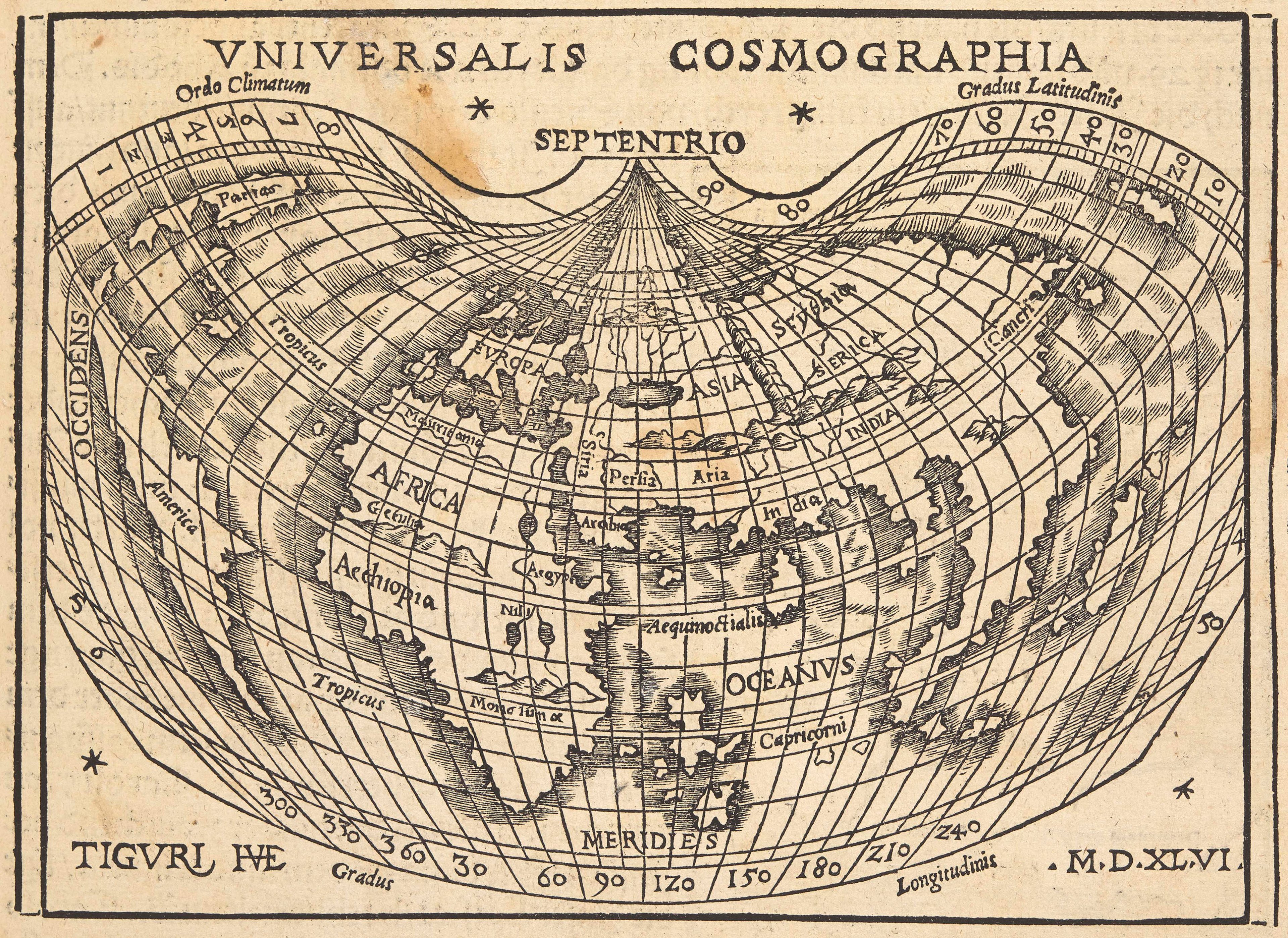
In addition, it features a reduced version of Petrus Apianus's 1520 cordiform world map made by Johannes Honter (1498-1549).
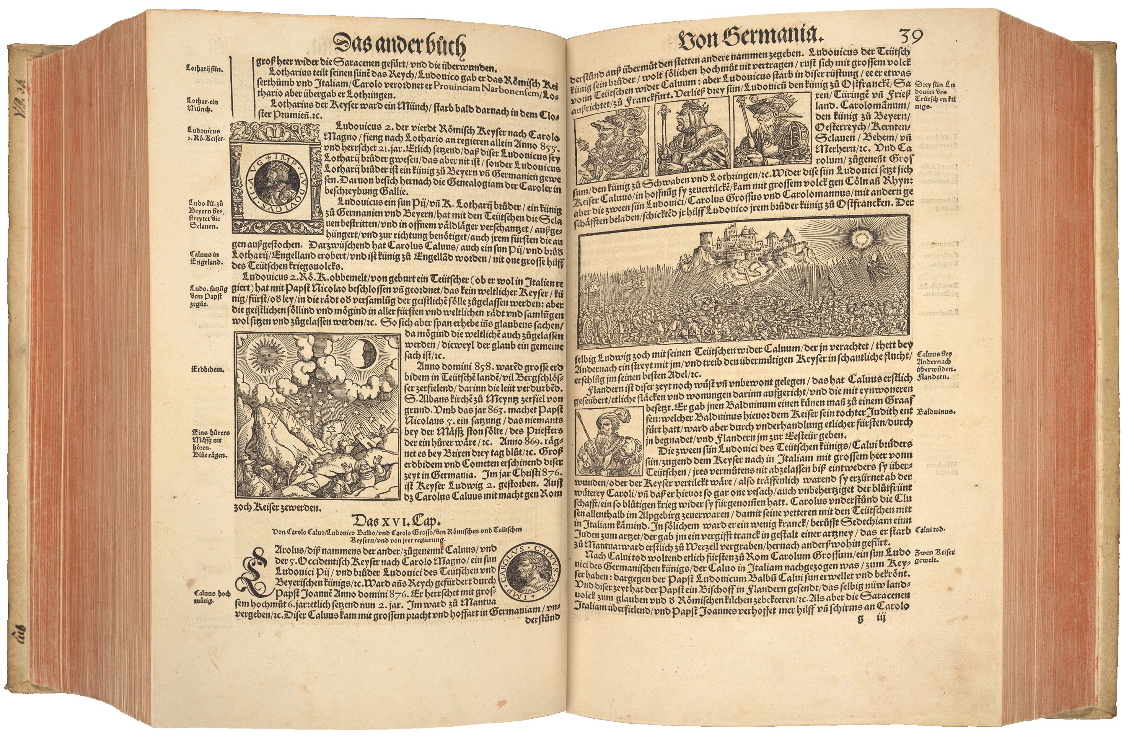
With almost 4,000 woodcuts, Johannes Stumpff's Chronicle is one of the most richly illustrated printed works ever, surpassing even the seminal Nuremberg Chronicle (1493) by Hartmann Schedel.
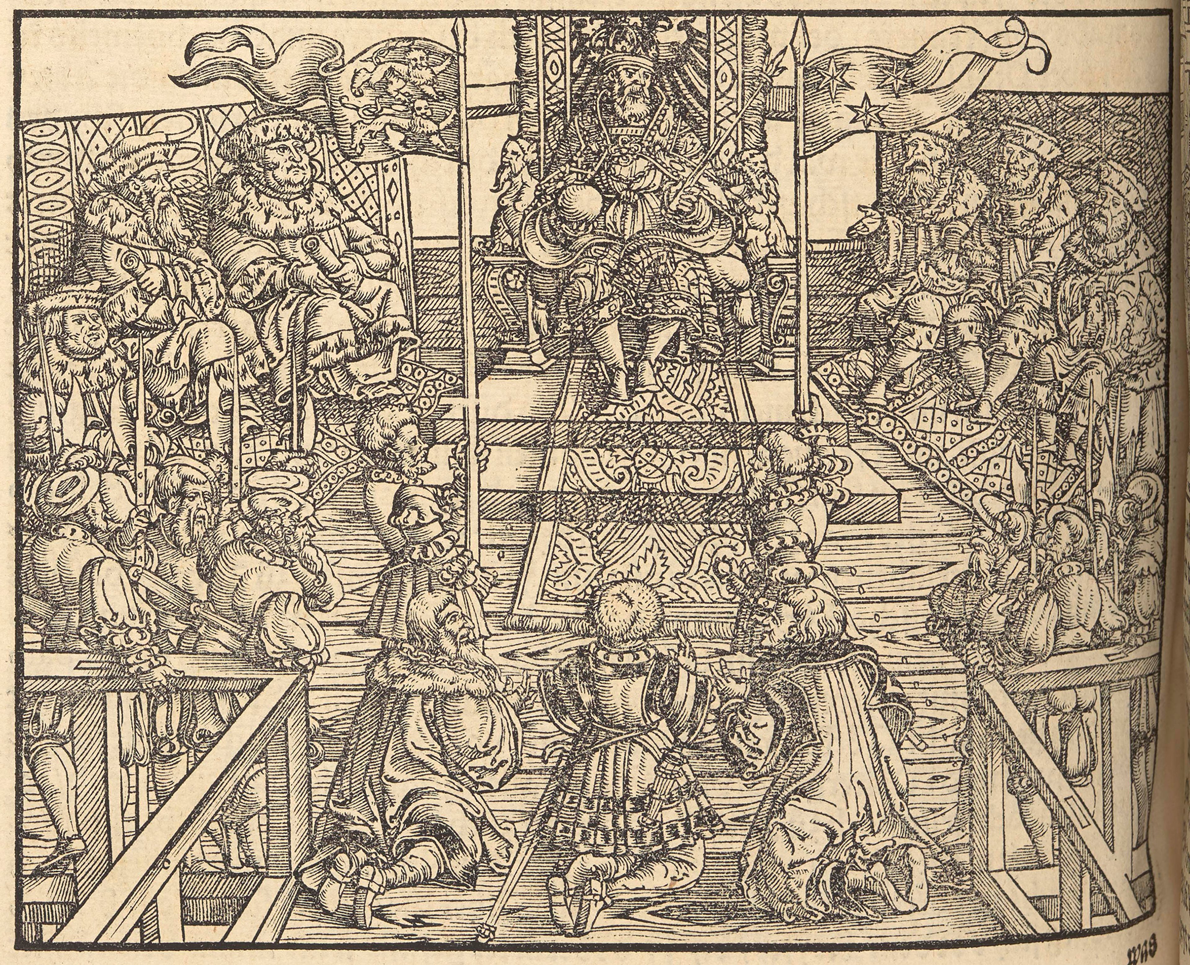
The illustrations depict deeds, intense battles, picturesque town views, coats of arms, holy figures, nobles and saints, celestial phenomena, scenes of daily life, Alpine animals, and other fascinating glimpses into Swiss history.
These woodcuts are the work of renowned Swiss artists of the day, such as Heinrich Vogtherr the Elder, the Zurich painter Hans Asper, Robert and Johann Rudolf Wyssenbach, the monogramist VS, and woodcutter Ludwig Fryg.
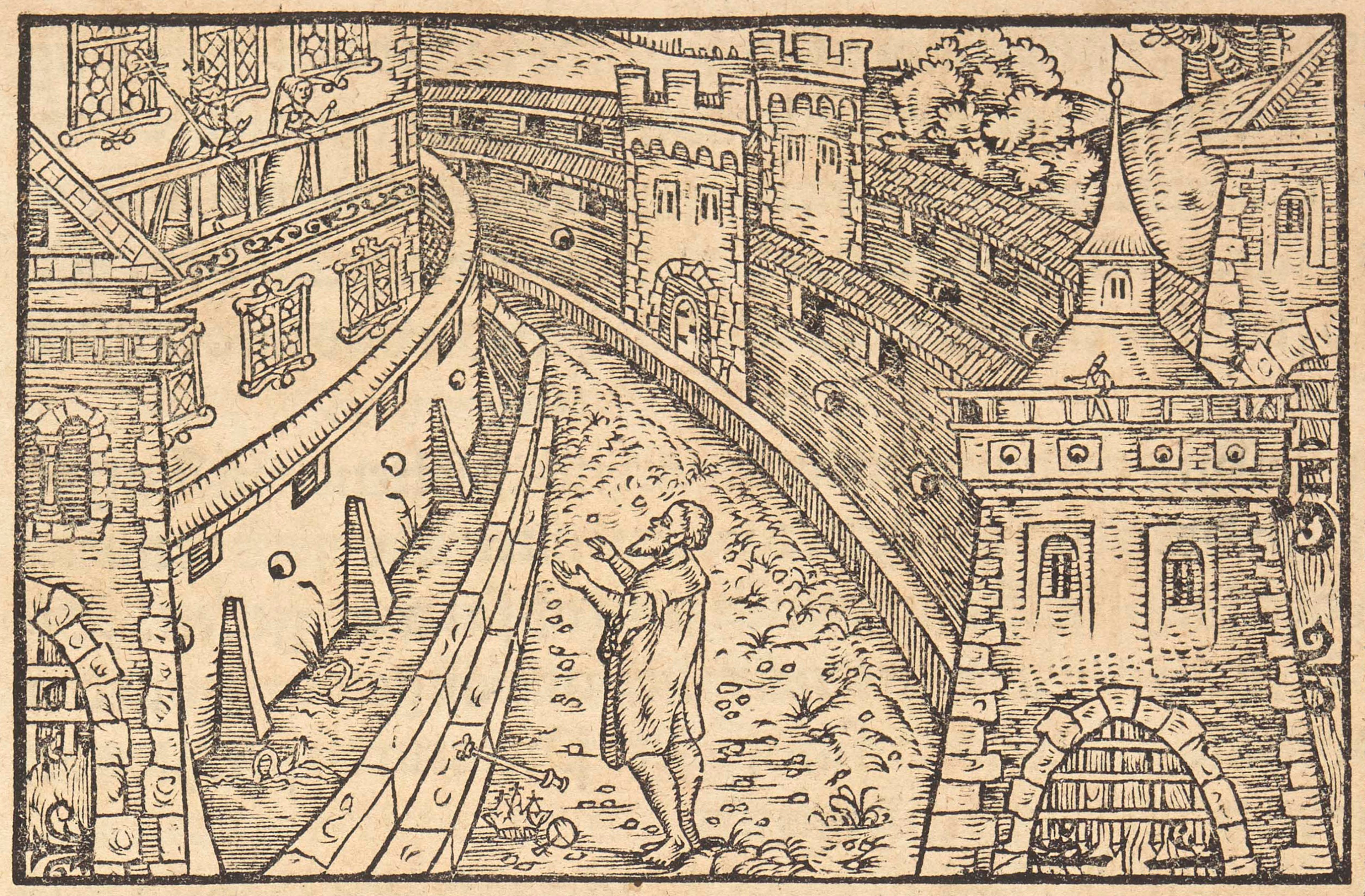
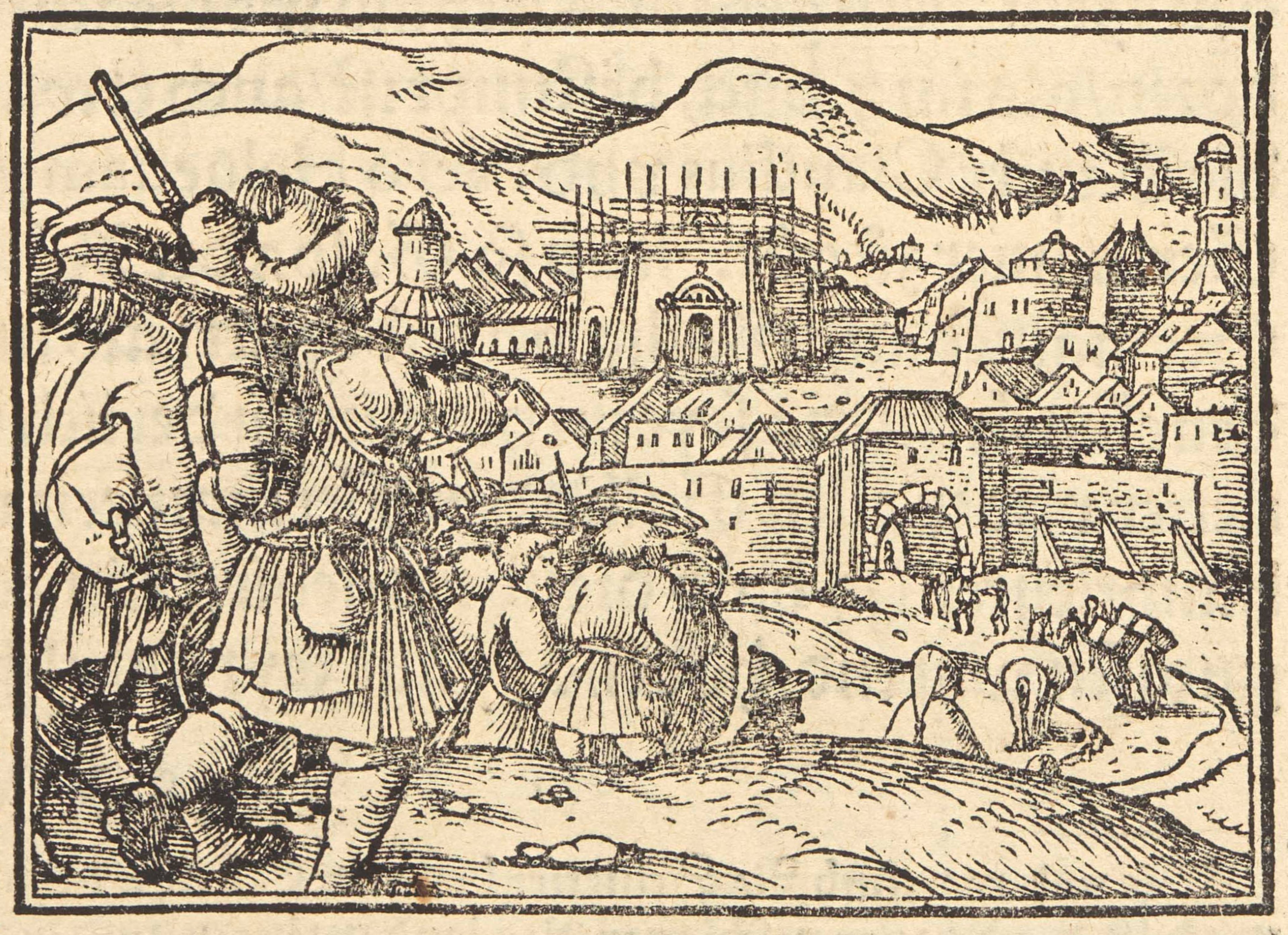
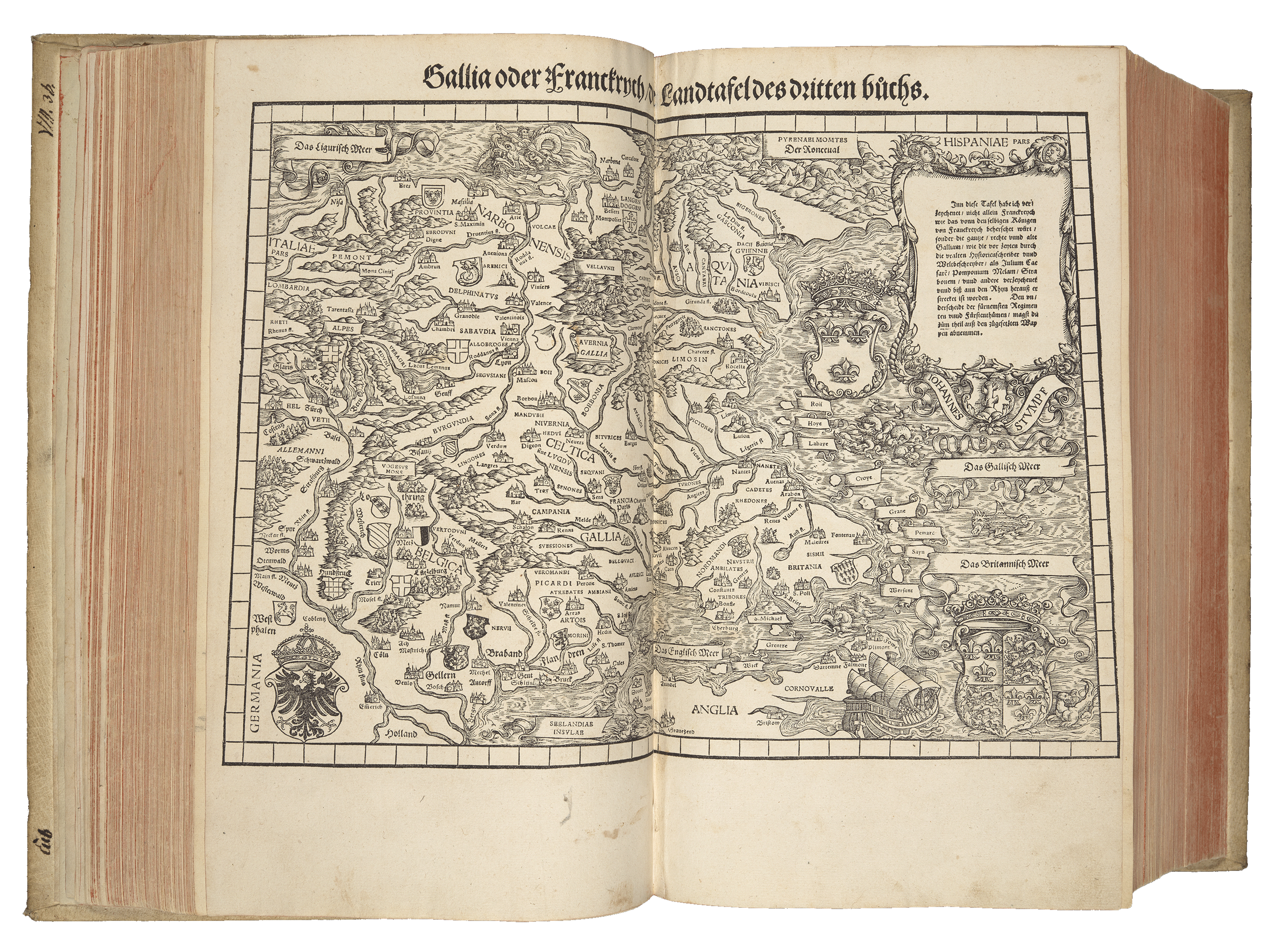
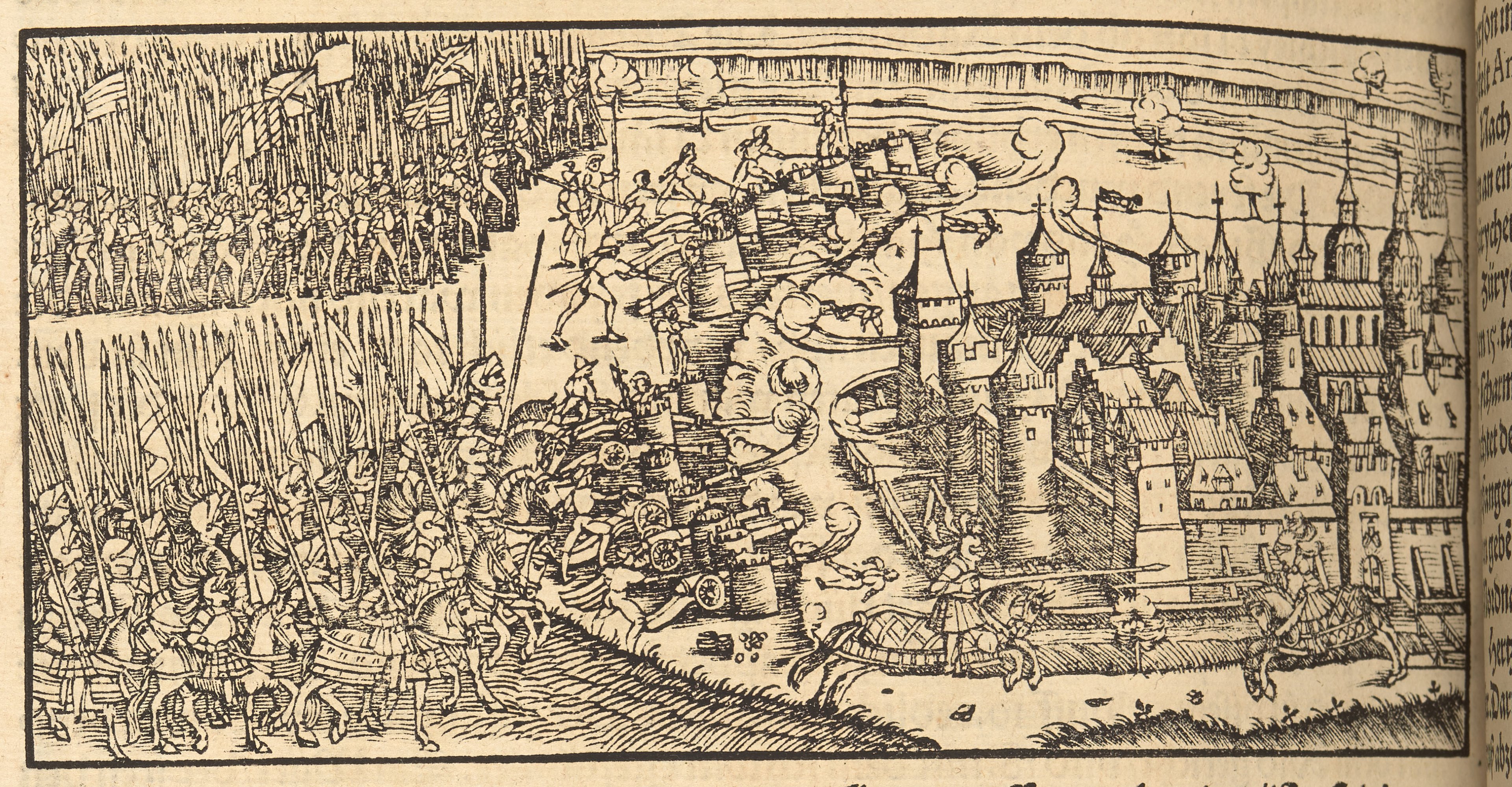
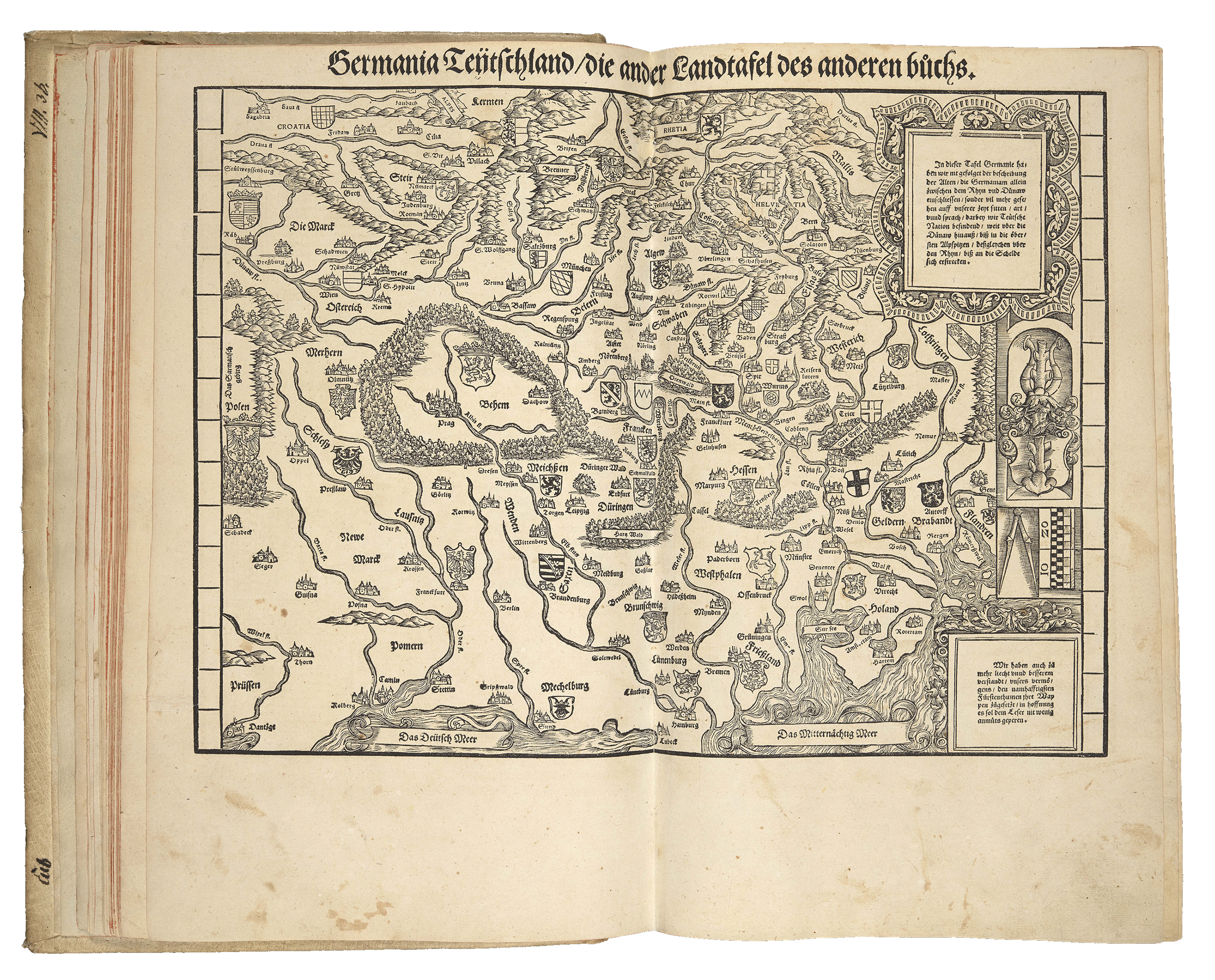
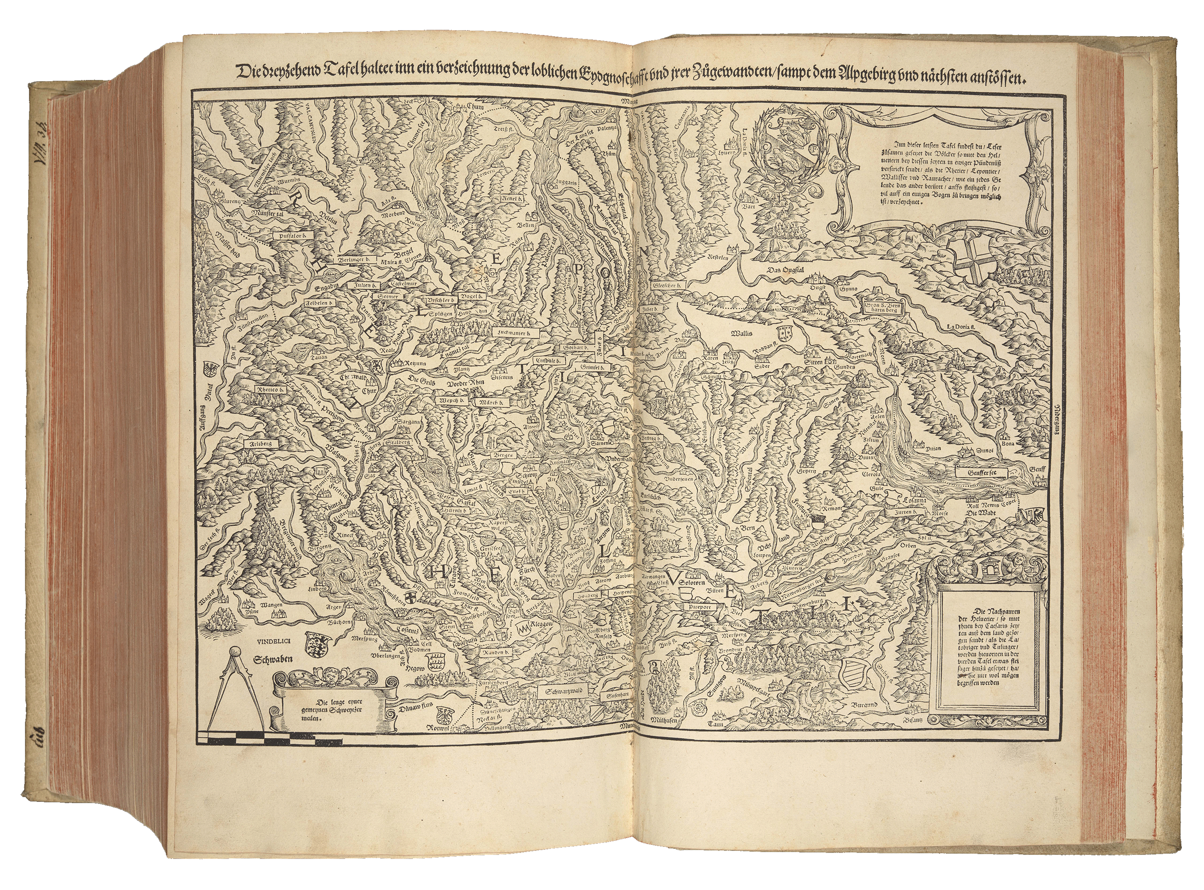
Map of Switzerland from Stumpff’s Chronik (1547)
Stumpff received support and input for his work from leading humanists and historians including the reformer and cartographer Joachim Vadianus (1484–1551); Antistes Heinrich Bullinger (1504–1575); and the printer Christoph Froschauer (1490–1564), who spared neither effort nor expense to help render this masterpiece.
Ulrich Zwingli was a close ally of Stumpff, and because of the strong narrative against the Catholic Habsburg Empire the Chronicle is sometimes referred to as the Reformationschronik (Chronicle of the Reformation).
The Chronicle remained a foundational and authoritative work on Switzerland up to the eighteenth century.
William Tell and the Apple: Switzerland's Origin Story
One of the many woodcuts featured in the chapter on Swiss history is the legend of William Tell.
It is the story of one man’s defiance against Albrecht Gessler, a tyrannical bailiff who worked for the House of Habsburg.
Seeking to show his power, Gessler placed his hat on a pole in the market square of Altdorf village in the canton of Uri, demanding that all who passed it bowed to the hat in homage. Tell refused to do so, and Gessler had his son seized in punishment. Tell was given the chance to shoot an apple off his son's head with a crossbow in order to save his life.
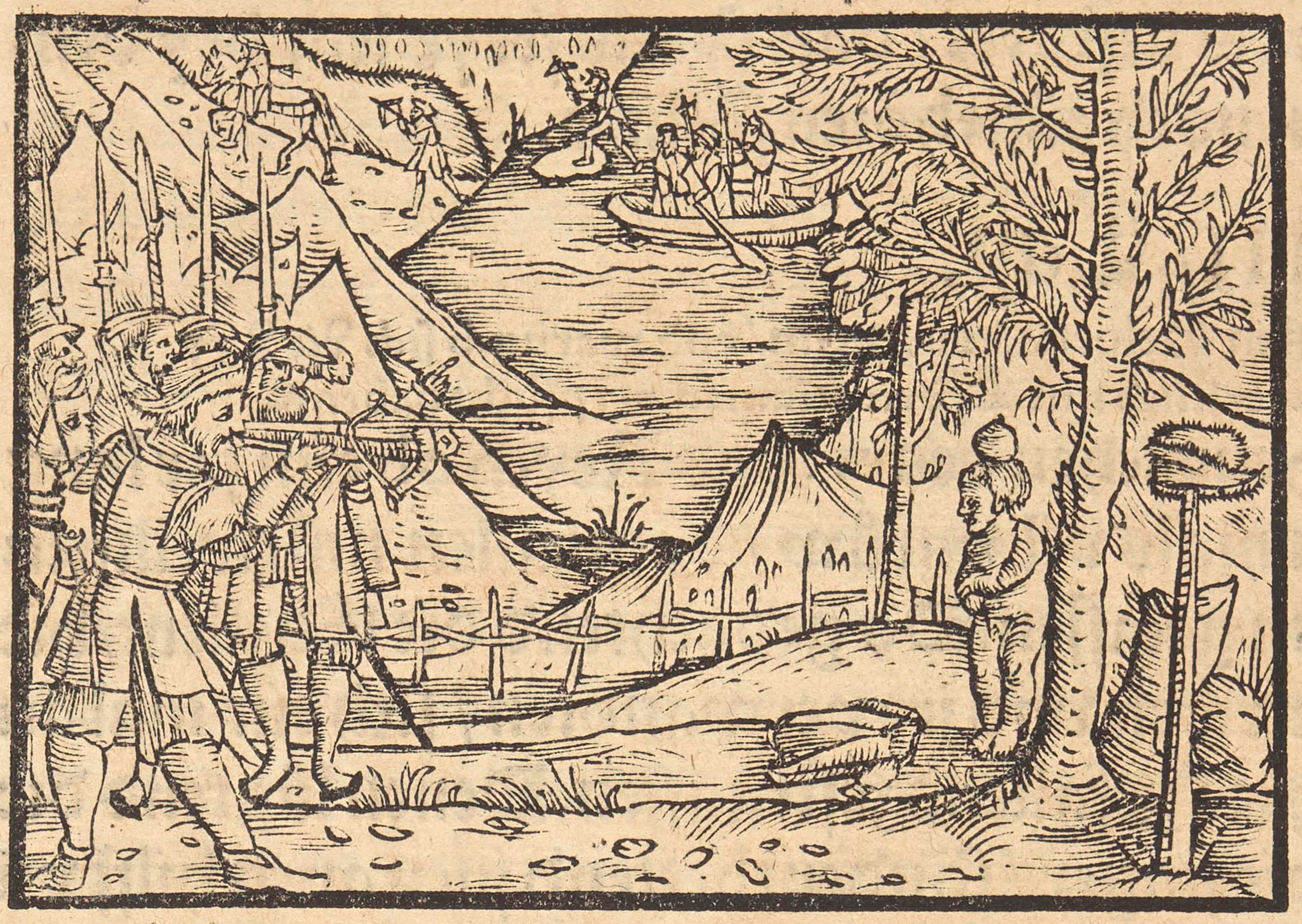
Thankfully, Tell - an excellent marksman - split the apple without hurting his son. He confessed to having a second, hidden arrow that was intended to kill Gessler if Tell failed to make his shot. Tell was swiftly arrested but escaped during a fierce storm. He later ambushed and killed Gessler.
Tell's defiance inspired the Swiss struggle for freedom from the Habsburgs. His actions sparked an open rebellion, prompting the canton of Uri to make a pact with neighbouring cantons of Schwyz and Unterwalden. This alliance marked the foundation of the Swiss Confederation.
William Tell is a central figure in Swiss historiography. He remained a steadfast symbol of resistance against aristocratic rule during Switzerland's nineteenth-century Restoration and Regeneration, and across Europe during the Revolutions ‘Spring of Nations’ (1848) against the House of Habsburg.
The tale of Tell’s exploits was first mentioned in a manuscript called the White Book of Sarnen, a compilation of manuscripts by Hans Schriber (1470), and later became a household name thanks to Friedrich von Schiller's play Wilhelm Tell (1804).
His exploits were also immortalised in the opera William Tell (1829) by Gioachino Rossini (17982-1868), with its famous overature. The first three notes of this piece are still used as the sound of the horn of the Swiss Post buses!
Made In Switzerland
The Sunderland Collection is privileged to own a selection of important maps and atlases produced in Switzerland:
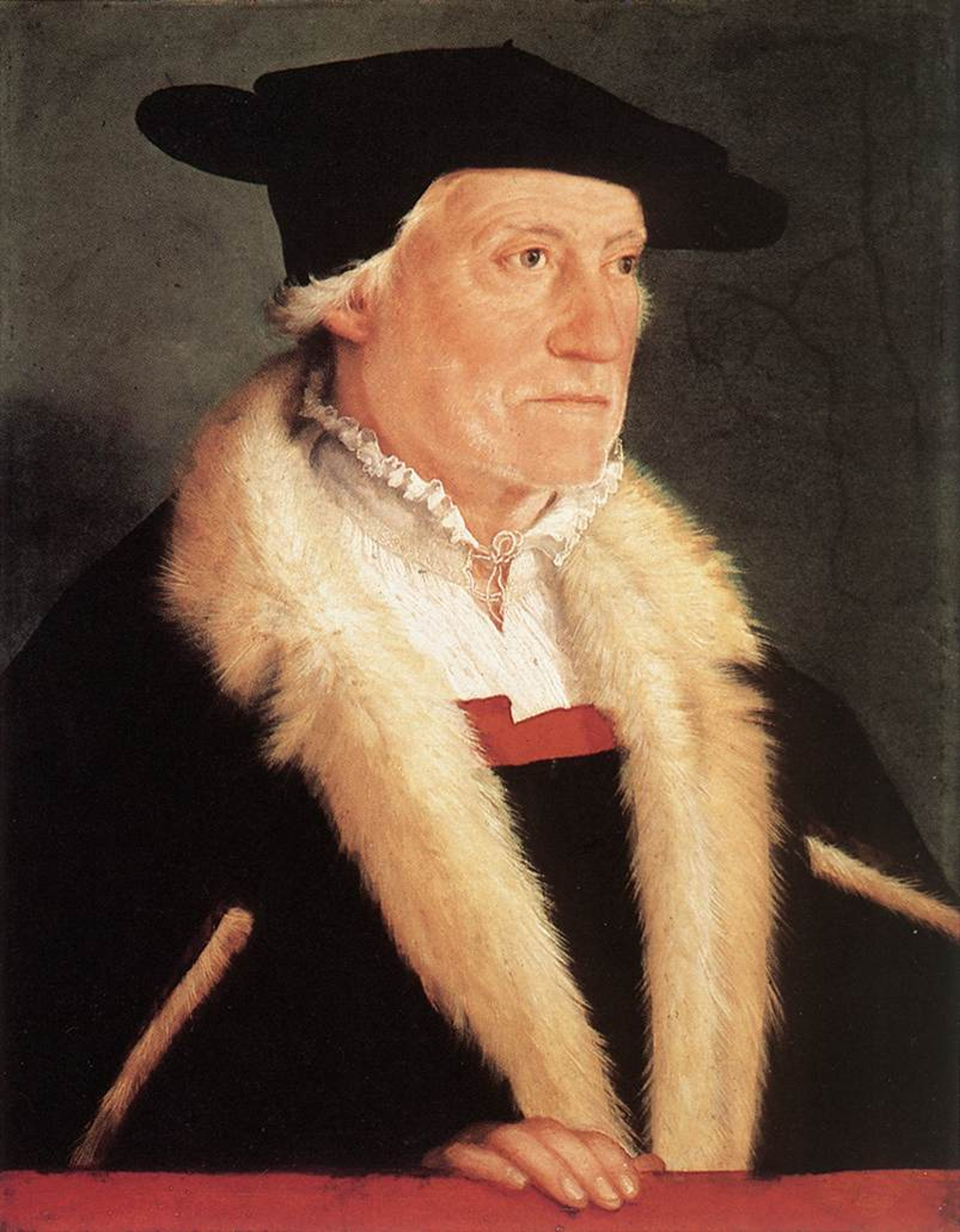
Portrait of Sebastian Münster by Christoph Amberger, c. 1552. Credit: Art Renewal Center. Public Domain, via Wikimedia Commons.
Sebastian Münster (1488-1552)
Sebastian Münster (1488-1552) was a prolific cosmographer, theologian, linguist and Franciscan monk from the Franciscan monk.
You can find out more about Münster here.
Münster published some of his most celebrated works in Basel. These included his important edition of Claudius Ptolemy's Geographia (1540) and his masterpiece, the Cosmographia Universalis (1559).
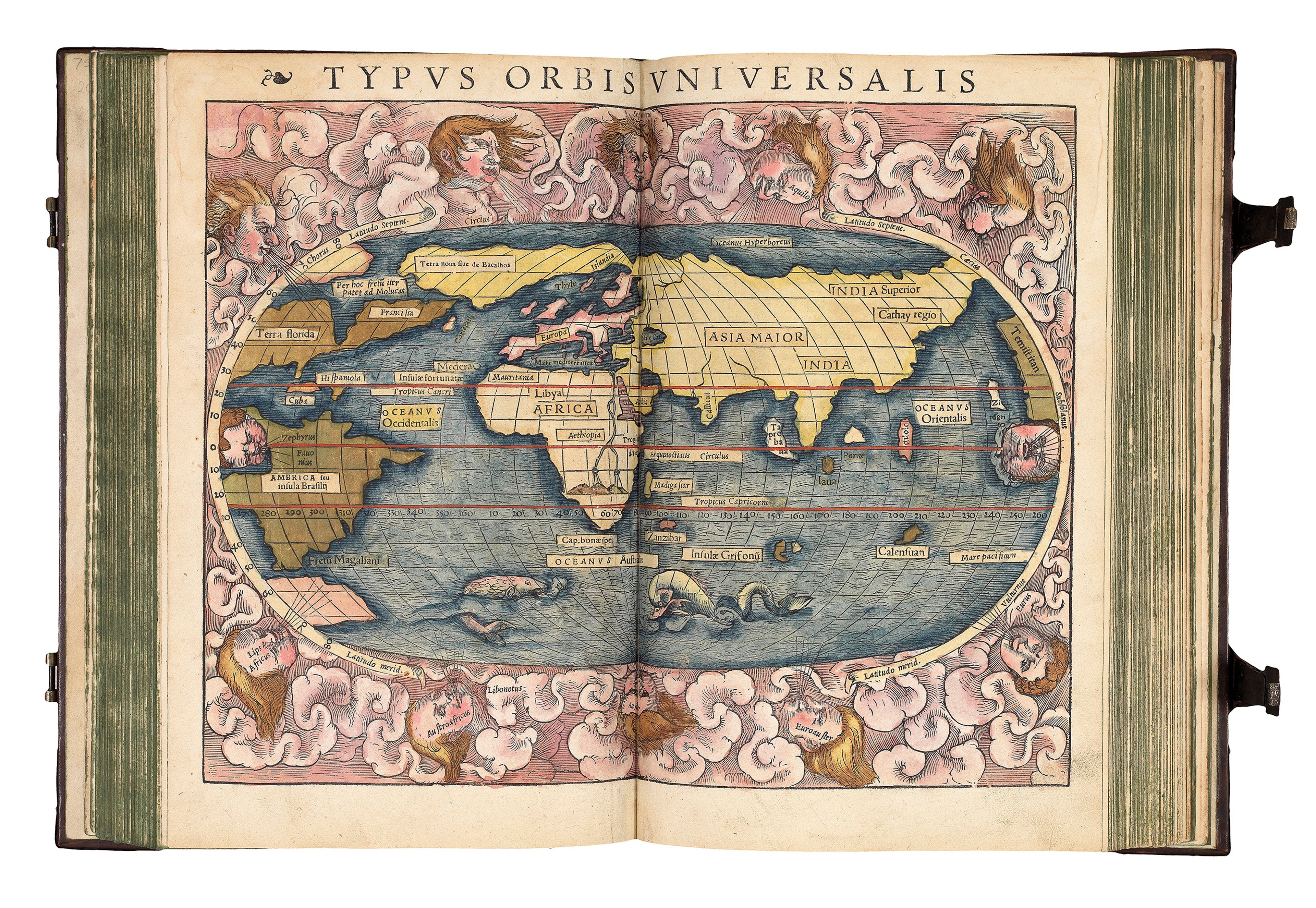
World map from the Geographia (1540)
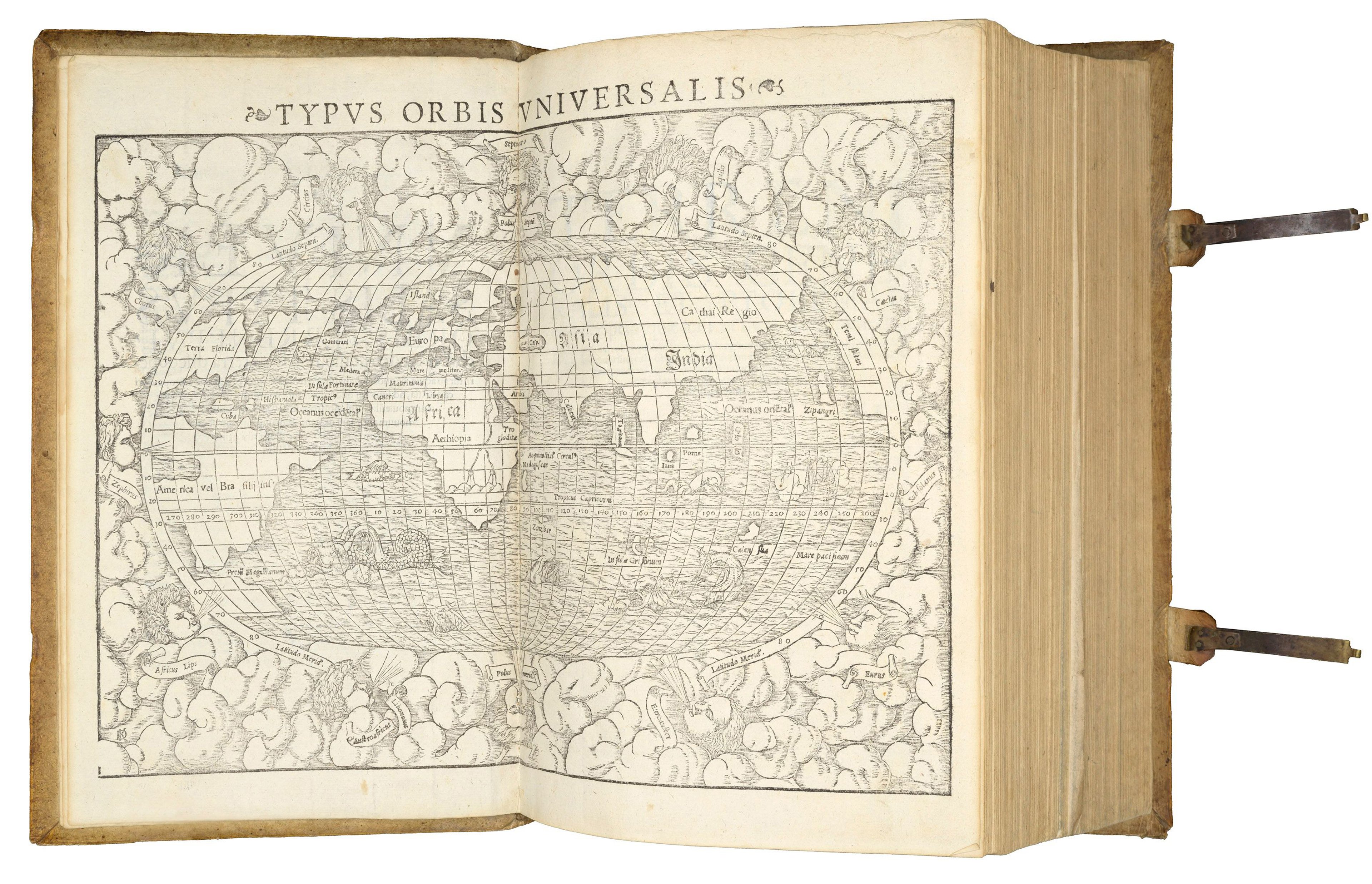
World map from the Cosmographia (1559)
The Collection also owns a copy of Münster’s well-known woodblock world map from 1532, compiled with German theologians Simon Grynaeus (1493-1541) and Johann Huttich (c.1490–1544).
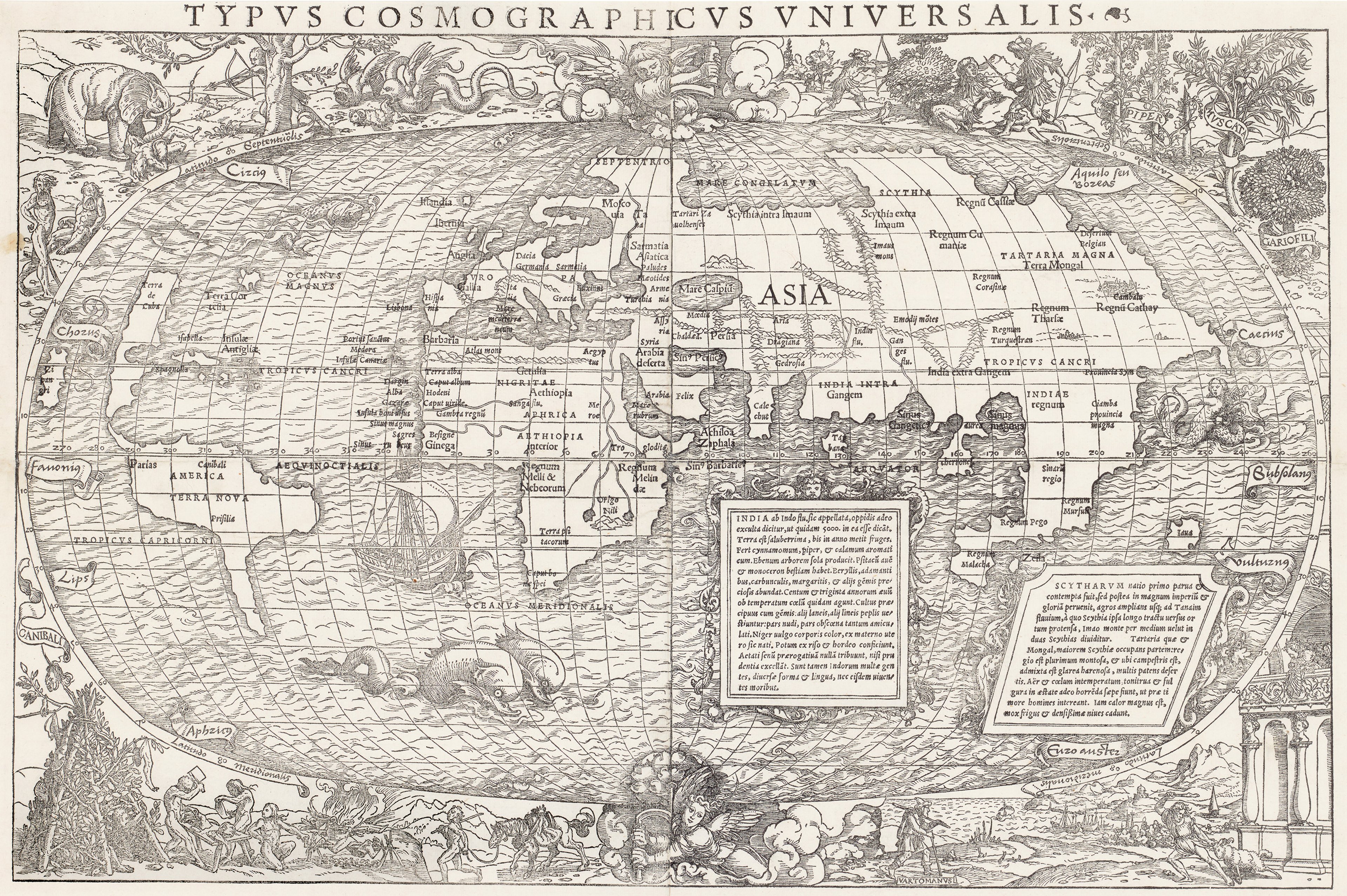
This famous and beautiful map was made by Münster for the Novus Orbis Regionum (1532), a foundational book of early explorative voyages featuring accounts by Christopher Columbus, Amerigo Vespucci, and Marco Polo. It was also created in anticipation of Münster's Cosmographia (1544). It is one of the earliest maps to show an emerging “New World”, the Americas.
The map was published in Basel by Johann Hervagen (1497-c.1558). It features intricate woodcut border decoration by great Renaissance artist and Basel resident, Hans Holbein the Younger.
These embellishments cleverly reveal an implied understanding of the controversial heliocentric theory of the cosmos by Nicolaus Copernicus (1473-1543) with its depiction of two angels using mechanical cranks to rotate the Earth on its axis. Find out more about this map here.
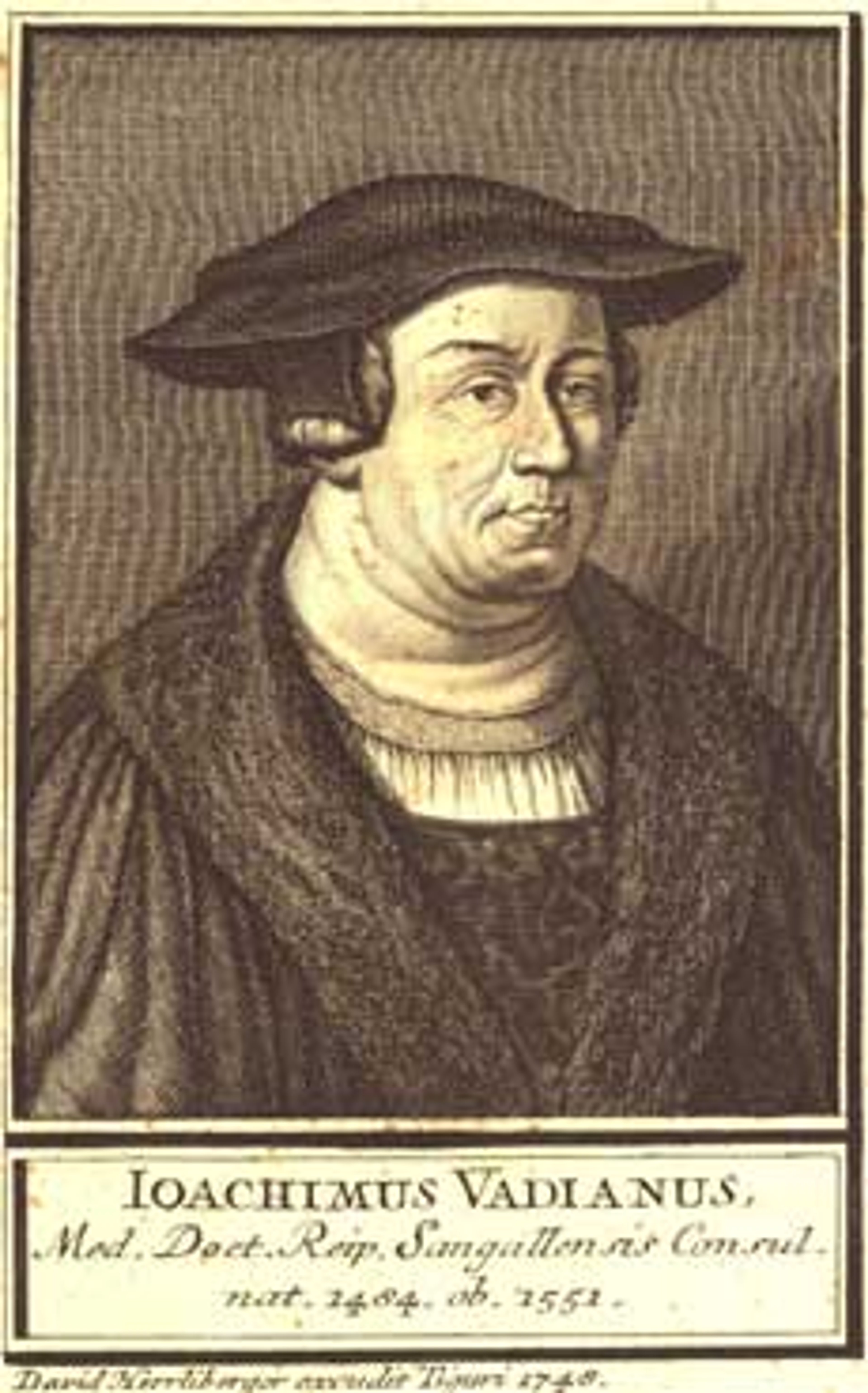
Joachim van Watte. Public Domain via Wikimedia Commons.
Joachim van Watte, also known as Vadianus (1484-1551)
Vadianus was a Swiss humanist and physician, and the mayor of Sankt Gallen in eastern Switzerland.
He oversaw the town's conversion from Catholicism to Protestantism during the Reformation. Vadianus wrote on a wide range of subjects, including history, literature and theology.
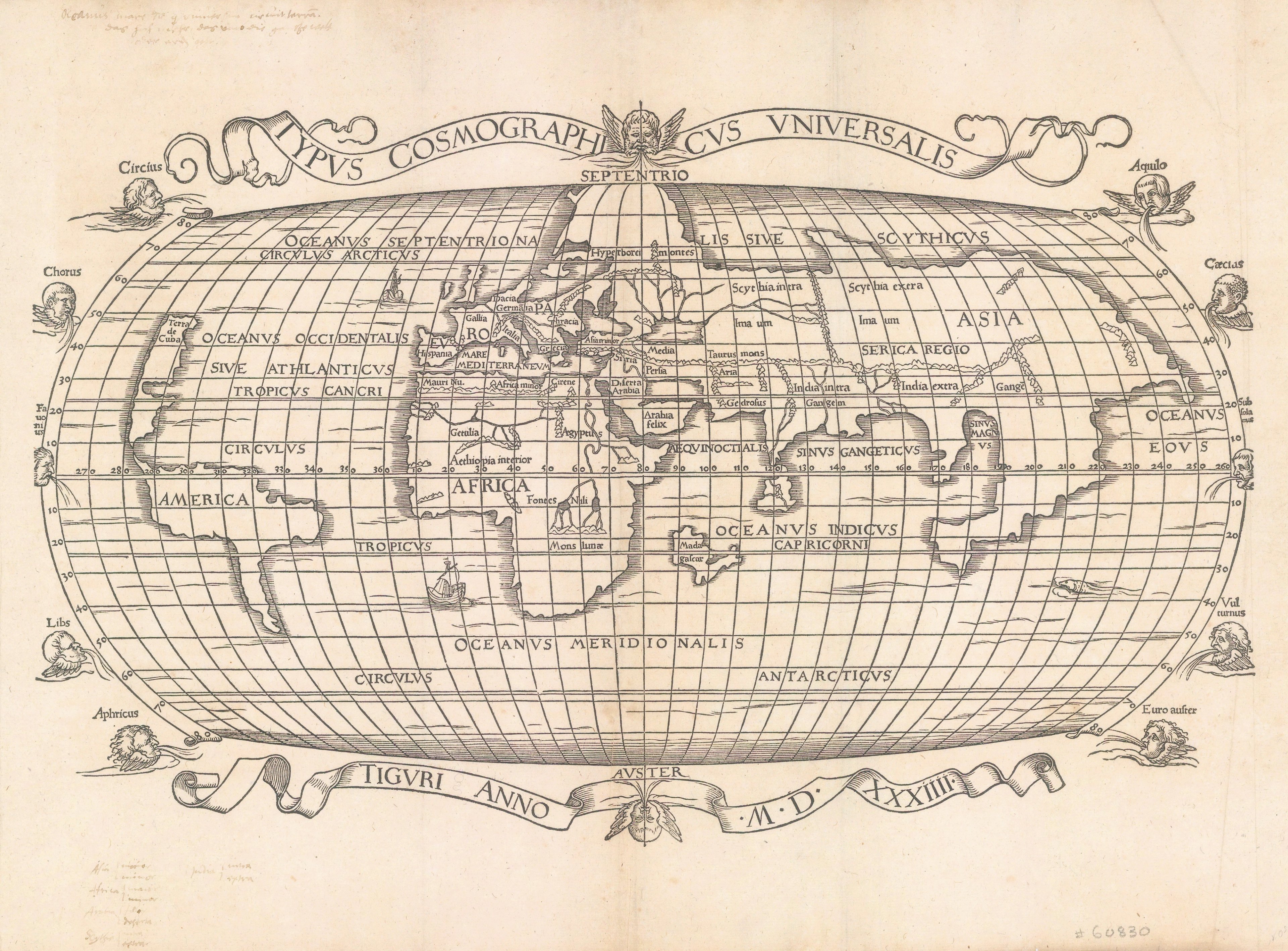
Vadianus’s best-known work was his geographical description of the world, Epitome Trium Terrae Partium, or A Summary of the Three Parts of the World (1534) published in Zürich, from which this map derives. He also wrote a commentary on Pomponius Mela's De Situ Orbis (1482), the only surviving ancient treatise on geography, written in classical Latin.
The map itself is a simplified version of Münster’s map of 1532, with the decorations by Holbein replaced by engraved windheads. The geography, for all intents and purposes, is the same as Münster’s oval world map, but there were some updates (India and Sri Lanka) and omissions (the Caribbean islands). View this map in more detail here.
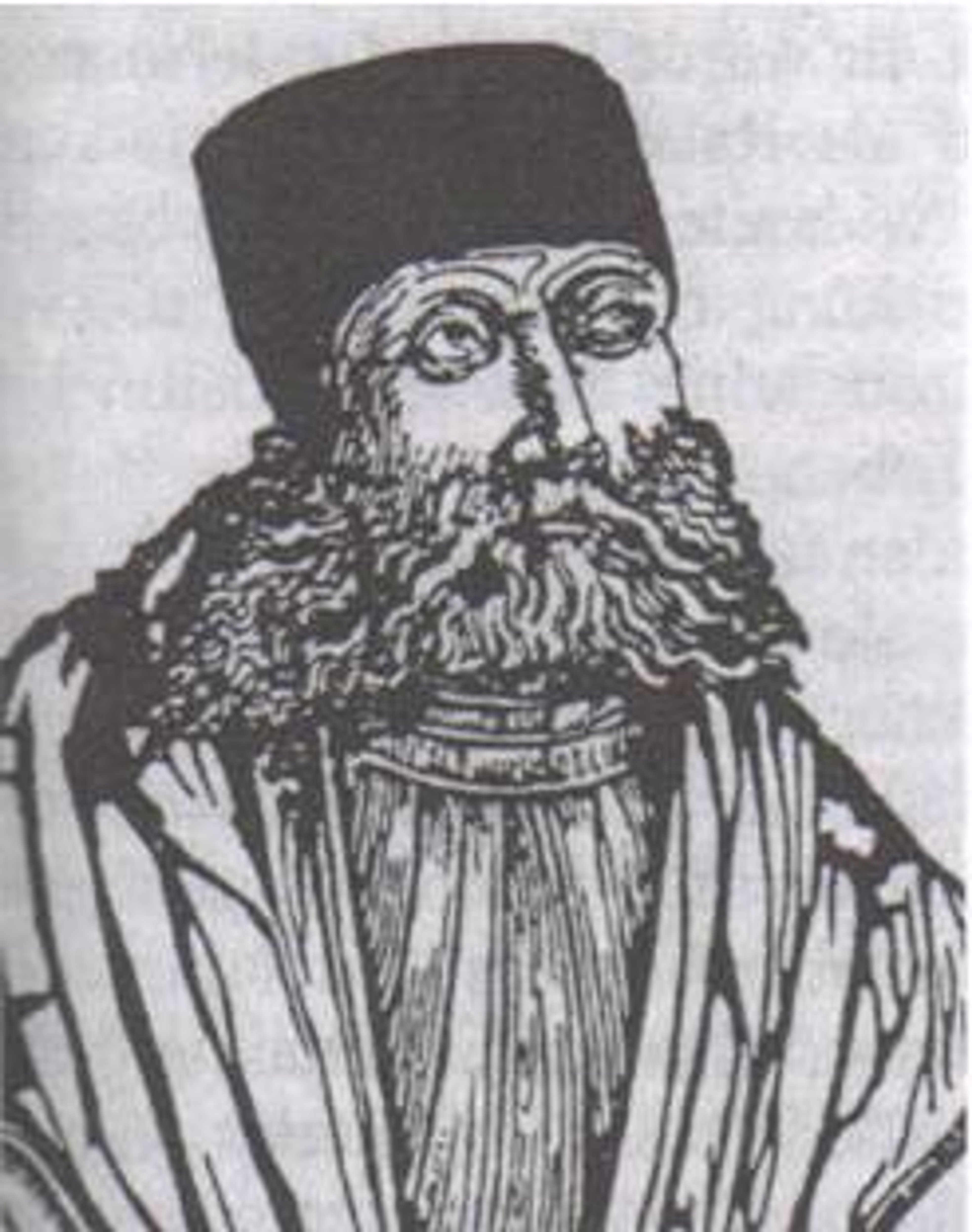
Johannes Honter. Image: Kulturstiftung der Deutschen Vertribenen
Johannes Honter (1498-1549)
Honter was a Transylvanian mapmaker and theologian - as well as a strong supporter of the Protestant Reformation.
In 1541, Honter produced his own editions of the earliest printed star charts (1515) originally published by Albrecht Dürer (1471-1528) and Johannes Stabius (1450–1522).
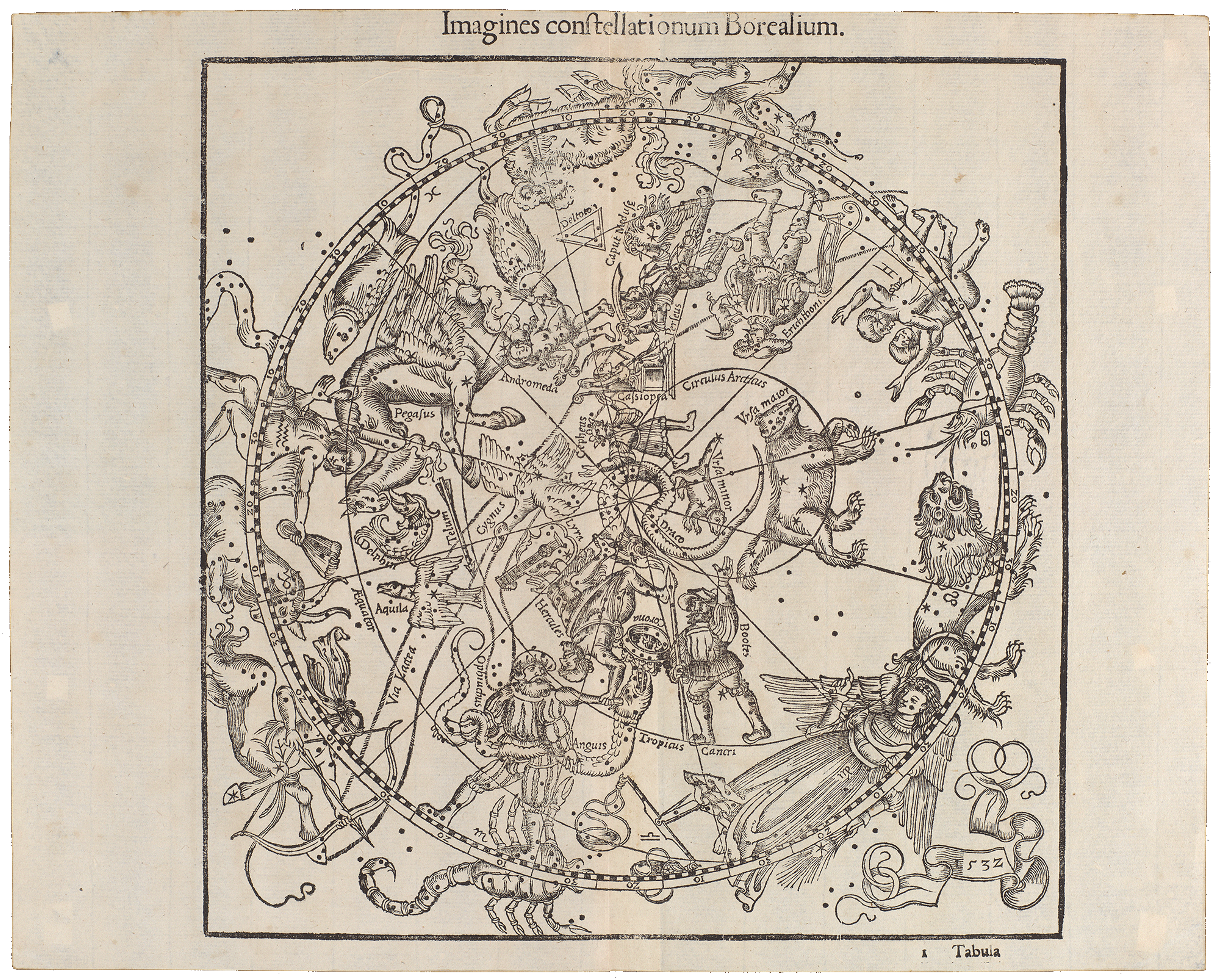
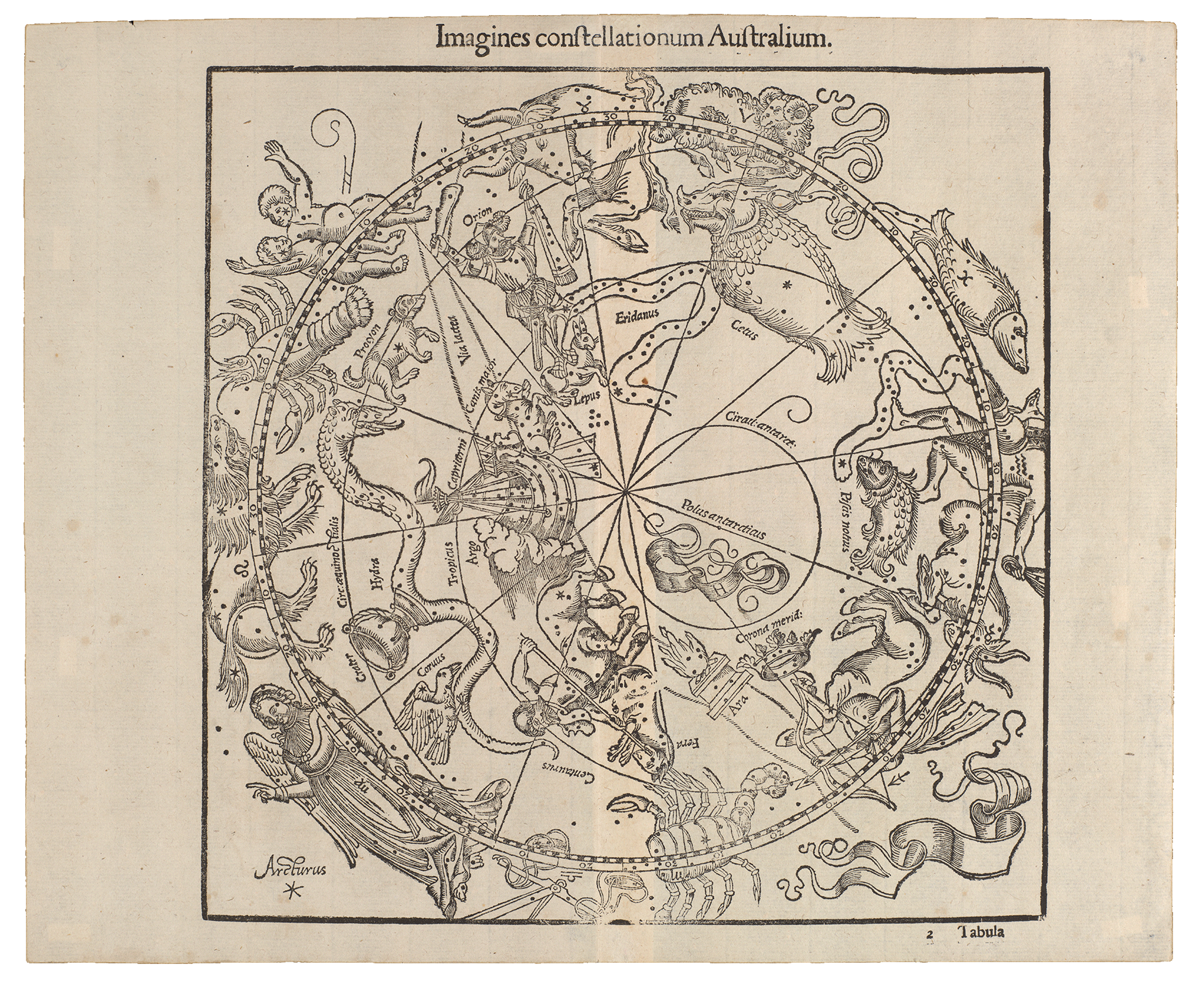
By presenting the constellations in a concave projection as if viewed directly from Earth, rather than looking down from the heavens, Honter's beautiful woodcut charts introduced a radical new perspective. They represented a significant shift from a classical worldview of the heavens to the humanist belief that human reason is central to understanding the world.
These charts also serve as a charming historical record of contemporary dress during the sixteenth century. Explore these maps in more detail here.
More images of Switzerland in The Sunderland Collection
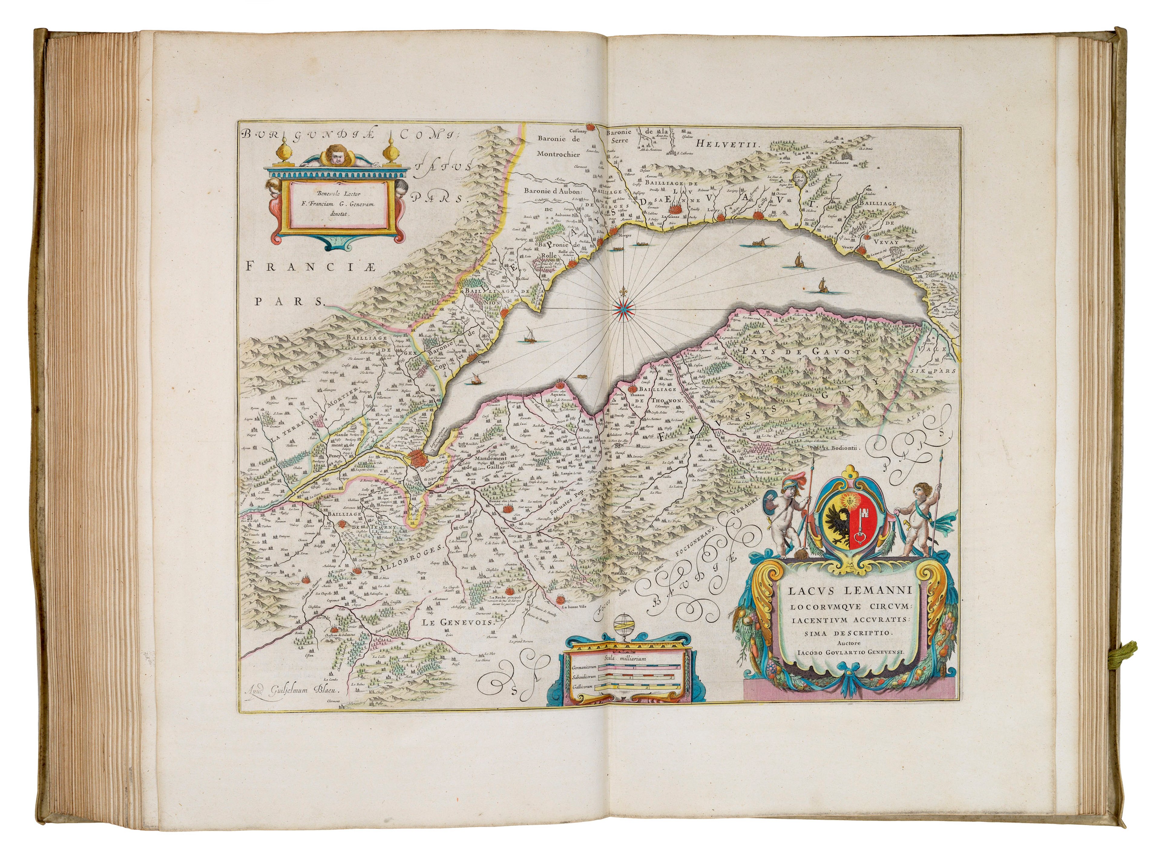
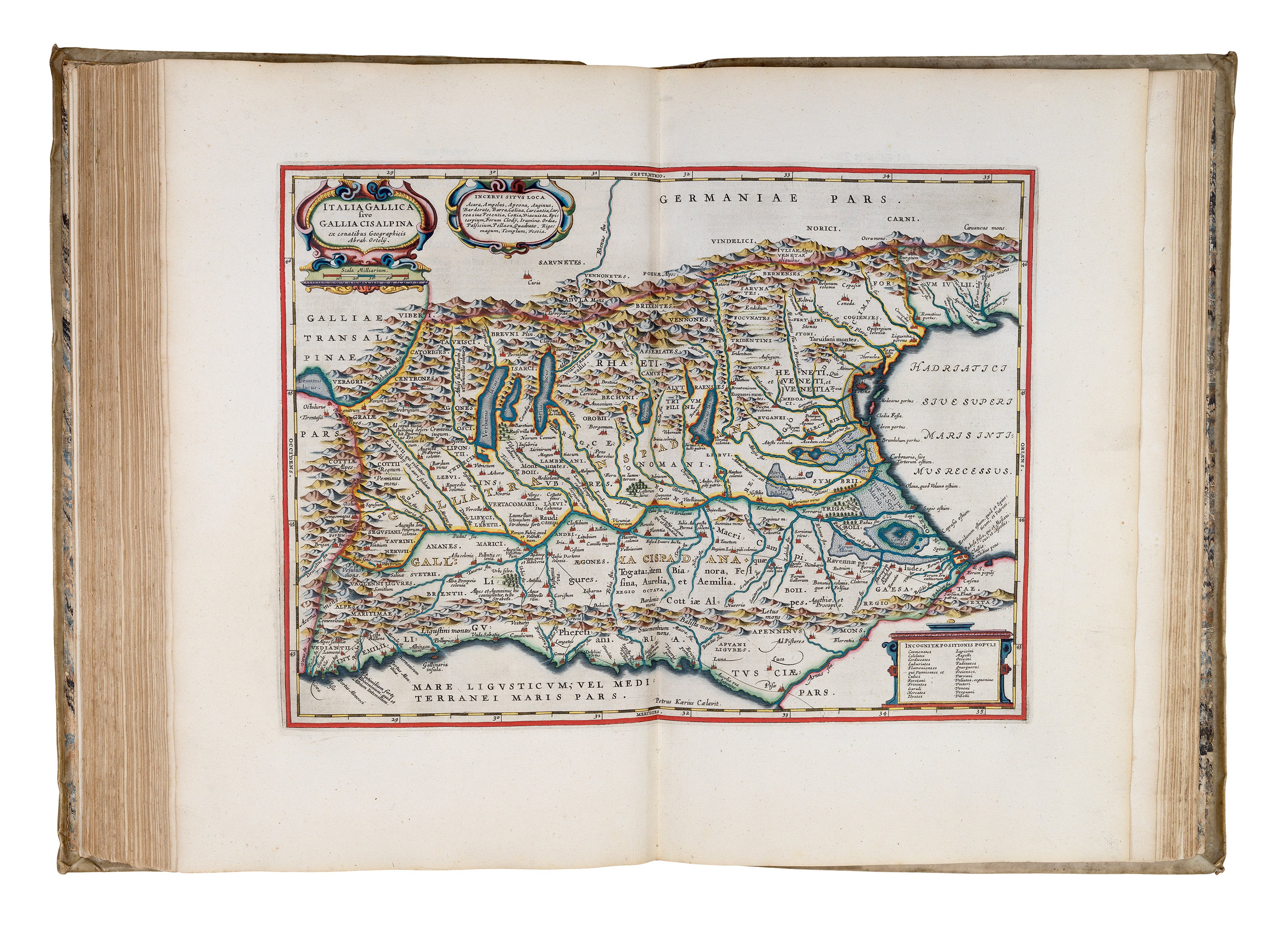
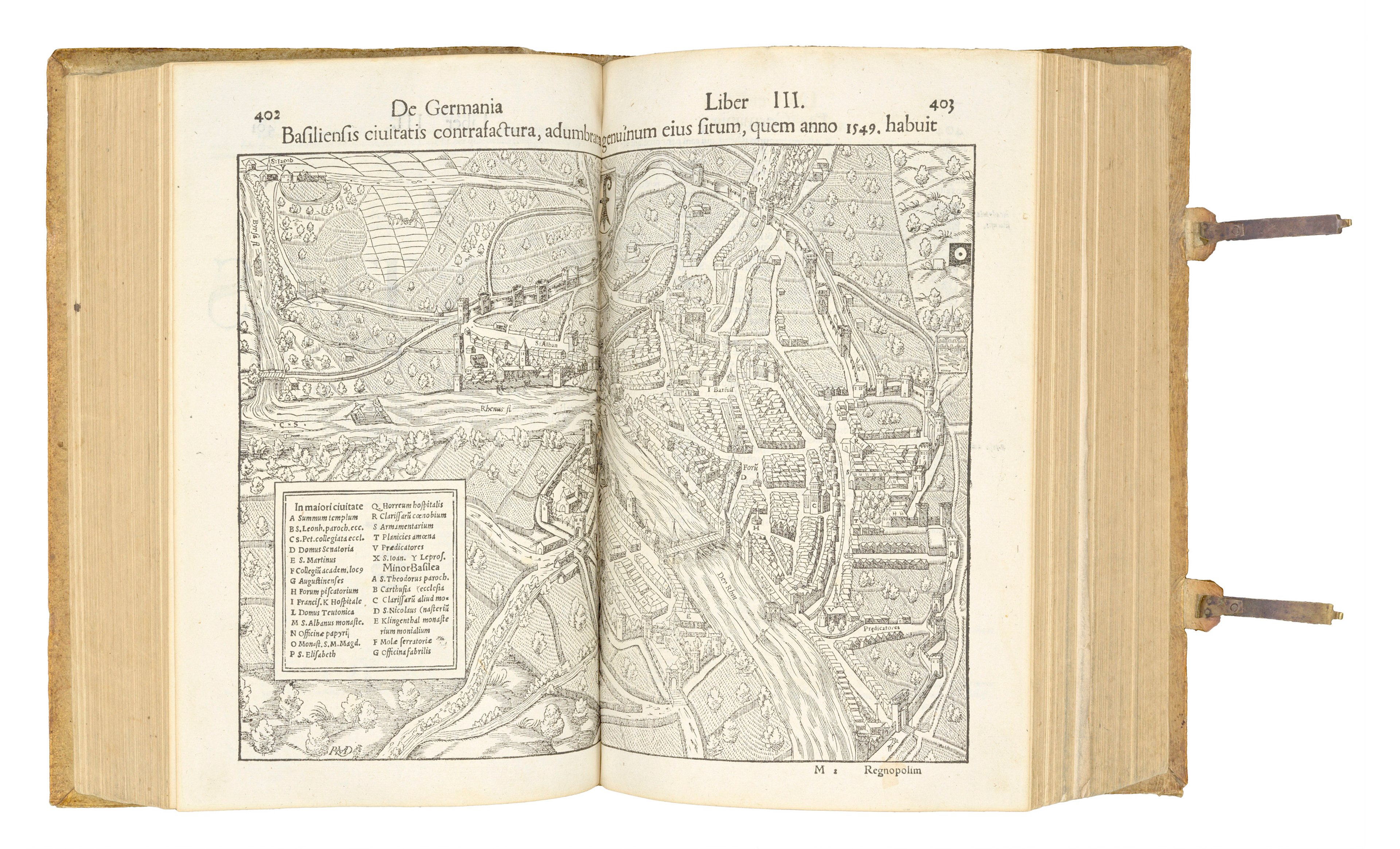
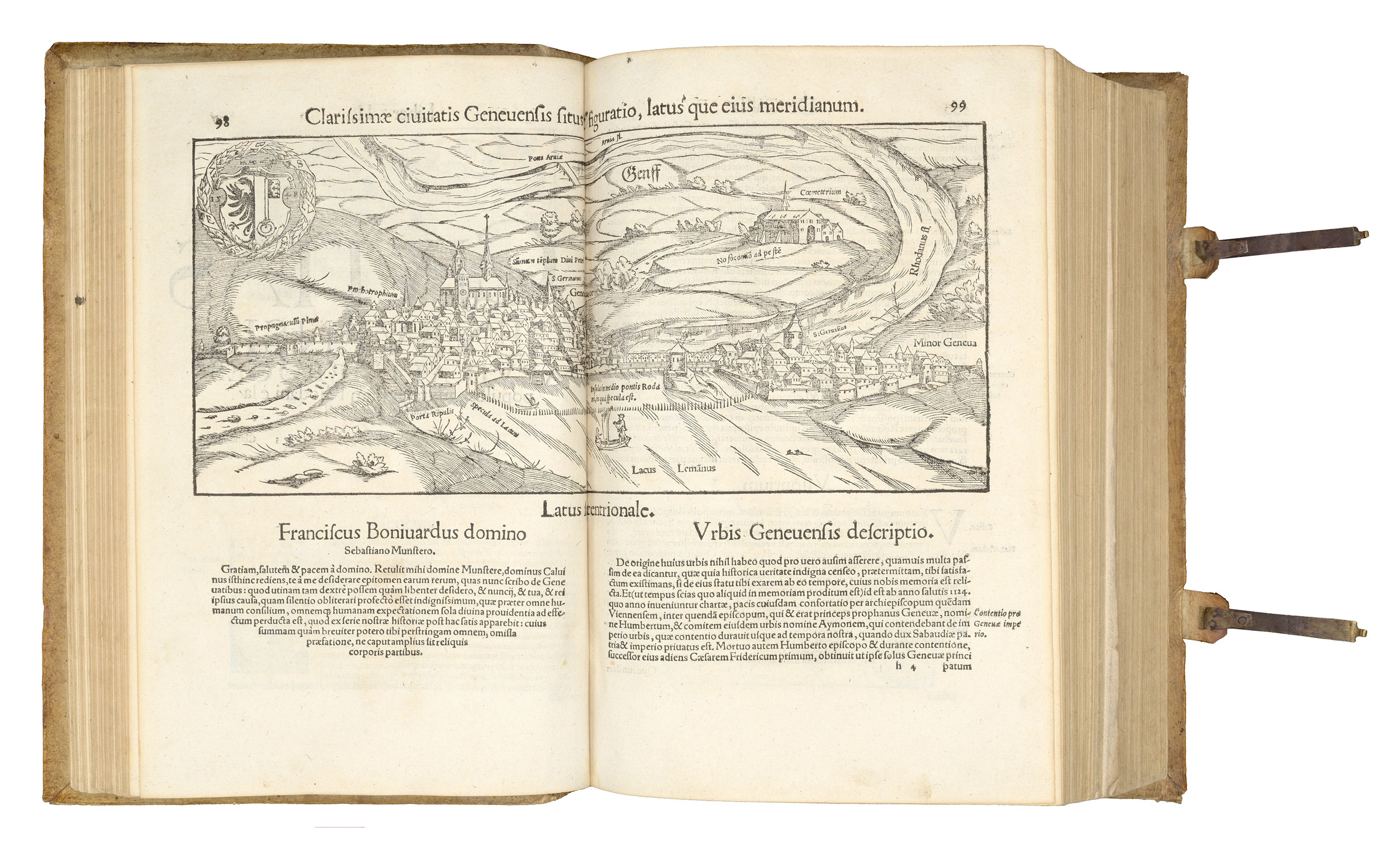
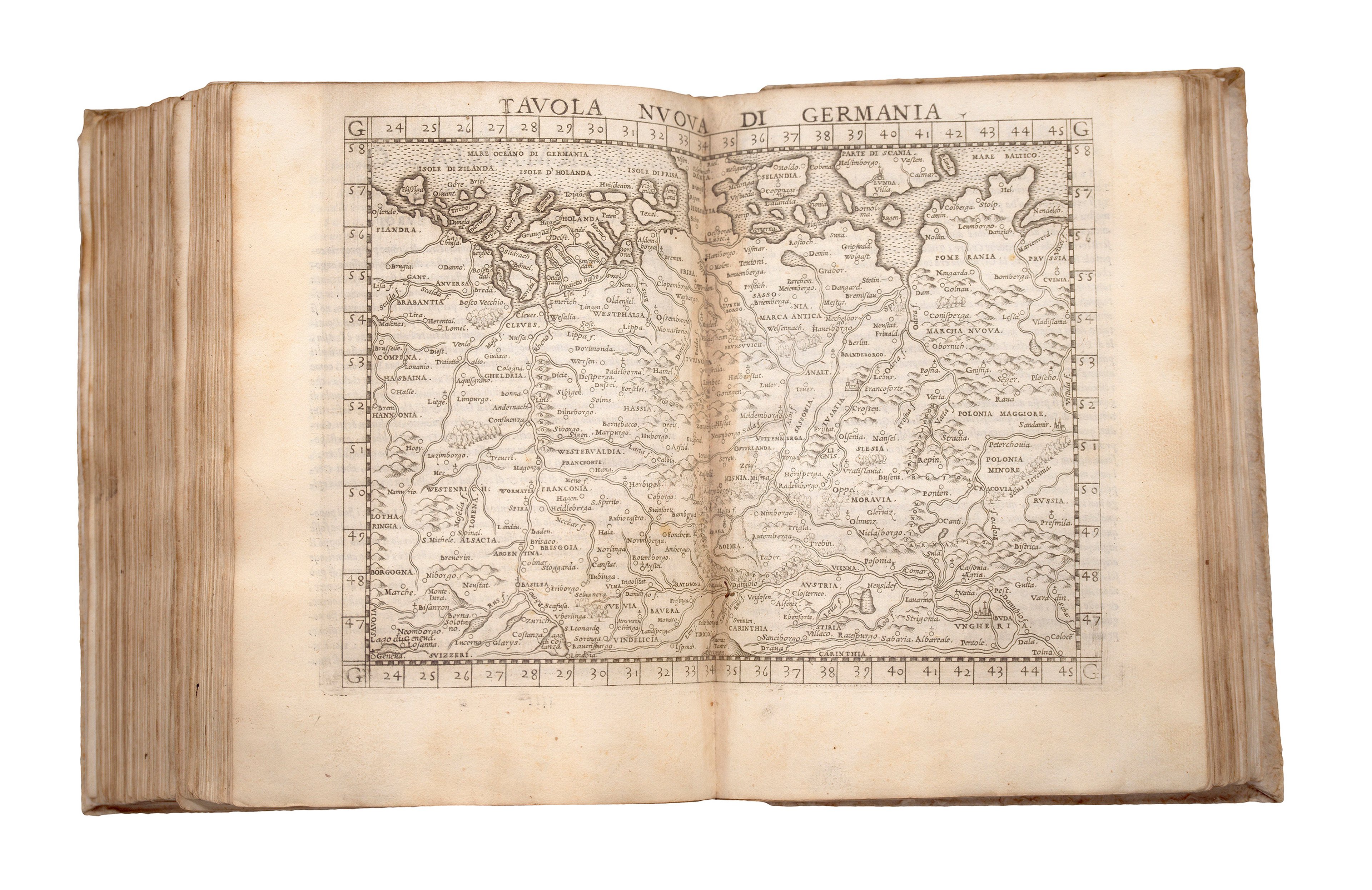
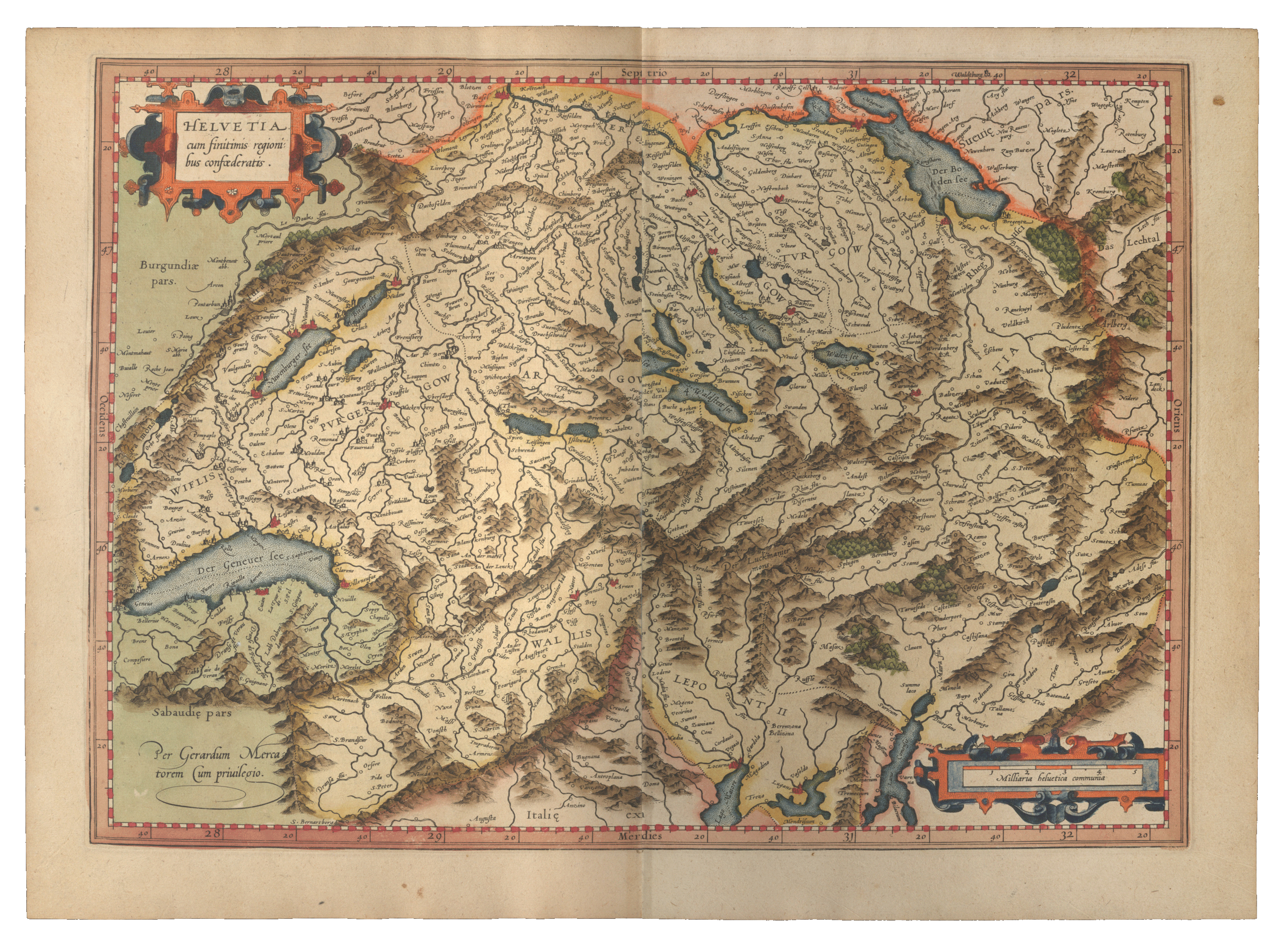
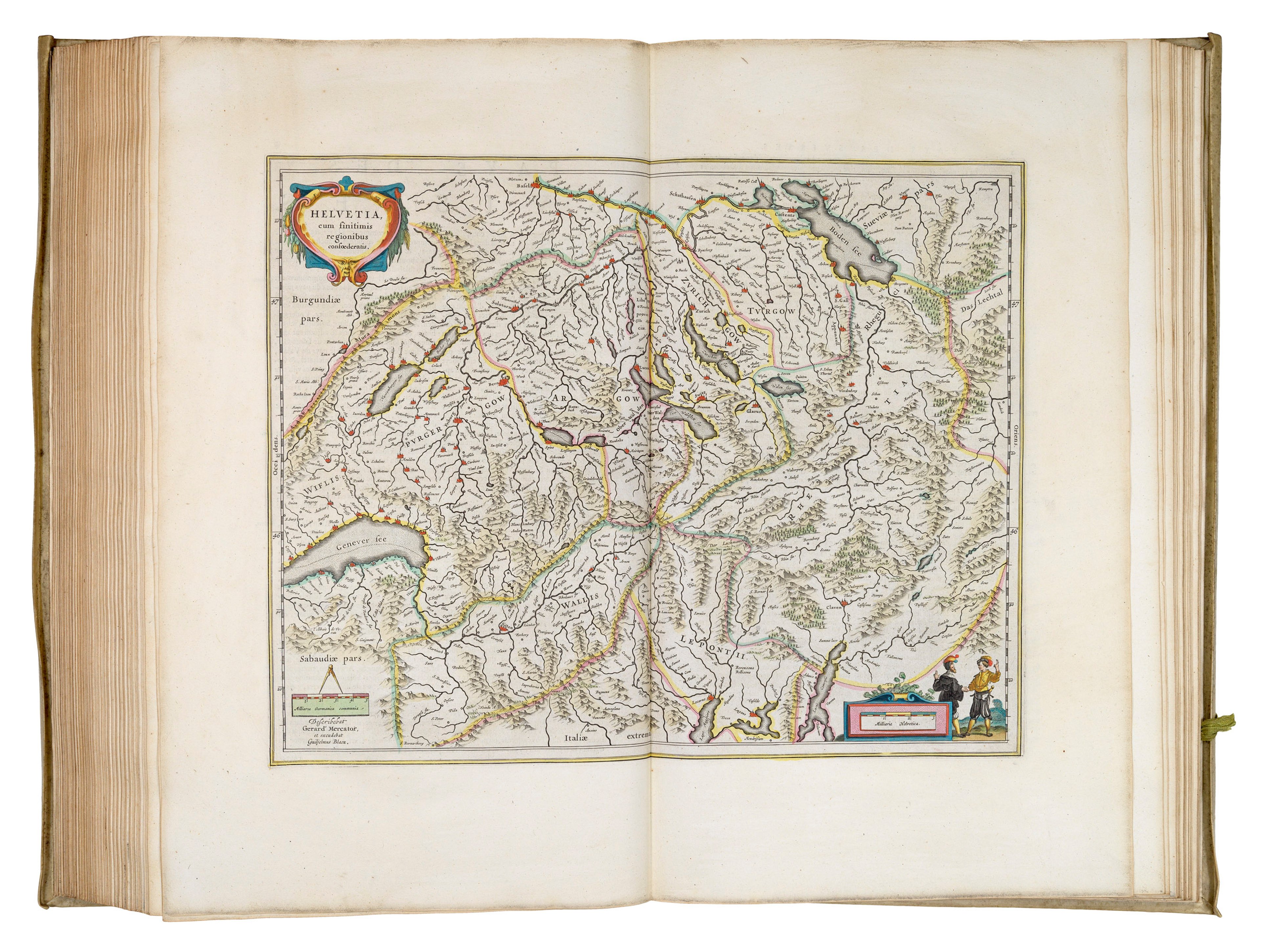
The Collection features many national and regional maps and town panoramas of Switzerland, showing the advancement of geographical understanding and importance of the country. Here are just a few of our favourites:
The earliest modern, non-Ptolemaic map of the country was produced in 1513 by Martin Waldsemüller (c1470-1521).
This map derives from an important early edition of Claudius Ptolemy’s Geographia (1541) by Michael Servetus (d.1533), published by Laurent Fries (1490-1532).
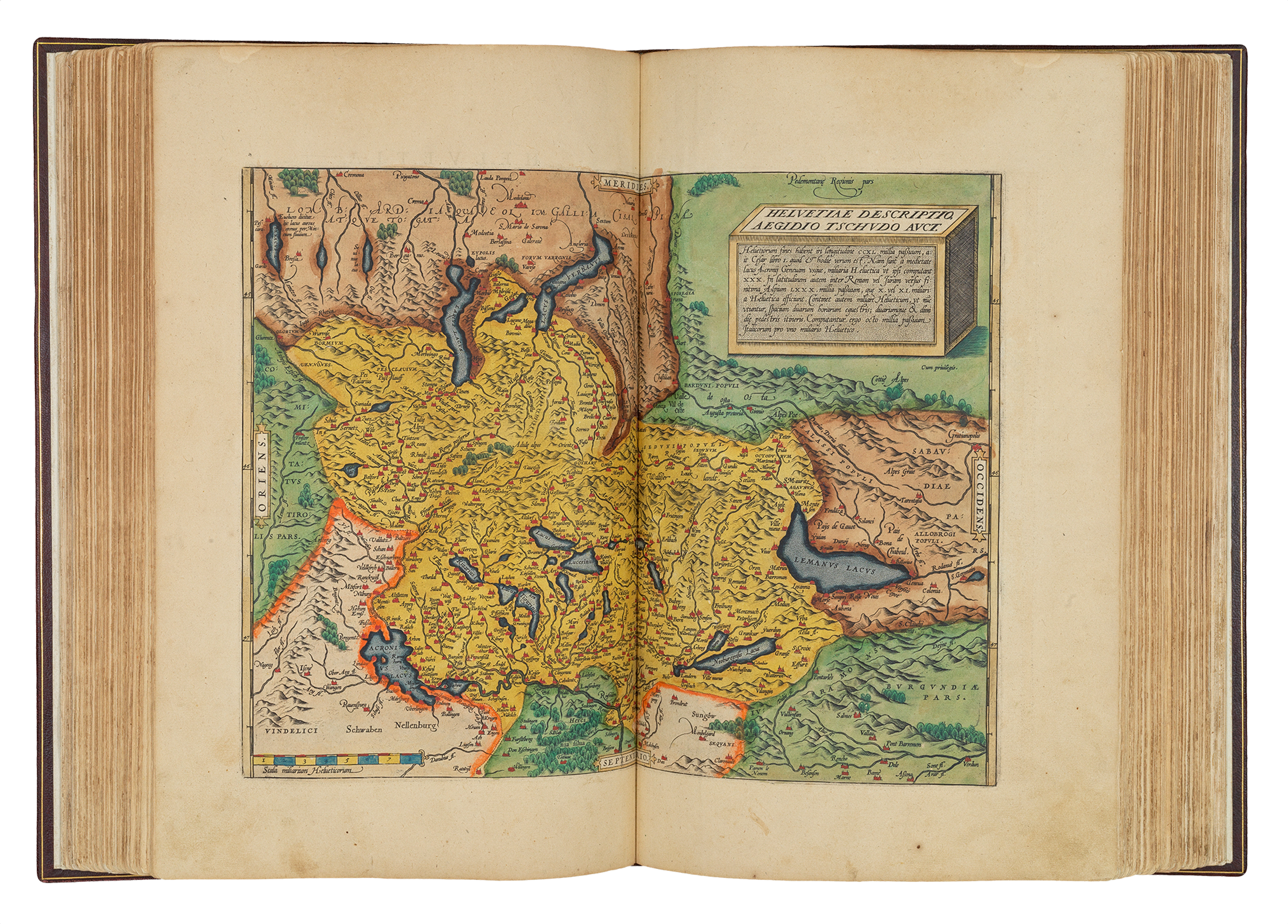
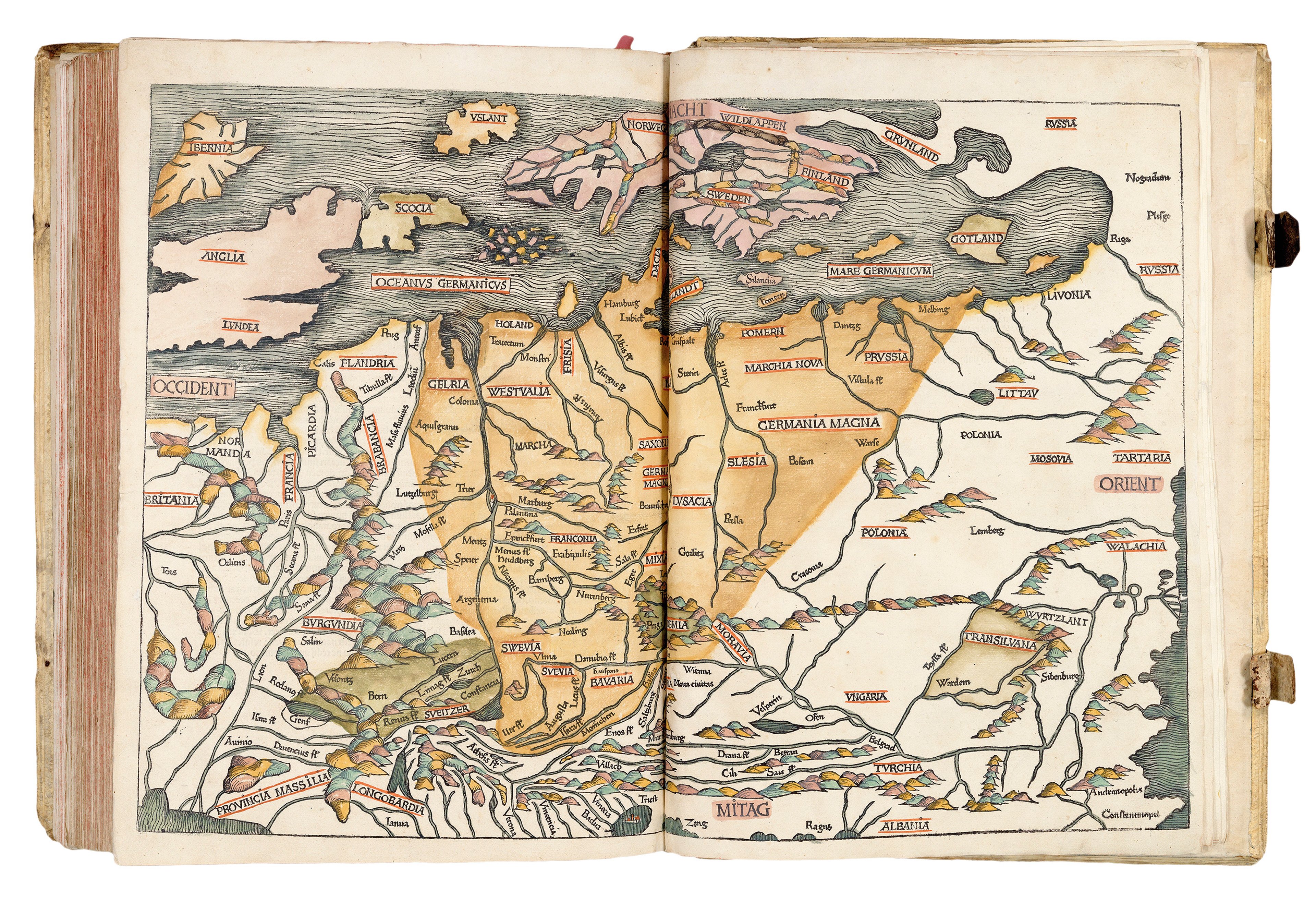
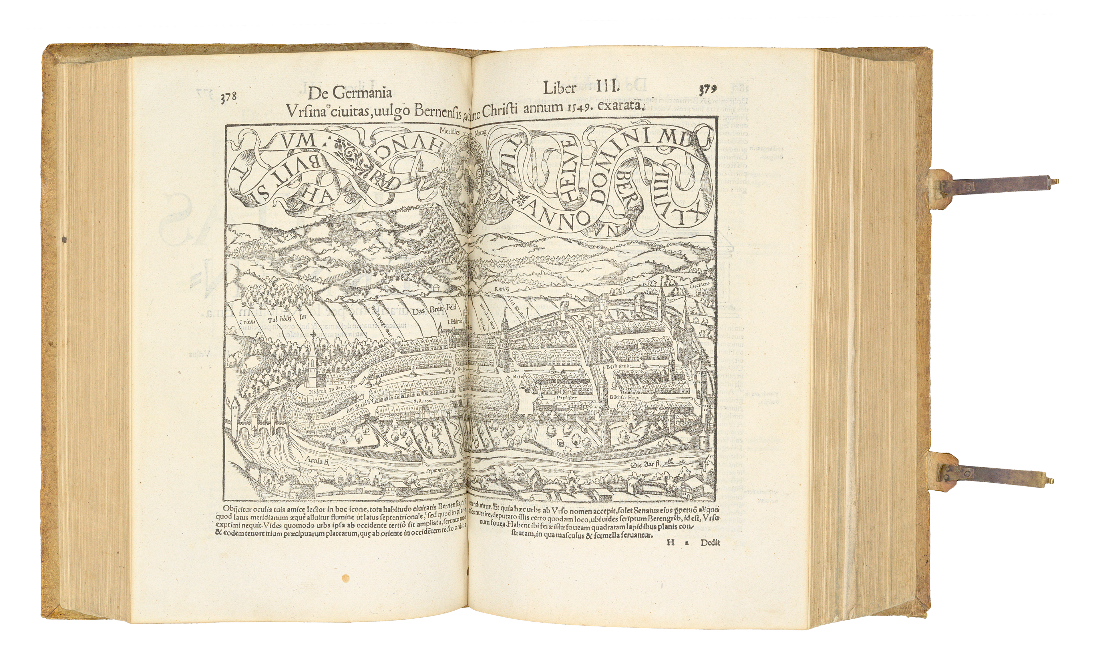
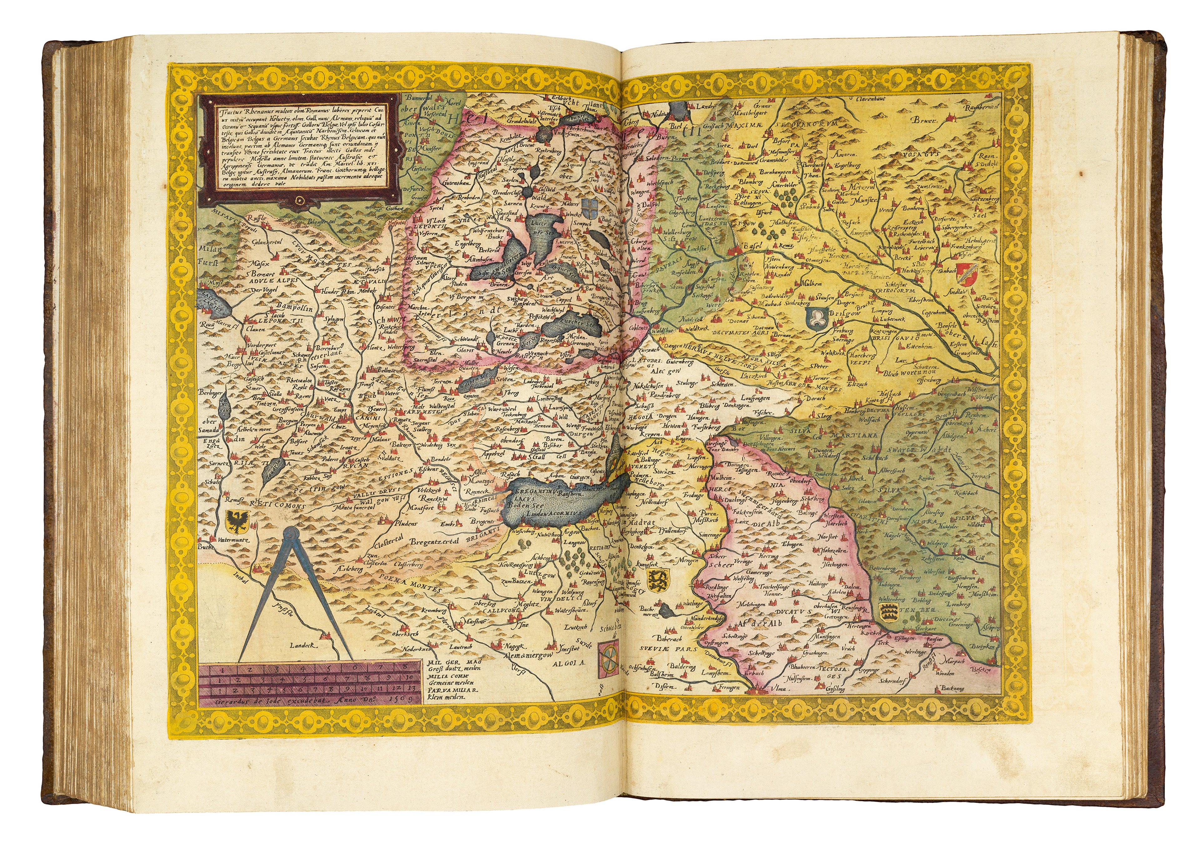
If you are located in Switzerland, do be sure to check out the Fantastische Karten | Fantastical Maps exhibition at Zentralbibliothek Zurich from 4 September - 5 December. Ex Carta is proud to be lending sixty maps will be on display as part of a celebration of legendary stories. Find out more using the link below.
Sign up for all of the latest updates and events from The Sunderland Collection and Oculi Mundi:
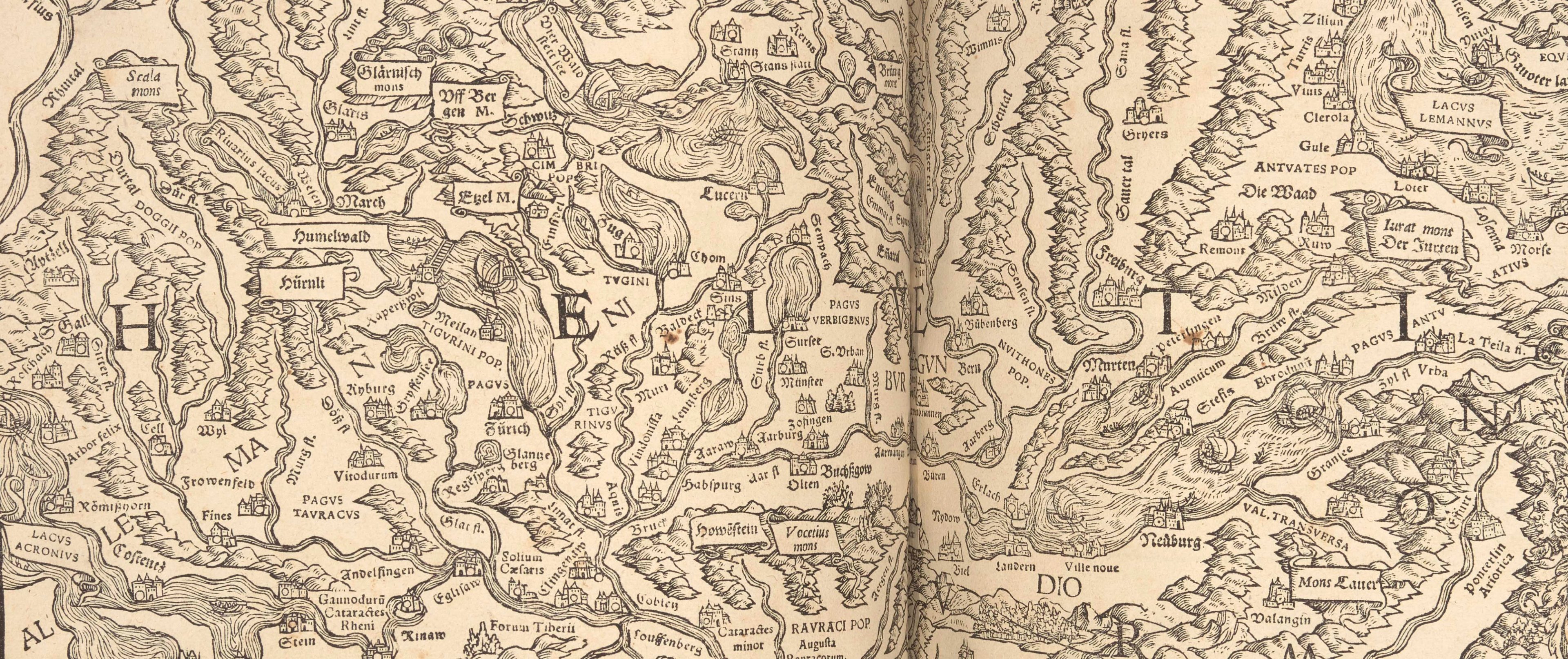
Detail of Johann Stumpff’s map of Switzerland (1547)
Select References
Leu, Urs, Series: Book Printing in Europe (2017, Landesmuseum Zürich)
Steiner, Alyssa, Exhibition Catalogue for ‘Apud Basileam: Printing in Basel around 1500. (2019, Taylor Institution Library Oxford)
Anon, William Tell, a symbol of Switzerland known throughout the world (2025, Schweizerische Eidgenossenschaft)
Watts, Pauline Moffitt, The European Religious Worldview and Its Influence on Mapping (History of Cartography, Vol3, Ch.11)
Anonymous, The History of Switzerland (2024, Schweizerische Eidgenossenschaft)
Egli, Emil, Switzerland (2026, Encyclopedia Britannica)