Nicholas Crane
What's Your Map? Live
Manoeuvres along the Meridian: What's Your Map? live at the British Library with Nicholas Crane
This special live episode was recorded at the British Library on Saturday 25 October 2025. You can enjoy the recording below, or watch on our YouTube channel.
In this episode, Jerry speaks to celebrated geographer, author, broadcaster and former President of the Royal Geographical Society, Nicholas Crane.
They discuss the discreet War Department takeover of an area of the Wiltshire countryside for British Armed Forces training, and the Military Manoeuvres Act of 1872 as demarcated on James Wyld's map of Salisbury Plain.
We learn more about the importance of map projections and the world's first scientific atlas by Gerard Mercator. We will also hear about Nicholas' own epic journeys across the UK, including his extraordinary coast to coast walk two degrees west of the prime meridian from Berwick-upon-Tweed in Northumberland, to the Isle of Purbeck in Dorset.
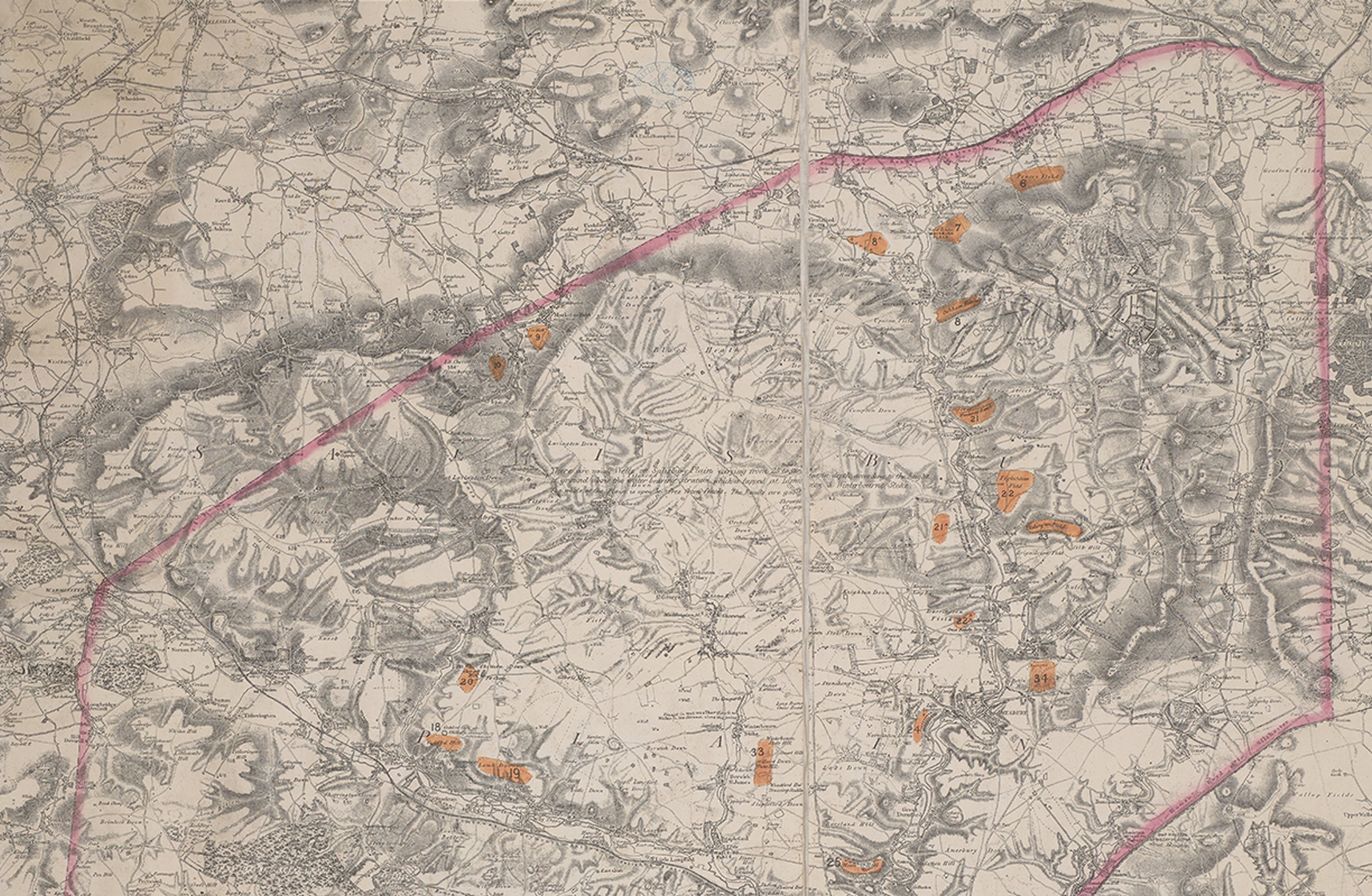
In preparation for an upcoming book ‘The Path More Travelled: The Secret History of Britain's Footpaths’, Nicholas spent time researching historic footpaths at the British Library. One map in the archives that caught his attention was James Wyld's ‘Map of Salisbury Plain showing the Country to be Occupied for the Military Manoeuvres during the Autumn of 1872, including the camps’:
©British Library - Maps 5710.(1).
Dated 8 August 1872, this map outlines the limits of the area assigned for military exercise as described in the Military Manoeuvres Act of 1872. This government legislation became an Act of Parliament, giving the British War Department permission to carry out un-restricted artillery exercise without having to request to do so each time. The pink outline shows the boundary of this area, and the numbered orange markers show the position of permanent Camps across the Plain.
Throughout the 1850s and 1860s there was a tense political situation in England and Salisbury Plain came into sharp focus due to its suitability as military training ground. The UK government under Prime Minister Lord Palmerston was anxious about the potential threat of French invasion. This was soon followed by the Franco-Prussian War (1870-1871) and the Unification of Germany (1871) which heightened the sense of imminent danger.
Salisbury Plain, located in the southwestern English county of Wiltshire, is the largest chalk grassland in north-western Europe. It is home to a diverse array of wildlife, butterflies and birds, and is brimming with important archaeological sites dating back 6,000 years - including Stonehenge. It is also home to the British Army’s 38,000-hectare training area.
On 10 August 1872, the Military Manoeuvres Act passed and around 30,000 troops descended on Salisbury Plain. The War Department (now the Ministry of Defence) felt that the training drills in this area of northern Wiltshire were so successful that they began to purchase the area in 1897.
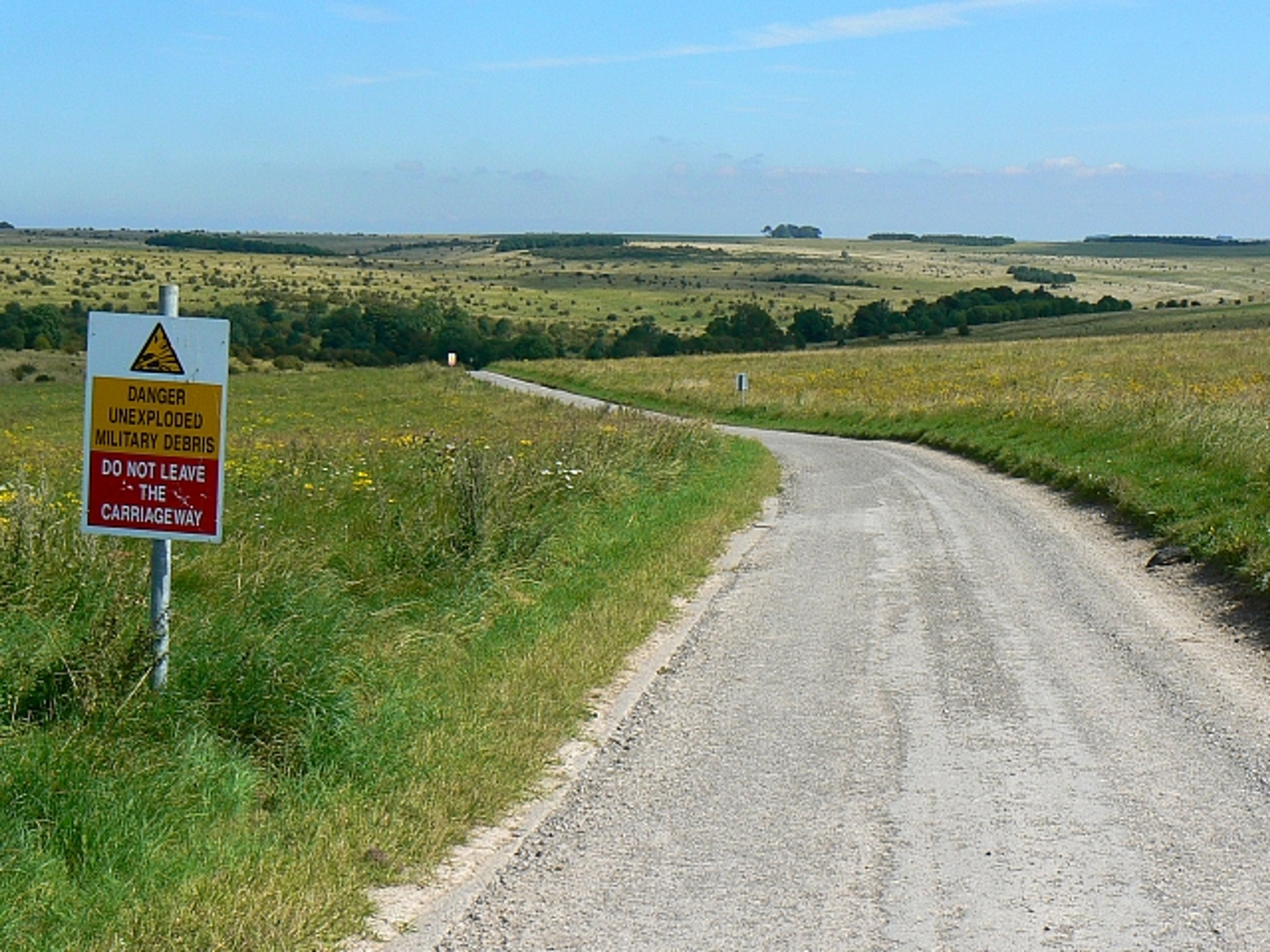
The gradual take over of British countryside would close and restrict a criss-cross of public footpaths and communities would be moved out of their homes for their own safety - most famously in the village of Imber. To this day, when the red flags are hoisted on the perimeters of the Plain, it is a warning that live firing is taking place, and that all public rights of way and footpaths are closed.
Public domain via Wikimedia Commons.
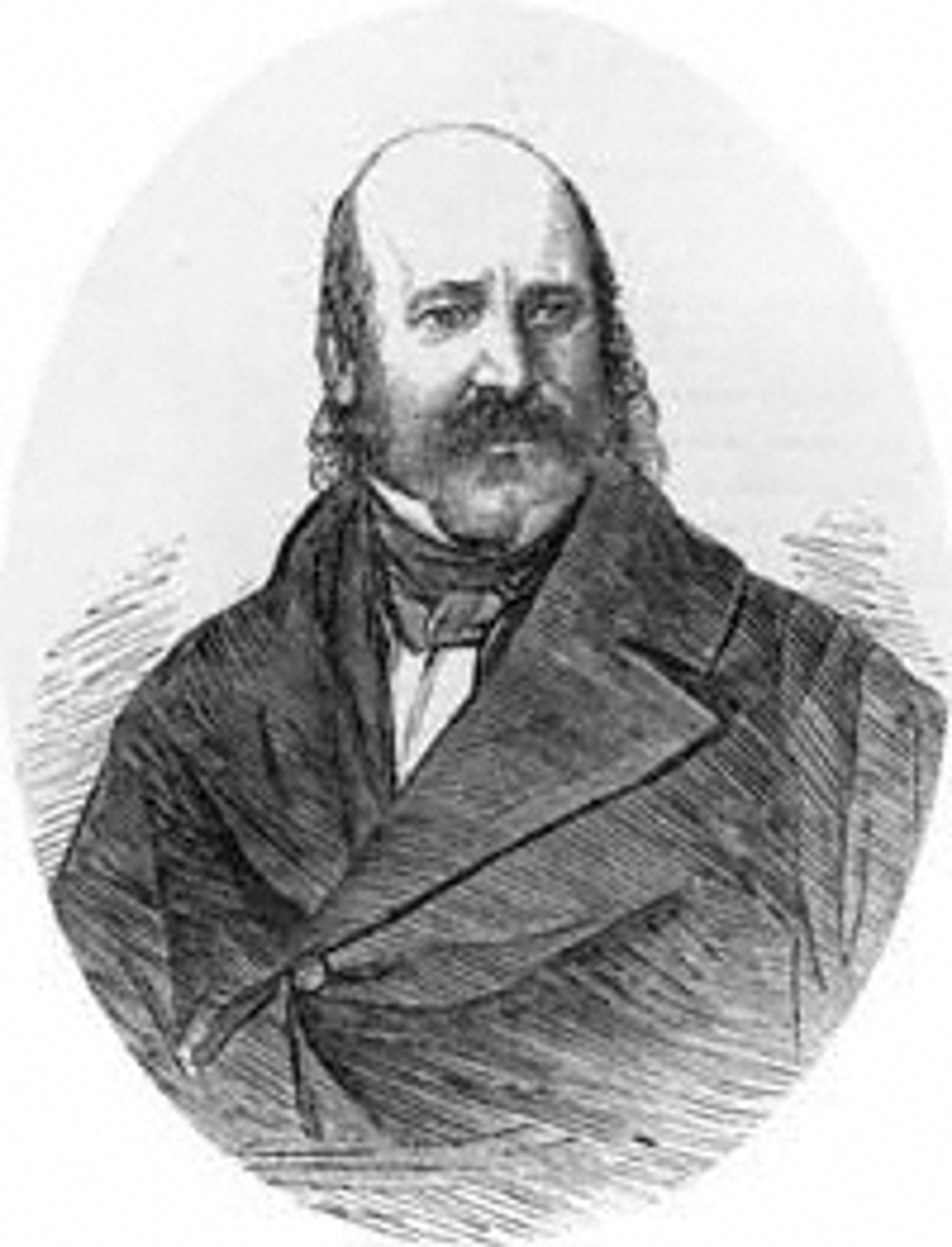
This map was produced by esteemed English cartographer James Wyld (1812–1887) who at the time held the prestigious title ‘Geographer to Queen Victoria’.
Wyld was a very commercially successful mapmaker and a prolific publisher, with a special focus on military maps and charts.
Wyld had a reputation for being outrageously entrepreneurial, so much so that in 1849 British periodical Punch Magazine, or the London Charivari (Vol 17-18) ran a story titled ‘A Wyld Goose Chase Over the Globe’ saying “... His industry certainly goes to the utmost limits. We doubt if there is the smallest scrap of the world left [for] him now to make a map of. … Go, search the North Pole, and you will find one of Wyld’s Maps dangling at the end of it.”
He would be commissioned to make maps on demand for military generals and government bodies - like this map which would not have been for public consumption - in the hope that this geography would become something he could alter to produce for a mass-market.
One thing keen map enthusiasts will note is that this map does not feature lines of longitude or latitude. This is because the counties of England and Wales (and indeed Scotland and Ireland) would have been mapped by a multitude of cartographers on a variety of scales. As this map covers parts of Wiltshire, Hampshire, Dorset and Somerset, collating them into one single map would have been a difficult task as they would not have lined up with one another.
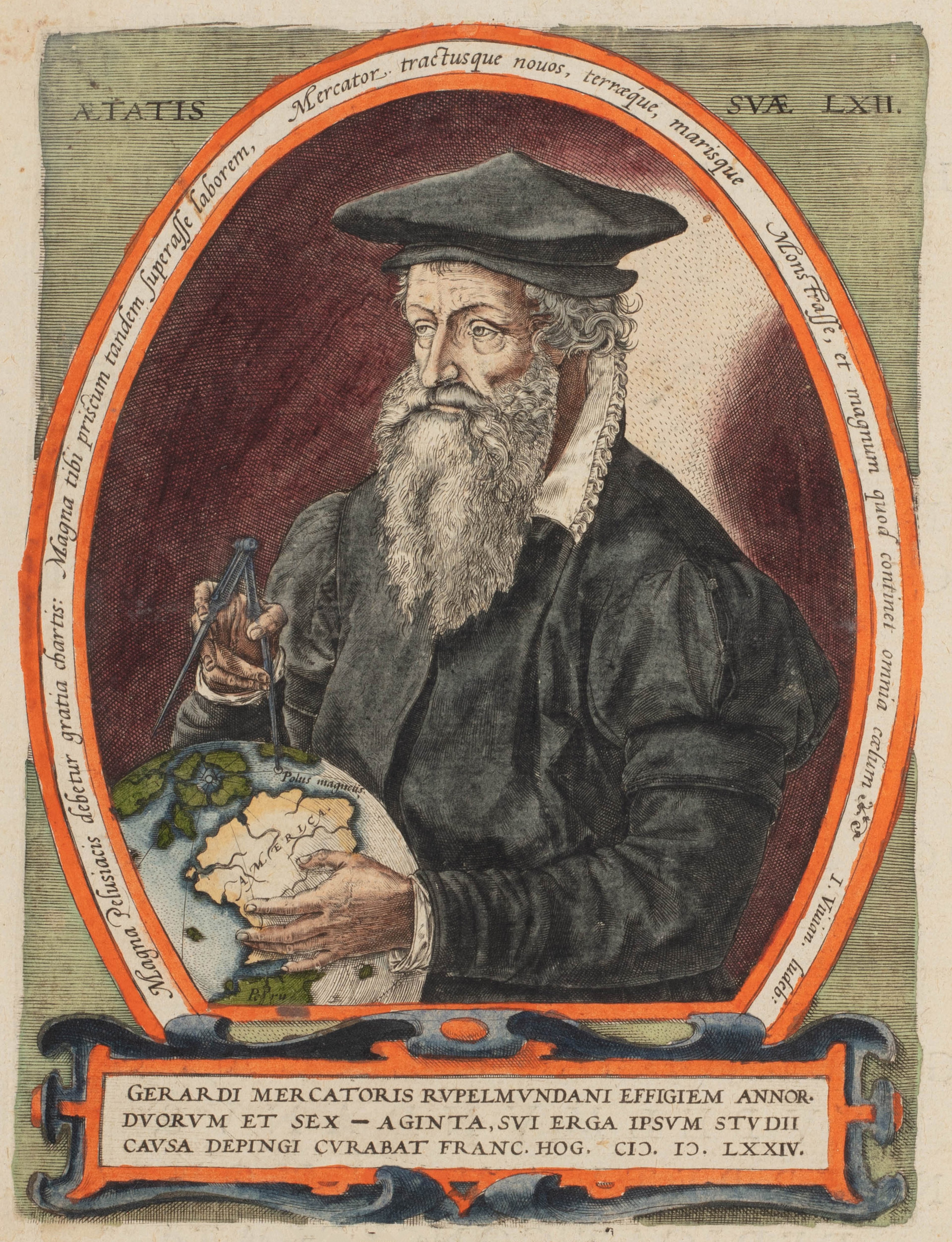
Along their cartographic journey, Jerry and Nicholas go back in time to discuss the importance of projections and scales, leading them to introduce the revolutionary design by sixteenth century cartographer, Gerard Mercator.
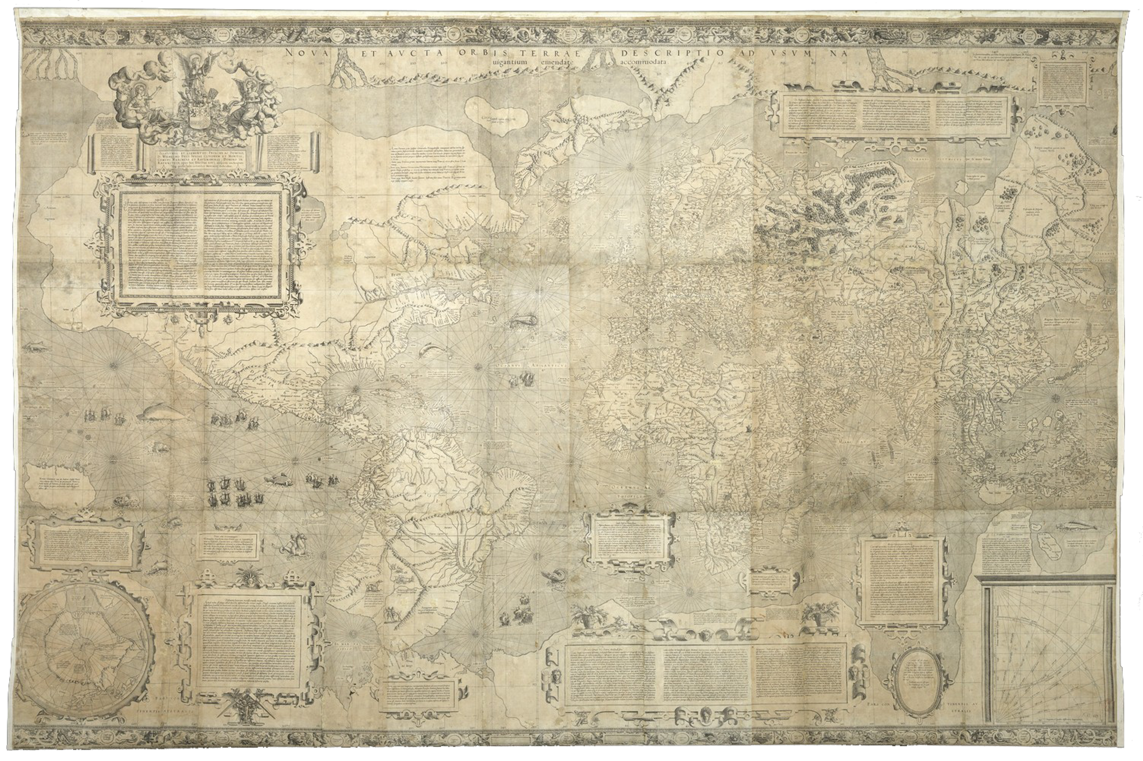
Source: gallica.bnf.fr / Bibliothèque nationale de France
This is Gerard Mercator's famed world map of 1569. Titled 'Nova et Aucta Orbis Terrae Descriptio ad Usum Navigantium Emendate Accommodata' which from Latin translates to 'New and more Complete Representation of the Terrestrial Globe, properly adapted for navigation'. It marked a significant turning point in the advancement of mapmaking "since the time of Ptolemy".
There is only 1 copy of this sixteenth-century map that is known to have survived. It is held by the Bibliothèque nationale de France.
©The Sunderland Collection.
Mercator's goal was to create a map projection that was useful for both practical navigation and illustrating geography with better proportions. He included a criss-cross of loxodromes - also known as rhumb lines - which intersected at the compass points, aiding direction.
With the publishing of this map, Mercator transformed the lay of the cartographic land from pictorial woodcut maps, to defined, scientific maps engraved in copper.
©The Sunderland Collection.
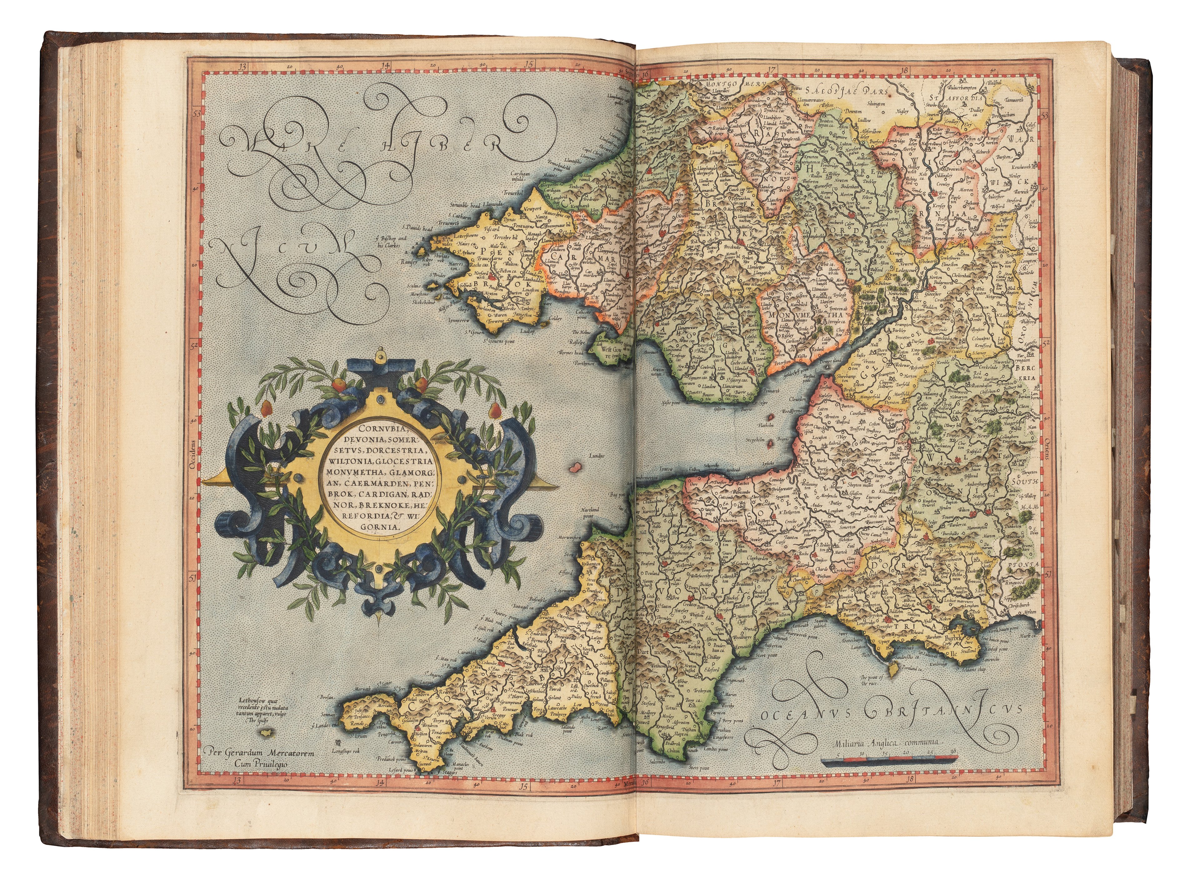
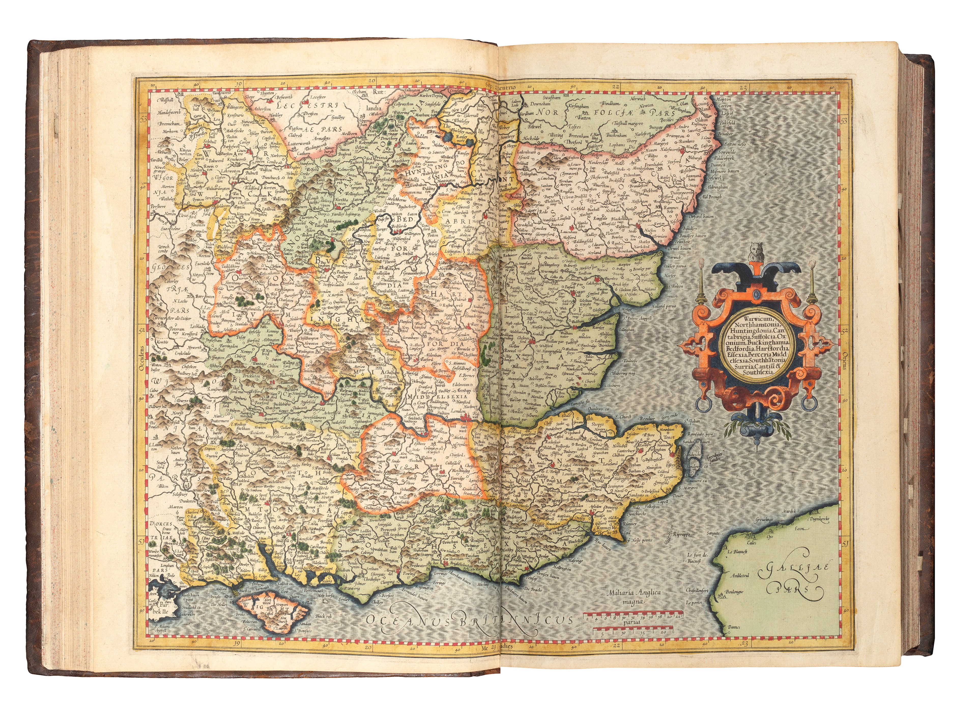
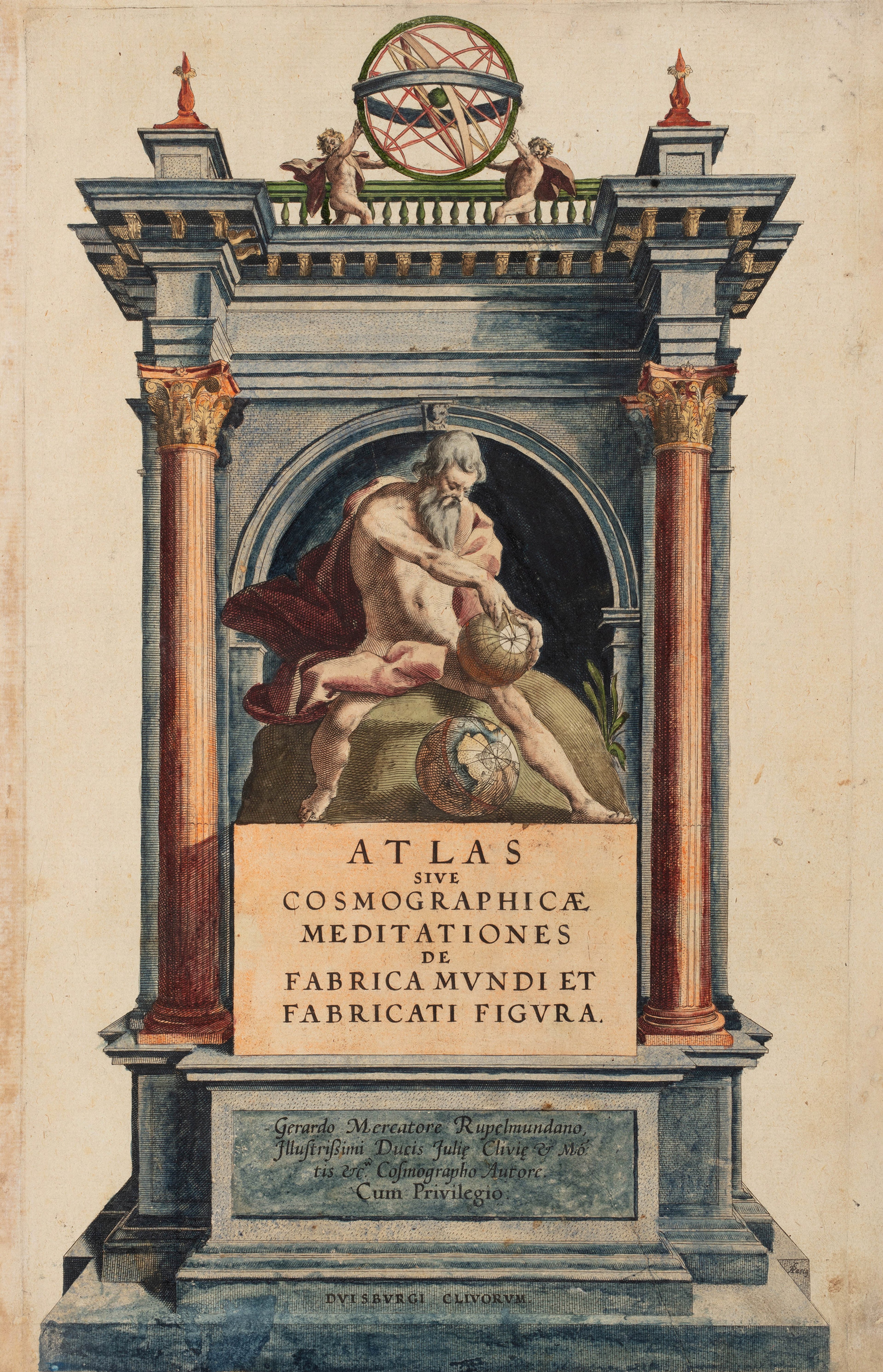
This map of England and Wales, with parts of Scotland, Ireland and north-western Europe is also by Mercator. It derives from his masterpiece 'Atlas sive Cosmographicae Meditationes de Fabrica Mundi et Fabricati Figura' (1595) which is celebrated for being one of most important European cartographic works produced during the Renaissance.
It is widely considered to be the first modern scientific atlas. It is also the first work to use the term 'atlas' in a title for a collection of maps. In Greek mythology, Atlas was the Greek god who bore the weight of the Earth and the Heavens on his shoulders, a punishment given to him by Zeus for warring with the Olympian gods.
©The Sunderland Collection.
Mercator's 1595 'Atlas' contained 5 regional maps of England, and by doing this he offered the viewer three levels of scale to provide better detail for these regions.
All of the maps of England are said to have used Christopher Saxton as a cartographic source - drawing on both his 1583 map of Great Britain and Ireland, and his individual county maps dating between 1574 and 1579.
However, according to Imago Mundi scholar J. H. Andrews, Mercator's use of latitude and longitude in the 'Atlas' was a less accurate than that of Saxton!
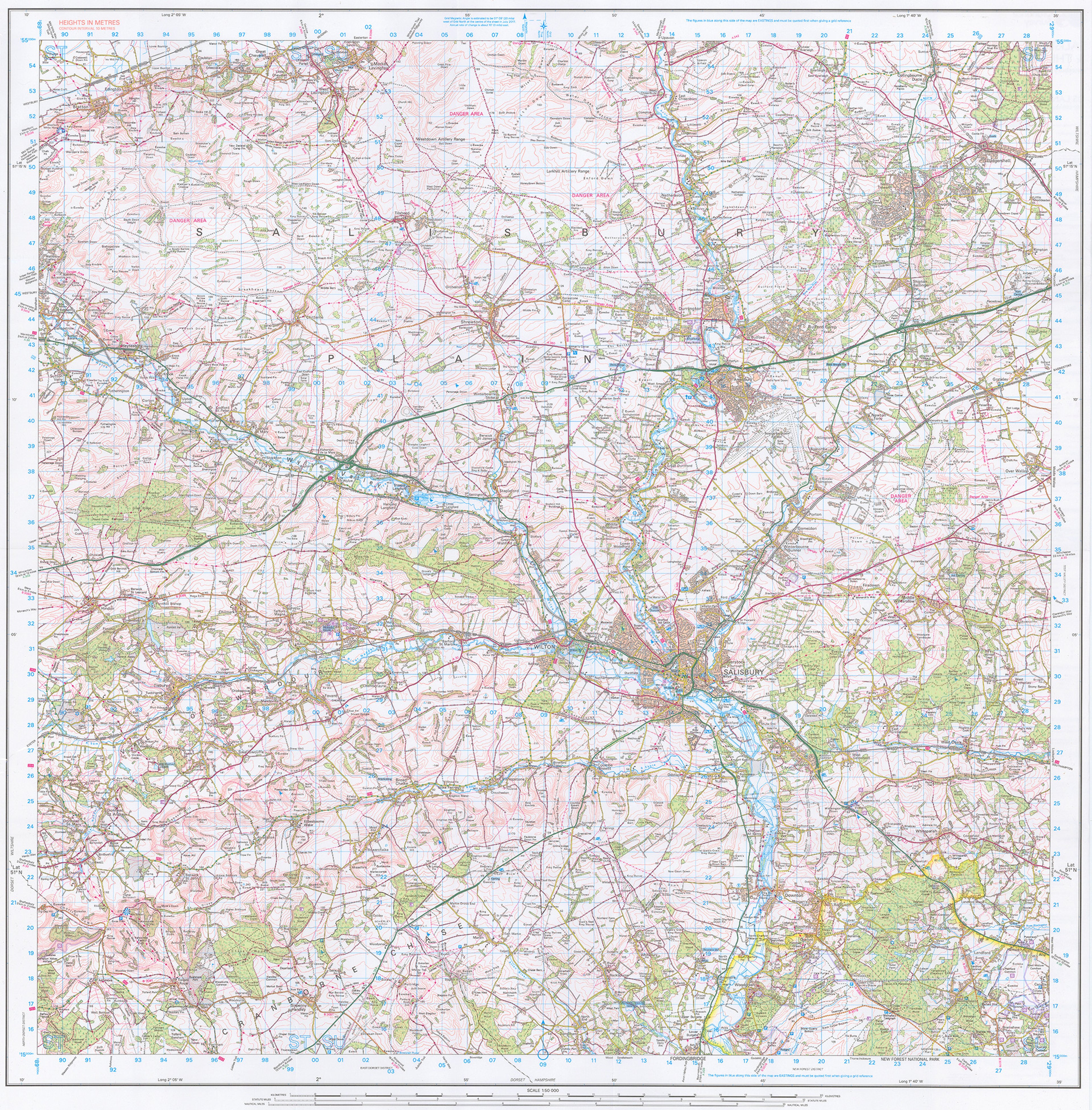
Ordnance Survey 1:50 000 scale Map of Salisbury Plain - Landranger 184 ©Ordnance Survey.
This is Ordnance Survey's 1:50,000 scale 'Landranger' map of Salisbury Plain in Wiltshire (OS184). The Ordnance Survey is the UK's national mapping agency. Established in 1791, the OS has been making maps and innovating cartography for over 230 years.
The founding of the Ordnance Survey led to the implementation of a nationwide trigonometric survey and the introduction of the National Grid reference system as well as consistent map scales and icons on their maps. Ordnance Survey maps use what is known as a Transverse Mercator Projection - a variation of Mercator’s projection where the imagined cylinder wrapping around the globe runs along a longitudinal meridian as opposed to the equator. This is the most accurate way to present large-scale maps with north-south orientation as it preserves angles and geography in smaller areas with less distortion. For this, the OS chose the line of longitude two degrees west to present as little distortion as possible. The further away something is from the prime meridian, the more distorted the geography is.
Ironically Wyld helped to start two organisations - the Association of Surveyors and the Surveyors' Institution - that rallied against the Ordnance Survey as he saw them a threat to his business. However, when these organisations failed, he would have his own company appointed as one of a limited few official retailers for the new Ordnance Survey maps.
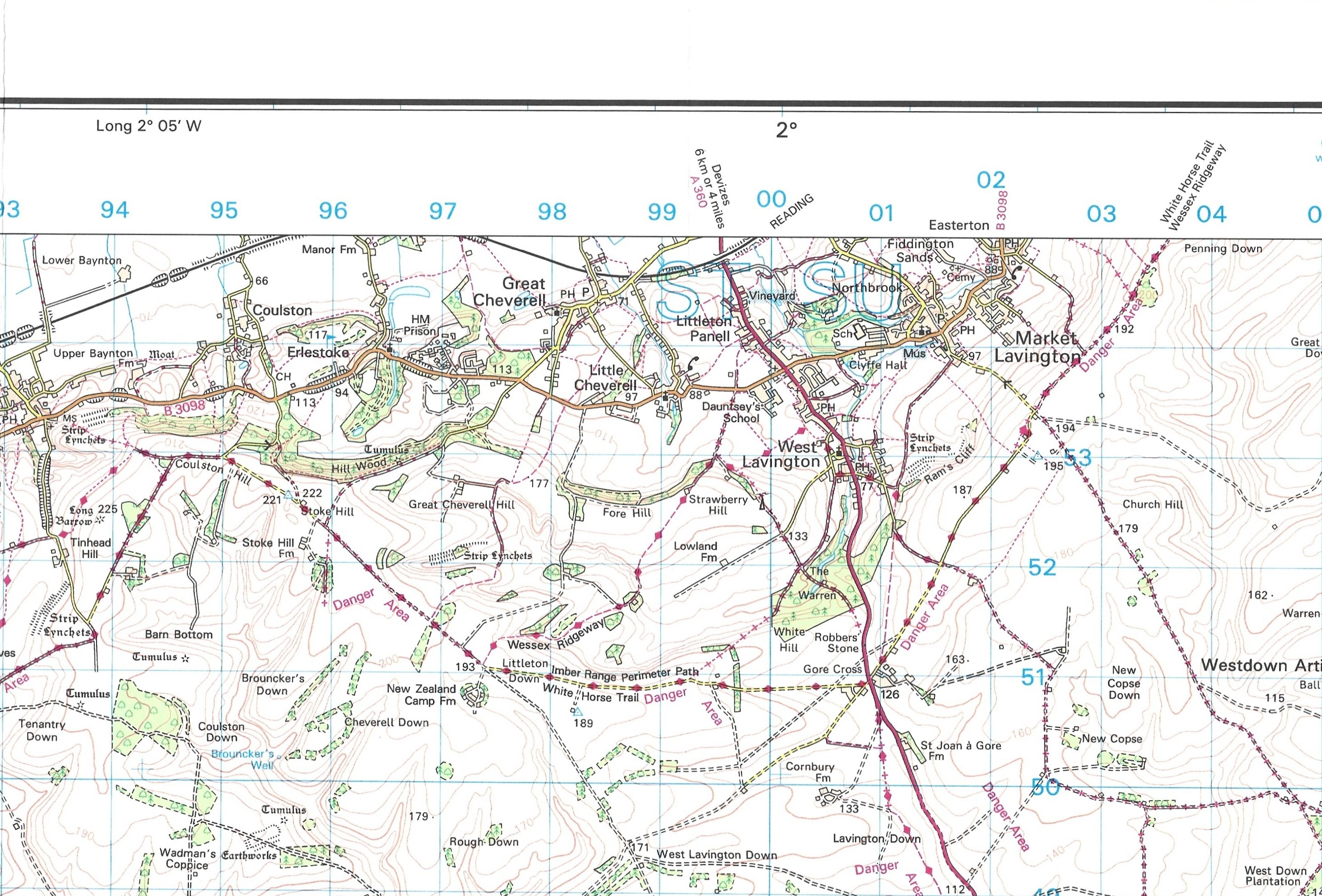
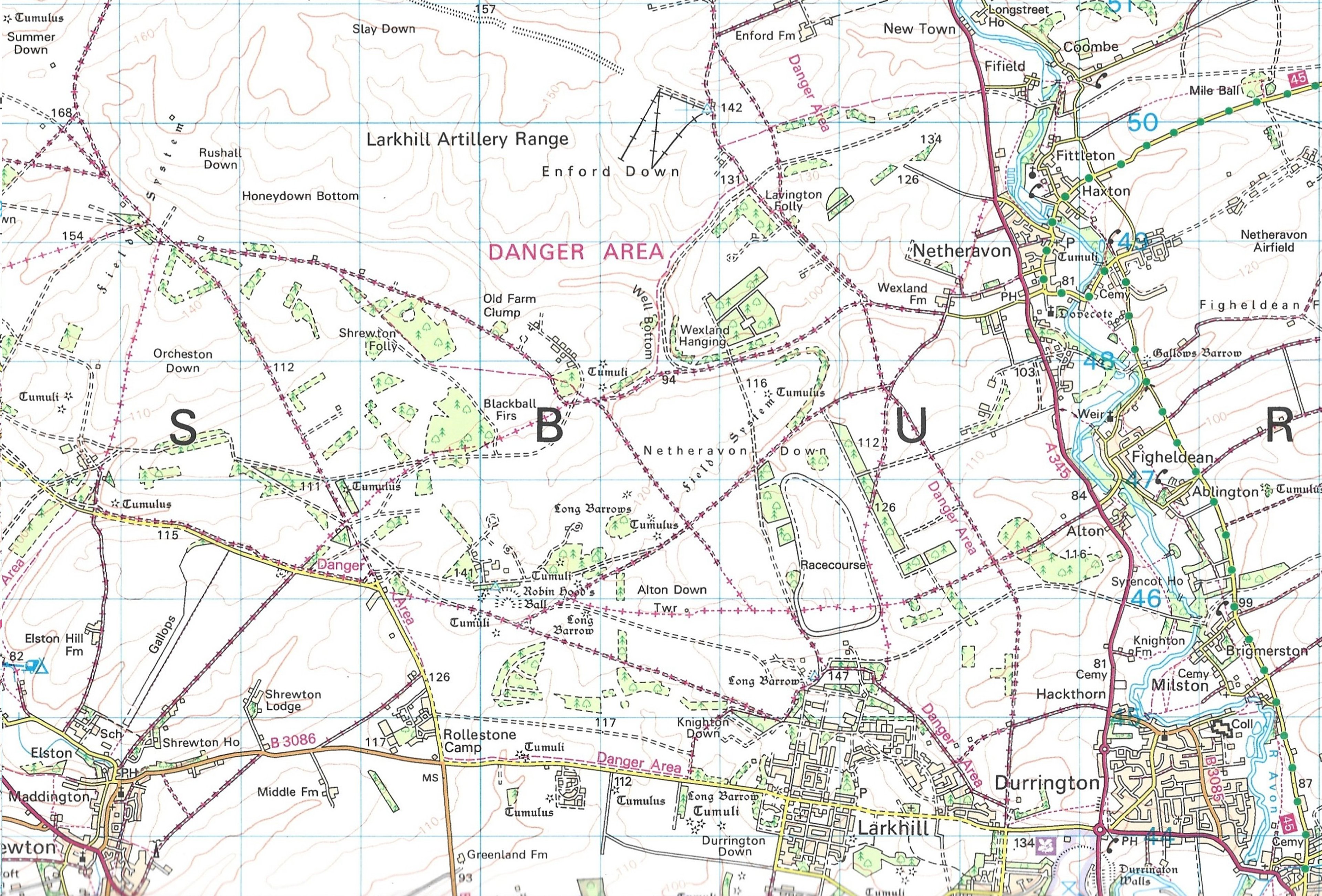
Nicholas used his own copy of this map to navigate across Salisbury Plain during his Two Degrees West expedition. Adhering to his strict rules of following this 'longitudinal tightrope' meant that he had to gain special permissions to travel through the active training zone on the Plain and the RAF base at MOD Lyneham (near Chippenham).
On the podcast, Nicholas describes to Jerry the excitement of his own military manoeuvres. He was escorted by the British Army across the Plain during live firing; across a runway at the then UK's main transport aircraft base in Lyneham, and later, being taken across Poole Harbour by the Royal Marines!
The road from Heytesbury to Imber, Salisbury Plain. Brian Robert Marshall. Public Domain.
About Nicholas Crane

Nicholas Crane is an author, geographer, cartographic expert.
He is the recipient of the Royal Scottish Geographical Society’s prestigious Mungo Park Medal in recognition of outstanding contributions to geographical knowledge, and of the Royal Geographical Society’s Ness Award for popularising geography and the understanding of Britain.
Between 2015 and 2018, Nicholas served as the elected President of the Royal Geographical Society.
Nicholas has been the lead presenter on more than 80 BBC films - presenting many acclaimed TV series’ on BBC2, including: Map Man, Great British Journeys, Town, Britannia and Coast.
An an author, his books include Clear Waters Rising: A Mountain Walk Across Europe (Penguin, 1996), which describes his solo, 10,000-kilometre walk along the continent’s mountain watershed and was called ‘One of the liveliest and most enthralling travel books I have read for years’ by Miranda Seymour in the Sunday Times.
Two Degrees West: An English Journey (Viking, 1999), described as ‘An elegant and moving snapshot of England, a beautifully written book…very funny’ by The Times, is the account of a walk from one end to the other of England, following the prime meridian.
In 2002, Nicholas wrote the cartographic bestseller Mercator: The Man Who Mapped the Planet (Orion), which was praised by the great Lisa Jardine as ‘A gripping and densely informative biography’.

The Sunderland Collection is truly honoured to have been invited by the British Library to collaborate on this exciting live event, as part of the programming to accompany the Library's exhibition Secret Maps.
Why not continue your exploration of the wonderful world of maps by subscribing to the podcast? That way you will never miss an episode.
Feel free to let us know - What's YOUR Map?!