Habitable Climes: Emblems
An Index of Emblems

The namesake of the exhibition, this series titled "Habitable Climes" draws from theories first described by Aristotle in which the Earth was thought to have five climes: the Arctic and Antarctic, or North and South frigid zones; the North and South temperate zones; and one very hot zone between the two tropical zones.
Only the temperate zones were thought to be habitable. Referred to by Claudius Ptolemy as a zone on a map, 'climes' persisted for hundreds of years in European cartography.

This series of 5 works, Habitable Climes, were inspired by the "Map of the Ancient Known World", deriving from Abraham Ortelius’s landmark atlas,”Theatrum Orbis Terrarum”. A 1603 example of the atlas is held within The Sunderland Collection.
The inspiration for this work was the 'Map of the Ancient Known World', deriving from Abraham Ortelius’s landmark atlas, "Theatrum Orbis Terrarum". A 1603 example of the atlas is held within The Sunderland Collection.
Each of the five works also features an emblem based on the projections of maps from the Collection that first inspired Kristina.
"Zona Frigida, clima i" (2025)
Pigment print on Japanese Kozo Natural 110gsm, 90 x 110 cm


Zona Torrida, clima i (2025)
Emblem source: Jodocus Hondius’ Globe Gores, circa 1618
These exceptionally rare globe gores were prepared by Jodocus Hondius II, sometime shortly after the discovery of the Le Maire Strait in 1618.
These gores correspond to an approximately fifteen-centimetre terrestrial globe, no completed examples of which are known to exist. Furthermore, there is only one other known example of the gores, located in a Parisian institution.
"Zona Temperata, clima ii" (2025)
Pigment print on Japanese Kozo Natural 110gsm, 90 x 110 cm


Zona Torrida, clima ii (2025)
Emblem source: Laurent Fries’ Reduction of Waldseemüller’s Ptolemaic Map, 1535
This fine world map is a reduced version of Martin Waldseemüller’s famous 1513 map. It was published in 1535 by Laurent Fries for his edition of Claudius Ptolemy’s ‘Geographia’. Fries’ version is finishing in original hanembellished with decorative details such as windheads, which were lacking in previous editions.
"Zona Torrida, clima iii" (2025)
Pigment print on Japanese Kozo Natural 110gsm, 90 x 110 cm

Zona Torrida, clima iii (2025)
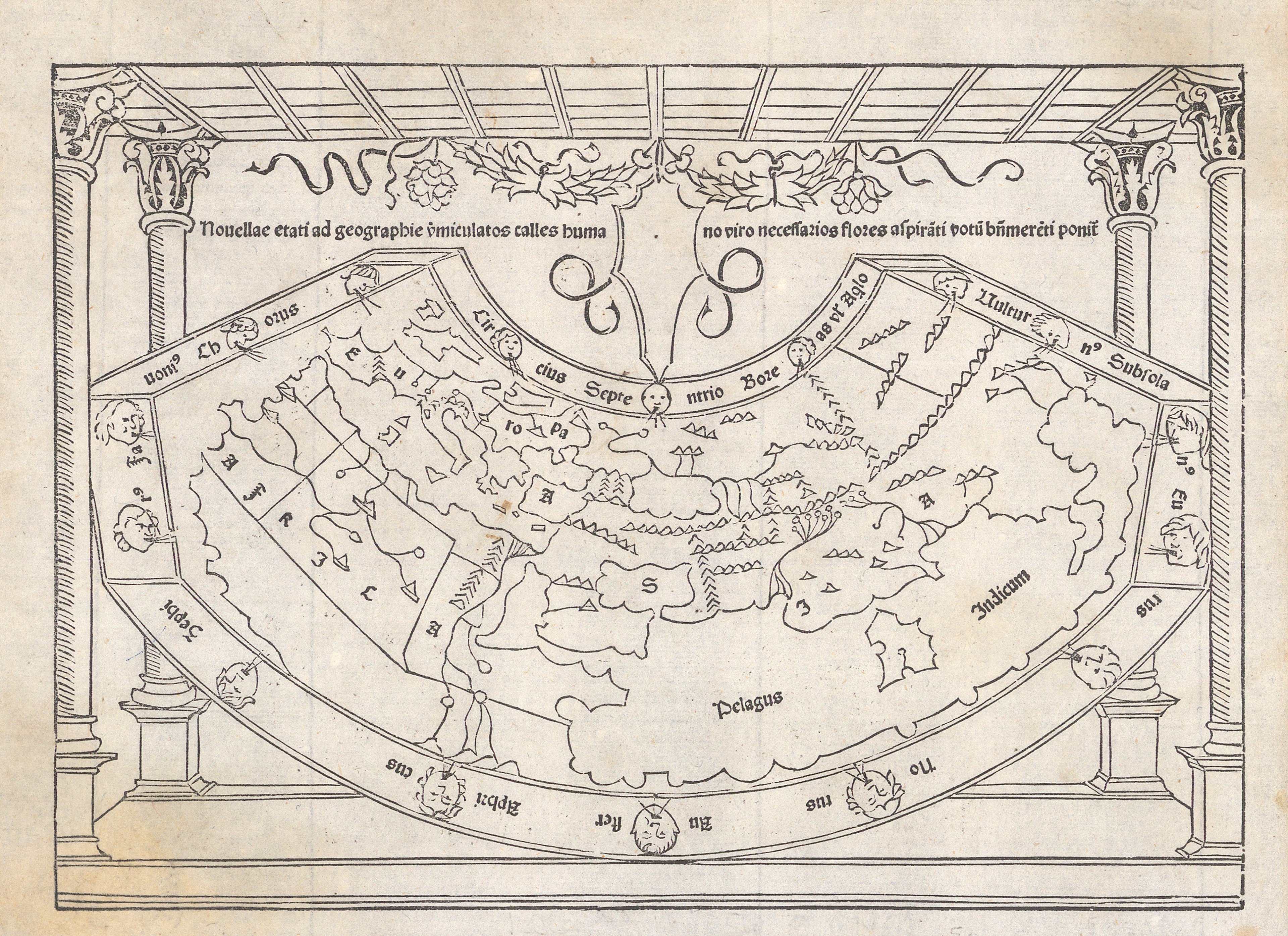
Emblem source: World Map from Pomponius Mela’s “Cosmographia”, 1482
This lyrical map shows the world on a Ptolemaic projection hanging in space, amid four pillars. Although the map is quite simple and small in scale, it is packed with interesting content and charming decorative details. The map illustrated an early printed edition of the ‘Cosmographia’, composed by Pomponius Mela around 43 CE. It was the first to depict contemporary Portuguese knowledge of the west coast of Africa and was consulted by the Columbus brothers before they set out on their western voyage in 1492. It is also the source for another important and early map of the world: Hartmann Schedel’s world map from the 'Nuremberg Chronicle' in 1493.
"Zona Temperata, clima iv" (2025)
Pigment print on Japanese Kozo Natural 110gsm, 90 x 110 cm

Zona Torrida, clima iv (2025)
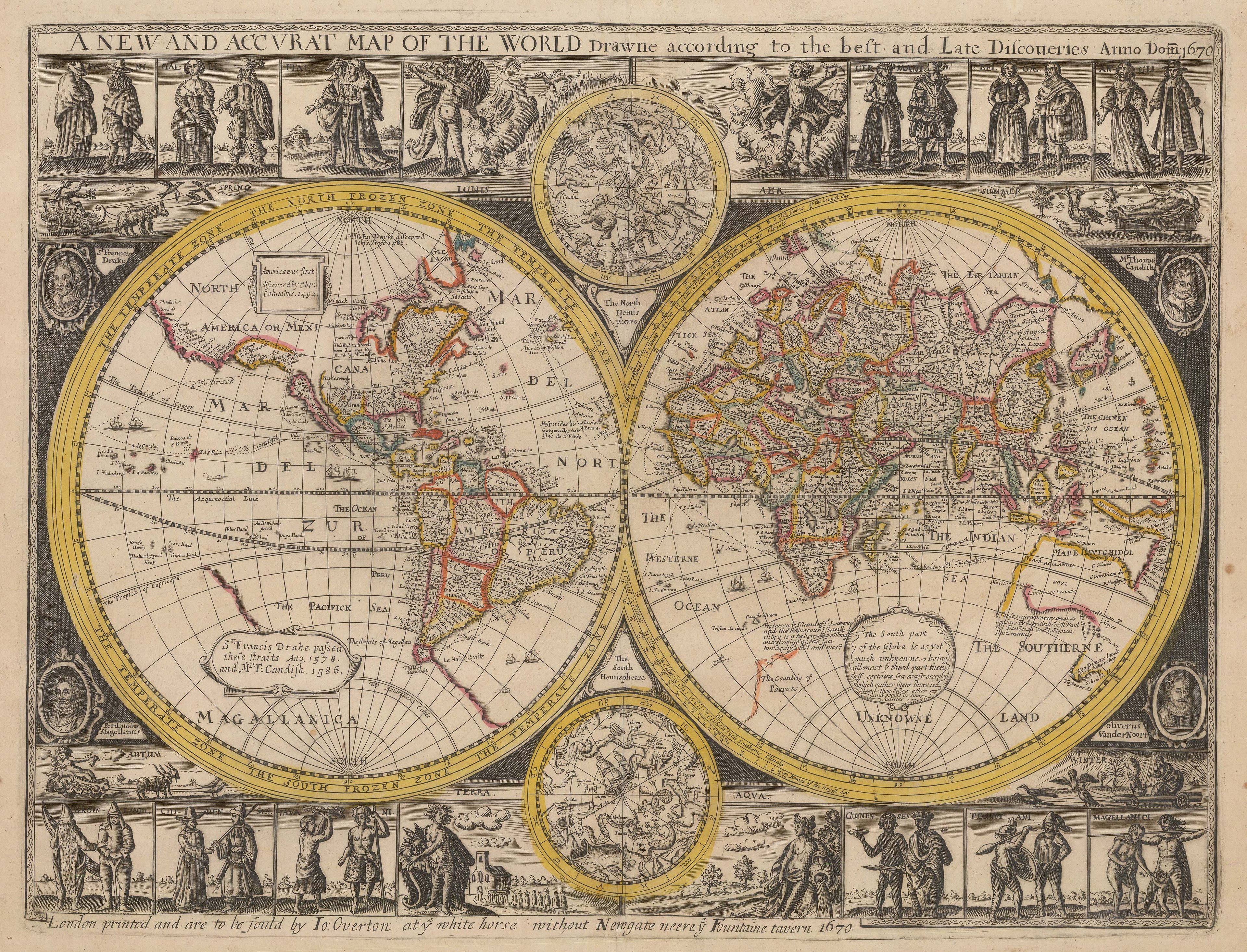
Emblem source: John Overton’s Double Hemisphere World Map, 1670
John Overton’s exceedingly rare English map of the world is a reissue of Peter Stent’s double-hemisphere map of 1663, incorporating elements of Stent’s 1657 map in the decorative border. Overton’s world map has its own curious points of interest.
"Zona Frigida, clima v" (2025)
Pigment print on Japanese Kozo Natural 110gsm, 90 x 110 cm

Zona Torrida, clima v (2025)
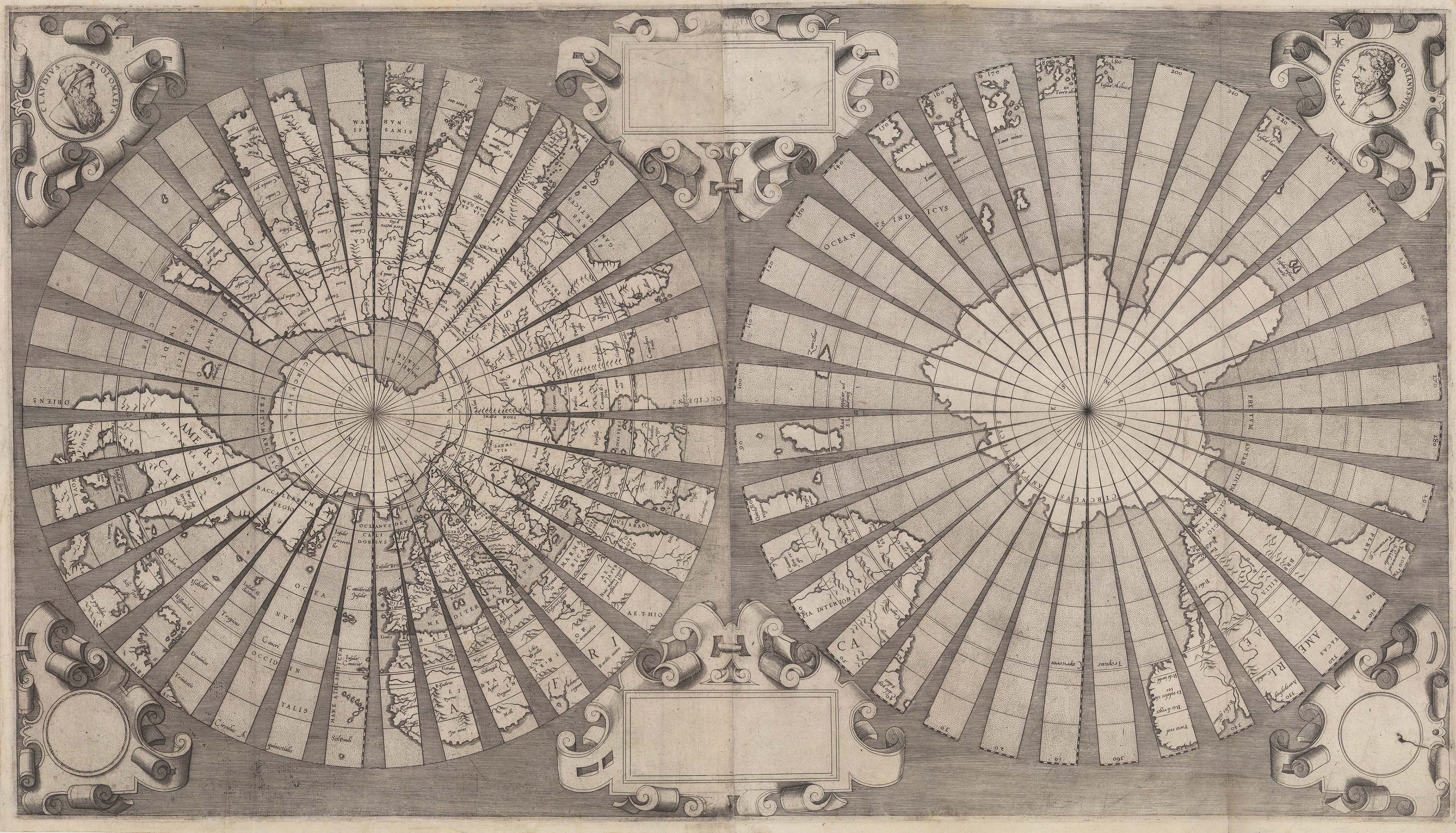
Emblem source: Floriano’s ‘Bicycle Spoke’ World Map, circa 1555
This striking double-hemisphere map is affectionately known as the ‘Bicycle Spoke’ world map. It was designed by Antonio Floriano, a painter from Udine, and published in Venice with privileges granted from the Senate. Floriano writes that he created the map to enable viewers to ‘easily study and learn cosmography and see the entire picture of the world, since it can be reduced to spheric form’.
The design of the map is mysterious. Based on a polar projection, each hemisphere is divided into thirty-six gores of ten degrees longitude each, as if it was intended to be mounted to a globe. However, elaborate strapwork boarders and portraits of Floriano and Claudius Ptolemy in the upper corners make it unlikely that it was intended to be cut apart.