Mercator: History in the (Map)Making
Introduction
For this collection highlight, we present two atlases by one of the most important European cartographers, Gerard Mercator.
- Mercator’s edition of Claudius Ptolemy’s ‘Geographia’ (1584), an homage to early geographical science
- Mercator’s 'Atlas sive Cosmographicae Meditationes de Fabrica Mundi et Fabricati Figura' (‘Atlas, or Cosmographical Meditations on the Fabric of the World, and the Figure of the Fabrick'd’ (1595), his ground-breaking modern atlas
Who was Gerard Mercator?
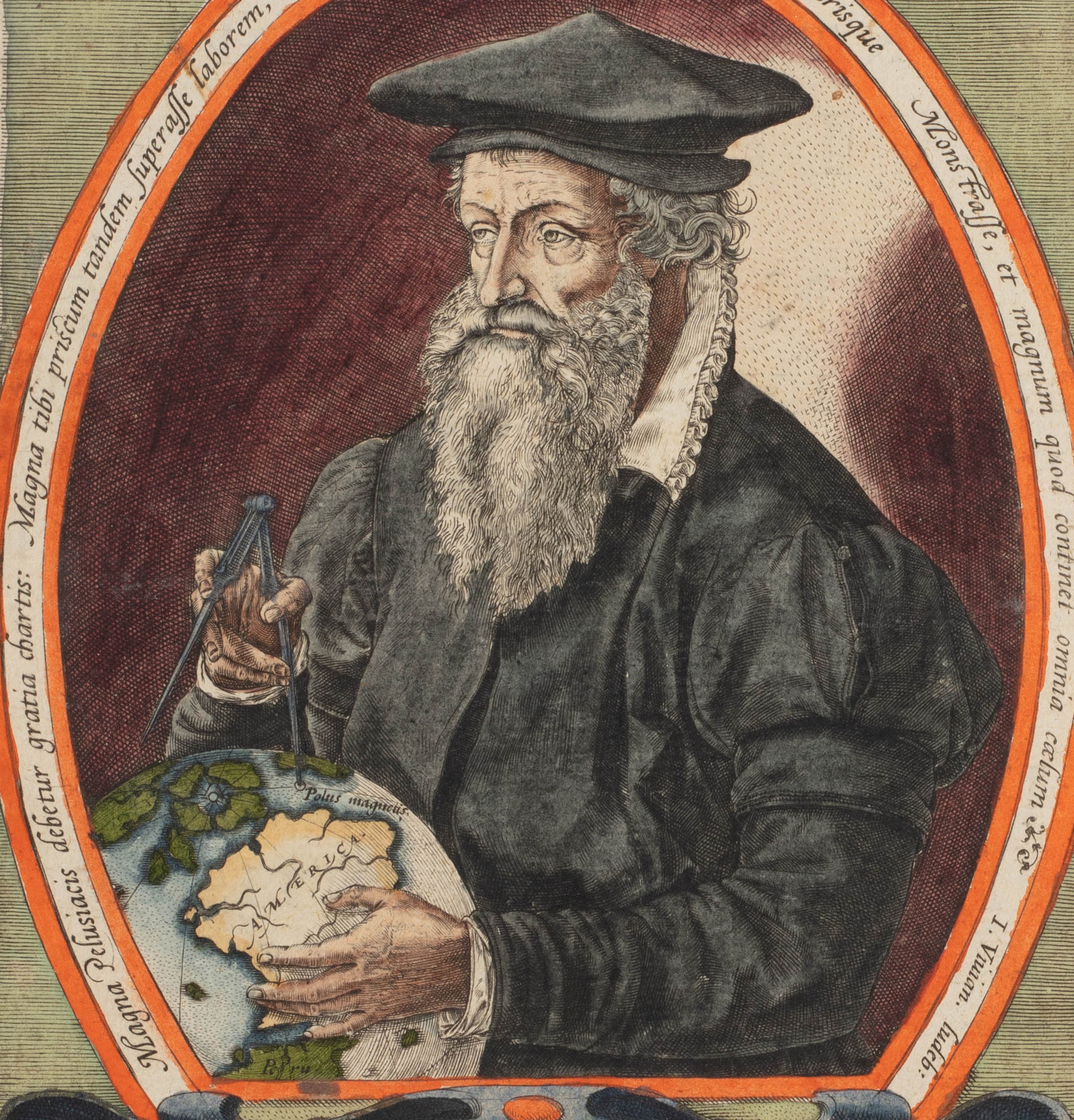
Mercator was one of the most prominent figures in European cartography during the sixteenth and seventeenth centuries - a skilled cosmographer, geographer, historian, and a maker of maps, globes and scientific instruments.
His greatest contribution was his eponymous projection - the Mercator Projection: a worldview that succinctly solved the problem of depicting a spherical Earth onto a two-dimensional plane. He was also responsible for coining the term ‘Atlas’ when referring to a book of uniform maps, and is credited as being the founder of commercial map production in Europe.
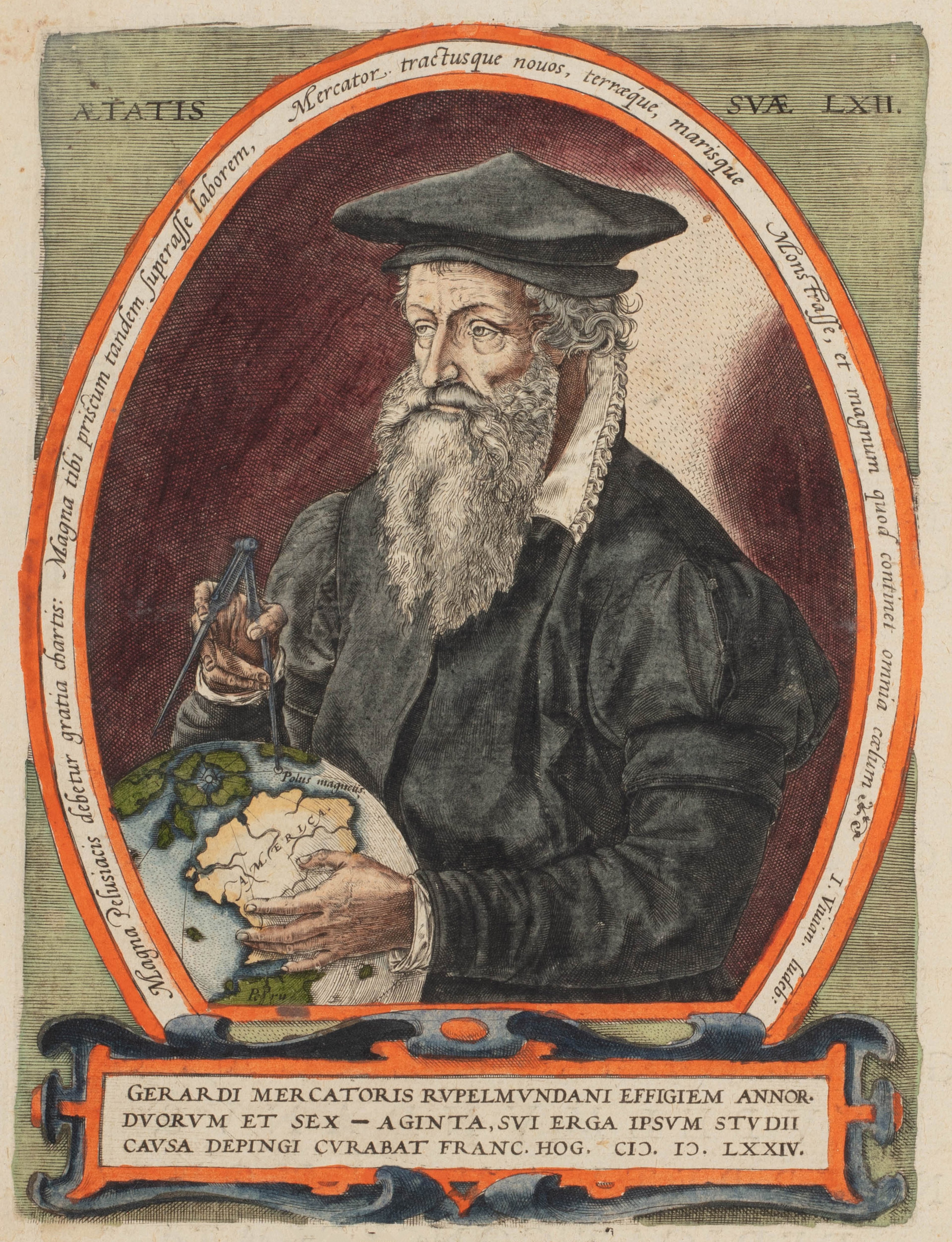
Born ‘Geert De Kremer’ in Rupelmonde, Belgium in 1512, Mercator was the youngest of seven children in a modest family. His father was a humble cobbler.
Mercator spent his formative years in Gangelt in modern North Rhine-Westphalia, on the border between The Netherlands and Germany.
The town was situated between the economic giants of Antwerp and Cologne, which formed part of the Hanseatic Trade route to Italy.
Europe in the early sixteenth century was marked by the religious turmoil of the Reformation and plagued by disease. Due to worsening living conditions and famine in Gangelt, the De Kremer family moved back to Rupelmonde to live with Mercator’s uncle on the banks of the River Schelde, southwest of Antwerp. This location was highly influential on the young Mercator: the river acted as a highway, allowing him to gather information from passing travellers and scholars.

Rupelmonde from ‘Flandria illustrata’ (1641) by Antonius Sanderus. Public domain.
Following the death of his father in 1526 and under the guardianship of his uncle who was a priest, Mercator was sent to Den Bosch to attend the Roman Catholic school of the Brethren of the Common Life. Here, he studied the Bible and Aristotle, and gained his new Latin name Gerard Mercator.
Mercator's Bible studies conflicted with the theories of philosophers like Aristotle as well as his own personal investigations of the world. This tension between faith and scientific understanding would be a thread throughout his life.

Gemma Frisius. Smithsonian Libraries
In 1530, Mercator enrolled at the famous University of Leuven, where he studied philosophy and mathematics. He went on to study philosophy in Antwerp. On his return to Leuven in 1534, he advanced his studies in astronomy, geography and mathematics, and trained in globe and instrument making under the distinguished professor and polymath Gemma Frisius (1508-1555). He would also work alongside goldsmith Gaspar van der Heyden (c1496–c1549).
This experience provided Mercator with valuable skills and insights on running a business, and eventually secured him the patronage of the Holy Roman Emperor, Charles V.
Mercator never ventured far from his birth place, but was an avid armchair traveller who meticulously gathered information. He had an extensive library with thousands of books, and maintained regular correspondence in many languages with scholars, explorers, religious figures and mapmakers. This allowed him to remain current with the newest ‘discoveries’ and ideas. He travelled annually to the Frankfurt Book Fair to buy and exchange books, maps, manuscripts, and learn about the latest theories.
His involvement with Frisius and their successful globe production business taught Mercator how to compile and update geography using existing maps and travel accounts, as well as how to market and sell their work.
World chronicles, books of knowledge, and Bibles in the late fifteenth and early sixteenth centuries featured maps of the known world and the Holy Land. It is not a surprise to find that the first printed regional map published by a European cartographer was a woodcut map of Palestine. Famous examples of these feature in Lucas Brandis de Schass’ ‘Rudimentum Novitiorum’ (1475), and Lucas Crannach the Elder’s Bible (1525). It is highly likely Mercator had access to these works and their subsequent derivatives.
Due to their religious importance and connection to pilgrimages, these maps were fairly widely disseminated, providing those with access a visual sense of how the world was organised and what their place was within it. Reproducing maps of the Holy Land served as a significant rite of passage for European mapmakers, often becoming their first published cartographic work. Combining his two devotions, Mercator published his own in 1537.

Mercator’s map of the Holy Land (1537), showing the Mediterranean at the top and the Red Sea at the left. ©Bibliothèque Nationale de France

Mercator’s double-cordiform (heart-shaped) polar map (1538). ©Library of Congress
A year after his map of the Holy Land, Mercator published his first world map which was directly inspired by the double-cordiform polar-projection map (1531) by pioneering French cartographer Oronce Fine (1494-1555). On it, Mercator became the first European cartographer to record both North and South America - distinguished as separate landmasses - on a printed map.
The map survives today in only two copies at the American Geographical Society Library and the New York Public Library.
Mercator saw contradictions between the Biblical account of Creation and the writings of Aristotle. At the time, questioning the Bible could be construed as blasphemy. He also began corresponding with Franciscan preachers in nearby Antwerp and Mechelen, and visited them several times to discuss theology and science.
In 1544, he was arrested and imprisoned for several months in Rupelmonde Castle on a charge of heresy by the Spanish Inquisition. To escape religious persecution, Mercator moved to Duisburg in 1552. A tolerant enclave renowned for being a ‘sanctuary for scholars,’ it is here that he continued his work producing globes and maps until the end of his life.

Pair of table globes created by Mercator (1551)

©National Maritime Museum, London
Like many mapmakers and cosmographers of the Early Modern period (1450-1750), Mercator was searching for a solution to the problem of accurately representing the sperical form of the Earth on a two-dimensional piece of paper.
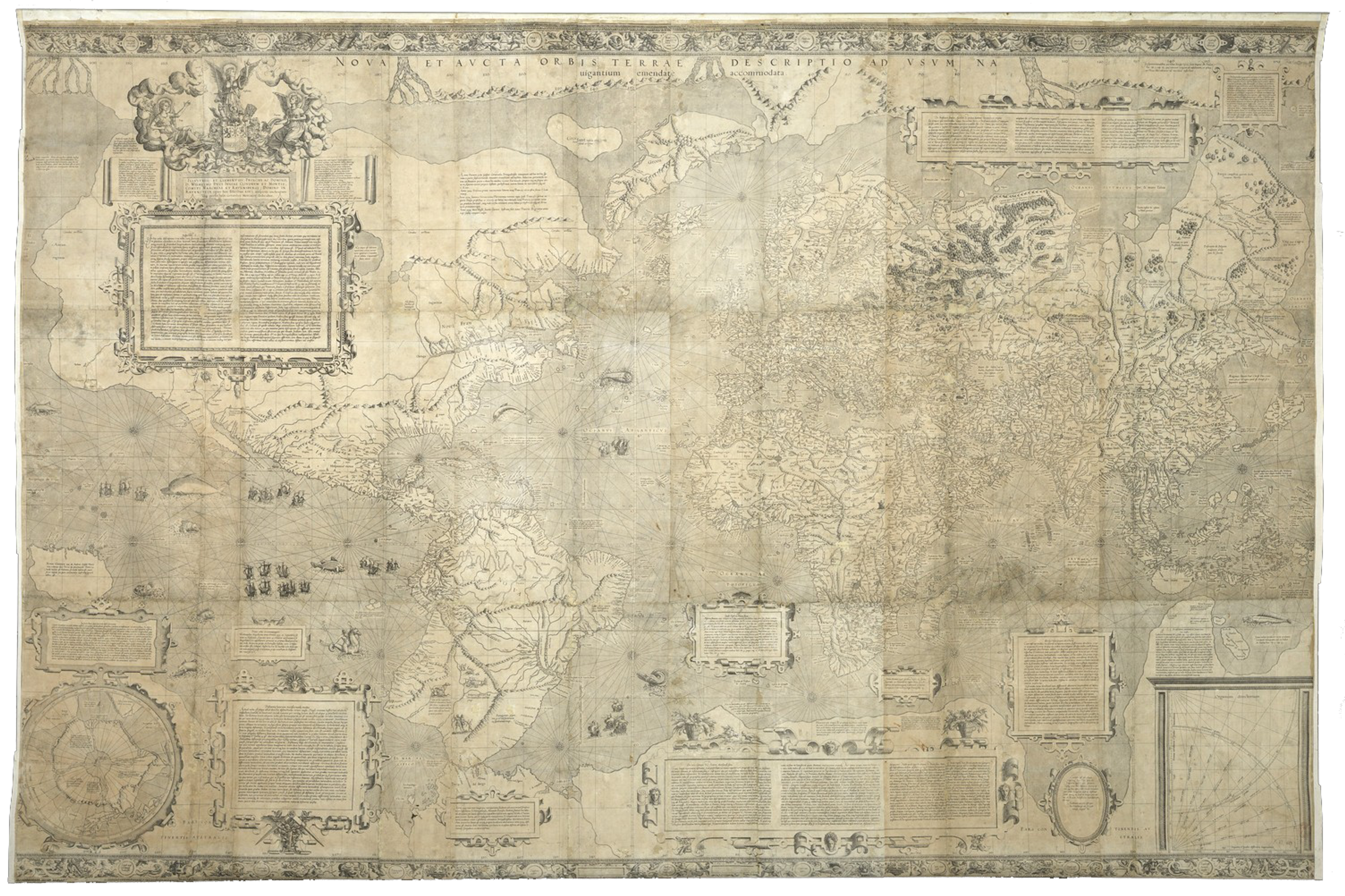
In 1569, Mercator secured his name in the history books by producing an extraordinary new view of the world on his own projection - the Mercator Projection. This approach to map-making has been adopted globally ever since.
©Bibliothèque Nationale de France
Mercator's famed world map was titled 'Nova et Aucta Orbis Terrae Descriptio ad Usum Navigantium Emendate Accommodata', or 'A New and more Complete Representation of the Terrestrial Globe, properly adapted for navigation'. It marked the turning point in the advancement of mapmaking, and has left an indelible mark on how Europeans viewed the world - although only three copies of this magnificent eighteen-sheet map are known to have survived.
In his model, Mercator treated the world as if were projected onto a cylinder, thus preserving straight and perpendicular lines of latitude and longitude so that they can be used for navigation. The map centres on Europe and includes a criss-cross of rhumb lines and useful annotations, theoretically enabling navigation on land or at sea.
Although the Mercator projection more accurately maintains the shape of landmasses that are close to Europe, however, it exaggerates the size of land the further away it is from the Equator, with extreme distortion seen at the North and South Poles.
Mercator's 'Geographia' (1584)


Mercator’s edition of the iconic ‘Geographia’ was first published in 1578.
The ‘Geographia’ was originally written by Claudius Ptolemy in the second century BCE. The rediscovery and translation of this text in fifteenth-century Europe sparked a new era of mapmaking as the coordinates and instructions set out by Ptolemy in his text were used to draw actual maps.
By the time Mercator released his edition, around twenty-seven distinct editions of this iconic book had been published around Europe.
Although they were increasingly aware of how inaccurate and out-dated Ptolemaic maps were, mapmakers like Mercator continued to release editions of the Geographia as an homage to Classical knowledge and due to the revered status of this ancient text. Some mapmakers would also include their own ‘modern’ maps, such as Francesco Berlinghieri in his ‘Geographia’ (1482).
By the early 1500s, mariners could calculate latitude fairly confidently thanks to instruments like astrolabes and quadrants, which measured the altitude of the Sun at noon or the height of the North Star. However, the problem of determining longitude would remain unsolved until the eighteenth century. Mercator did his best to make necessary corrections to the degrees of latitude and implement longitude in his edition of the ‘Geographia.’


His edition of Ptolemy’s work featured a beautiful world map along with twenty-seven maps of the known world: ten maps of Europe, four maps of Africa and thirteen maps of Asia. They were the truest renditions of Ptolemy’s maps to date, and Mercator went to great lengths to also include descriptions of the sources and projections he used in the five-page preface to the work. As well as adding a multitude of toponyms, embellishing the cartouches with ornate strapwork, fauna, flowers, and the occasional sea monster, Mercator also added an extra map - an enlargement of the Nile Delta.

Like the German cosmographer Sebastian Münster (1488–1552), who published his own edition of the 'Geographia' in 1540, Mercator's version used a Latin translation by Willibald Pirckheimer (1470–1530). This beautiful, faithful edition illustrates just how influential Ptolemy’s world view still was to cosmographers of the period.
Mercator’s work is particularly significant because all twenty-eight of the maps featured in the book were not only painstakingly researched and redrawn, but also engraved by the great cartographer himself. Mercator’s ‘Geographia’ was printed in seven editions between 1578 and 1730.
It is dedicated to his dear friend and main competitor Abraham Ortelius and in turn, Mercator was lauded by Ortelius in his own atlas as “the Ptolemy of [our] time.” Ortelius’ masterpiece atlas ‘Theatrum Orbis Terrarum’ (first published 1570) achieved near-divine status by the last quarter of the sixteenth century.
The 'Atlas' (1595)
After years of intense work - recovering from the monumental undertaking of 'Geoographia', keeping up with correspondence about contemporary 'discoveries', and even helping Oxford scholar William Camden with his magnum opus 'Britannia' (1586) - Mercator began another huge project of what he called his 'new geography'. It took over a decade of preparation. However, sadly, Mercator died before his master-work could be completed.
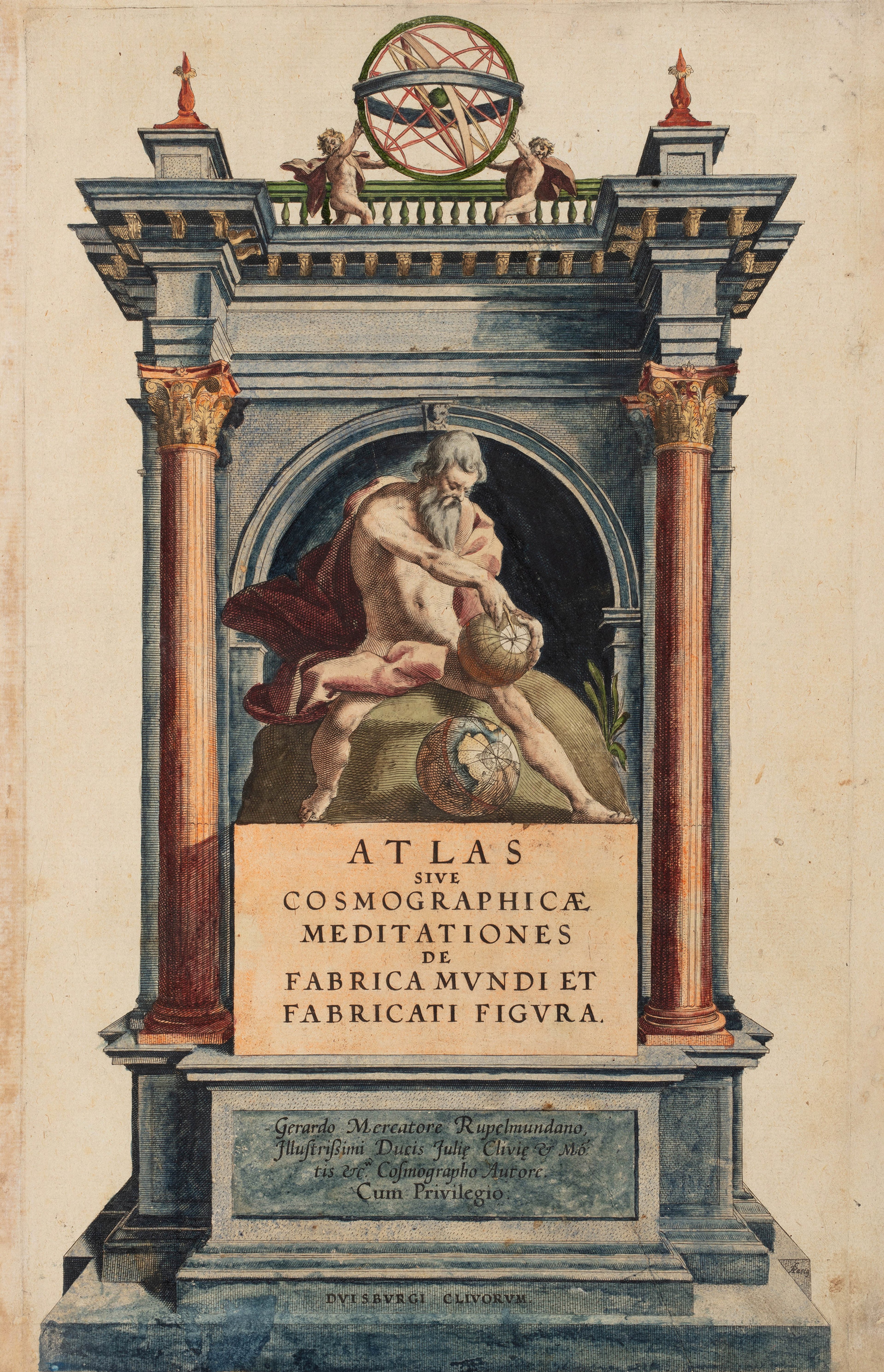
The 'Atlas sive Cosmographicae Meditationes de Fabrica Mundi et Fabricati Figura', or ‘Atlas, or Cosmographical Meditations on the Fabric of the World, and The Figure of the Fabrick'd’ (1595) is the first truly modern scientific atlas. Although Ortelius’ ‘Theatrum Orbis Terrarum’ (1570) was the first uniform collection of maps covering the world to be published in Europe as a book, Mercator’s work was the first collection of maps to actually use the word ‘Atlas’ in its title.
This name was chosen, as he wrote, ‘to honour the Titan Atlas, King of Mauretania, a learned philosopher, mathematician, and astronomer’. In the frontispiece of the work, Atlas can be seen holding a celestial sphere.
This beautiful and highly influential work was first published a year after Mercator’s death by his youngest son, Rumold (c.1541-1600). It contains a monumental 107 maps.

As with the ‘Geographia’, Gerard Mercator engraved the majority of the copperplates included in his ‘Atlas’ himself. Intended to be a part of a grand ‘Cosmography’ to be published in five volumes, Mercator presented the first three issues of his ‘modern geography’ containing fifty-one maps (twenty-six of Germany, sixteen of France, nine of The Netherlands) in 1585. This was followed by a further twenty-two maps of Southeastern Europe in 1589: these included maps of Italy, Greece, and the Balkans.
Although much of Mercator’s fame comes from his revolutionary 1569 world map, it does not feature in his modern ‘Atlas’. Instead, Rumold included his own double-hemisphere world map (1587) that he engraved on his father’s projection.
In the creation of his ‘Atlas’. Gerard Mercator laboured over political and administrative divisions before instructing his colourists to confirm the demarcations featured on his maps, and - recognising the nuances - each region was prefaced with a commentary on its history and governance.


Gerard Mercator would become gravely ill, suffering a stroke in 1589 that would paralyse him for the rest of his life.
To finish the ‘Atlas’, his son Rumold added his double-hemisphere world map (which would become famous in its own right), and inserted an introduction describing the Creation of the world. He completed the remaining thirty-four unfinished maps in his father's image. These 'new' maps covered the four continents and North and East European regions - the British Isles, Iceland, Scandinavia, Prussia, Russia, the Baltics, Transylvania, Ukraine, and the North Pole. Notably excluded from the ‘Atlas’ were the Iberian Peninsula and regional maps of Asia and Africa.
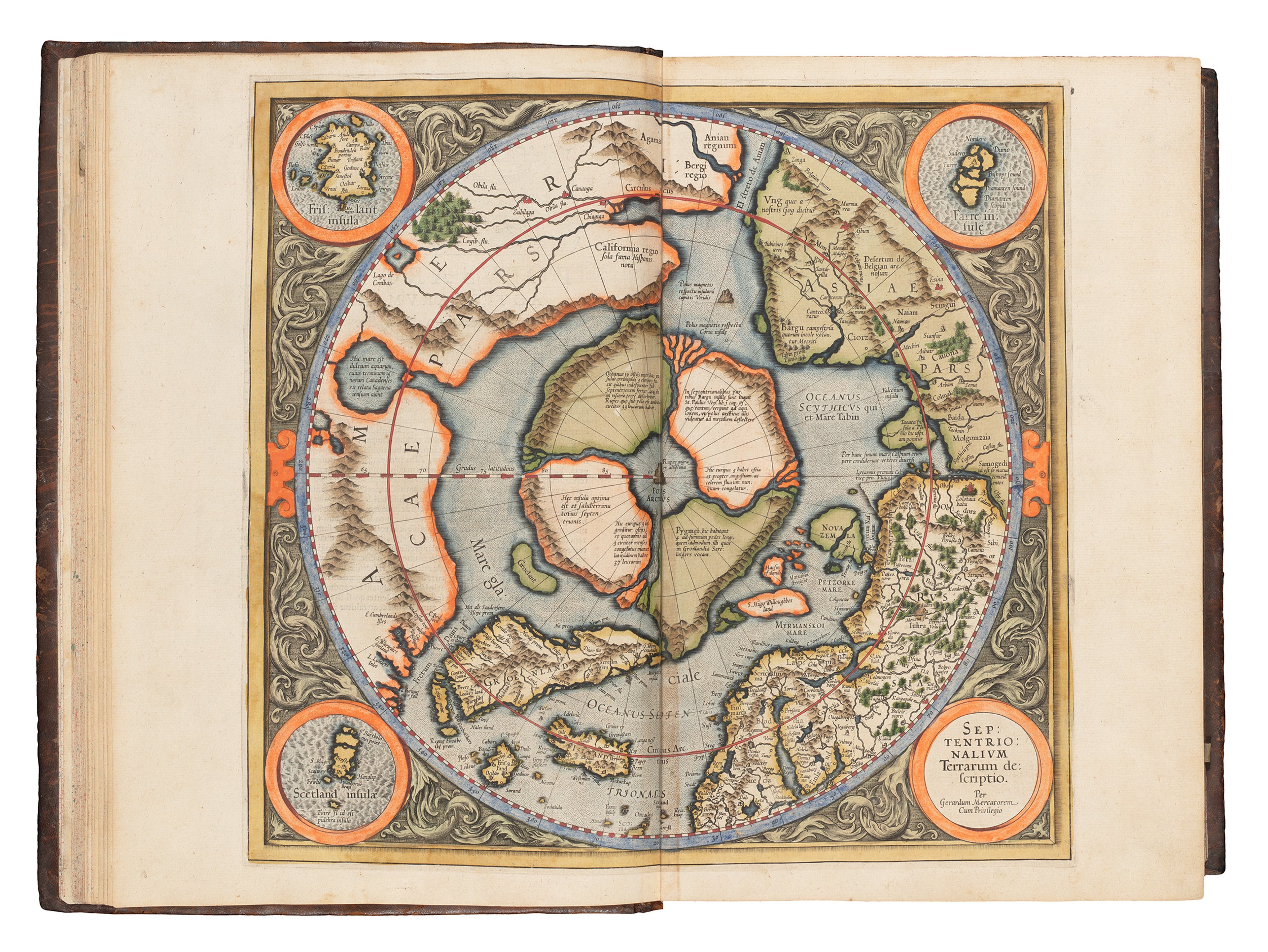
Out of all of his ‘new’ maps, his map of the North Pole is particularly well-known. Gerard Mercator used earlier maps, travel accounts, and his own speculations to create his map of the Arctic. The four mountainous islands derive from Aristotle’s theory that there must be landmasses in the North to counterbalance the large but unknown Southern Continent. At the centre of these islands is a mountain of iron, explaining why compasses point North. A prototype of this map is featured on Mercator’s 1569 world map.
Mercator’s modern atlas became seminal in European cartography. Utilising scientific techniques such as triangulation, his work significantly advanced the precision and standardisation of maps which was embraced by later cartographers. Readers were also presented with three levels of scale - an innovative early ‘zoom’ function. In the atlas, Mercator hoped to display ‘continuous maps [with which] a politician and scholar could roam the globe from home.’
Here, you can see here a map of Europe, a map of the Low Countries and part of Germany, followed by a regional map of Brabant marking Rupelmonde, Gangelt, Leuven, Den Bosch and Duisburg.


Walter Ghim, Mercator’s neighbour and the Mayor in Duisburg wrote a touching eulogy for Mercator which was included in the posthumously published 'Atlas’. Titled ‘Vita Celeberrimi Clarissimique viri Gerardi Mercatoris Rupelmundani’ (Life of the Celebrated and Most Famous Gerard Mercator of Rupelmonde), Ghim praised him as a “remarkable man" with a "mild character and honest way of life."
Due to the premature death of Rumold in 1599, the ‘Atlas’ was never finished in his father’s envisioned final form. Lack of initiative from other members of the Mercator family meant that business declined as a result and was eventually liquidated in 1604.
It is then that Flemish map engraver and publisher Jodocus Hondius (1563-1612) purchased all of the copper plates from the Mercator estate. Hondius had been based in Belgium until 1584, when he moved to London to avoid religious persecution. In 1593, Hondius settled in Amsterdam - the undisputed capital of European map production at the time - where he remained until his death.

Public Domain via Wikimedia Commons.
After acquiring Mercator’s plates, Hondius continued to publish editions of the ‘Atlas’, reaching fourteen editions by 1633. The 'Mercator-Hondius’ atlases elaborated on the work by including up to thirty-seven new maps: seven maps of Spain and Portugal, four of Africa, eleven of Asia, five of the Americas and six new European maps. Unusually, Hondius added new continental maps but did not remove the old ones.
In an attempt to lend legitimacy and gravitas to his efforts, Hondius added this friendly dual portrait in the 1613 Editions of the Mercator-Hondius atlas, although it is likely the two never met!
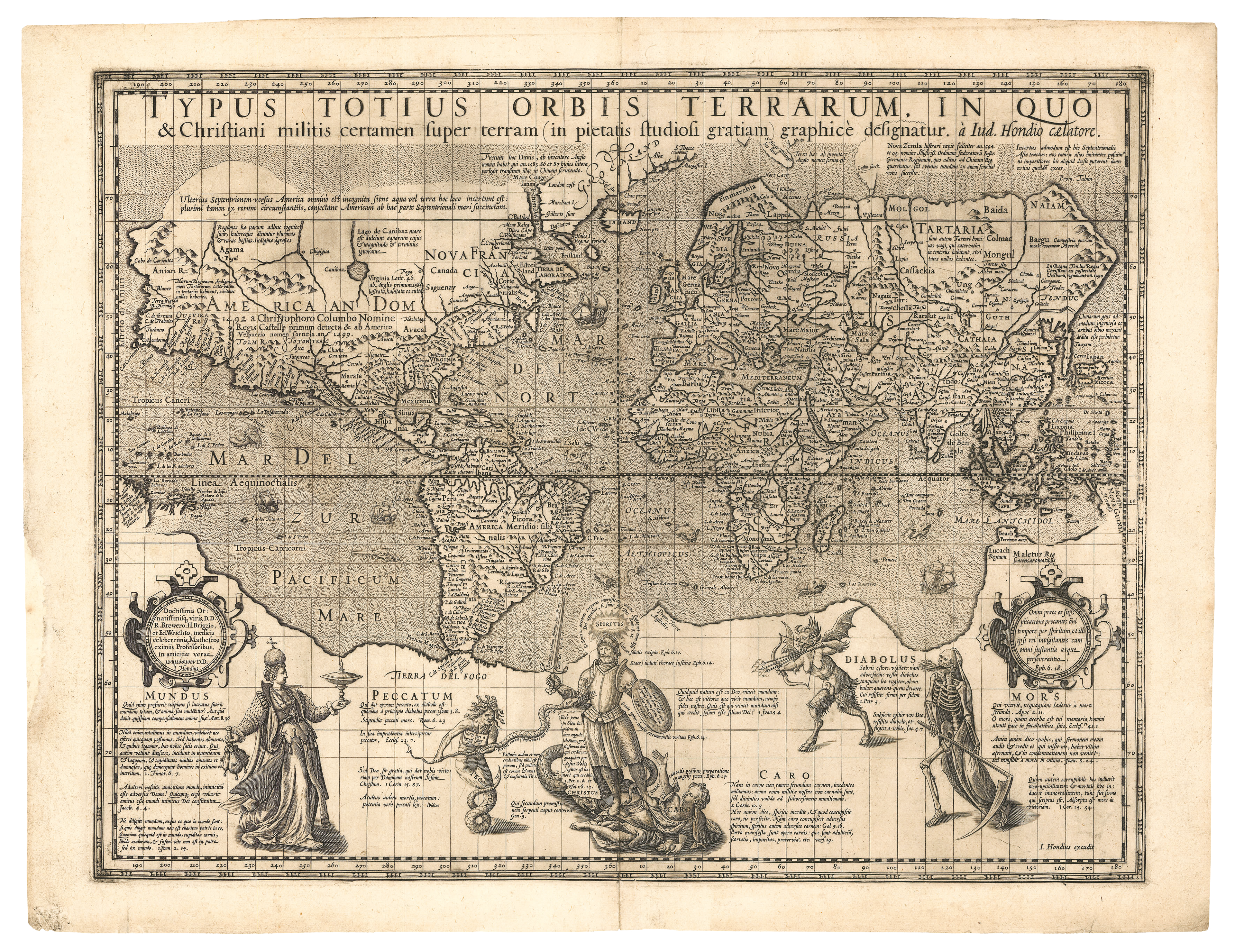
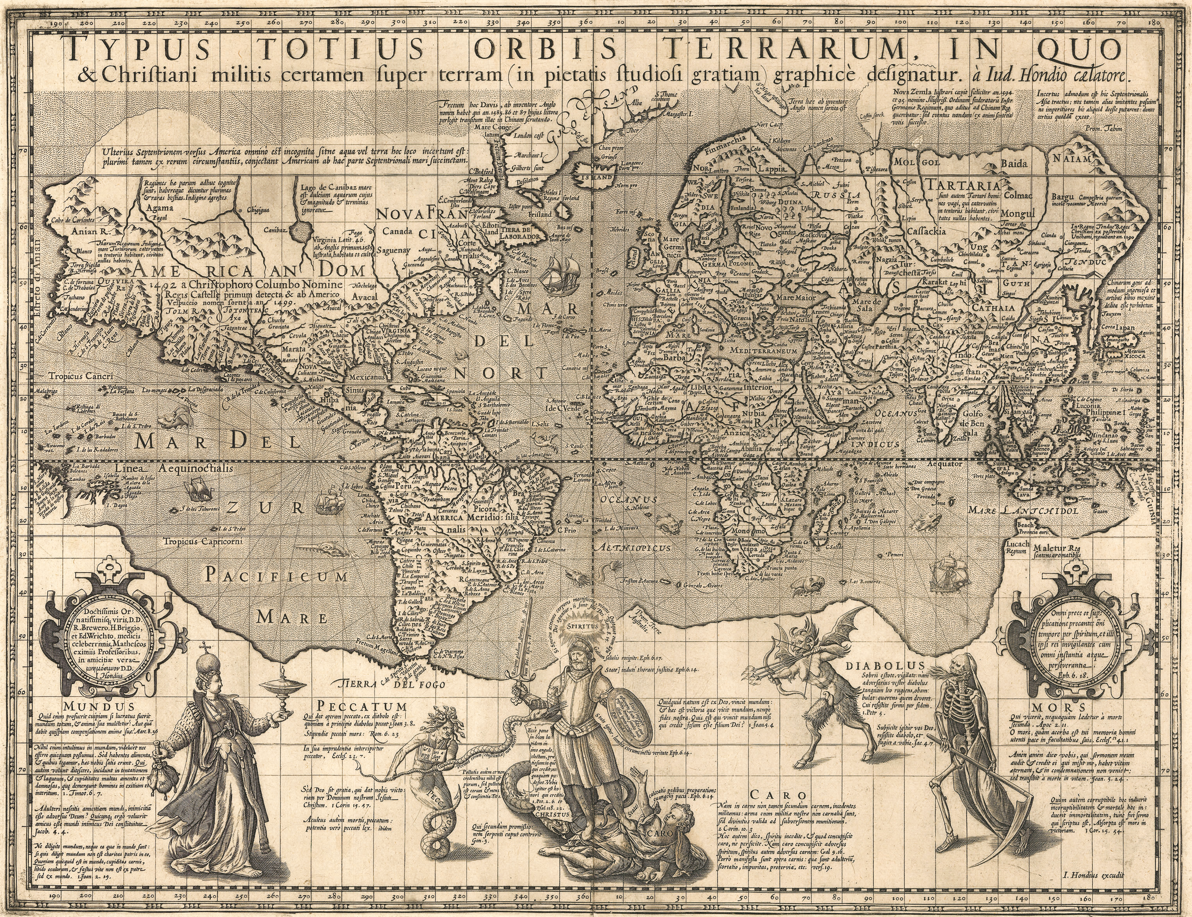
Hondius was notable for having been the first mapmaker - aside from Rumold -to have published a map on Mercator's Projection after the death of its inventor. This was the 'Christian Knight Map' (c.1597), published in England and based on an allegorical Christian etching by Hieronymous Wierix. Copies of the map and its source engraving are held in the Sunderland Collection.
Legacy
The enduring nature of Mercator’s legacy is demonstrated by the continued relevance of his work today. International mapping agencies NASA, GoogleMaps, the British Ordnance Survey and the British Admiralty, as well as a multitude of digital mapping applications worldwide, all still use the Mercator projection for its navigational properties and relatively clear representation of localised geography.
Modern classrooms, however, have recently moved away from the Mercator projection and instead use the Peters, Winkel Tripel or Robinson projections, which more accurately represent the shape of global landmasses and their relative sizes. Compromises in accuracy remain unavoidable, due to the round shape of the earth.
Click the links below to explore these atlases in detail. You can also enjoy two WHAT’S YOUR MAP? podcast episodes to learn more about Mercator’s work in the Collection.
What's Your Map? Episodes
Select References
Nicholas Crane. ‘Mercator: The Man Who Mapped the Planet.’ Weidenfeld & Nicholson, 2002
Mark Monmonier. ‘Rhumb Lines and Map Wars: A Social History of the Mercator Projection.’ University of Chicago Press, 2004
The Forum Podcast - ‘Gerard Mercator: The man who revolutionised mapmaking’ Mon 27 Apr 2020. Rajan Datar with Nicholas Crane, Emily Thomas and Philippe De Maeyer.
Johannes Keuning. ‘The History of an Atlas: Mercator-Hondius.’ Imago Mundi, 4, 37-62. (1947) from Jstor
Jerry Brotton. ‘A History of the World in Twelve Maps.’ Penguin, 2012.
Cornelis Koeman, Günter Schilder, Marco van Egmond, and Peter van der Krogt. ‘Commercial Cartography and Map Production in the Low Countries, 1500–ca. 1672’ History of Cartography Project, Volume 3, University of Chicago Press.
Marco van Egmond. ‘The 'Atlas' by Mercator and Hondius’, Utrecht University