
Blowing in the Wind
Explore the history of windheads through maps in The Sunderland Collection
What is a Windhead?
Windheads are decorative features on many old maps. They are the winds that blow from different directions, shown as human faces. Their unruly tendrils of hair billow in the airstream, whilst their cheeks swell to express powerful torrents of wind across the landmasses.
Winds have been crucial to humankind for centuries: they effect the weather, agriculture, and navigation - particularly by water. Therefore, many cartographers included them in their maps, and showed the direction in which they blow quite specifically.

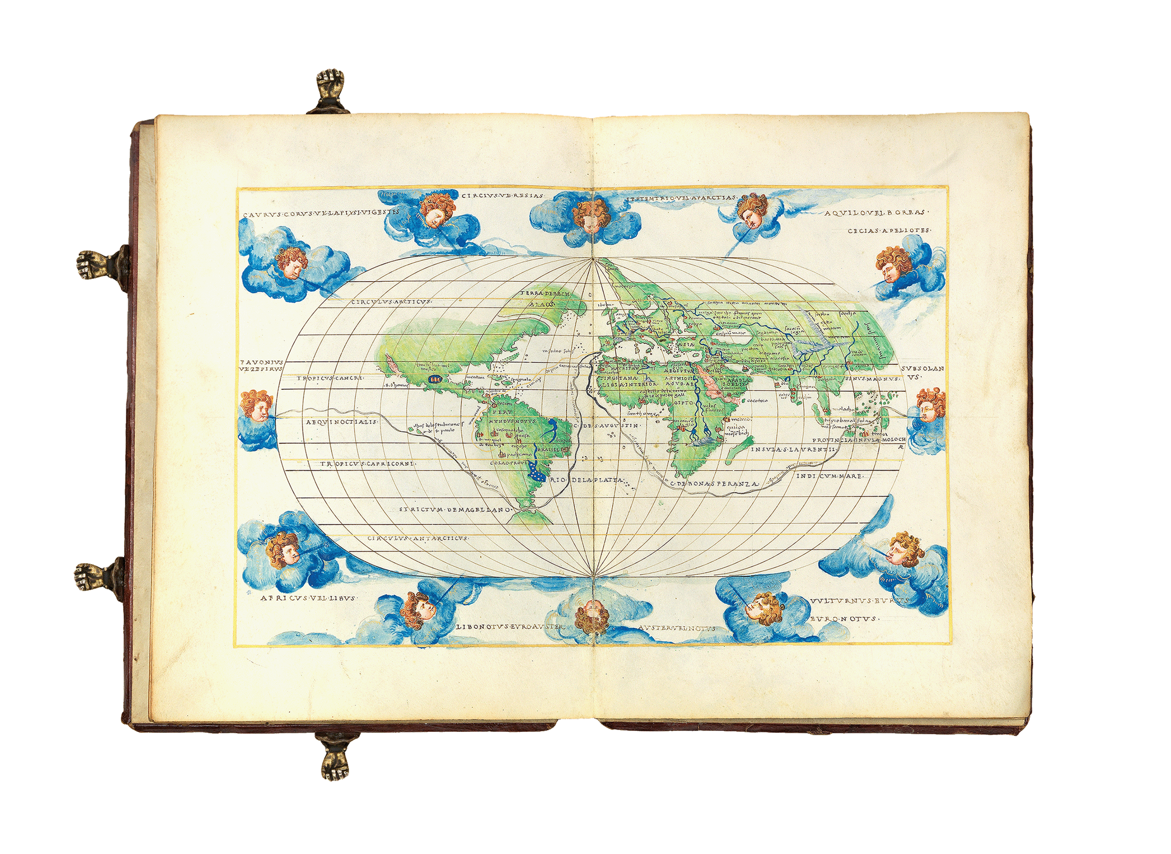
The windheads on classic maps drawn on a Ptolemaic projection are usually found floating in the blank space surrounding the conical globe. They appear at each cardinal and intercardinal direction (that is, each main point on a compass), as seen on this world map from 1480 by Taddeo Crivelli.
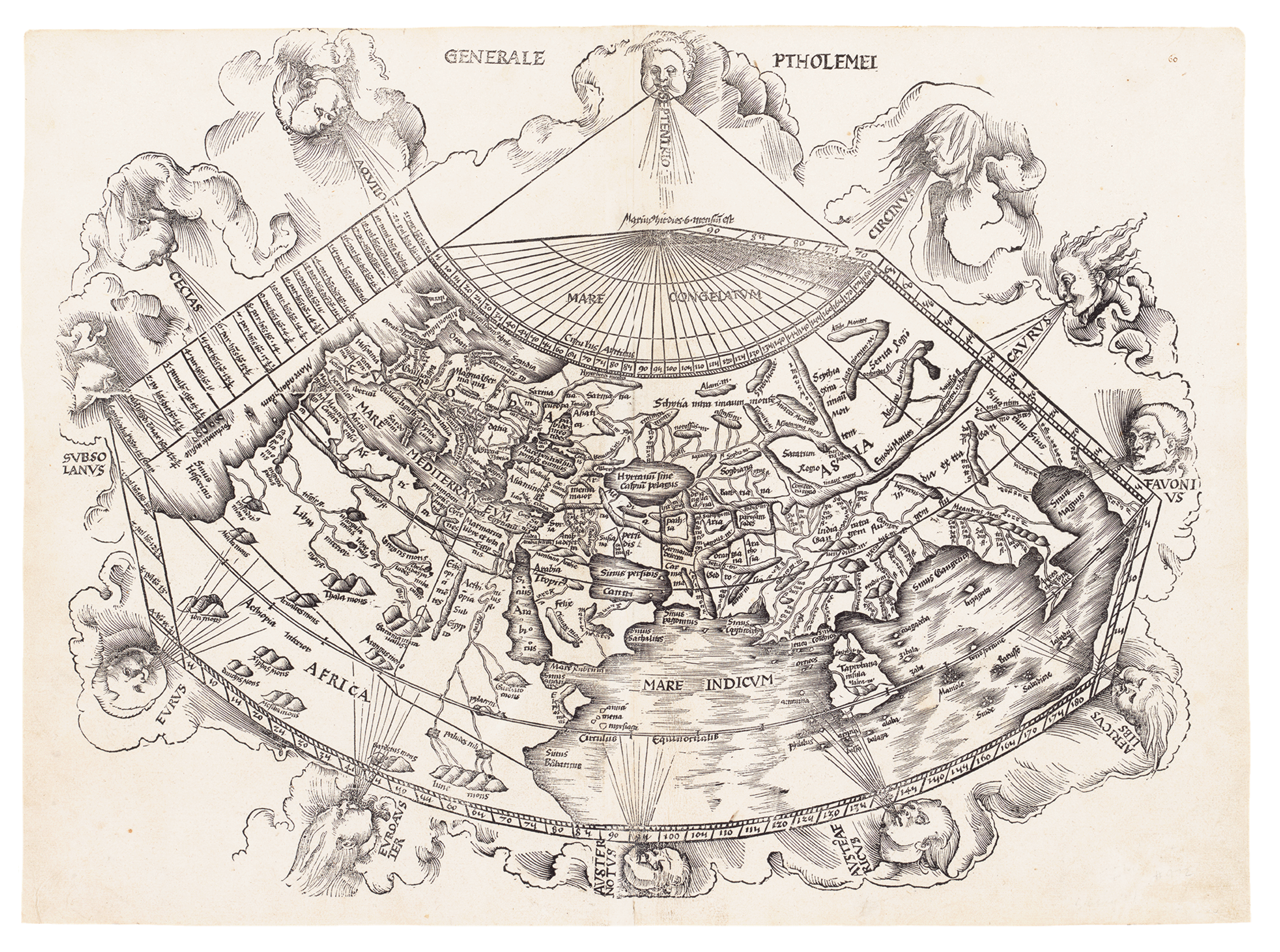
Martin Waldseemüller's Amended Ptolemaic World Map, 1513
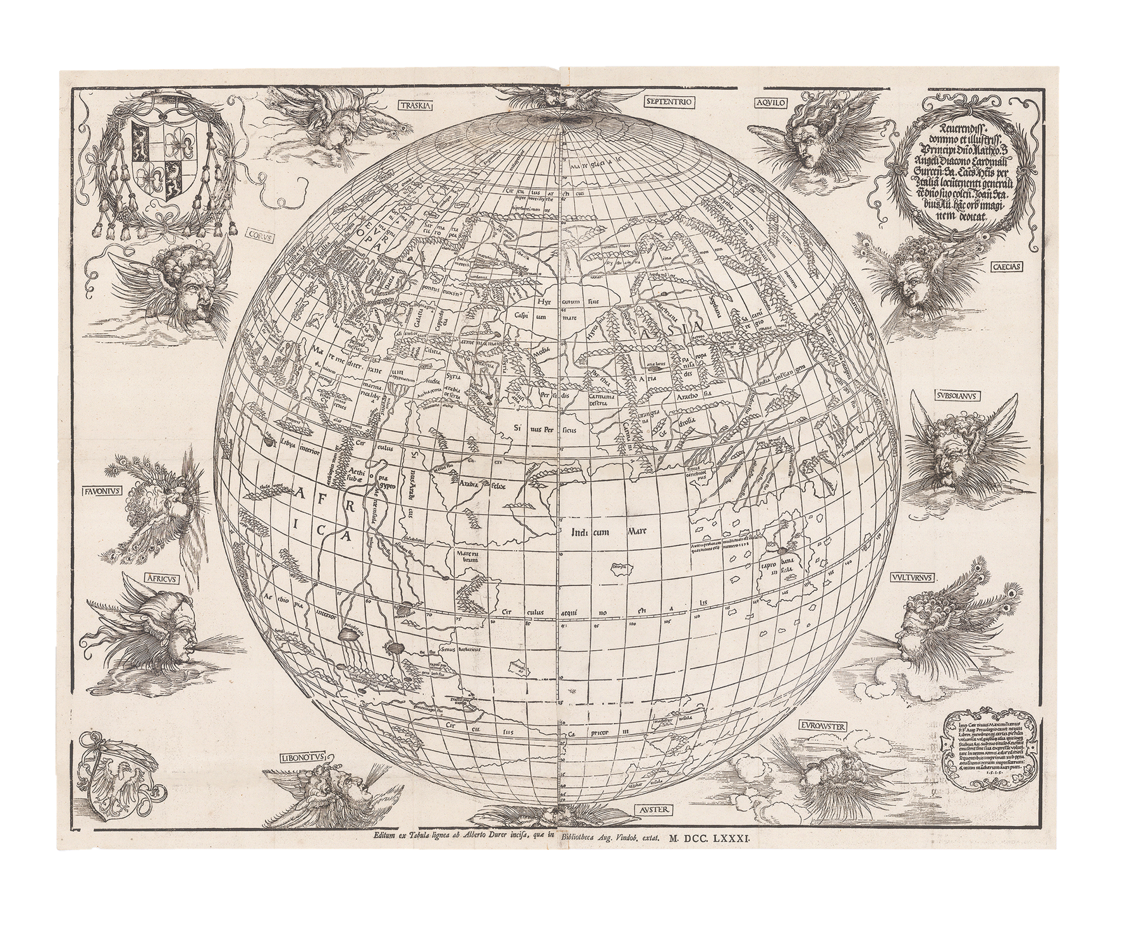
Albrecht Dürer's World Map as a Sphere, 1515 [1781]
The pioneering mapmaker Martin Waldseemüller represented the heads morphing in and out of a blanket of clouds on his 1513 Ptolemaic world map and, in 1515, Albrecht Dürer transposed the ancient windheads into a distinctly modern depiction of the globe as a perspectival sphere.
Increasing in popularity from the later Medieval period, windheads served diverse aesthetic, symbolic, navigational, and quasi-scientific purposes.
Classical Mythology
Although the inclusion of windheads peaked in popularity during the Early Modern period, their designs are rooted in classical mythology and ancient traditions.
In his famous epic work the Odyssey, Homer provides a cautionary tale on the power and might of the winds when chronicling an encounter between Odysseus’ men and Aeolus, the Greek God of the winds. Aeolus used a bag to confine all of the Earth’s winds, except the west wind, guaranteeing the sailors a safe journey home. When the men mistakenly open the bag, they are blown back to Aeolia and Odysseus is forced to undertake his journey to Ithaca once more. This story illustrates the monumental strength of the winds that 16th and 17th century sailors and explorers would encounter on their own voyages.
The classical portrayal of the winds as personified deities or gods reflects their Early Modern cartographic depictions as wise men watching over the Earth, establishing a cultural link between their civilisations. The personalities and temperaments of the ancient gods reflected the nature of the winds.

Boreas, the Roman God of the north wind, often shown with frosty airstreams through their billowing cloaks.
They are known for their cruel disposition, using a conch shell to call the thunderous north winds to shipwreck Hercules.
Shown here on Reisch's 1503 World map.

Eurus, the God of the east wind is connected to warm milder climates.
They are often shown with a youthful and gentle expression.
Here depicted on Martin Waldseemüller's 1513 Ptolemaic World map.

Notus is the Greek God of the south wind, and is associated with humidity and monsoons.
They are often shown amongst storm clouds with flowers growing from his airstream, illustrating their influence over the growth of crops.
Depicted on Gemma Fries' Cordiform World Map from 1544.

And finally, Zephyrus the God of the west wind labelled using their Roman name, Favonius.
Shown here on Albrecht Dürer's spherical world map from 1515.
They are adorned with peacock feathers representing the rebirth of Spring.
European explorers' knowledge of classical mythology enabled them to recognize familiar gods on maps, prompting them to exercise caution on their voyages. Historian Chet Van Duzer makes a comparison between windheads and the depictions of sea monsters on 16th and 17th century maps: he suggests that the visuals were used to convey abstract concepts through the viewer’s awareness of their symbolic meanings. The depiction of windheads served as a visual reminder and warning to sailors as they could use the map’s artistic embellishments to adjust their behaviour. Maps and atlases were not just navigational tools, but culturally rich artefacts that provide wonderful insight into Early Modern European worldviews.
Astrological Significance
Outside of their terrestrial impact, windheads also had strong astrological connotations. A significant cosmic force, the winds were thought to be connected to the movement of celestial bodies and meteorological phenomena. The physical sensation and identifiable impact of the wind’s strength was understood to connect the individual to invisible celestial processes and demonstrated the link between elements such as the earth and sky.
Medieval cosmology centred around the notion that the world was made up of four elements: earth, water, fire, and air. The elements constituted all matter and even impacted a person’s characteristics. Wind was naturally associated with the element of air, and in Medieval alchemy, air was affiliated with the colour yellow, intellect, and the breath of life.

Andreas Cellarius' stunning Map of the Cosmos According to Aratus published in 1660 [example dated to 1708], shows the Zodiac in a similar scheme to the earlier depictions of windheads, personified and circling the cosmos.
In astrology, each wind direction was linked to a planetary sign. For example, the east was connected to Mars and Aries through the rising sun, whereas Libra and Venus were associated with the west through the setting sun. Understanding Medieval and Early Modern belief systems provide insight into the significance of charting windheads on a map, as they did not just show the direction of an airstream, but reveal how the terrestrial and celestial spheres interconnect and the Heavens’ influence over the Earth.
Windheads are not just quasi-scientific but symbolic, laden with cosmographical meanings. They illustrate the intersections between the fields of meteorology, navigation, and astrology, placing the disciplines on an equal footing, a refreshing way to interpret these subjects, which are now understood to be entirely distinct with varying levels of credibility.

Bernard Sylvanus' 1511 Heart-shaped World Map surrounded by windheads and zodiac symbols.
Artistic Creativity
To create a comprehensive world map, cartographers and artists were under pressure to produce precise visual translations of the known world. This required a rigorous eye for detail and scrupulous commitment to accurate delineation, so their maps could be used by voyagers for practical navigational purposes. As a result, windheads emerged as an opportunity for the artist to exercise a degree of creative freedom and whimsical ingenuity.
Draughtsmen were given a chance to render faces with unique features and able to show their ability in depicting a variety of characters, such as young boys with ruddy complexions or wise old men with wrinkled skin. Artists illustrated their virtuosic skill when transforming the intangible force of the wind into a personified character bursting with personality.

Martin Waldeseemüller entangled the windheads in billows of dark clouds, evoking a stormy and fierce atmosphere, as seen here on his Amended Ptolemaic World Map, 1513.

Whereas, in 1493, Hartmann Schedel achieved a comparatively peaceful scene by housing the windheads in a close border and depicting their airstream as limp and weak.
This detail from Schedel's Ptolemaic World Map features in The Nuremberg Chronicle, 1493.
Windheads were an opportunity to encourage engagement with the viewer through playful actions such as the airstream being blown out towards the audience. Each element or attribute is a purposeful expression by the artist, revealing the nature of the wind. Long tendrils of hair, a disgruntled expression, or delightfully rendered accessories conveyed the difference between a gentle breeze or a fierce gale.
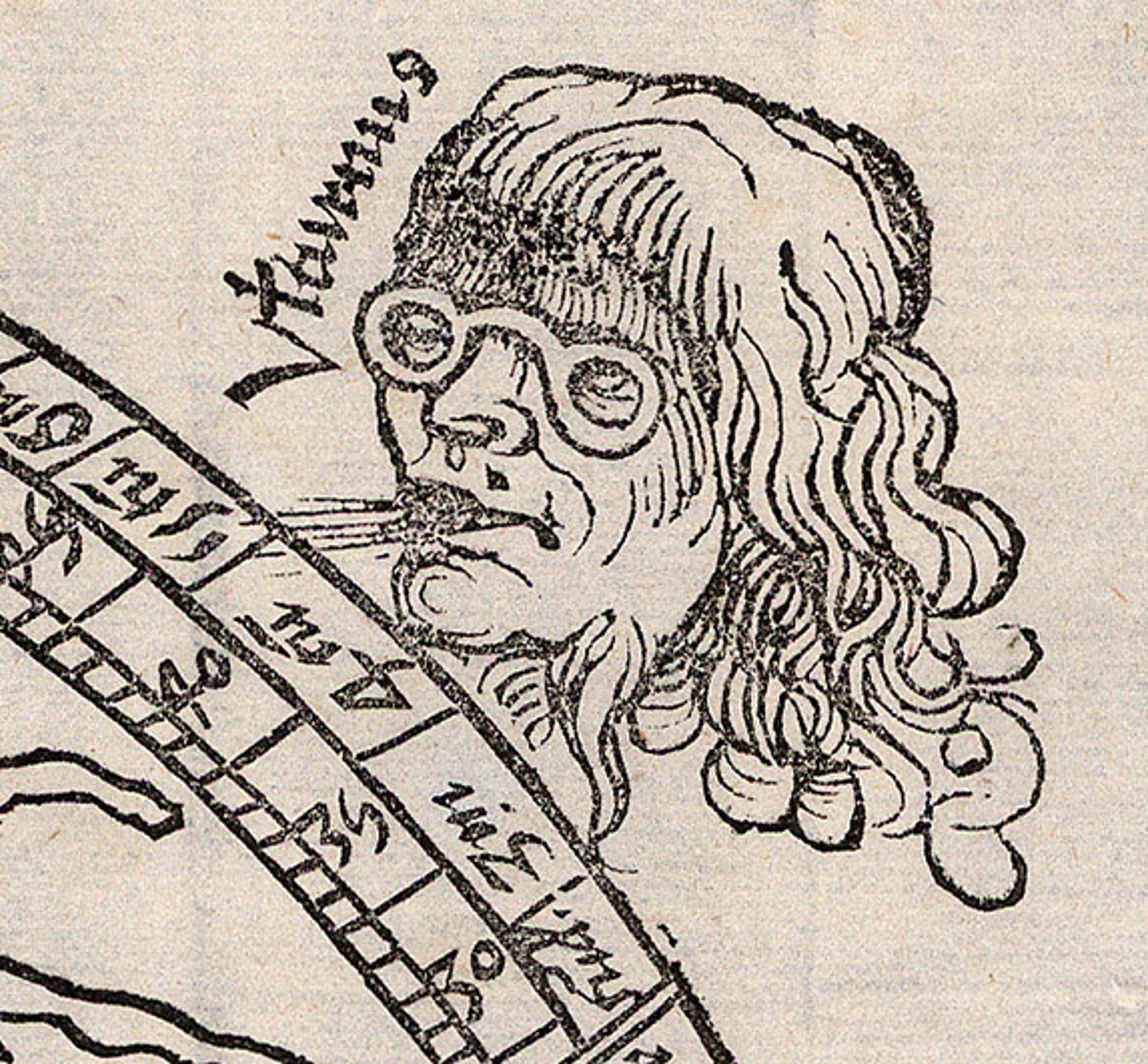
Vulturnus
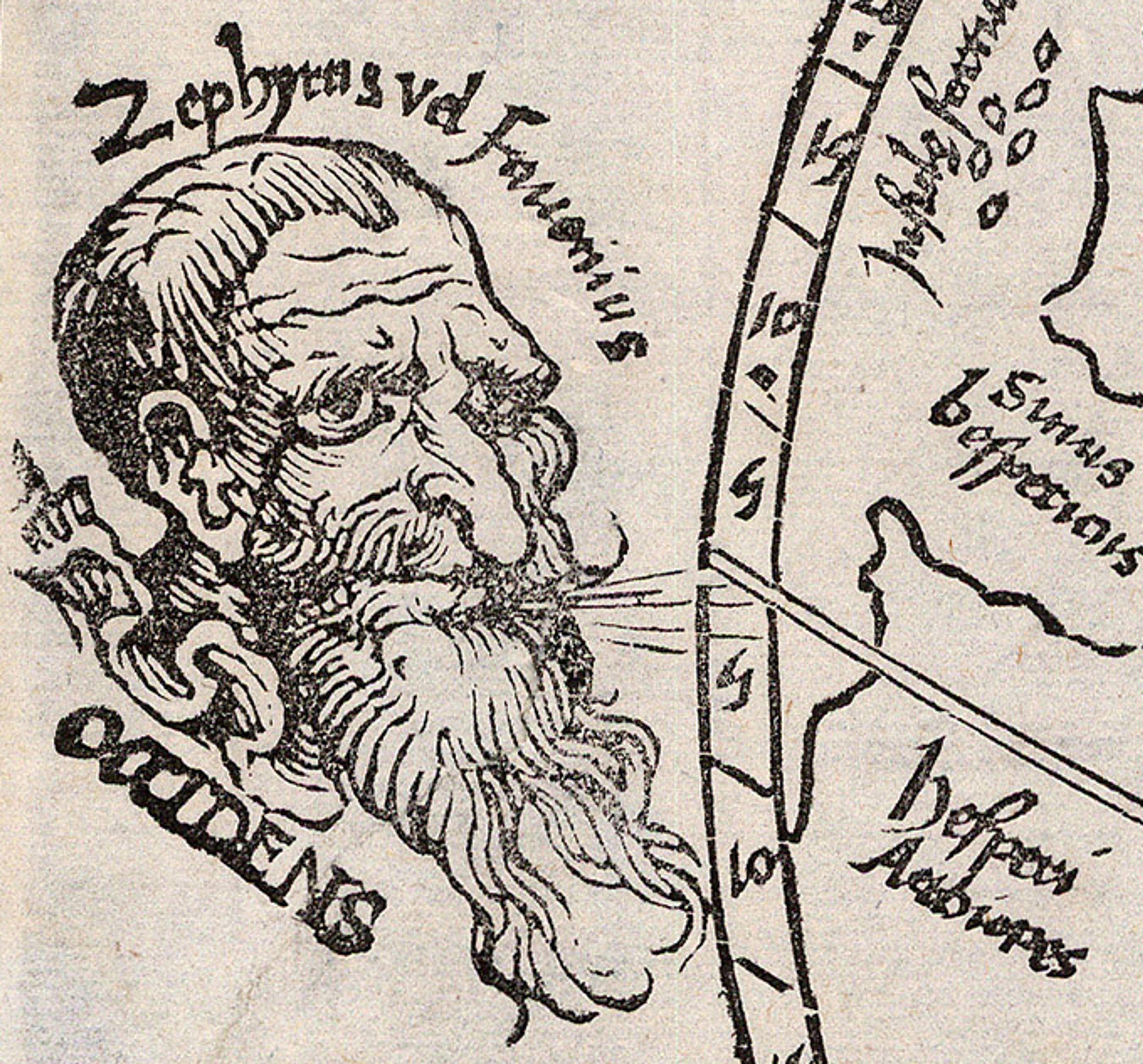
Zephyrus
A striking example of this in the Sunderland Collection is Gregor Reisch’s Ptolemaic map of 1503 where a caricature-like depiction of Vulternus is seen wearing a pair of spectacles and Zephyrus is shown as an old man with a large nose and plump cheeks. Windheads allude to art’s storytelling capacity and positions the artist as a great communicator.

Gregor Reisch's Ptolemaic World Map, 1503, where the windheads take centre stage.
The inclusion of windheads on Early Modern maps can be seen as the artist's effort to achieve a harmonious design, blending scientific accuracy with aesthetically pleasing decorative elements. Windheads often featured alongside ornamental elements such as scrolls and banners, making maps sophisticated artworks not just navigational tools.


Detail of a windheads Cauro and Circio, from Berlinghieri's extraordinary 1482 world map.
Francesco Berlinghieri's Ptolemaic World map of 1482 incorporates hand colouring using the expensive pigment of lapis lazuli to emphasise and tonally shade the windheads. The artist’s technical proficiency elevates this map to a work of art. The integration of new-found cartographical knowledge and playful embellishments further illustrates the artist’s skill, effortlessly moving between two seemingly opposite modes of conveying information.
Windheads are typically positioned circling the peripheries of the map, their breath creating diagonal leading lines, drawing the viewer’s eye to the centre, continuously redirecting them to the cartographical knowledge represented in the map. This emphasis on composition reflects a wider Early Modern ambition, to marry function with form.

This approach was taken by Petrus Apianus in ‘Astronimicum Caesareum’, 1540. Windheads reveal the cultural perspective of artists in 16th century Europe, their desire to experiment and innovate within the constraints of traditional cartographic design.
Navigation
Beginning in the early 15th century, the Age of Exploration saw a sharp increase in maritime travel. The demand for navigational techniques and tools for sea voyages meant that windheads became the perfect instruments for the wealthy elite to plan such journeys.

Martin Waldseemüller's celebrated "Admiral's Map", 1520, designed specifically for navigation.
As seafaring became more common and the European powers expanded their maritime empires, the demand for accurate navigation also expanded. Maps required more detailed representations of wind patterns for sailors to predict the different obstacles and challenges they would face on their travels.
Placed as each cardinal and intercardinal point, windheads were a simple means of orienting oneself and understanding the direction of the prevailing winds in a particular area. Sailors could identify directions and determine their heading through their association with a particular wind god, as a result they were instrumental in route planning.
World Map surrounded by windheads from Battista Agnese's Portolan Atlas of 1550, which could be used to plan a seafaring voyage.

Detail of a windheads in the East from the astonishing World Map in the Agnese's Portolan Atlas, circa 1550
Windheads could even be used to discover faster, safer trade routes, as wind patterns were visually plotted on Early Modern maps, establishing a relationship between the oceans, ports, and the elements. This was especially important when visiting distant and unfamiliar lands.
The depiction of personified windheads allowed explorers to plan their expeditions, aligning their path with that of the gentler wind such as the east wind, increasing the efficiency and reducing the risk of their travel plans.
Furthermore, including aesthetically appealing visuals to maps made navigational information easier to recall at a later date. Windheads were a form of elegant apparatus and could be used in conjunction with other Early Modern navigation tools such as astrolabes, which calculated latitude and predicted the sunrise by determining the altitude of celestial bodies such as stars.
Education
Windheads were important for navigation in the Early Modern period and acted as visual cues for specific wind patterns and directions [12]. As a result, they played a significant role in the education of young seafarers by breaking down complex information into a digestible format. Windheads may have served a mnemonic purpose, with their physical representations acting as a memory aid for explorers to remember the type of conditions or weather associated with that wind. Personifying the winds helped reinforce memory through the potential to develop stories or narratives around each wind. By memorising their characteristics, mariners could quickly recollect this information without the assistance of an atlas or when a detailed map was not available, adding to their practical navigational skills.

Detail of a woodcut of a shipwreck after stormy weather, as depicted in Johannes Stumpff's World Chronicle, 1547.
Meteorology & Agriculture
Early Modern Europe also saw significant developments within meteorology, the study of the atmosphere and weather. This period marked a transition from mythological and astrological understandings about climatic conditions towards a more methodological, observation-based approach to studying the atmosphere.
Throughout the Medieval and Early Modern periods, Aristotle’s ‘Meterologica’ remained the main authority on meteorology. Dating back to the 4th century BCE, the text explored the formation of clouds, wind, rain, and thunderstorms. The use of mythological wind heads to represent new observations on the weather illustrates how Early Modern artists blended new and old knowledge together, as these symbolic images reflected the actual known wind pattern in the 16th century. The inclusion of windheads in Renaissance cartography illustrates the overarching cultural interest in how these intangible processes occur and how these phenomena come about.

Athanasius Kircher used windheads to illustrate his theories on weather, the formation of volcanoes following a visit to Sicily in 1637. These and theories on other terrestrial phenomena feature in his landmark work "Mundus Subterraneous" (1664).
Other developments such as the invention of the barometer for testing air pressure by Evangelista Torricelli in 1643 and the publication of Descartes' "Meteorology" (1637) further illustrate the Early Modern fascination with the weather. The increase of travelling by sea further indicates that there was not just a quasi-scientific interest in the celestial process, but a practical need to understand the weather to ensure the safety of explorers.
Although windheads were primarily used as cartographical embellishment, they also had practical application in agriculture. In the Early Modern period, much like their use in meteorology, the depiction of windheads aided in the understanding of atmospheric phenomena (such as wind patterns), which was essential for effective crop management. This practice illustrates an overarching fascination with studying weather conditions.
Representing the prevailing winds on detailed local maps would have allowed farmers to recognise which crops would thrive in specific regions and plan their agricultural practices based on their weather predictions. Wind has a large impact on pollination processes and working knowledge of wind patterns was necessary when growing crops like grass and grains. Being able to anticipate frost could save entire fields of produce and avoid famines. Windheads captured seasonal knowledge or certain conditions, for example Notus, or the south wind, was associated with monsoon season. This early form of forecasting meant that farmers could plan when to sow seeds at favourable times of year.
Why don't Windheads appear on Early Modern maps?
When browsing The Sunderland Collection, you may notice that windheads don’t appear in the 1472 edition of Isidore of Seville’s ‘Etymologies’ or on the T-O map from c.1200 by William of Conches.
Windheads did not peak in popularity until the 16th century, approximately 100 years later, when there was far more exchange between different European locales, Isidore of Seville’s text pre-dates the widespread use of personified wind representations.
Close up of the T-O map featured in he 1472 work by Isidore de Seville
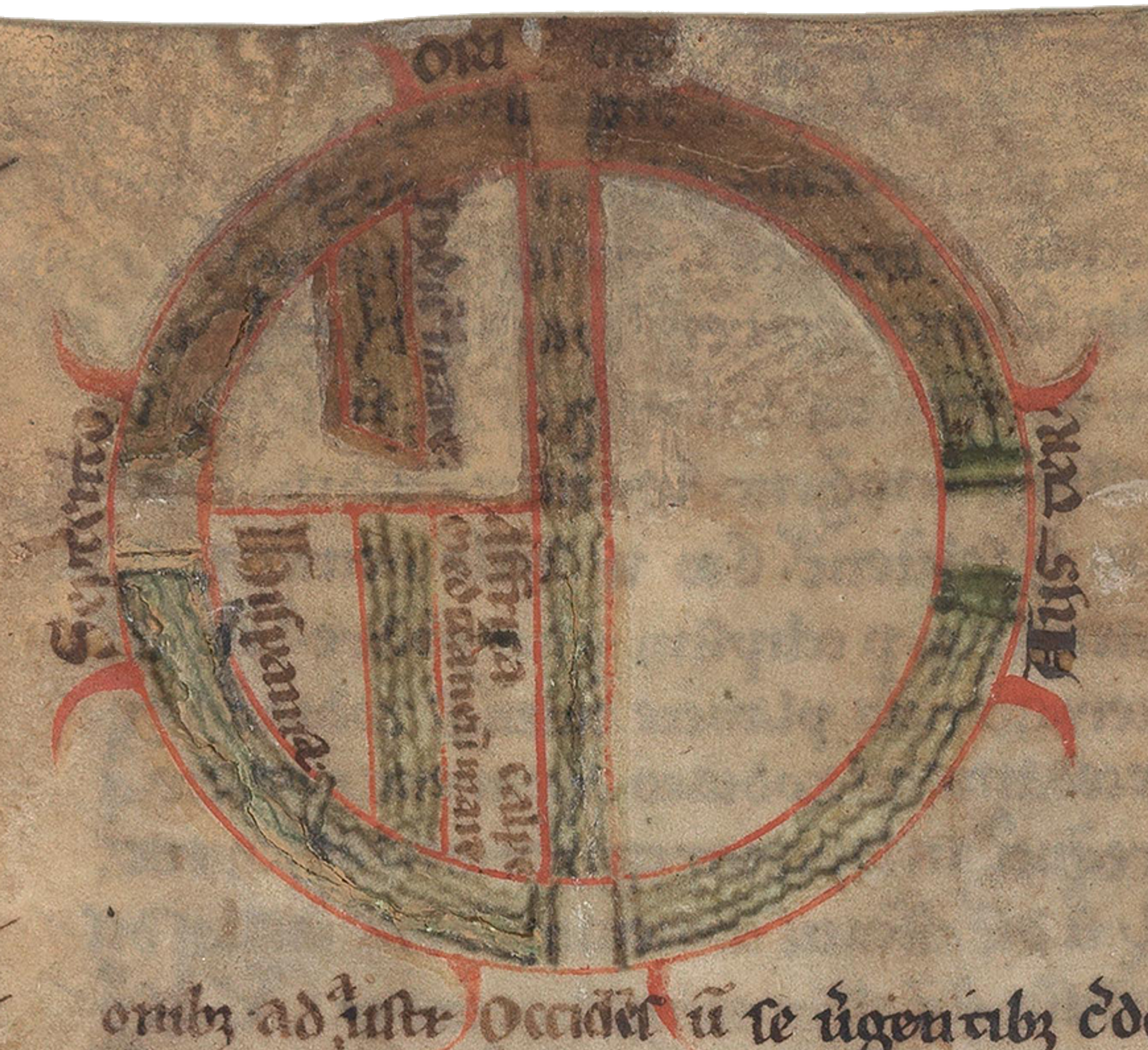
Close up image of William de Conches circa 1200 manuscript T-O map
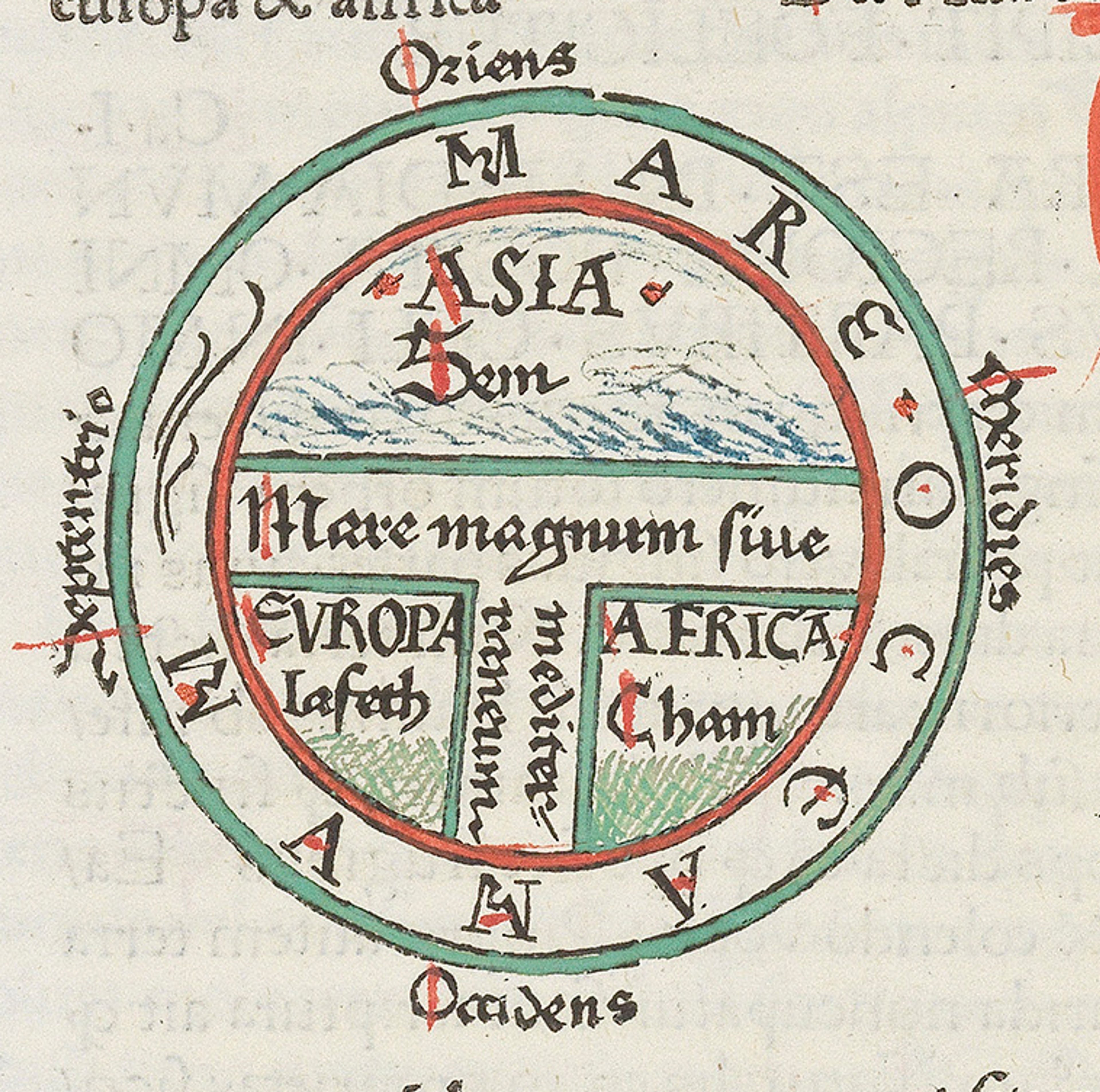
These Medieval maps served a different purpose to the cartography of the Early Modern Period, which aimed to codify the expanding world and supported mariners during the Age of Exploration. Maps from the Middle Ages were not used for navigation and aimed to represent theological ideas such as religious understandings of the world’s composition or moral symbolism, as opposed to the meteorological ideas later maps depict. It could be said, the Medieval maps depict a symbolic geography through arrangements such as the T-O type, which broke the world up into three sections and were often influenced by Byzantine traditions. The expansion of maritime travel and the increasing shift towards empirical observation led to windheads becoming a common cartographic feature.
Why did Windheads disappear?
Through the 17th century, the use of windheads in cartography diminished. In general, artistic representations became more technical, for example, using the borders of a map to depict the known continents of the Americas, Africa, Asia and Europe. Despite these allegorical images relying on stereotypes, these artistic embellishments depended more on the accounts and interpretations of those who had visited these sites, unlike the chiefly mythological personifications of the winds.
The move away from including windheads on Early Modern maps parallels the cultural turn to observation and the emphasis on accuracy that embodies early forms of science as we know it today. Scholars focused on gathering accurate data to produce charts which were more straightforward and functional. These advancements in meteorology and other technologies shed light on the actual processes that create certain weather conditions, and our increasing knowledge slowly began to render traditional windheads obsolete.

Furthermore, the prominence of highly detailed French cartography in the 17th century, such as Marie Angélique Duval’s world map from 1676, reflects another shift in aesthetic preferences.
It could be said that windheads no longer fit the artistic values of the period and were fundamentally less fashionable than the precision-focused designs, which emphasised utility and were more standardised.
Written by Melissa Irving

Limited Edition Windheads
To celebrate the first anniversary of Oculi Mundi's official launch, we have produced a limited edition intaglio print of our popular 'Circio' Windhead Print in three luxurious, glowing variations!
This gorgeous little image is a unique intaglio print: each one is hand-inked and hand-pressed from a bespoke polymer plate, using a traditional printing press. The generous margin means that Circio can be displayed on a little easel, in a frame, or simply propped up on a shelf.
Mercator's Ptolemaic Map of 1606
References
Oxford Reference. "Wind-head." Accessed August 6, 2024.
J.B. Harley and David Woodward, eds., The History of Cartography, vol. 3 (Chicago: University of Chicago Press, 1987).
Chet Van Duzer, Sea Monsters on Medieval and Renaissance Maps (London: The British Library, 2013).
Catherine Delano-Smith, Visualizing the Invisible: The Artistic Depiction of Winds in Early Cartography (Chicago: University of Chicago, 1999).
Delano-Smith, Catherine. "Cartographic Signs on European Maps and Their Explanation before 1700." Imago Mundi 37 (1985): 9-29.
Martin, Craig. "Girolamo Cardano’s Meteorological Predictions: Hippocratism, Weather Signs, Winds, and the Limits of Astrology." Perspectives on Science 30, no. 5 (2022): 851–873.
Marr, Alexander. "Ingenuity in Nuremberg: Dürer and Stabius’s Instrument Prints." The Art Bulletin 100, no. 3 (2018): 48–79.
Baumgärtner, Ingrid. "Winds and Continents: Concepts for Structuring the World and Its Parts." In Maps and Travel in the Middle Ages and the
Early Modern Period, 5–16. Berlin: De Gruyter, 2019.Harley, J. B. The New Nature of Maps: Essays in the History of Cartography. Baltimore, Md.: Johns Hopkins University Press, 2001.