Robert Greene
Back to people overviewRobert Greene was an English cartographer, whose earliest works were maps of England and Germany. Many of Greene’s publications were collaborative even though he owned his own ‘presses to Print’.
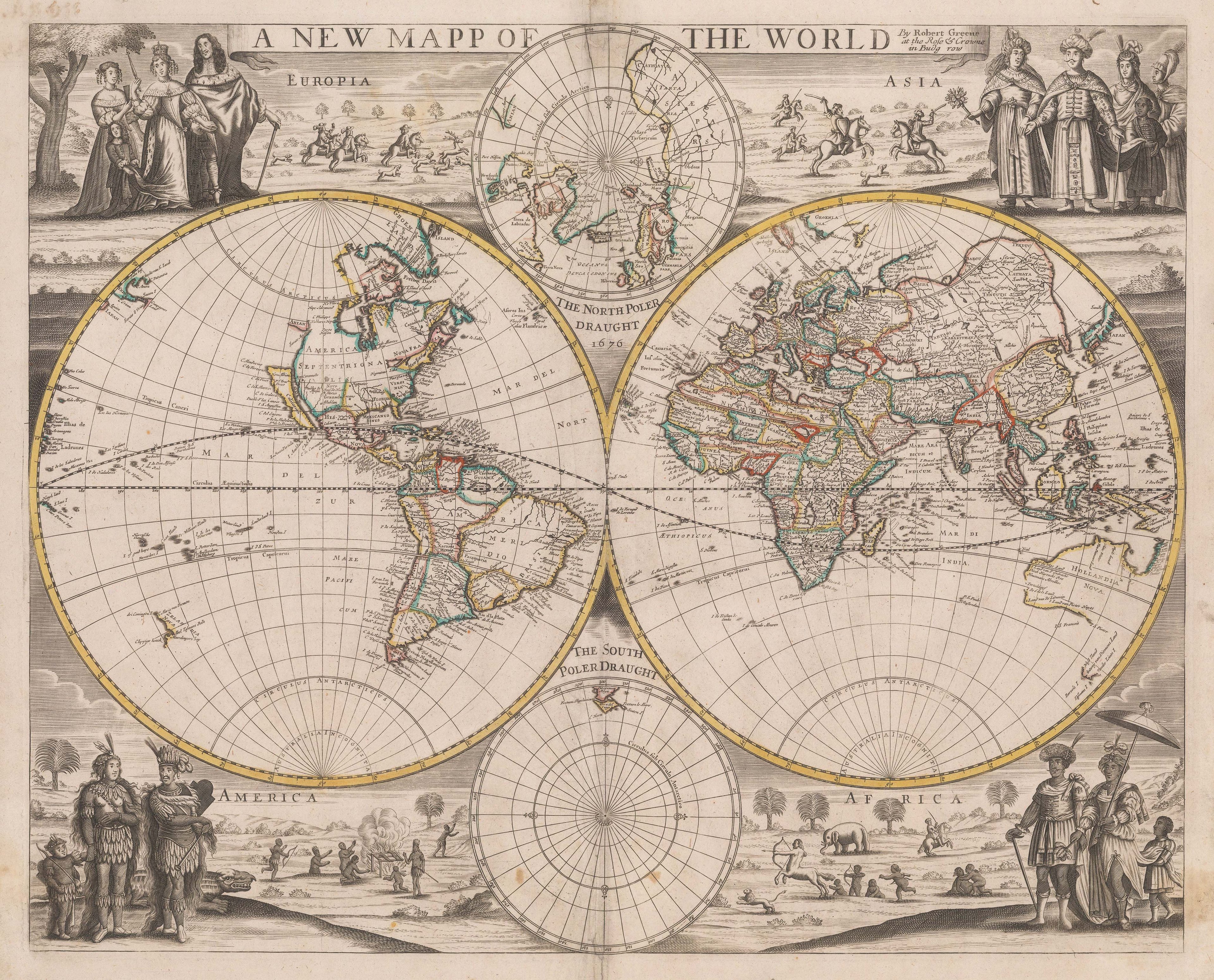
His double-hemisphere world map of 1676 is possibly the earliest world map made in England to use a polar projection. It is also one of the first to show the coastline of New Zealand. In the map, Greene does not depict the South Pole; this was because voyagers had not yet discovered a continent in the region. Despite the uniqueness of the projection, the map pays homage to earlier Dutch cartographic precedents and their 'discoveries' in the West Coast through notations on the map.