Elif Shafak
Series 6 Episode 6
A Shared World with Elif Shafak
Series 6 Episode 6
Available on all major podcast platforms: click the icons or hit 'play' to listen now.
In this special episode, Jerry will be joined by acclaimed British-Turkish novelist Elif Shafak, author of The Forty Rules of Love (2009), The Island of Missing Trees (2021), and In One Brief Moment All Eternity (October 2026).
On the podcast they discuss not one, but two pivotal early maps: a surviving fragment of a 450 year old map by Ottoman admiral and cartographer Piri Reis, and a remarkable 6th century Babylonian tablet map of the cosmos - the earliest recorded map of the then known world as seen from above.
Tune in to hear their discussion about curiosity of the unknown, fluid borders, multi-belongings, shared spaces, and the unrecorded silences in history. Through the lens of historical maps and literature, they examine how stories travel beyond borders and bridge human experience. We also learn about how these two ancient maps and other geographical works of art and literature have inspired Elif’s writings.
Click the images below to explore the maps as you listen to the episode:
The surviving fragment of the Piri Reis map (1513). Library of Topkapı Palace Museum, Istanbul. Public domain, via Wikimedia commons.
The map is an early-sixteenth-century portolan chart of extraordinary detail. Drawn by hand on gazelle skin in 1513, the map shows the Atlantic Ocean. It is traversed by rhumb lines that intersect at compass roses and the ocean is adorned with depictions of ships. On the land there are illustrations of kingdom rulers, wild animals, mountains, waterways, and legendary creatures. The map features extensive notes, primarily in Ottoman Turkish, describing the landscapes and people, as well as recent history or information of a curious nature, all often citing the source of the knowledge.
In the east, the map starts at the Bay of Biscay and the Iberian Peninsula, extending south to the Strait of Gibraltar, across to the African Continent and then following the coastline from Morocco down and around Western Africa to the Gulf of Guinea. And, in the west, there is an emerging image of the New World, or the Americas. The map traces the coast from the West Indies, namely Cuba and Hispaniola, through Central America and the Caribbean Islands, to South America. The southernmost tip of South America adjoins a rendition of Terra Australis.
The other two thirds of the map have been lost to history.
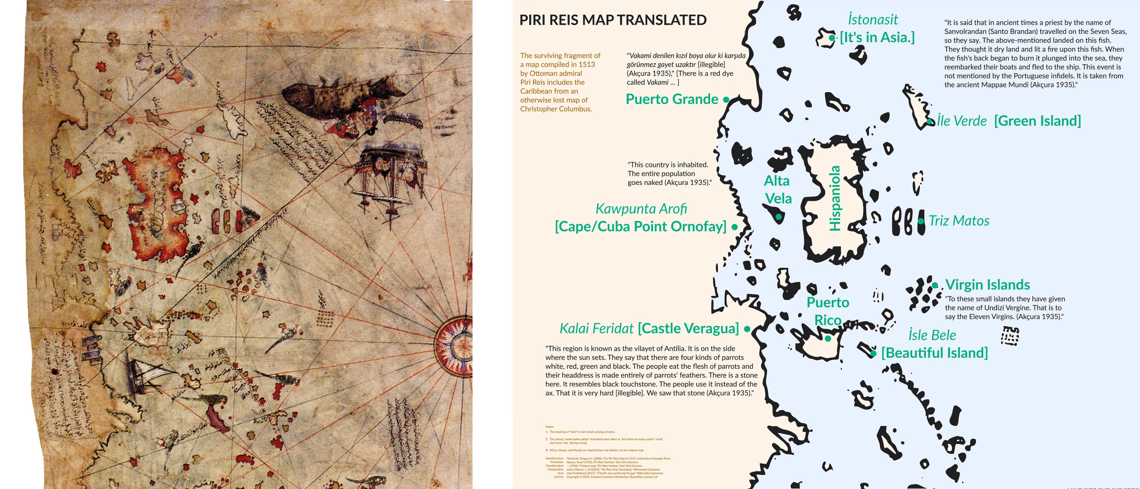
Details showing the Piri Reis map (left, 1513) and the comparative translation (right, 2023).
Remarkably, this map was made just two decades after the voyage of explorer Christopher Columbus (1451-1493) in 1492-93, and depicts the Caribbean and the coastlines of the Americas with brilliant accuracy.
The map was presented to Sultan Selim I (r. 1512–1520) in 1517, following the Ottoman Empire’s victory over Mamluk Sultanate in Egypt. For centuries, the use and whereabouts of this map were unknown, and this surviving fragment was found only very recently in 1929, when Topkapı Palace was undergoing renovation into an antiquities museum.
Its revival garnered lots of attention from around the world because it included what is believed to be a partial copy of Columbus’ own - now lost - map of 1498. Specifically, Columbus’ map was a direct source for its depiction of the Caribbean and surrounding American coastline - merging Cuba into the mainland, showing the island of Hispaniola where Columbus was recorded to have made landfall, and of course the confusion whether it was in fact the Americas, or Asia - the descriptive panels appear to align with Columbus’ belief that he had in fact found a route to Asia.
A full translation of the map can be found here.
The eponymous map, or surviving fragment of, was compiled by the Ottoman admiral and cartographer Piri Reis (1446-1553). He is known to have drawn upon a vast range of Greek, Persian, Arabic, and Western sources, and it is estimated that around twenty to thirty maps were consulted to create the 1513 map.
Piri Reis lived a life at sea, beginning his career working as a privateer (or pirate), learning the art of navigation by sailing from port-to-port with his uncle Kermal Reis (c.1451-1511), and later serving and piloting ships for the Ottoman Empire. It is at the turn of the sixteenth century that ventured into map-making. Find out more about Piri Reis here.
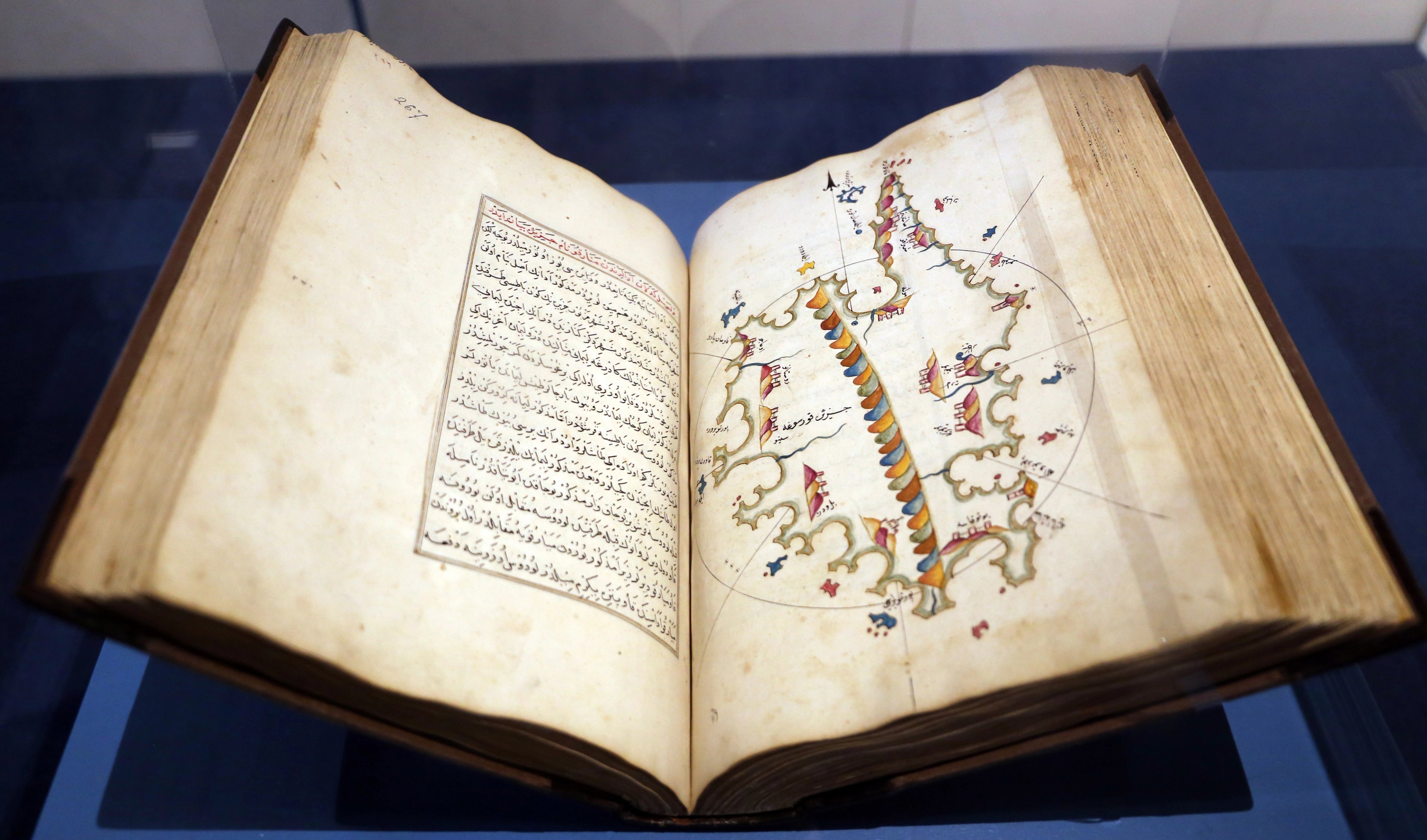
A map of Corsica from Kitab-ı Bahriye (1526) by Piri Reis. A manuscript edition by an unknown copyist. Photograph by Sailko. Public Domain, via Wikimedia Commons
Maps from Kitab-ı Bahriye (Book of Seafayring, 1521). CC0, via The Walters Art Museum, Baltimore, USA.
His life and legacy lives on through his maps. In the episode, Elif tells Jerry about another of Reis’ masterworks, specifically his 1526 maritime atlas Kitab-ı Bahriye (Book of Navigation). The book featured astute sailing directions and an astonishing 240 maps, designed for the purpose of sharing to pass on the knowledge and skills. Its comprehensive nature gave sailors instant access to practical information, and it rivalled any maritime handbook of its day.
As Elif notes, the way it was presented and compiled reflected the multi-lingual, multi-ethnic, and multi-faith nature of the Ottoman Empire; the Ottoman-Turkish language blended with Arabic, Persian, Kurdish, Armenian, and Ladino (Judeo-Spanish) vocabulary written in Arabic script.
As she shares with Jerry, the first time Elif encountered this map during her time at University, she was struck by its delicacy. This piece holds deep significance for her both for the creator's reverence for nature and also because of her fascination with the remarkable individuals who crafted such works.
For Elif, Reis’s maps are not just an instrument of Turkish exceptionalism, but a legacy of interwoven cultures and an emblem of human curiosity. They show a shared global history that expands beyond a European Renaissance.
In the same breath she describes the Turkish capital Istanbul in the plural. In doing this she aims to capture the vibrant spirit of the sixteenth-century cosmopolitan Constantinople, a city of overlapping worlds.
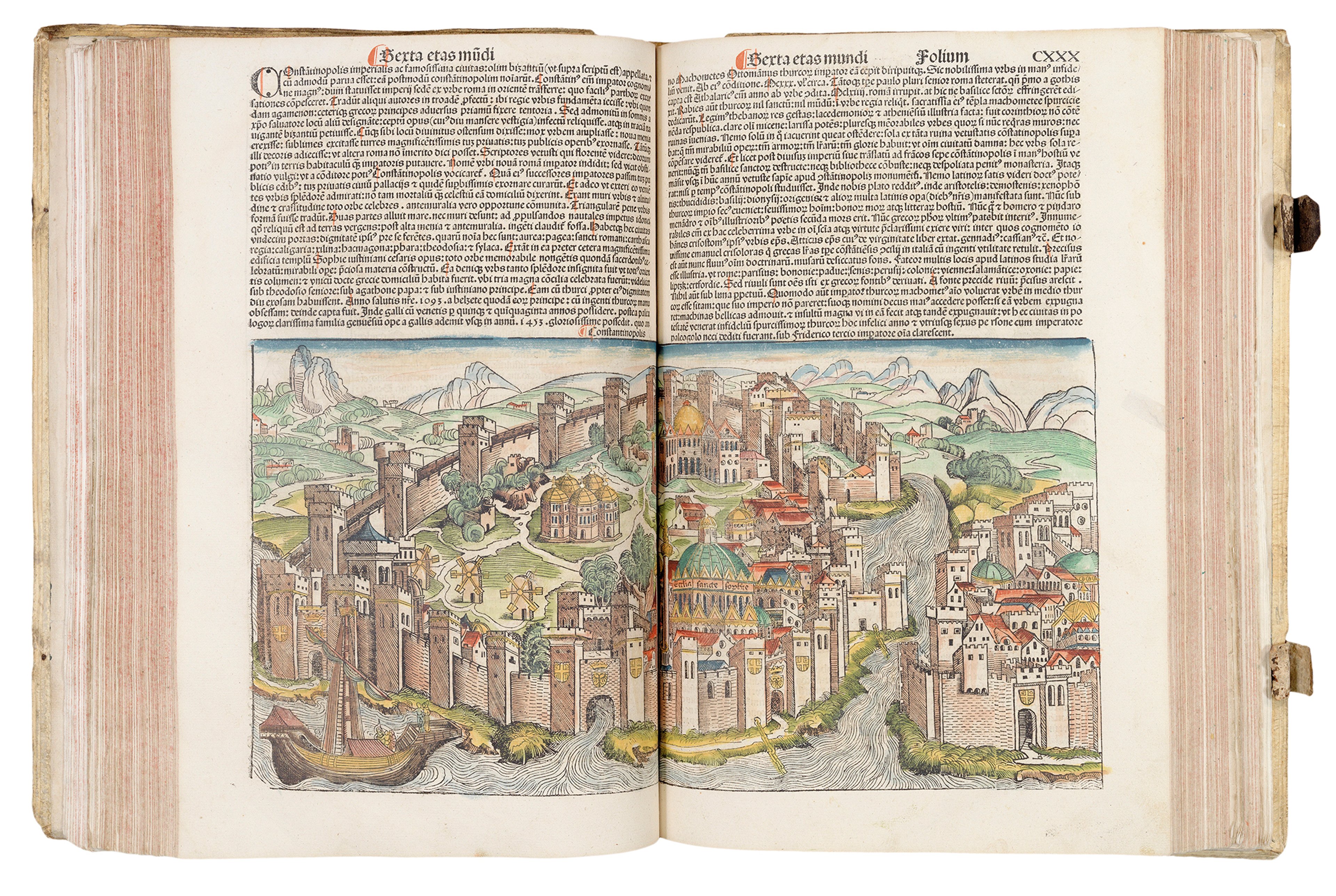
Hartmann Schedel’s map of Constantinople from the Liber Chronicharum (or Nuremberg Chronicle, 1493) ©The Sunderland Collection
Elif’s second map is a treasure housed in the British Museum in London. This early-Babylonian World Map is a clay tablet dating to around the sixth-century BCE, and is the earliest recorded depiction of the then known world. It is a schematic world map with two inscriptions written in the Akkadian language.
Despite its small physical size and delicate nature, this ancient artifact carries immense cosmological wisdom. The tablet features three distinct parts, a world map, a text above the map, and a text on the reverse. The map itself depicts the world bounded by a concentric ocean - which is named the ‘bitter river’ - with the Euphrates River flowing through its centre and Babylon positioned at the heart of the universe.
Late Babylonian (6th Century BCE) clay tablet map of the world © The Trustees of the British Museum
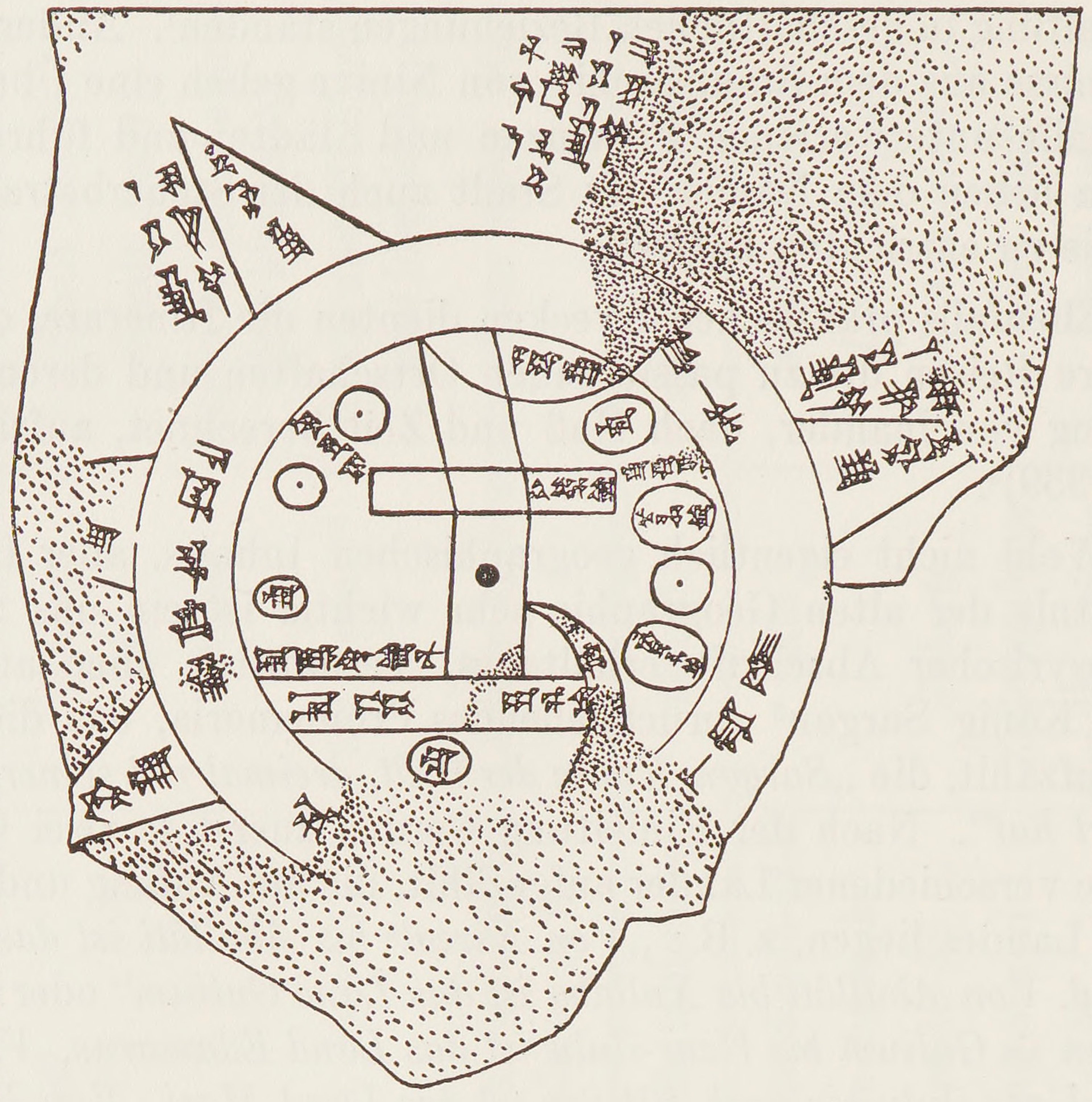
Illustration by German Assyriologist Bruno Meissner for his work Babylonien und Assyrien (1925). Public Domain, via Wikimedia Commons.
This ancient object links directly to Mesopotamia's rich heritage - a region that birthed sophisticated civilisations and literature like the Epic of Gilgamesh, and, as Elif states, faced early climate catastrophes.
The tablet was excavated in Iraq, on the east bank of the Euphrates River.
Keen map enthusiasts will recognise the inscribed map as the logo of the academic journal Imago Mundi, the International Journal for the History of Cartography.
Artists’ impression of the famous Royal Library of Ashurbanipal at Nineveh, from Hutchinson's History of the Nations (1915). Public domain, via Wikimedia Commons.
As Jerry highlights there is something about the physicality of this clay tablet map which may have drawn Elif to it.
She in turn shares how the nature of clay, water, and other ancient survivals such as the tablets like this from one of the world’s oldest surviving libraries, the Royal Library of Ashurbanipal in Nineveh (modern-day Mosul in Iraq) inspired her novels such as There Are Rivers in the Sky (2024) - a tale of a migrating droplet of water and two mighty rivers, the Thames and the Tigris.
Together, Elif and Jerry reflect on how clay tablets, though fragile and often found in fragments, survived centuries of destruction to preserve human memory.
Named after the ruler of the Assyrian Empire, the Royal Library of Ashurbanipal (c.685 BCE - c.631 BCE) comprised over 30,000 clay tablets and fragments featuring diverse texts in multiple languages from the seventh century BCE. Credited as an archaeological discovery by Austen Henry Layard in 1849, the majority of these tablets were relocated to the British Museum, and this tablet in particular was acquired in 1882.
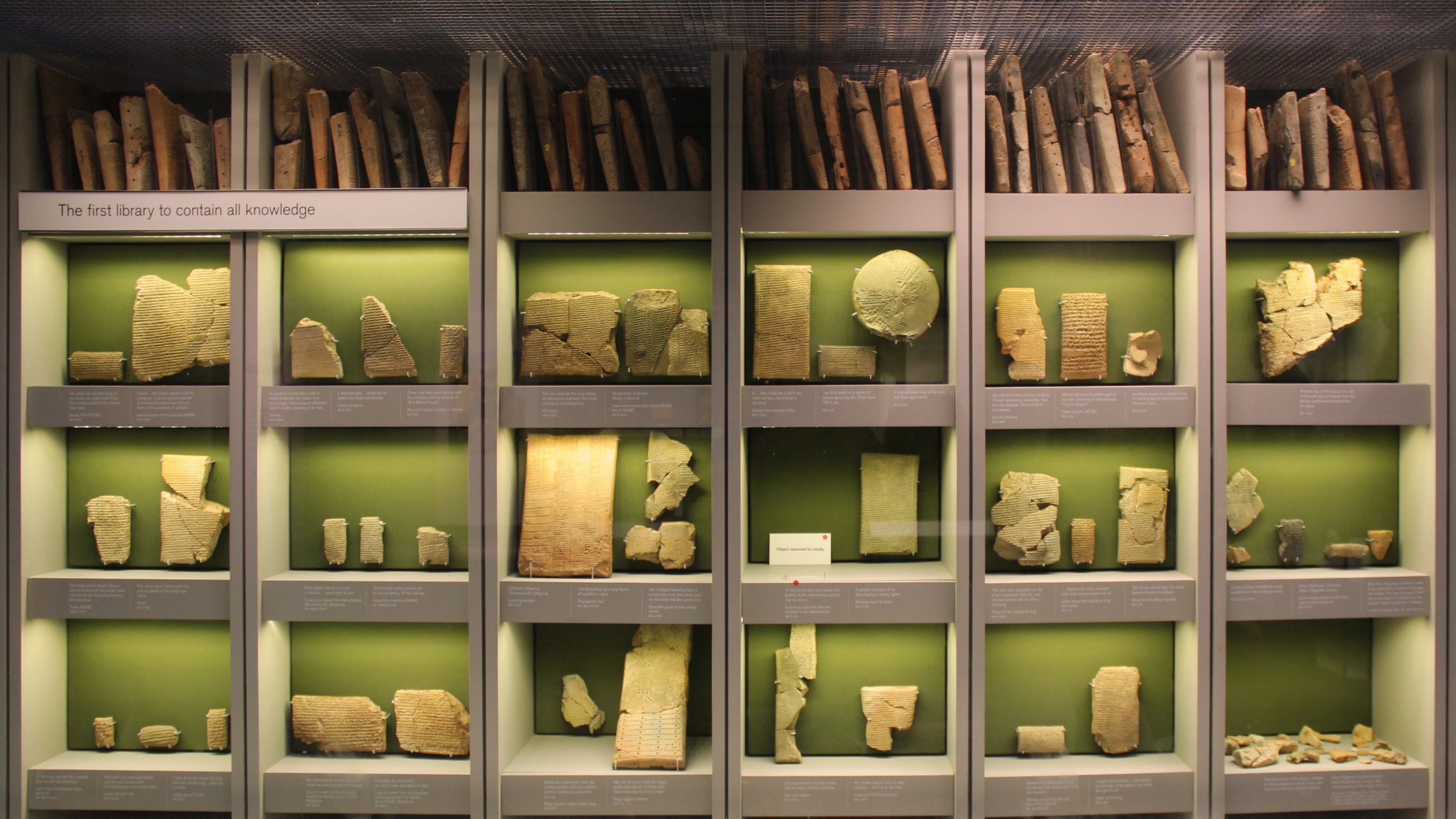
The Library of Ashurbanipal in the British Museum. Photo by Gary Todd. CC0, via Wikimedia Commons
Drawing a parallel between mapmaking and storytelling, Elif notes how early cartographers and cosmographers set down everything they knew while reaching into uncharted territories, seemingly undeterred by their fear of the unknown.
In contrast, fiction writers, like cartographers, cannot realistically include everything; they must selectively map their imaginative storylands, deciding what to highlight and what to leave unmapped…
Reflecting on her own journey as a writer born in France, raised in Turkey, and writing in English, Elif speaks to Jerry about the power of navigating across cultures and languages through her own experiences and how world-building plays an integral part in her work when constructing her complex fictional worlds. In the episode we gain privileged access to Elif’s creative process and learn about some of the challenges she faces in a world that prescribes fixed identities.
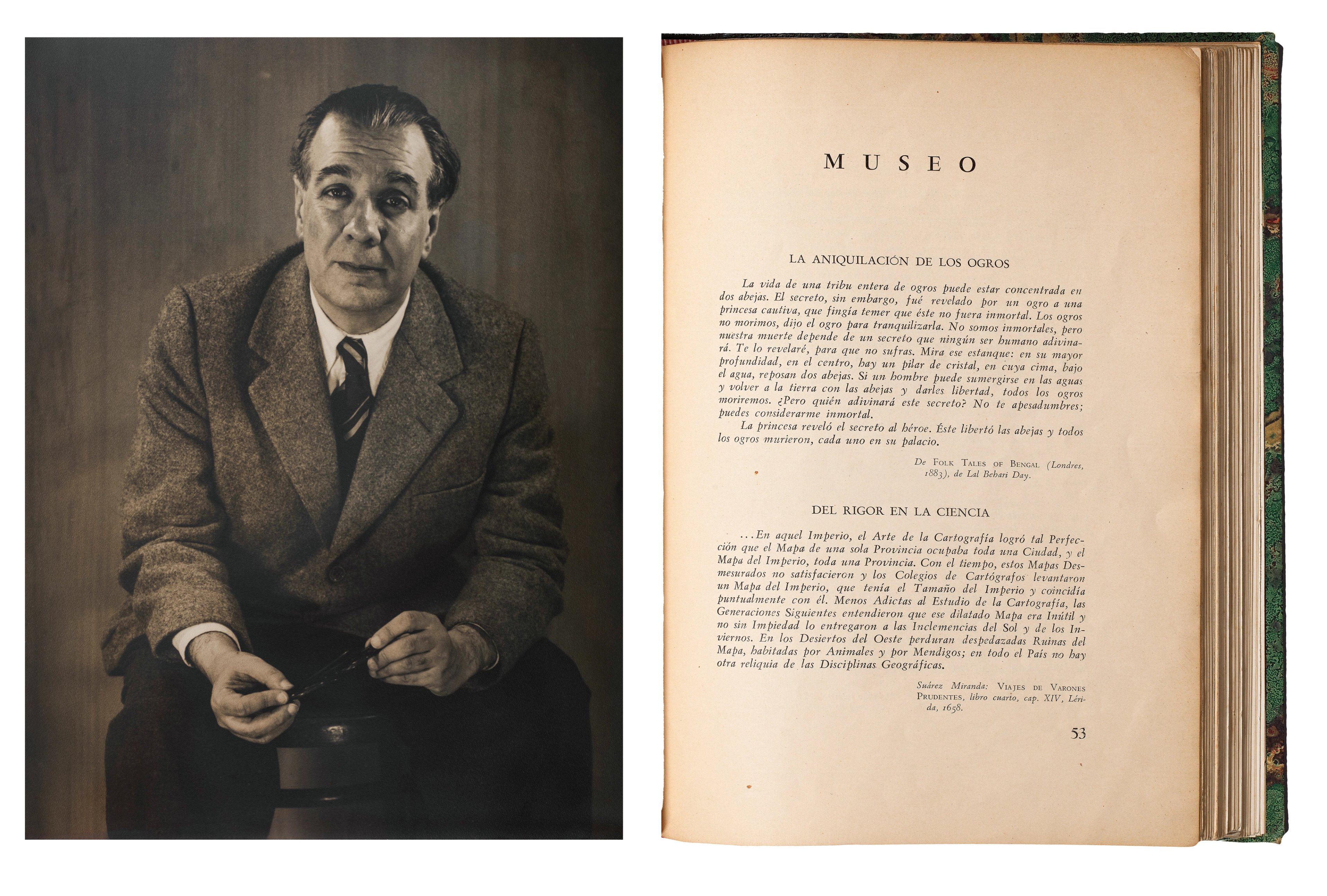
Left: Jorge Luis Borges (1951) by Grete Stern © 2015 Estate of Horacio Coppola Courtesy The Museum of Modern Art, New York. Right: Borges’ short story ‘Del Rigor en La Ciencia’ (On the Exactitude of Science, 1946) from the Ex Carta collection.
In their discussion about worldbuilding in fiction, Jerry references celebrated Argentinian writer Jorge Luis Borges (1899-1986) and his famous short fable Del Rigor en la Ciencia (On Exactitude in Science, 1964). His tale tells of a sophisticated empire that created a 1:1 scale map of the world, only to realise its uselessness.
Their conversation takes them across maps and mindscapes. Amid such global suffering - from ongoing wars to climate devastation - Elif admits she found herself questioning the purpose of writing. Seeking solace, she turned to the literary ghosts of the nineteenth century, and in particular French writer and Realist Gustave Flaubert (1821-1880), who produced iconic works despite the conflict and social upheaval surrounding him.
In her own work, In One Brief Moment All Eternity (2026), Elif revisits Flaubert’s reputation as a connoisseur of the female mind, and seeks to reframe that legacy by centring on thirty distinct - real and imaginary - female forces in his life. As Jerry mentions, the novel has incredibly rich cartographic architecture which has been inspired by Flaubert's own extensive travels, all the while restoring the voices of women forgotten by traditional histories.
About Elif Shafak
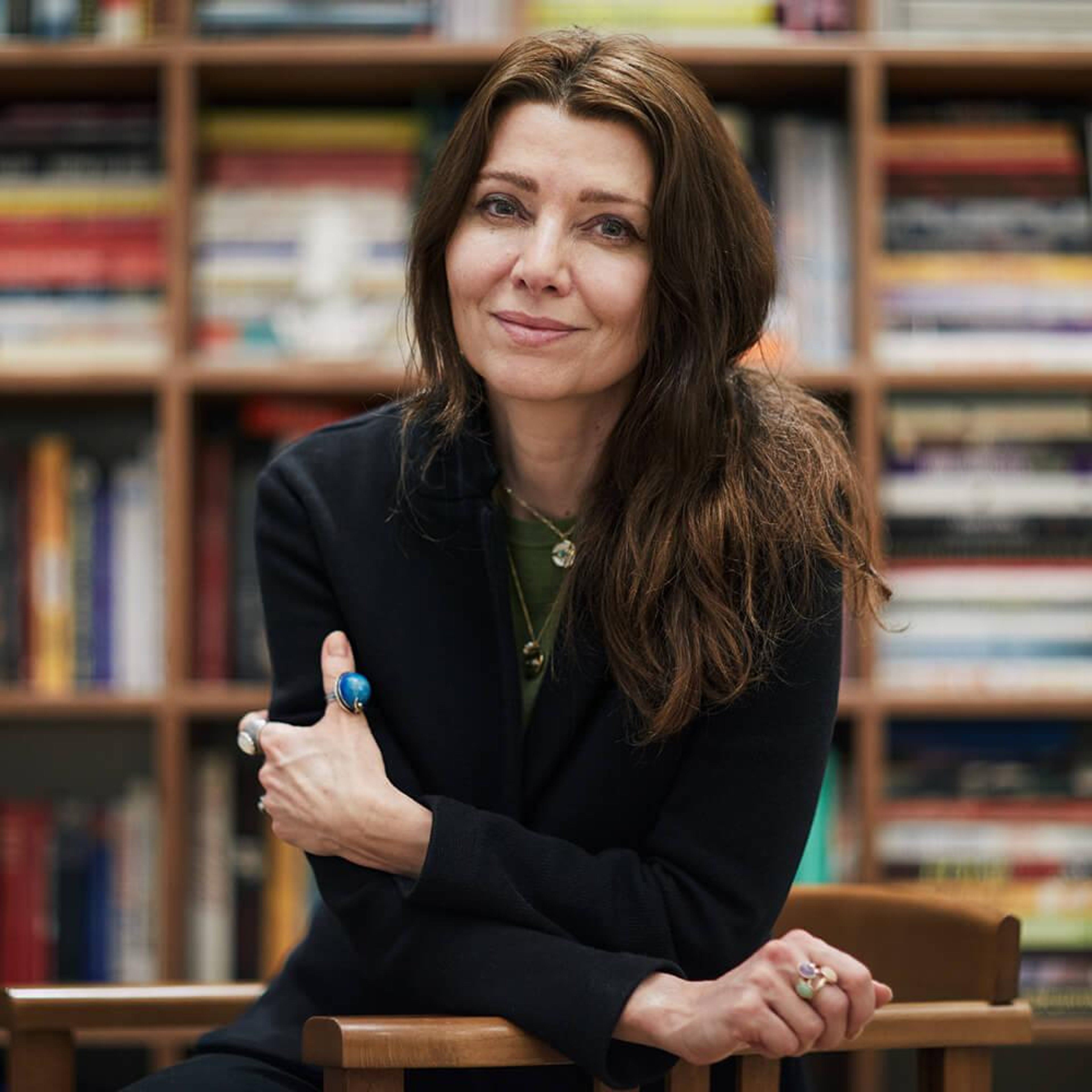
©Elif Shafak, courtesy Curtis Brown
Elif Shafak is an award-winning British-Turkish novelist and storyteller. She has published 21 books, 13 of which are novels and her books have been translated into almost 60 languages.
Elif holds a PhD in political science, and she has taught at various universities in Turkey, the US and the UK, including St Anne's College, Oxford University, where she is an honorary fellow. She also holds an honorary Doctorate of Humane Letters from Bard College. Elif is a Fellow and President of the Royal Society of Literature and has been chosen among BBC’s 100 most inspiring and influential women. She is a Public Humanities Fellow at the School of Advanced Studies (SAS) in recognition of her work to shape the future of Public Humanities, deepen its reach and expand its impact.
An advocate for women's rights, LGBTQ+ rights and freedom of expression, Elif is an inspiring public speaker and twice TED Global speaker. She contributes to major publications around the world, and she was awarded the medal of Chevalier de l’Ordre des Arts et des Lettres. In 2017 she was chosen by Politico as one of the twelve people “who will give you a much-needed lift of the heart”. She has judged numerous literary prizes, including The PEN Nabokov Prize and has chaired the Wellcome Prize. Elif is the recipient of the Halldór Laxness International Literature Prize for her contribution to 'the renewal of the art of storytelling. In 2024, Elif was awarded the British Academy President's Medal for 'her excellent body of work which demonstrates an incredible intercultural range.’
Find out more about Elif and her work at elifshafak.com and subscribe to her Substack Unmapped Storylands.
Why not continue your exploration of the wonderful world of maps by subscribing to the podcast? That way you will never miss an episode.
Feel free to let us know - What's YOUR Map?!
All views and opinions expressed by guests on the podcast are entirely their own and do not represent those of The Sunderland Collection or Whistledown Productions.