Katie Parker
Series 4 Episode 1
Silver Sails: Following the Galleon Route with Dr. Katie Parker
Series 4 Episode 1
Available on all major podcast platforms: click the icons or hit 'play' to listen now.
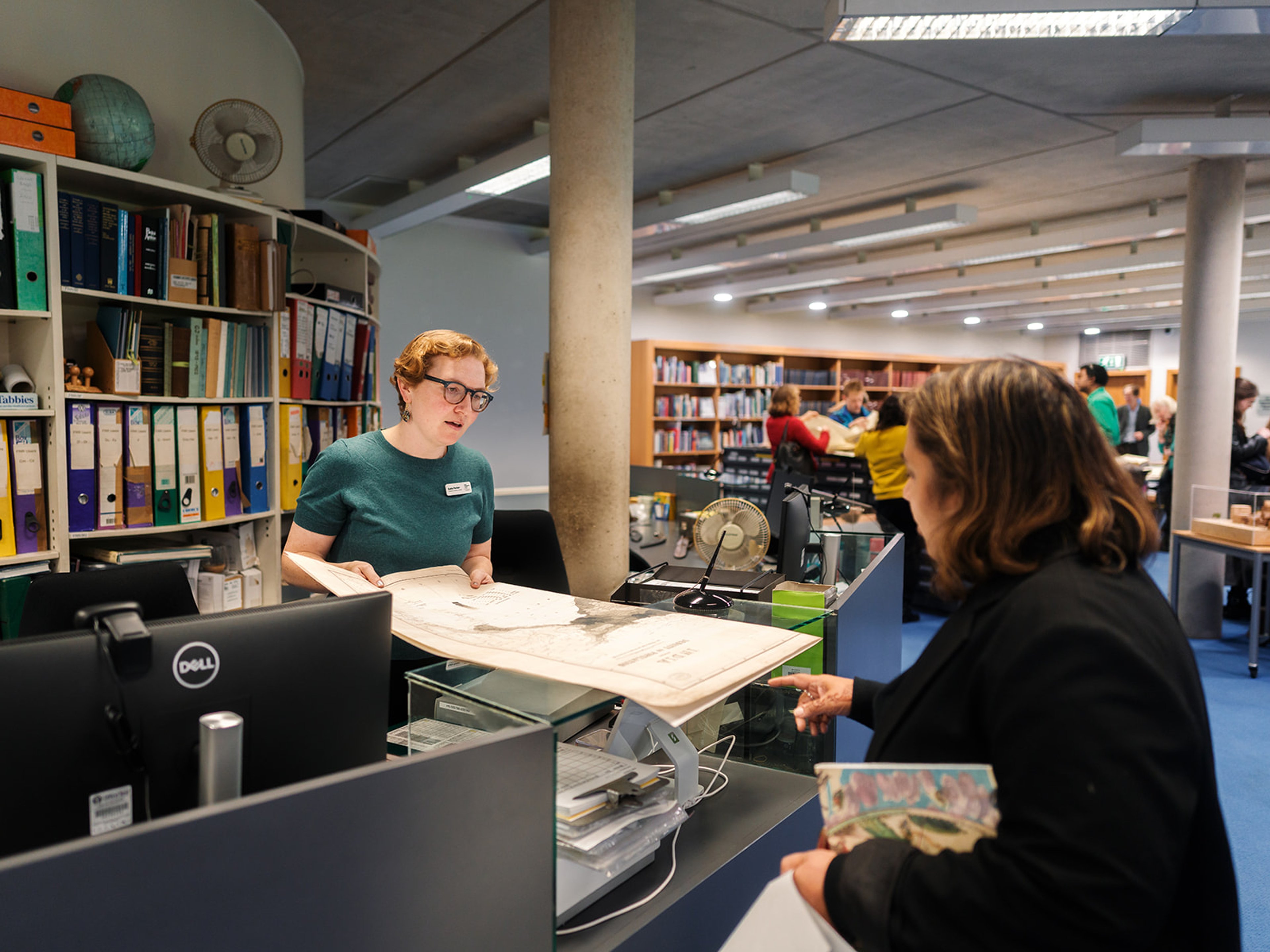
In this episode, Jerry finds himself at one of the world's largest and most active exploration-focused institutions: the Royal Geographical Society (RGS) in London. He meets with Cartographic Collections Manager Dr. Katie Parker to pore over a mid-sixteenth-century treasure that both the RGS and The Sunderland Collection are privileged to own an example of.
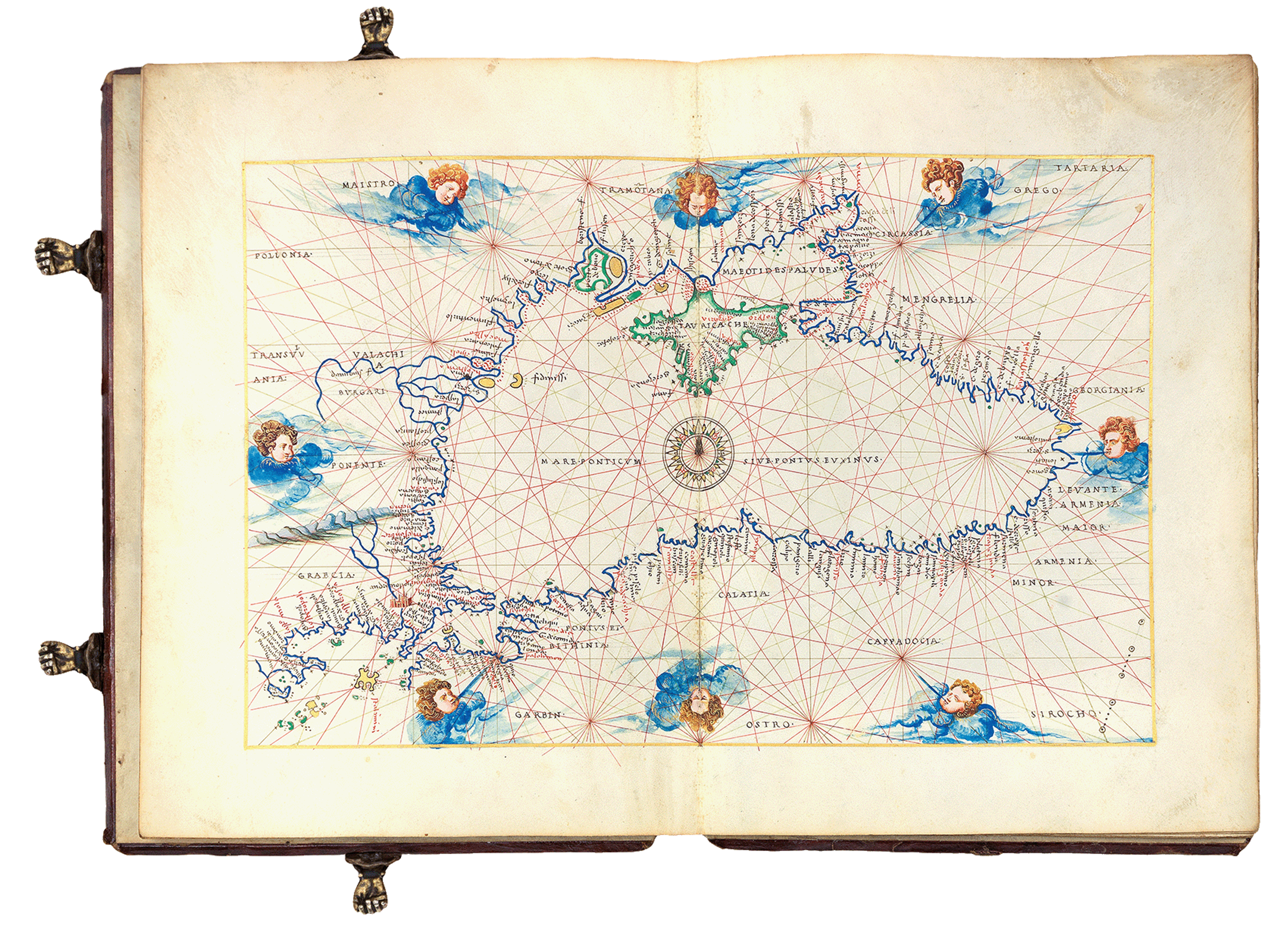
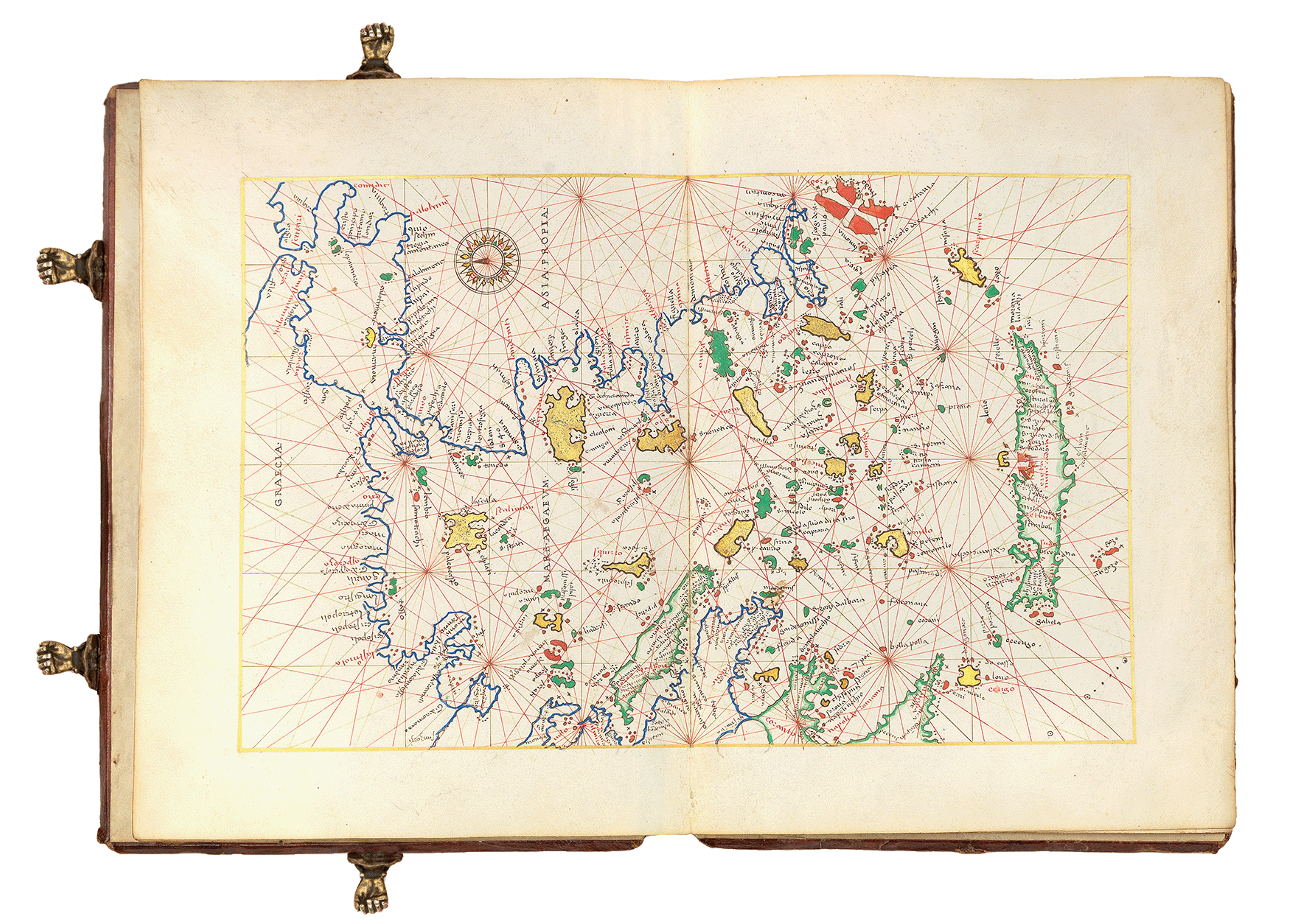
Produced in around 1550, atlases by Battista Agnese are a luxurious curation of about 13 hand-drawn portolan charts of the known world. Jerry and Katie explore what these exquisite maps show, and who would have owned them. They discuss the European desire for imperial expansion in pursuit of wealth, from silver and gold in the west to spices in the east. We also learn more from Katie’s expertise in eighteenth-century European maritime history and Pacific voyages of exploration.
View these glorious maps while you listen by clicking on the images below. You can explore the full Agnese atlas in brilliant detail in the Collection on Oculi Mundi.
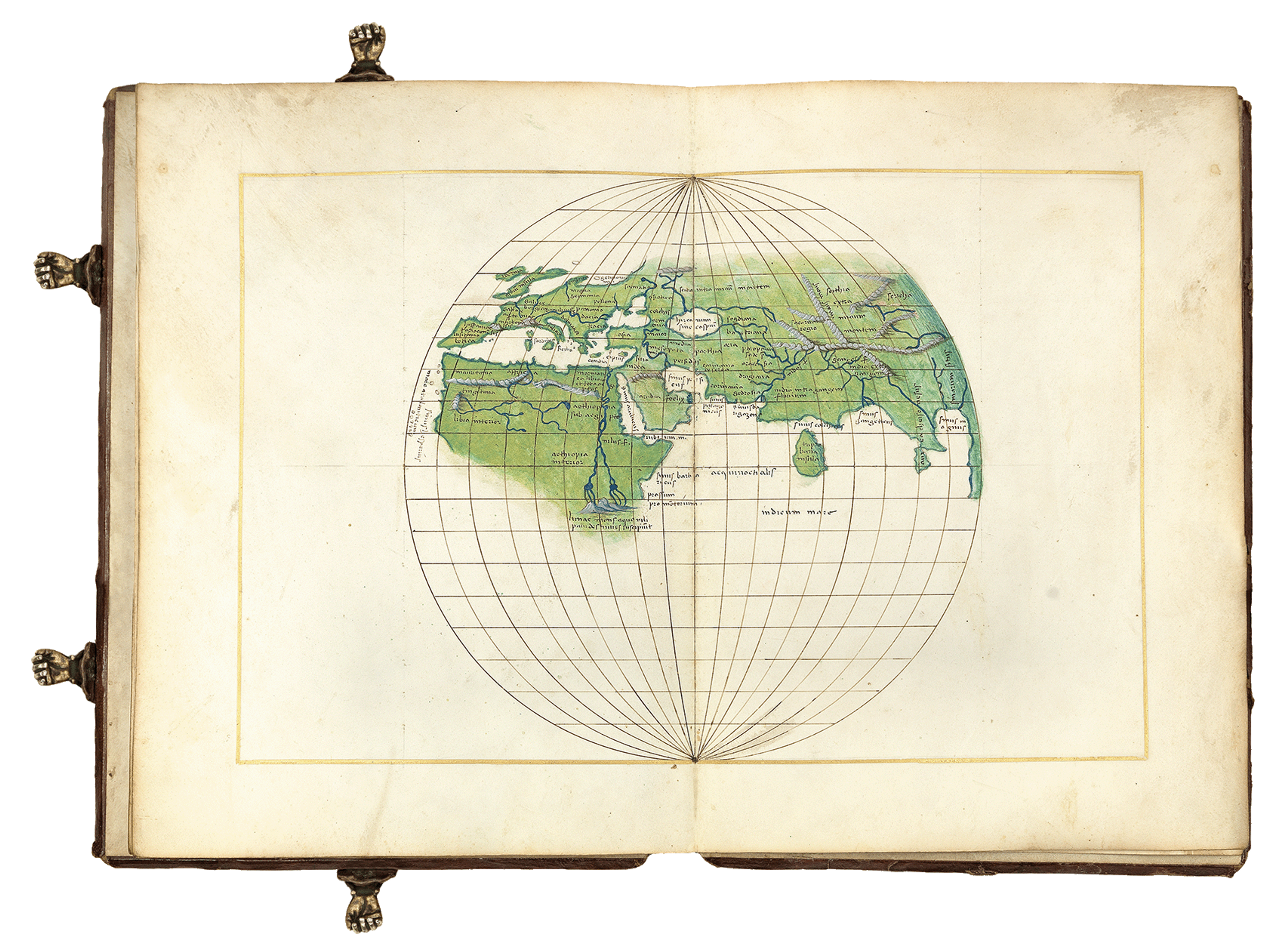
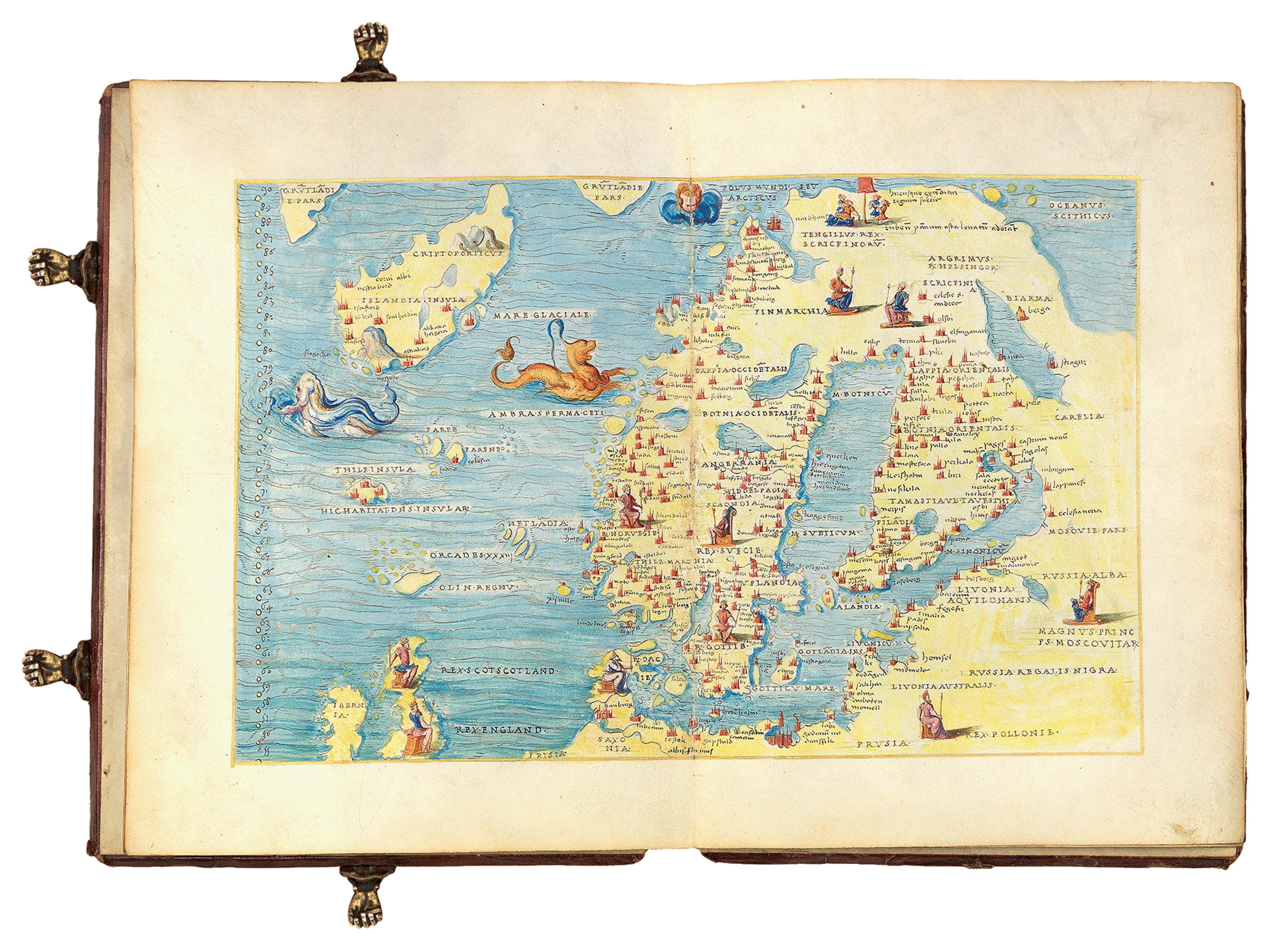
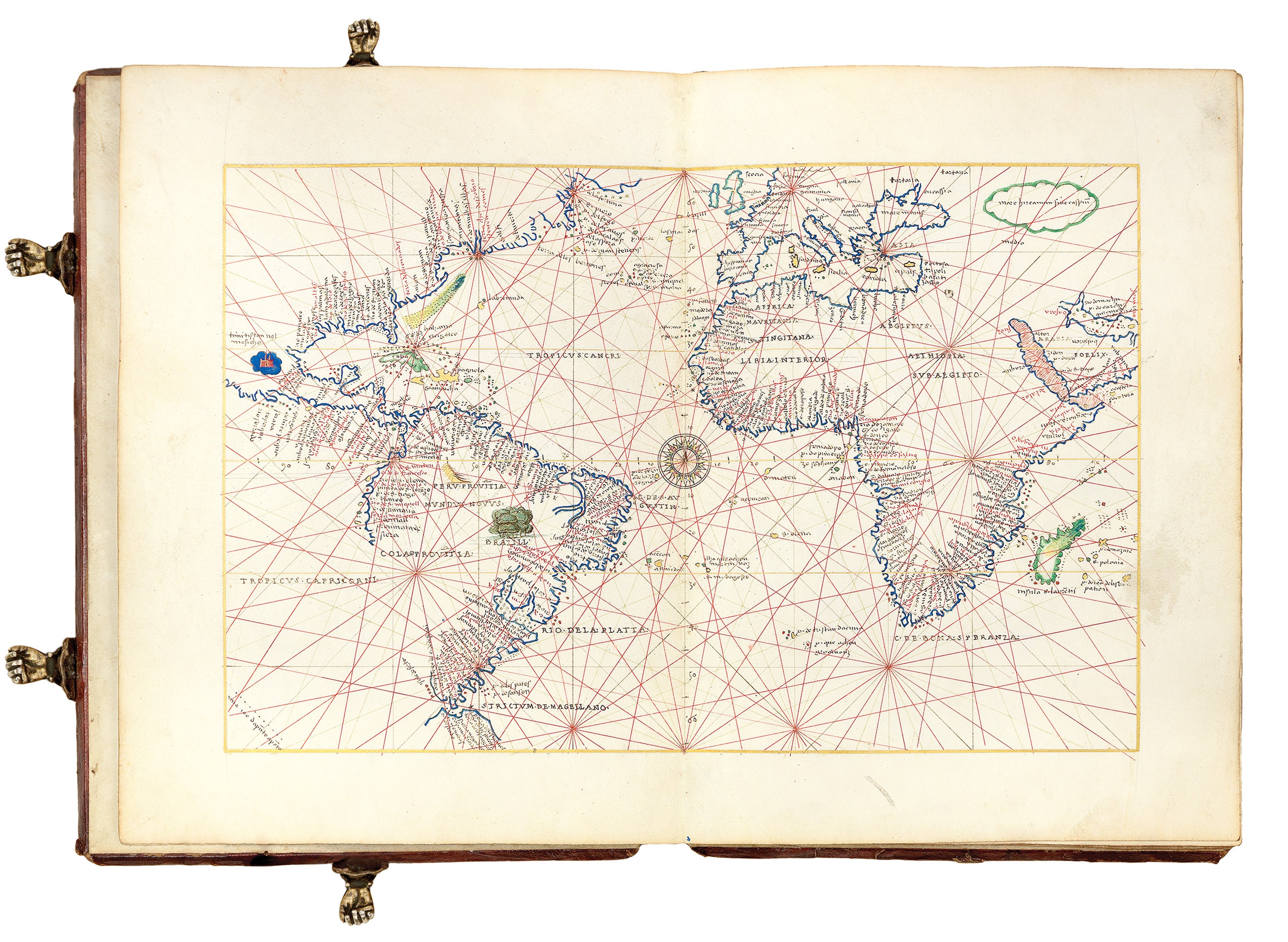
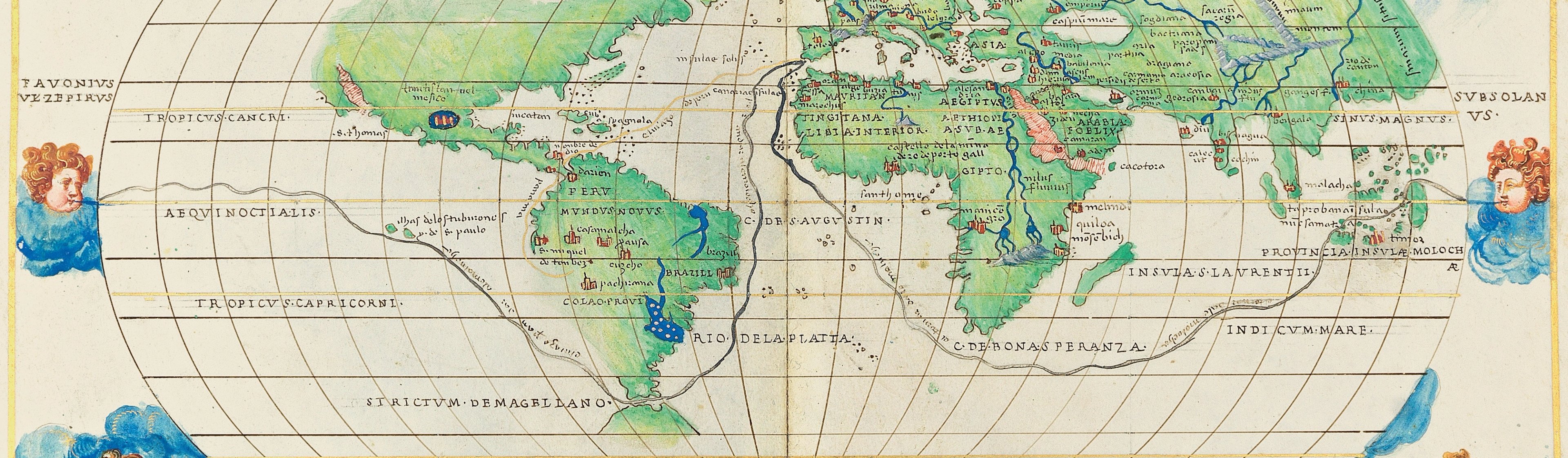
The world map from The Sunderland Collection's Agnese atlas (c.1550).
This striking oval-projection map shows the world as it was known in the mid-sixteenth century. The continents are painted in lush green: the unknown coastlines of northern America and Asia dissolve into the distance, and there is a complete omission of land inside the Antarctic Circle. Major settlements are identified with red and gold icons, and a selection of physical features such as mountains, rivers and lakes are also carefully drawn onto the map. The world is surrounded by the 12 personified winds, each suspended above the Earth in a flurry of blue clouds.
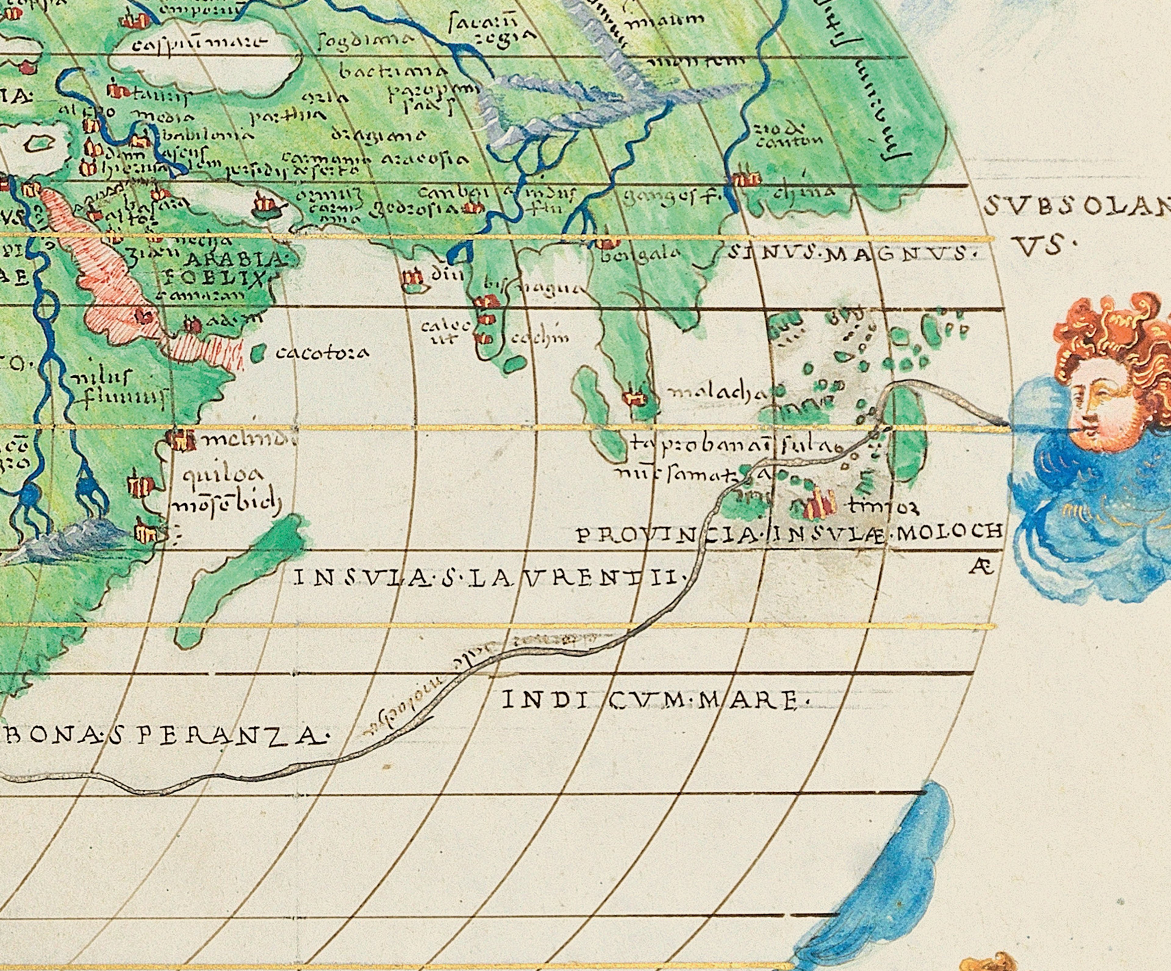
A glittering silver route on this map traces the first known circumnavigation of the earth by the adventurer Ferdinand Magellan (c.1480-1521). This took place during the Spanish Empire's expedition to Maritime Southeast Asia (1519-1522), which was historically known as the 'East Indies'.
An additional gilded galleon route departs from Spain, heads west across the Atlantic, through the Isthmus of Panama and down to Peru in search of silver and gold.
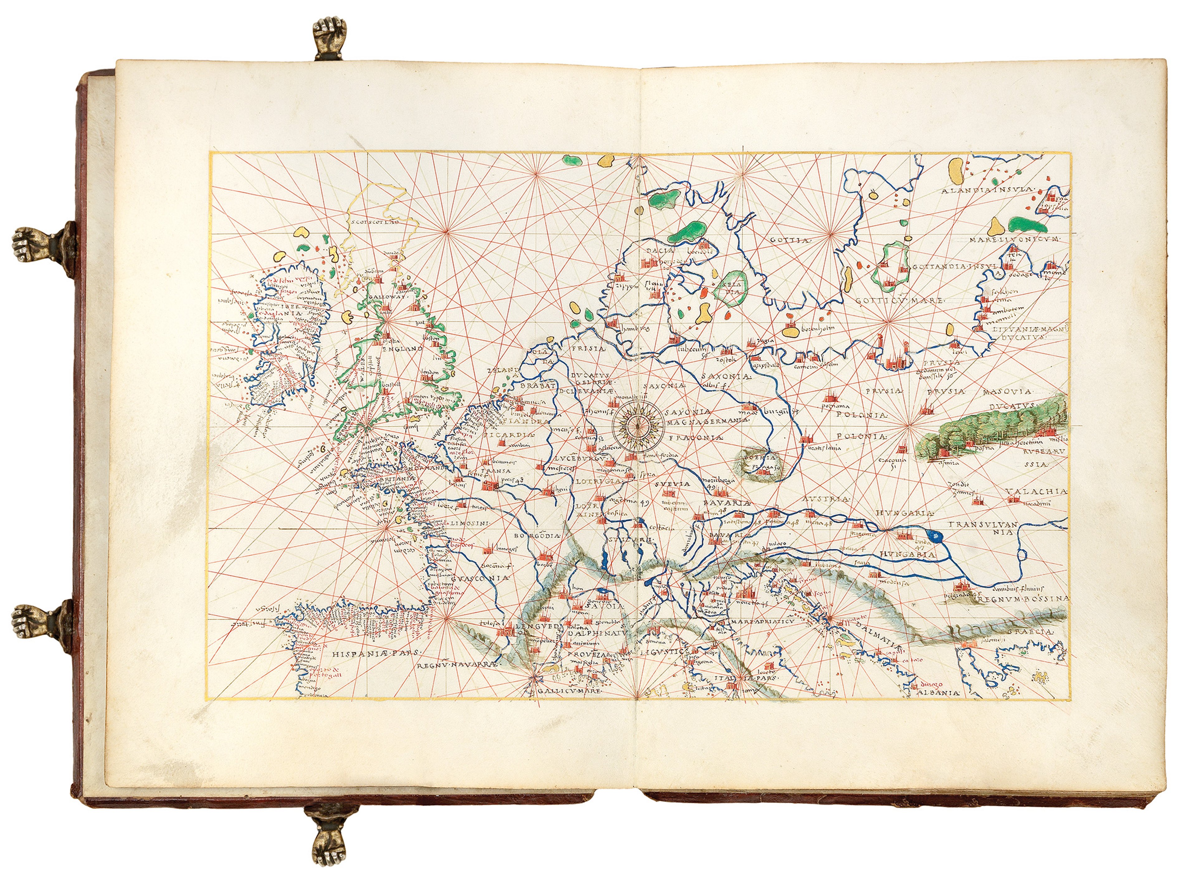
It is one of 13 charts in this exquisite portolan atlas. Each detail-rich map is hand-drawn on vellum, and the entire work is heightened in gold and silver.
At the end of the fifteenth-century, European explorers desperately sought maritime routes to Asia, driven by the desire to generate wealth from the continent's abundant produce - notably from the 'Spice Islands' laden with nutmeg, cloves and pepper.
The first such adventurer known to achieve this journey was navigator Vasco de Gama in 1498, securing a route for the Portuguese Empire. For centuries before de Gama’s arrival, the Moluccas had been an important spice production and trading centre. Although spices were available in Europe at this time, they were extremely costly due to the multiple traders involved during the lengthy overland journey. The main European marketplace for these exotic goods was Venice.
The Portuguese Empire dominated the European spice trade for a time, controlling important trading posts in the Indian Ocean as well as the Molucca and Banda Isles.
Emboldened by Magellan's expedition landing in the Moluccas in 1521, the Spanish Empire entered into a trade war, establishing their own trans-Pacific commercial route to avoid the Portuguese in the Indian Ocean. This new route connected with the course of the Spanish Treasure Fleet - marked in gold on Agnese's map - transporting predominantly silver from mines in Peru and Mexico back to Spain. It would be this silver would go on to fund global imperial expansion.
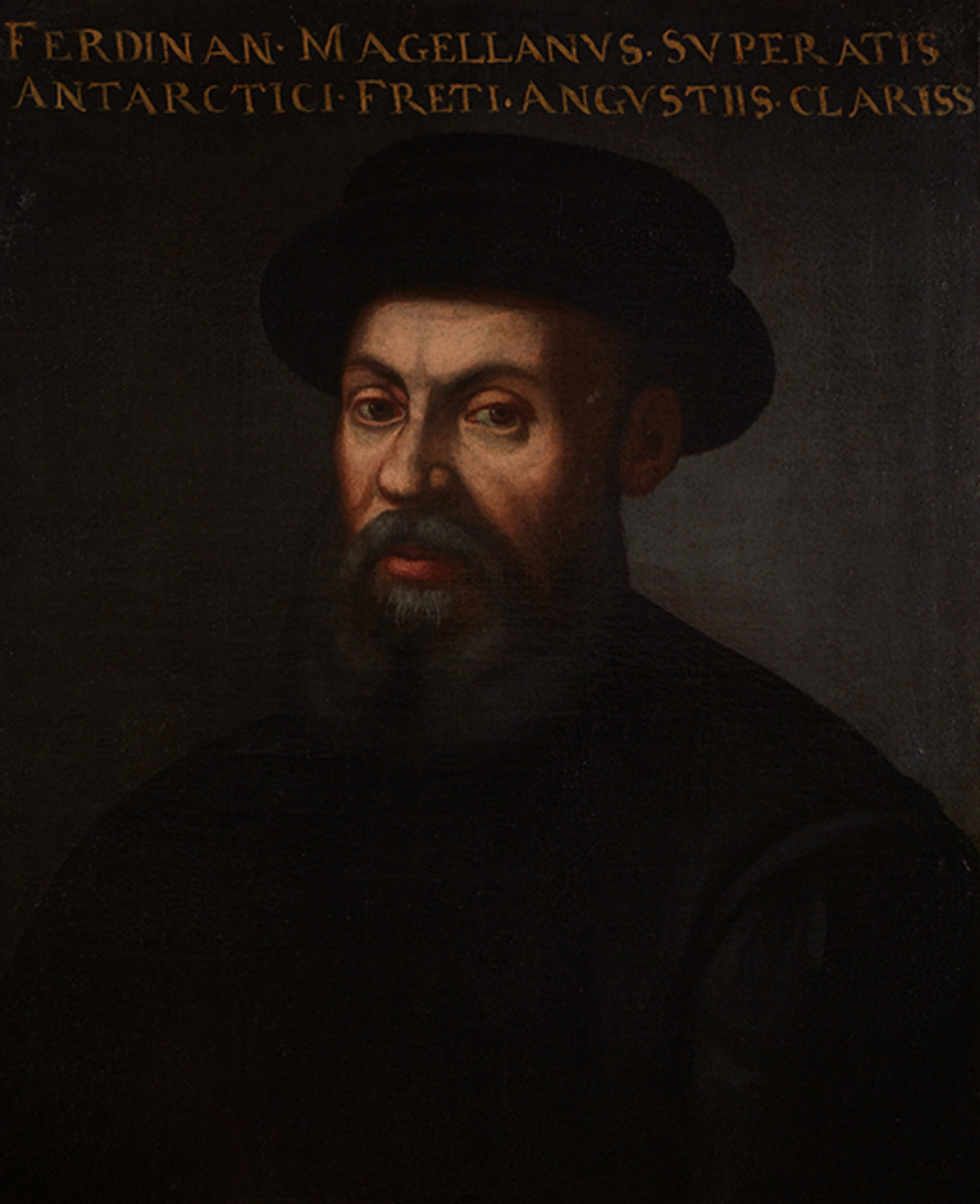
Portrait of Magellan from The Mariner's Museum Collection. Public domain.
Magellan (c.1480-1521) was an explorer - or as Katie describes, an opportunistic adventurer - hailing from Portugal. During his time as a navigator, he sailed under the both the flags of the Portuguese Empire (1505-13) and Spanish Empire (1519-1521).
In a quest to find a successful trading route between Spain and Asia, Magellan along with his crew of 270 men and 5 ships set sail from Sanlúcar de Barrameda, Spain. They travelled southwest across the Atlantic Ocean, through a navigable channel south of Chile - now known as the Strait of Magellan - and across the vast Pacific Ocean until they reached Southeast Asia.
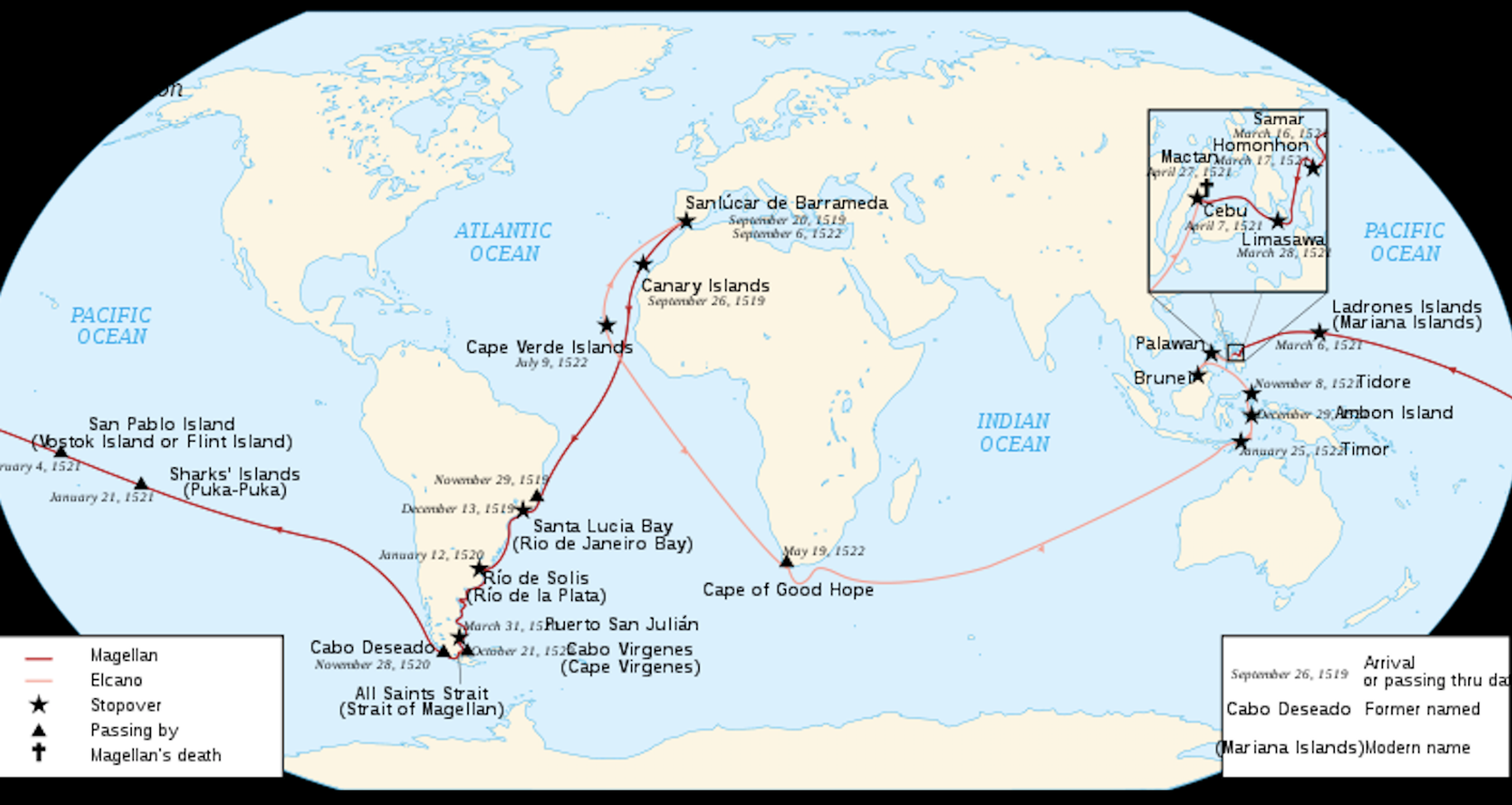
Map of the Magellan-Elcano Circumnavigation (1519-22). Source: Uxbona CC BY-SA 3.0.
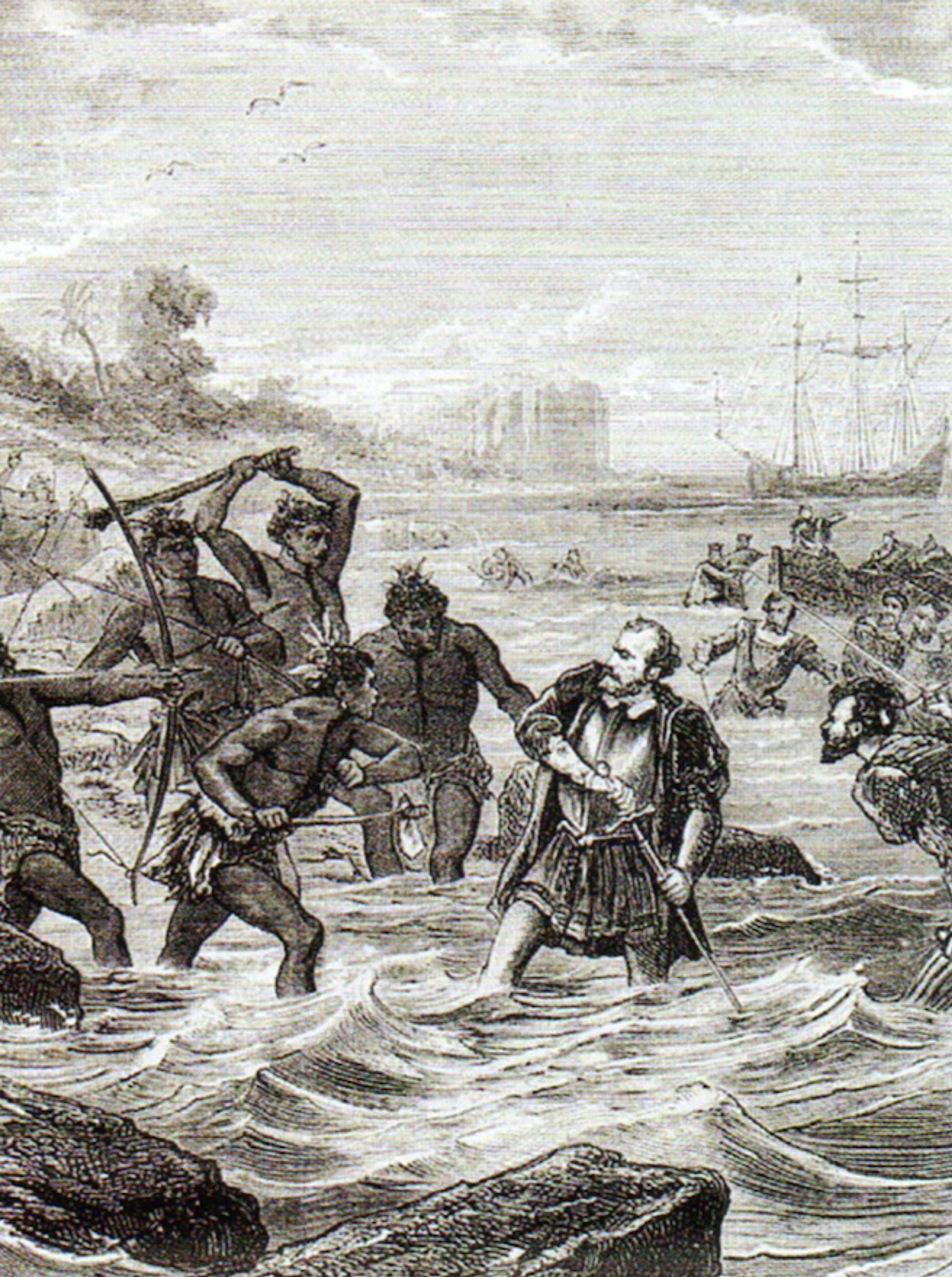
An illustration of Magellan's death during the Battle of Mactan in Cebu (1521). Public Domain.
Magellan's expedition was the opposite of plain sailing: along the way there were multiple mutinies and a troublesome crossing of the Pacific Ocean that lasted nearly 100 days! Magellan reached the Philippines, but did not return home - he was killed in an encounter with the inhabitants of the island of Cebu.
You can find out more about Magellan here.
The surviving members of the expedition were led home by Basque explorer, Juan Sebastián Elcano, who continued to head east to avoid retracing their awful Pacific journey. Only one ship, the 'Victoria', and 22 men, returned.
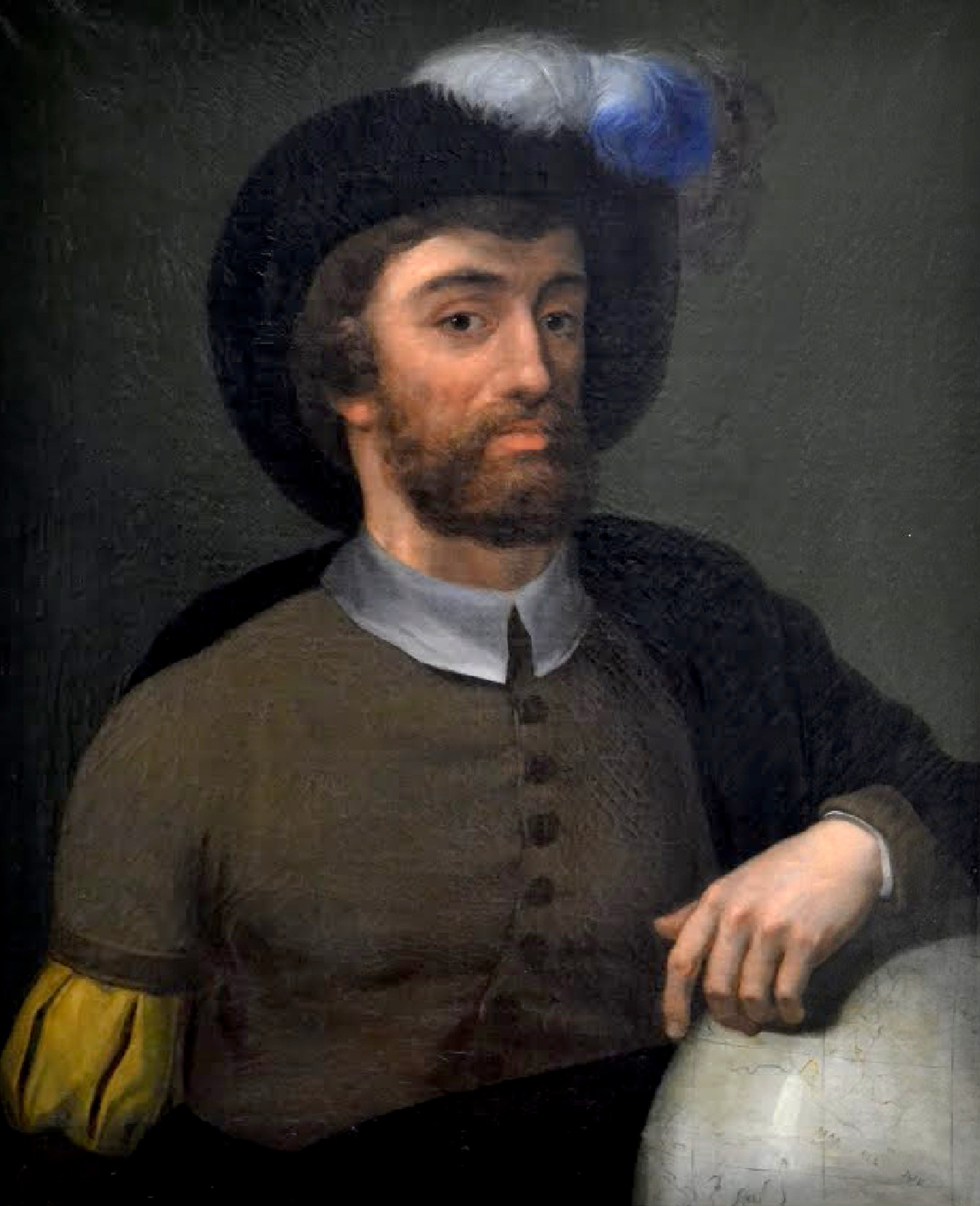
Anonymous nineteenth-century painting of Juan Sebastián Elcano. Google Arts & Culture, Public Domain.
Given Magellan's passing, Elcano (c.1476-1526) was actually the first European known to circumnavigate the Earth.
In 1525, he embarked on another voyage to claim and colonise the Molucca Islands for Spain. During this expedition, which was captained by García Jofre de Loaisa, both Elcano and Loaisa died - most likely of scurvy.
You can find out more about Elcano here.
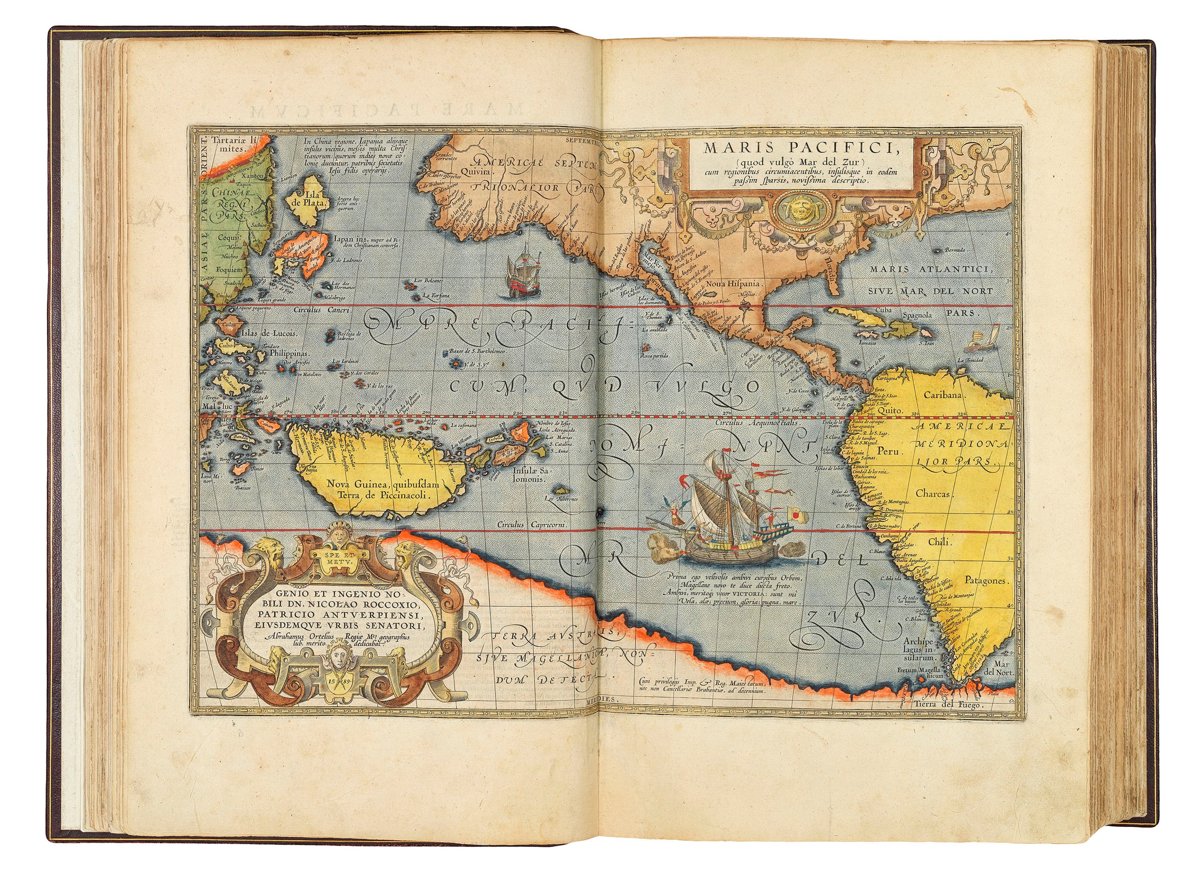
Celebrated map of the Pacific with a large vignette of Magellan's ship 'Victoria', from Ortelius' atlas the 'Theatrum Orbis Terrarum' (1603).
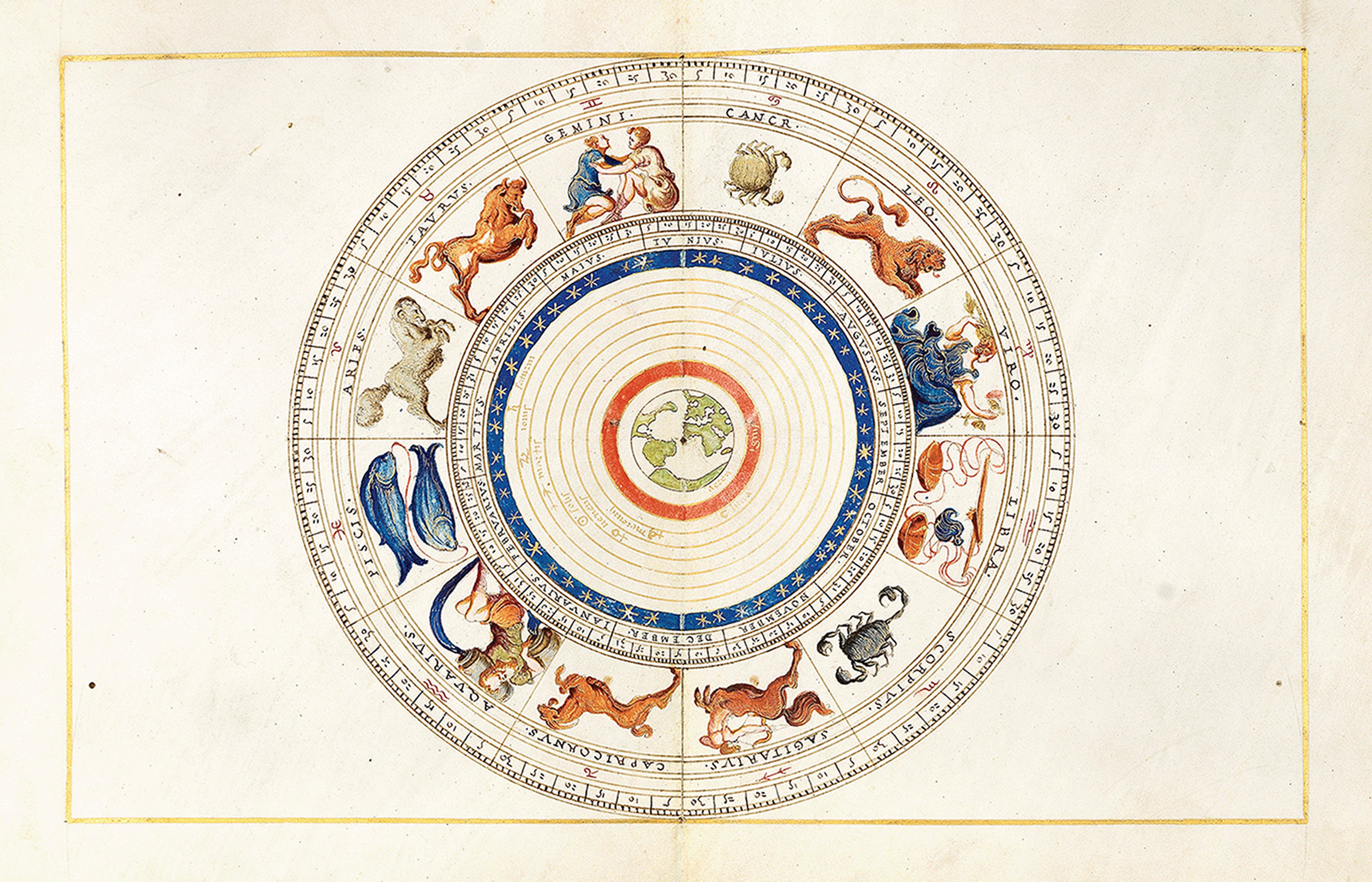
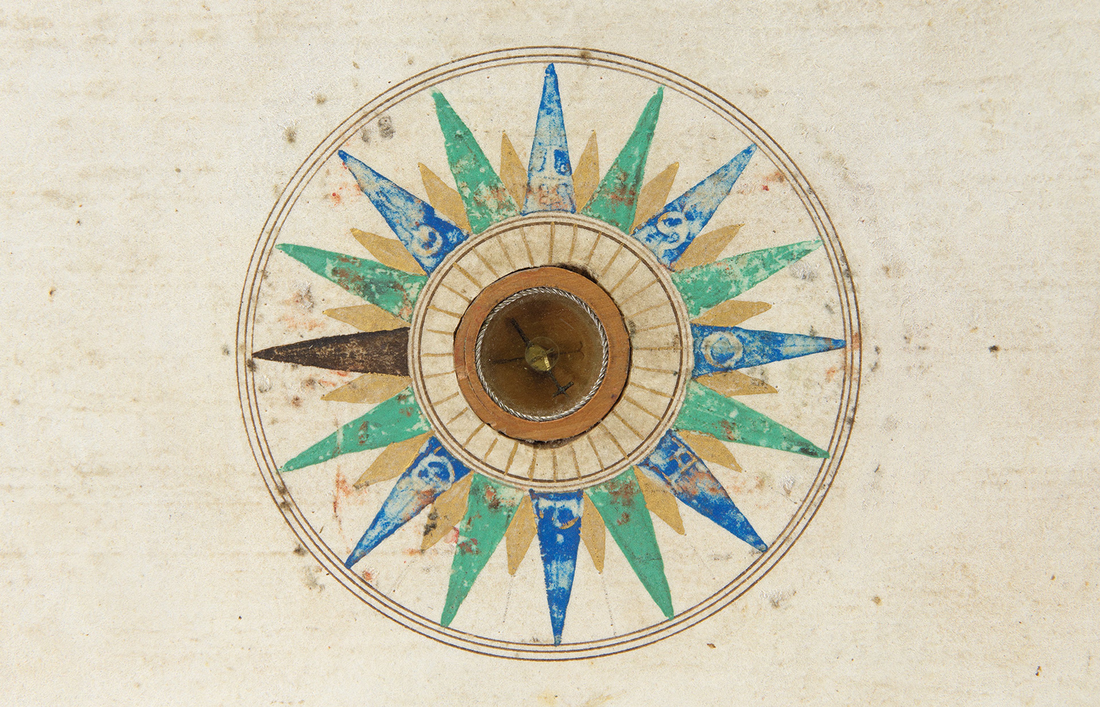
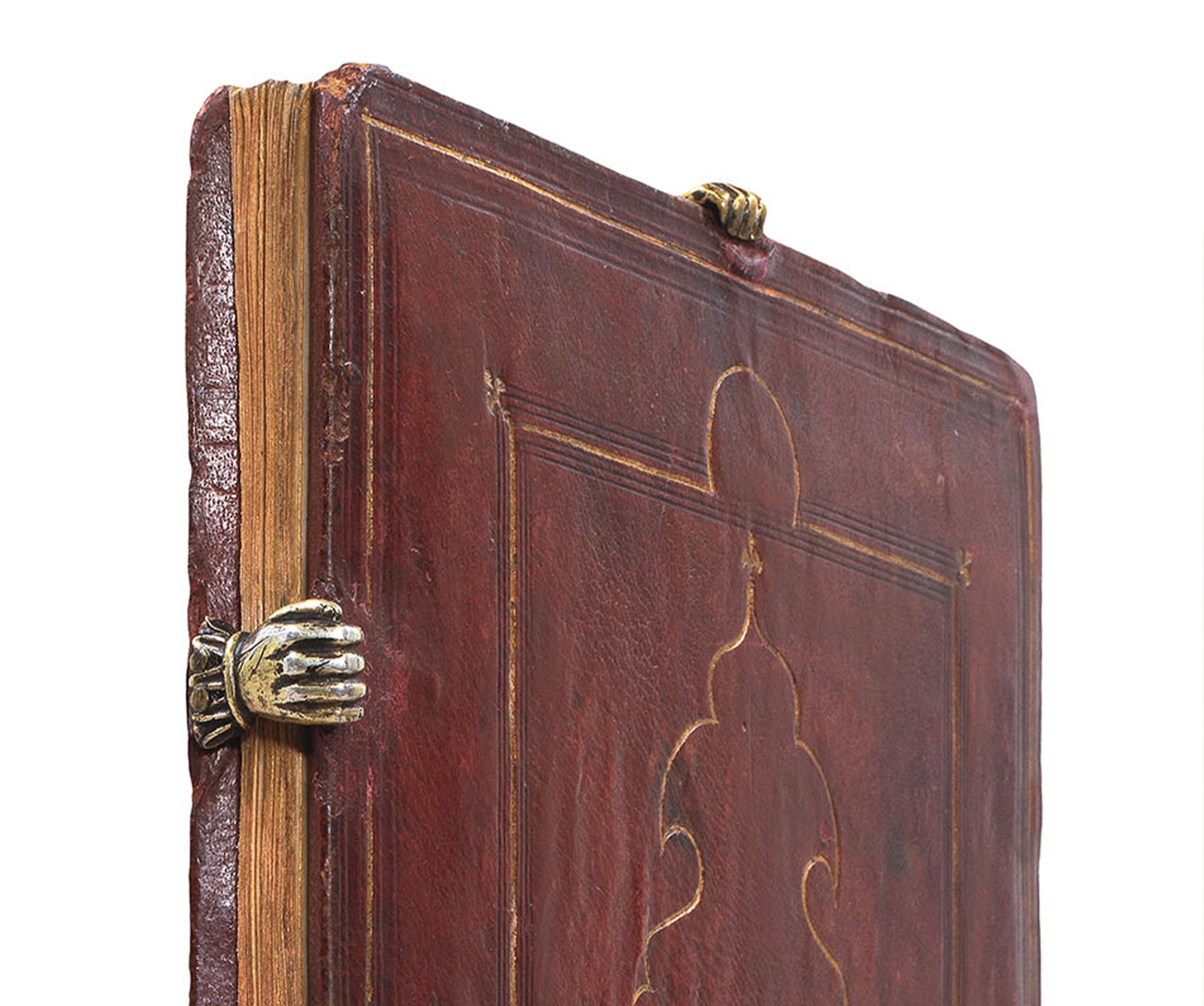
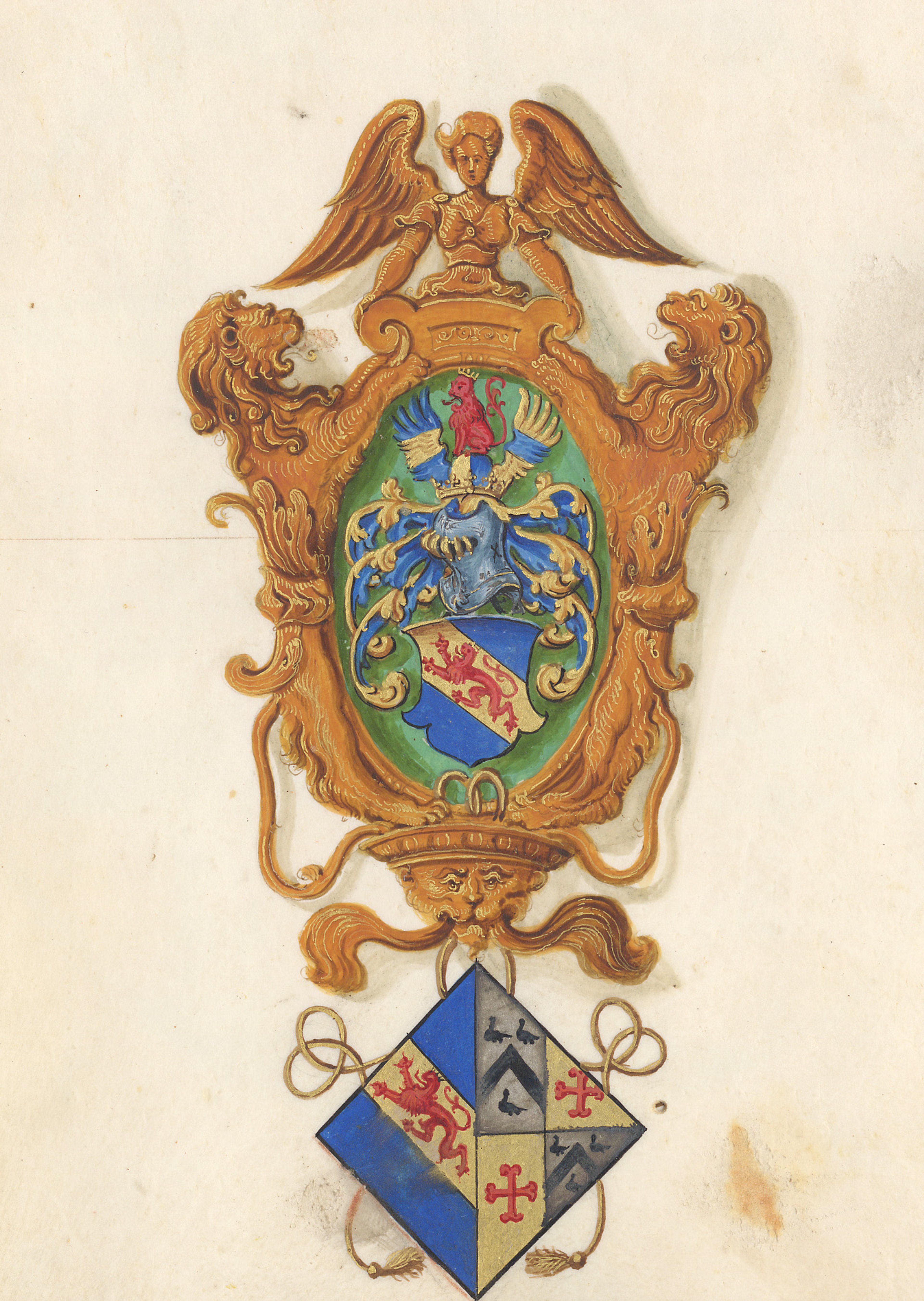
Each example of the Agnese atlas contains a handsome diagram of the zodiac, with a functioning 32-point compass inset into the lower board, and a short treatise in Latin on cosmographical dimensions. Both The Sunderland Collection and the RGS examples of this work are also presented in their original gold-tooled, red Morocco leather bindings with small clasps in the shape of hands.
©RGS-IBG
As Katy and Jerry discover, there are few differences between the two copies that they examine.
The main visual differences is that The Sunderland Collection example retains all of its darling brass hand clasps to hold the book shut, and the RGS copy features a stunning coat of arms of an unknown owner or patron.
(If anyone can identify these arms, please do get in touch!)
Battista Agnese (1514-1564) was a mapmaker and artisan, who produced highly prized, luxurious and beautifully decorated manuscript atlases at his workshop in Venice. His elite patrons included Holy Roman Emperor Charles V, King Phillip II of Spain, and King Henry VIII of England.
As Katie shares, very little is known about Agnese aside from the fact he was Genoese. It was an enterprising decision to base his studio in Venice: at the time it was an extremely important trading centre and would thus have granted him access to the latest knowledge from around the world. It was also a prominent location from which to present and sell to members of the cosmopolitan imperial elite. Owners would have been wealthy merchants or noblemen.
With the exception of the map of Scandinavia, Agnese has chosen to present the maps in an ‘antiqued’ style as opposed to using intaglio printing. This opulent illuminated manuscript style is an informed artistic decision and a nod to earlier decadent works; but the maps nonetheless include all of the latest geographical ‘discoveries’. Each atlas would have been an elite object with a high price tag!
One of the benefits of the maps being manuscript meant that updates could be applied almost instantaneously.
Katie explains to Jerry that there are around 70 known examples of Agnese atlases held in private collections or institutions around the world. They would all originally have been issued in the same luxurious binding, and illuminated and heightened in similar colours.
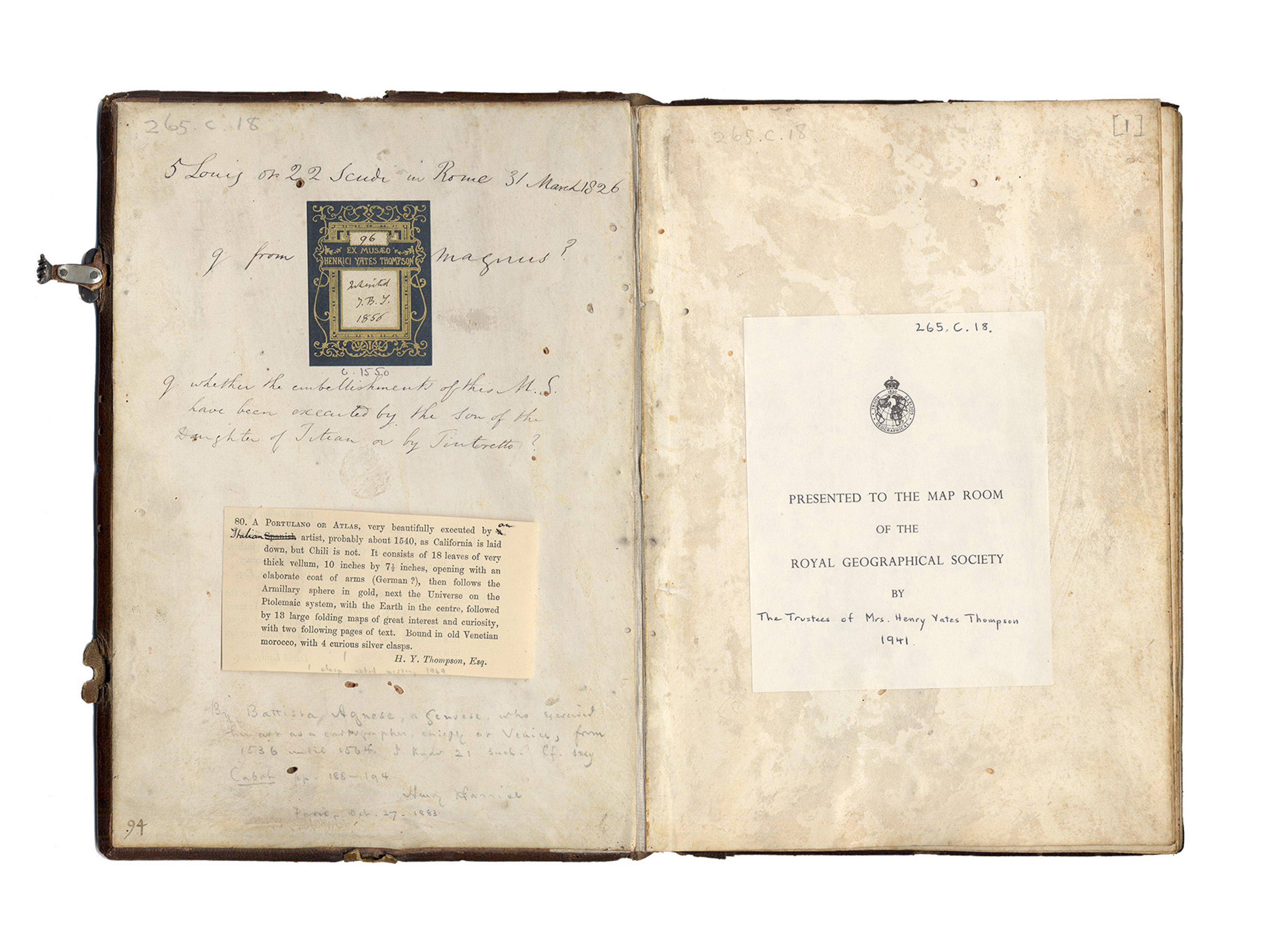
The Sunderland Collection and RGS copies each have distinguished provenance: the former from the collection of the eminent cartographic historian Henry Harisse (1829–1910), and the latter donated to the RGS by the family of British collector and author Henry Yates Thompson (1838-1928). Both contain annotations by Harisse, who was said to have inscribed the end papers of each copy he encountered, in order to confirm its authenticity.
©The Sunderland Collection
©RGS-IBG
American historian and bibliographer Henry Raup Wagner (1862-1957) gathered information of the surviving examples of Agnese atlases around the world. He published a detailed catalogue in 1931.
In this work, he determined the approximate dates when the charts within each atlas would have been drawn:
- Set I: Pre-California (c1535-1541)
- Set II: Including California (c1542-c1552)
- Set III: Including California and a new map of Scotland (c1552-1564)
The Sunderland Collection example has not been recorded in Wagner’s census, but has been dated to between 1545 and 1555.
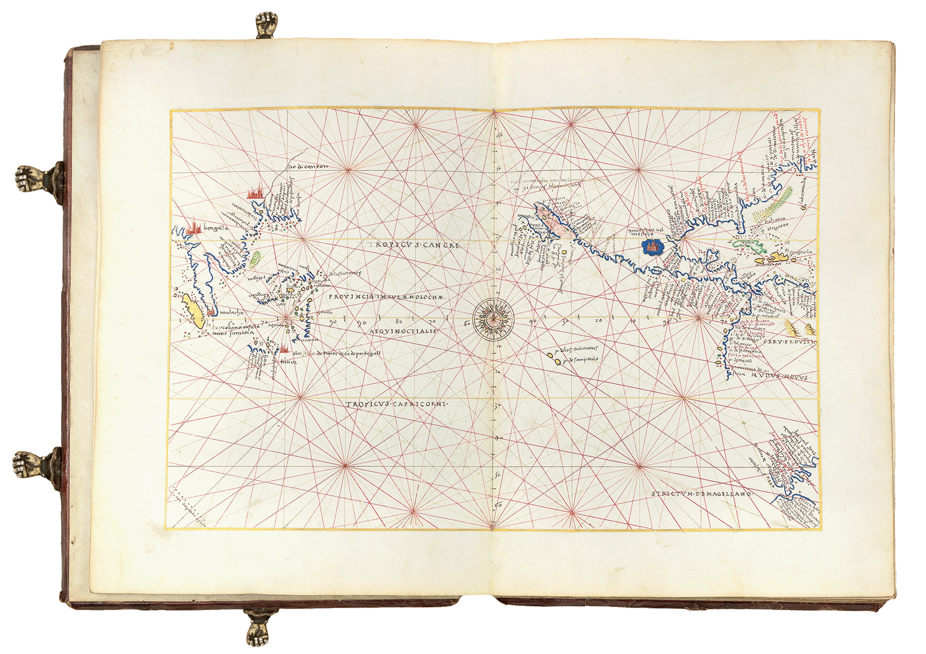
As a speciality on Pacific voyages and maritime history, it is no wonder which map Katie was most interested in within the atlas!
During this episode, she gives Jerry whistlestop tour of this beautiful hand-drawn chart, which is one of the earliest world maps to focus on the Pacific Ocean.
About Katie Parker
©Haych Digital
Dr. Katie Parker is the Cartographic Collections Manager at the Royal Geographical Society (RGS), where she promotes and preserves their collection of more than one million maps, charts, atlases, globes, and gazetteers.
Katie trained as a historian (PhD, University of Pittsburgh, 2016) specialising on the history of the book, the history of cartography, and of Pacific exploration. Her publications include Historical Sea Charts: Visions and Voyages Through the Ages (2021, White Star).
She teaches the history of maps and mapping at London Rare Books School (School of Advanced Study, University of London) and the History of Architecture at NYU London. Katie is also the co-Editor of Imago Mundi: The International Journal for the History of Cartography, and the Administrative Editor of the Hakluyt Society.
Katie in the Foyle Reading Room at the RGS © Haych Digital
About the RGS
The Royal Geographical Society is a learned society, professional body and registered charity with over 14,000 members that has been dedicated to the advancement of geographical science since its founding in 1830.
You can explore all the RGS' wonderful resources, research, and upcoming events - and of course links to find out how to access its incredible map collection - online at RGS.org
Continue your exploration of the wonderful world of maps by subscribing to our award-winning podcast - and never miss an episode. Visit your favourite podcast platform to subsribe.
And feel free to let us know - What's YOUR Map?!

