Chet Van Duzer
Series 6 Episode 5
Waldseemüller: Armchair Explorer with Chet Van Duzer
Series 6 Episode 5
Available on all major podcast platforms: click the icons or hit 'play' to listen now.
Jerry speaks to esteemed map historian and author Chet Van Duzer. As well as having written many books on maps and map motifs, Chet is the Associate Director of The Lazarus Project at the University of Rochester, which brings multispectral imaging - a technology for recovering information from damaged manuscripts - to cultural institutions around the world.
In this episode, Jerry and Chet discuss a monumental world map from 1516 that has been subject to an in-depth investigation by Chet: Martin Waldseemüller’s Carta Marina. Published just nine years after his landmark 1507 map of the world (known as the ‘birth certificate of America’), the Carta Marina is an extraordinary map that exists in one surviving copy at the Library of Congress.
Together Jerry and Chet talk about why Waldseemüller revised his world map so thoroughly, what sources he used and why. We also hear about how Chet himself became immersed in the world of maps, and how his current role as Director of the Lazarus Project sees him shining a (multi-spectral) light on some great cartographic mysteries.
To explore the map as you listen to the episode, click the image below:
Martin Waldseemuller’s Carta Marina (1516). Public domain, via Library of Congress
At the heart of Jerry and Chet’s conversation in this episode is German cartographer Martin Waldseemüller’s 1516 masterpiece, the Carta Marina, or Navigational Sea Chart. Printed across twelve woodcut sheets and measuring over two metres wide when assembled, it stands as a monumental wall map of the world. It survives in a single copy preserved at the Library of Congress, and one of the ‘crown jewels’ of the Jay I. Kislak Collection.
The map centres on the African Continent and stretches across vast oceans and lands, with the New World in the West, extending past the left neatline so that that coastline of the Americas is partially obscured; and some - but not all - of the Eastern coast of Asia.
This snapshot of the world at the start of the sixteenth century is absolutely teeming with descriptive panels containing history, trade data, and fascinating vignettes of galleons, local rulers, beasts, and sea monsters.
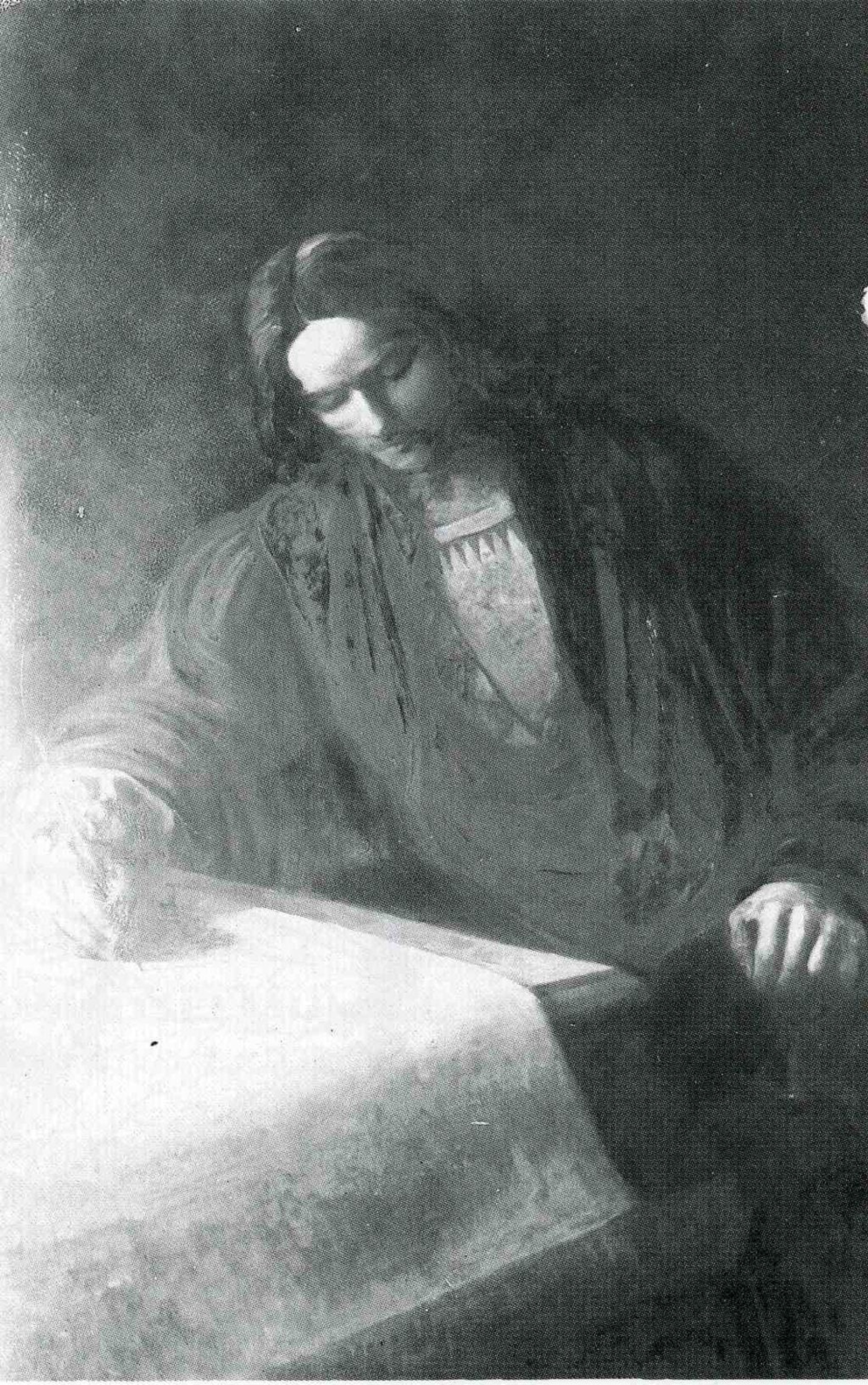
The map was created by the highly influential German scholar and cartographer Martin Waldseemüller (c.1471–1520).
Moving to Freiburg im Breisgau around 1480 and enrolling at the University of Freiburg in 1490, he studied Cosmography under the prominent Humanist scholar and mapmaker Gregor Reisch (1467–1525).
After completing his studies, Waldseemüller relocated to Basel, where he was ordained as a priest, and also gained the skills of printing and engraving. In around 1500, he joined a circle of Humanist intellectuals that had been established in Saint-Dié, in northeastern France.
Calling their group the Gymnasium Vosagense, they set out to release a revised edition of Claudius Ptolemy’s Geographia. In 1507, their leader Walter (or Gautier) Lud declared: “It will soon be possible to see more numerous and truer details of this country [the unknown land lately discovered by the King of Portugal] in the Ptolemy revised and greatly augmented by us and Martin Waldseemüller.”
In 1507, Waldseemüller created two maps that reflected information the scholarly circle at Saint. Dié had learnt of - the discovery of a new continent West of the Atlantic. He produced a map of the world designed on 12 panels.
The world map was accompanied by a pamphlet titled Cosmographiae Introductio (Introduction to Cosmography) which was bound with a new translation of ‘The Four Voyages of Amerigo Vespucci’ (first published 1505).
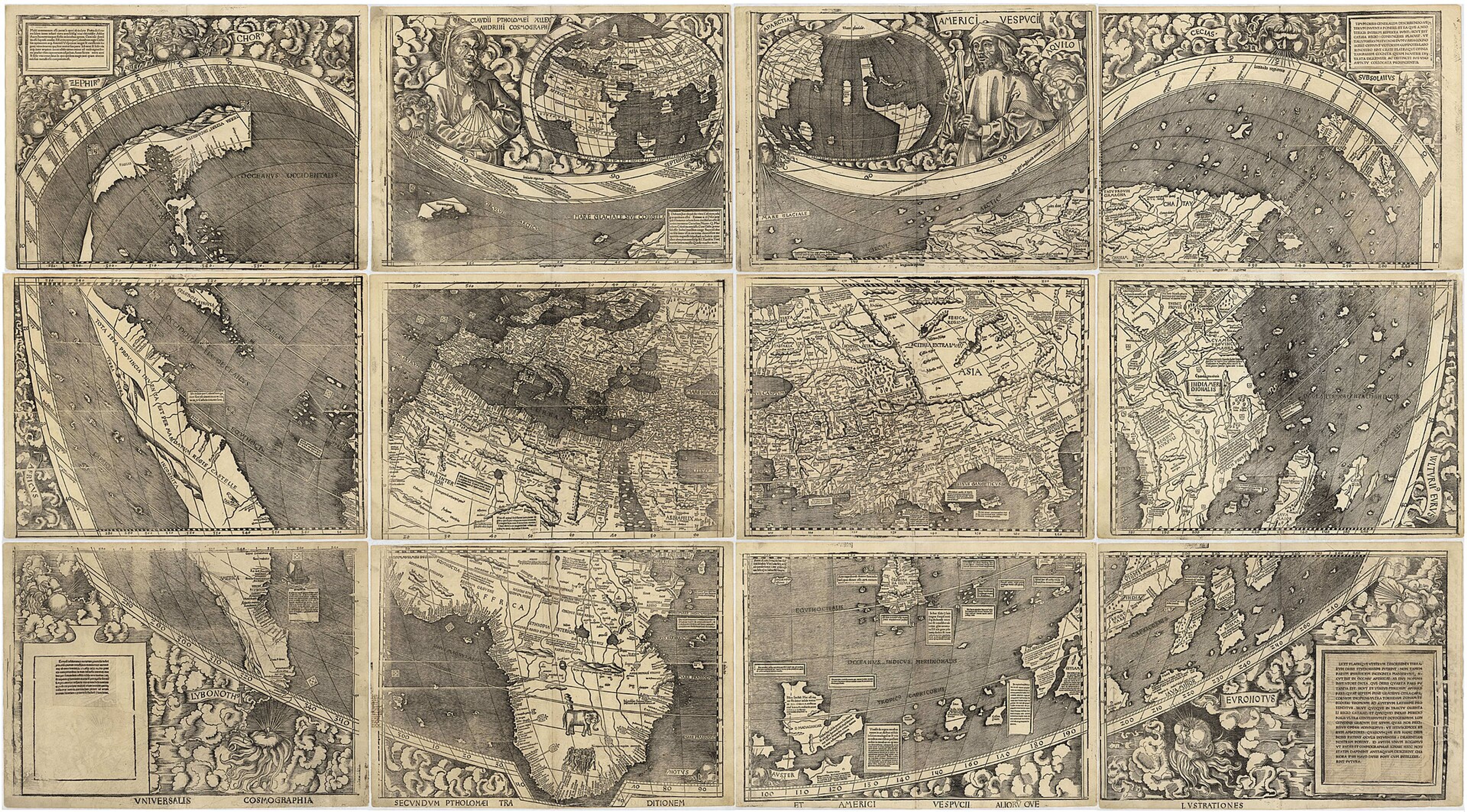
Waldseemüller’s 1507 World Map. Public Domain, via Library of Congress
This landmark chart became the defining work of Waldseemüller’s career. Today, it is widely referred to as ‘the birth certificate of America’, namely because it was the earliest document to name “America”, honouring Florentine navigator Amerigo Vespucci (1454–1512).
This ambitious work attempted to depict all 360 degrees of the Earth’s circumference, including a then-hypothetical Pacific Ocean prior to its European ‘discovery’ - this would not happen until 1513, which it was sighted by Spanish explorer Vasco Núñez de Balboa (1475-1519).
Jerry and Chet agree that the map would make a significant impact of the world, spawning many derivatives. Here are a selection held by The Sunderland Collection:
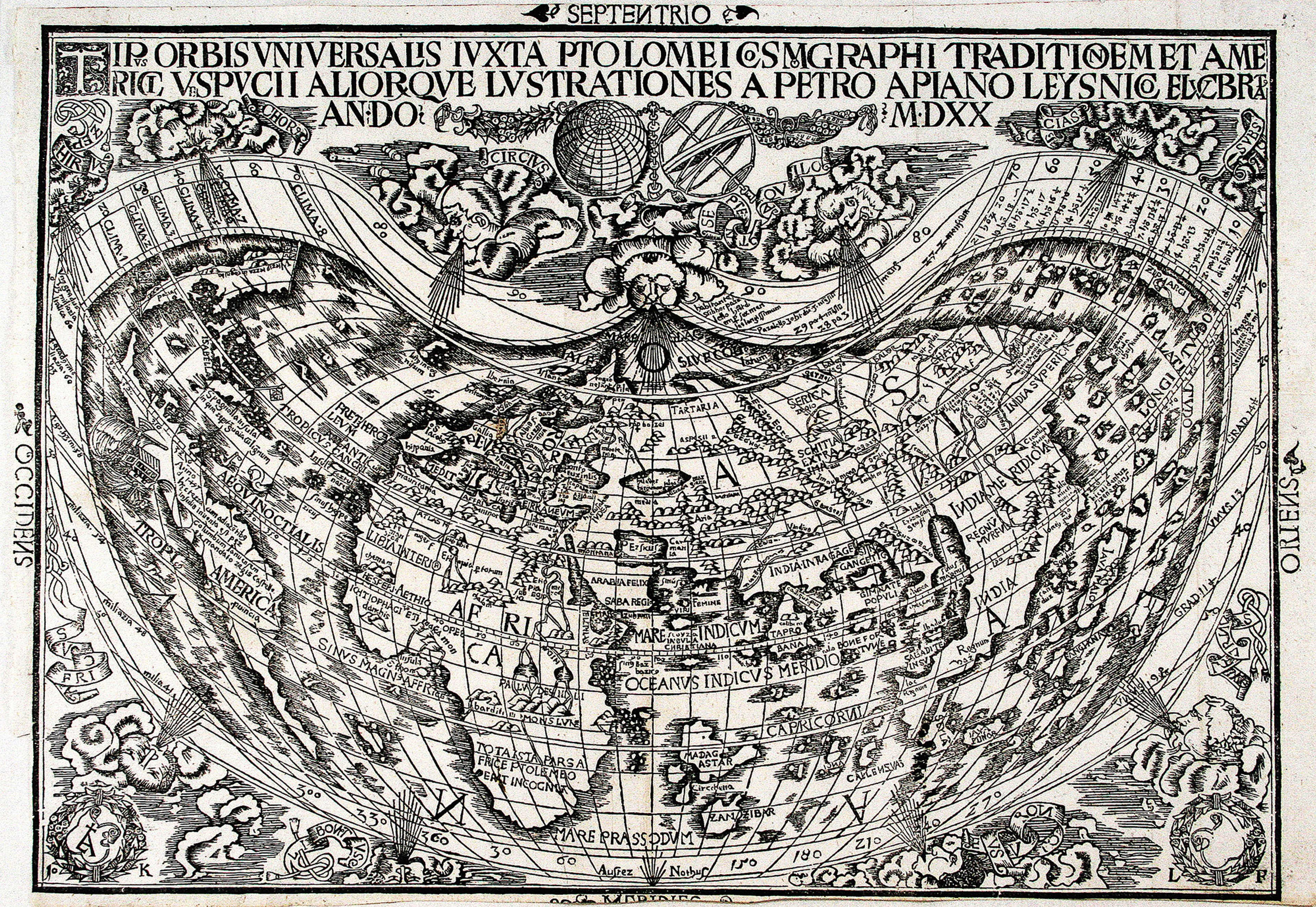

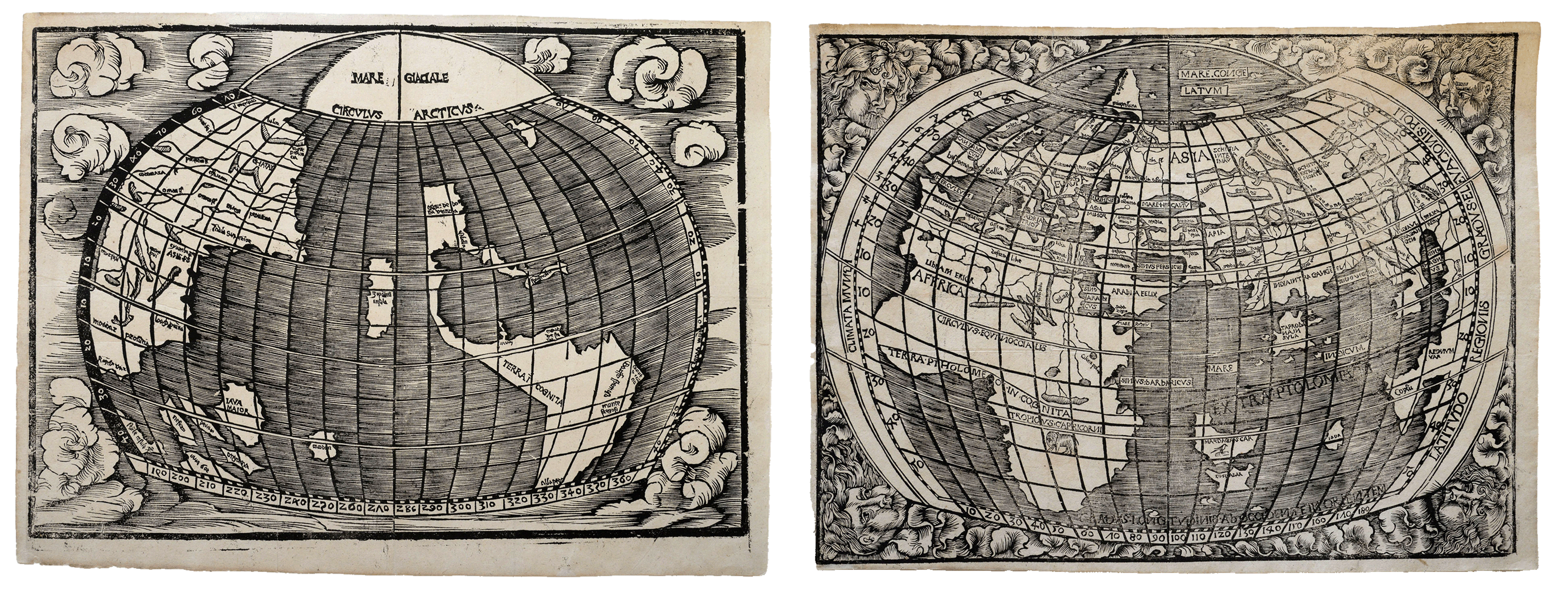

However, nine years later in 1516, Waldseemüller would make a radical pivot. As Chet explains, the Carta Marina stepped back from theoretical claims in favour of a more accurate, practical, and nautical focus - while also omitting 128 degrees of longitude for a more realistic perspective of early-sixteenth century understanding.
Realising that perhaps explorer Christopher Columbus (1451-1506) played a more central role in the ‘discovery’ of the New World than Vespucci, Waldseemüller used the Carta Marina to reframe this emphasis.
Geographically based on the 1506 Planisphère Nautique by Italian cartographer Nicolay de Caveri (unknown dates, fifteenth century), Waldseemüller copied precise coastal outlines from the manuscript portolan tradition and spent years painstakingly filling in the interiors with the fruit of his own research from the comfort of his study in Saint Dié.
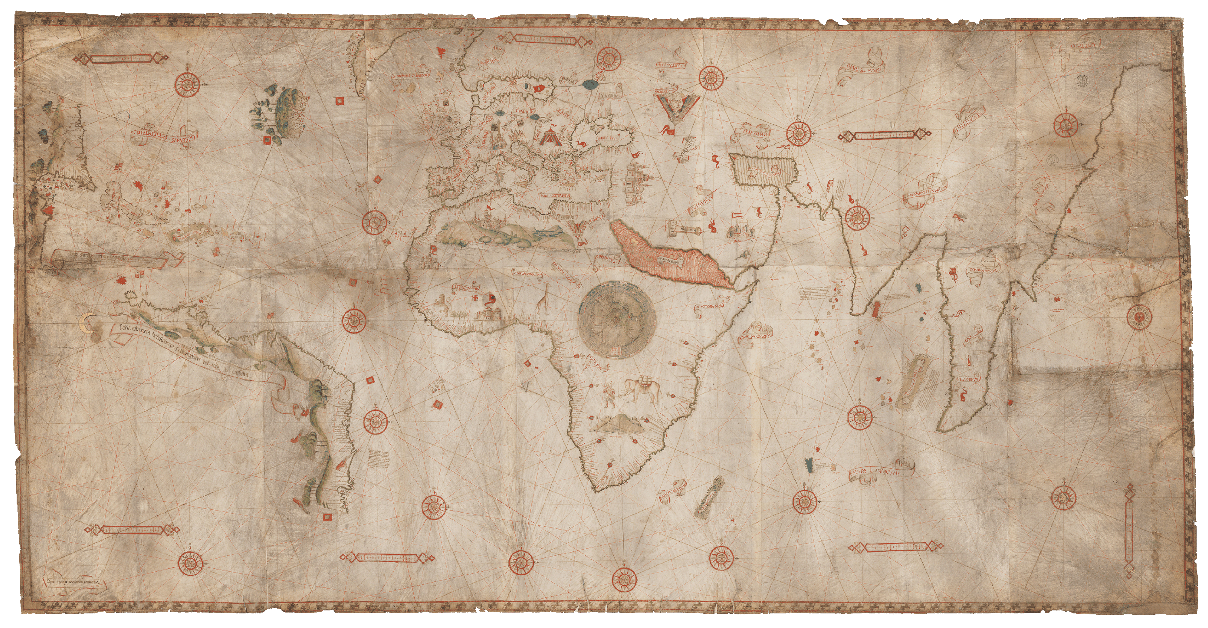
Planisphère Nautique by Nicolay de Caverio (1506). Public Domain, via Bibliothèque Nationale de France
Chet’s own dedicated panel-by-panel research - published in his monograph Martin Waldseemüller’s Carta marina of 1516: Study and Transcription of the Long Legends (Springer, 2020) - revealed how obsessively Waldseemüller updated his sources.
In the episode, Chet highlights some of these updates. While classical authors and Venetian merchant Marco Polo (1254-1324) heavily informed the 1507 map, only five Polo-related inscriptions were carried forward to 1516 Carta Marina.
Frontispiece for Itinerario (1515). Public Domain.
In their place, Waldseemüller systematically incorporated cutting-edge accounts - most notably from recent navigator and merchant accounts and letters, one such being Italian traveler Ludovico di Varthema’s Itinerario (1515), just one year before the map was printed.
This rapid integration highlights Waldseemüller’s dedication to obtaining the most recent printed texts and nautical charts from across Europe. It also speaks to the extraordinary intellectual exchange of knowledge within Europe at the time.
You can find out about some of these connections via our Map Matrices.
Within a large cartouche located in South America, Waldseemüller sets out his motivations for creating the map and outlines the sources he drew upon. Although we cannot read his entire bibliography and know every source he consulted, this inscription offers a valuable window into his working methods.
Evidenced by panels, such as a prominent text in the lower right corner detailing spice prices in Calicut (modern Kolkata), we can see that the map is designed with a practical orientation suited for merchants.
Chet takes Jerry on a whistle stop tour of some of the other eye-catching illustrations on map;
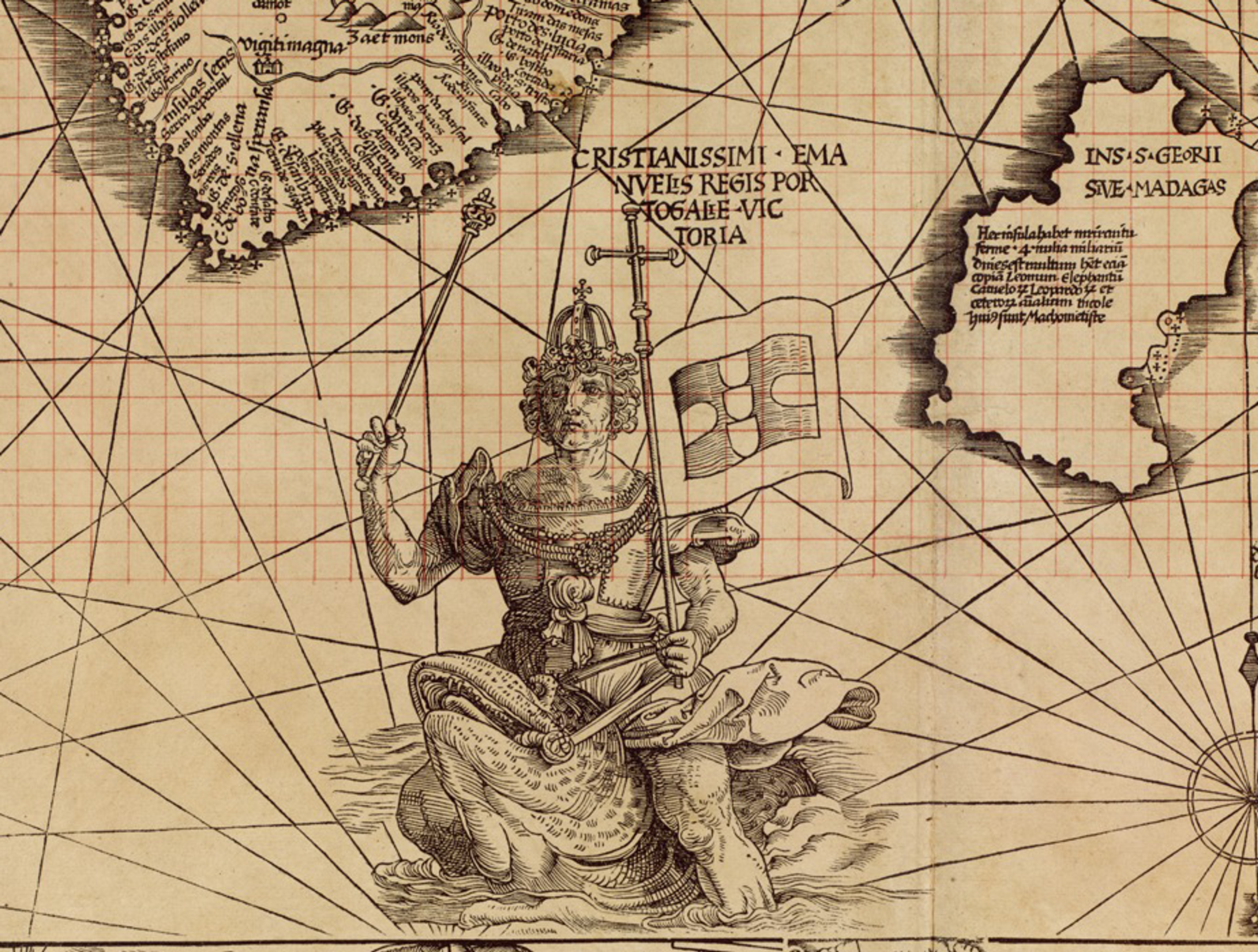
… including King Manuel I of Portugal (reigned 1495–1521), riding a majestic sea monster in the Indian Ocean just off the coast of South Africa. He holds the Portuguese flag to signal imperial mastery over maritime trade routes following Bartolomeu Dias’s successful rounding of the Cape of Good Hope in 1488. You can find out more about this voyage of exploration in Patricia Seed’s episode of the WHAT’S YOUR MAP? podcast.
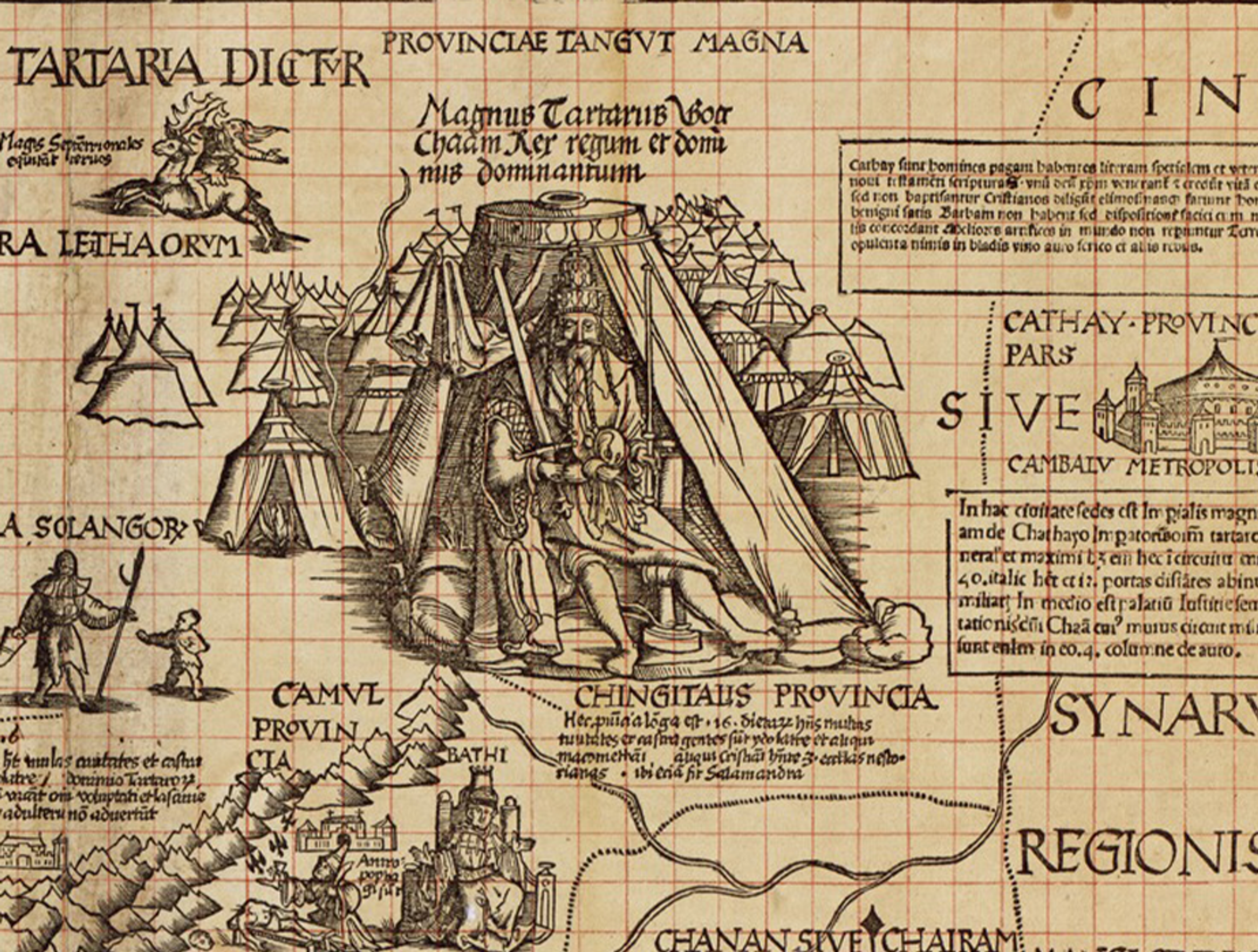
We are also directed to the depiction of the Great Khan in Asia - whom Chet was unable to identify the source for, but says that the image was likely borrowed from a manuscript that no longer exists!
Elsewhere, a Scandinavian walrus is misdrawn as an elephant due to descriptions of its tusks, and a rhinoceros in Africa draws upon a 1515 print by Hans Burgkmair the Elder rather than Albrecht Dürer's famous 1515 woodcut of Clara the Rhino.
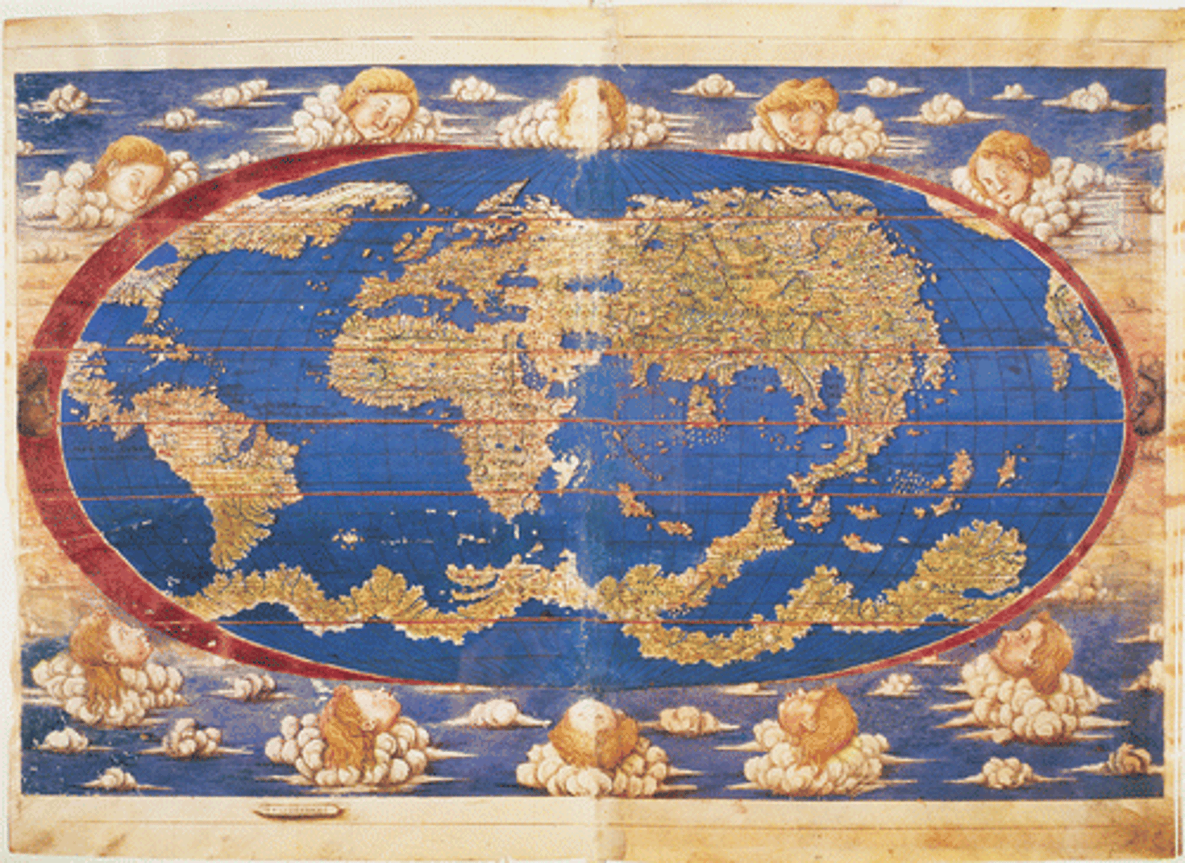
Anonymous manuscript world map (c.1530). Public domain, via Vatican Museums (MS Urb. Lat. 274)
During the interview, Chet shares how his passion for historical cartography began after encountering a c.1530 manuscript of Ptolemy’s Geography in the Vatican Museums.
The manuscript featured a hypothetical southern continent drawn as an unusual ring of land around the South Pole, labelled Terra Incognita yet curiously populated with placenames. His investigation uncovered that the mapmaker had transferred place names from Columbus’ fourth voyage (1502-1504) in Central America to the southern landmass, offering a window into how cartographers synthesised speculative geography when information was sparse or physically impossible to verify.
You can read about Chet’s own exploration of the hypothetical Southern Continent here.
Today, Chet continues to resolve cartographic mysteries as Associate Director of the Lazarus Project at the University of Rochester. Utilising multispectral imaging (MSI) - a non-invasive technology capturing images across various light wavelengths - his team recovers lost or faded text on damaged map and manuscripts around the world.
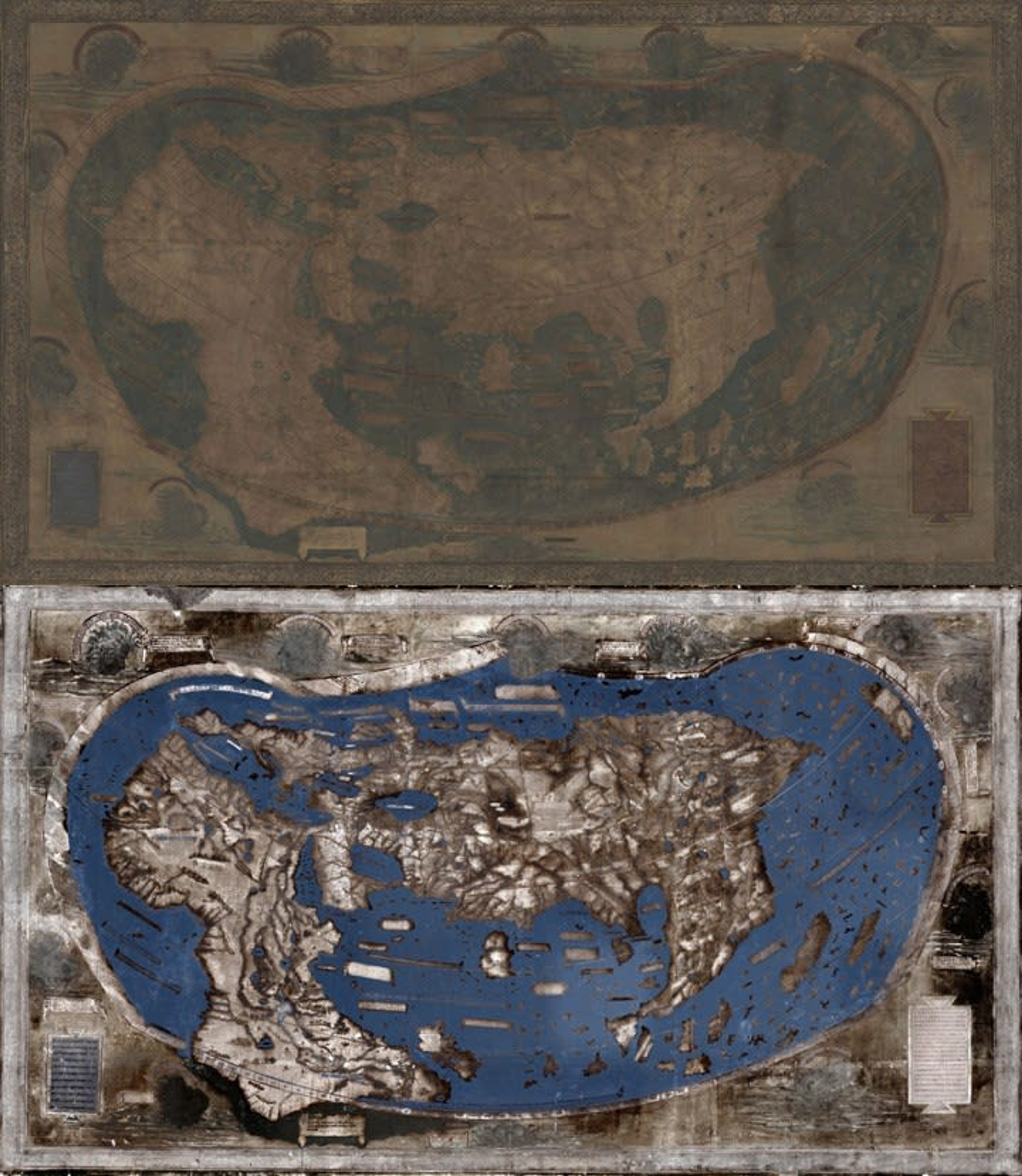
The Martellus Map (above), and viewed through multispectral imaging (below). Yale University/Rochester Institute of Technology.
A standout achievement was imaging a world map dated circa 1491 by Henricus Martellus Germanus (c1459-1496), at Yale's Beinecke Library.
Previously regarded ‘un-studiable’ due to severe fading and loss, Chet says that MSI revealed over 90% of its missing text!
Through in-depth study, their project established Martellus' map as a tool for Christopher Columbus and a cartographic source for Martin Waldseemüller. Find out more about this remarkable feat here.
About Chet Van Duzer
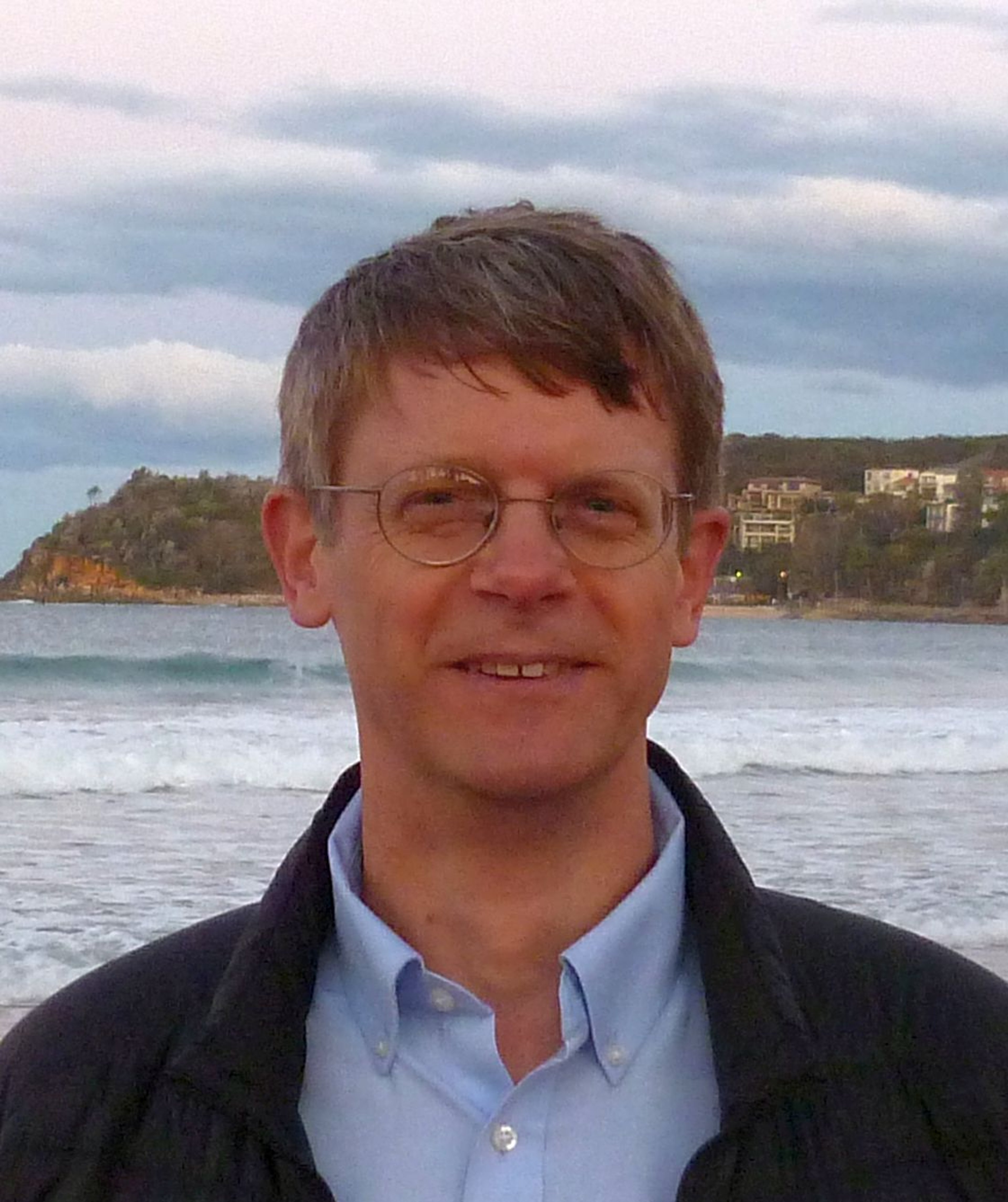
Chet Van Duzer is a historian of cartography. He is the Associate Director of the Lazarus Project at the University of Rochester, which brings multispectral imaging - a technology for recovering information from damaged manuscripts - to cultural institutions around the world. He runs the projects relating to maps and globes.
He has published extensively on medieval and Renaissance maps; his recent books include Henricus Martellus’s World Map at Yale (c. 1491): Multispectral Imaging, Sources, and Influence (Springer, 2019) and Martin Waldseemüller’s Carta marina of 1516: Study and Transcription of the Long Legends (Springer, 2020).
His book Frames that Speak: Cartouches on Early Modern Maps (Brill, 2023). His current projects are books about self-portraits by cartographers that appear on maps and the historical cartography of the Indian Ocean.
Why not continue your exploration of the wonderful world of maps by subscribing to the podcast? That way you will never miss an episode.
Feel free to let us know - What's YOUR Map?!
All views and opinions expressed by guests on the podcast are entirely their own and do not represent those of The Sunderland Collection or Whistledown Productions.