
Anton Thomas
Series 3 Episode 5
Wild, Native, Extant - Exploring Emotional Geography with Anton Thomas
Series 3 Episode 5
Available on all major platforms. Hit 'play' to listen now.
In this episode, Jerry interviews Melbourne based artist-cartographer Anton Thomas, who discusses his latest project - a meticulously hand-drawn world map titled 'Wild World'. This is a glorious example of a new, analogue map still being produced today.
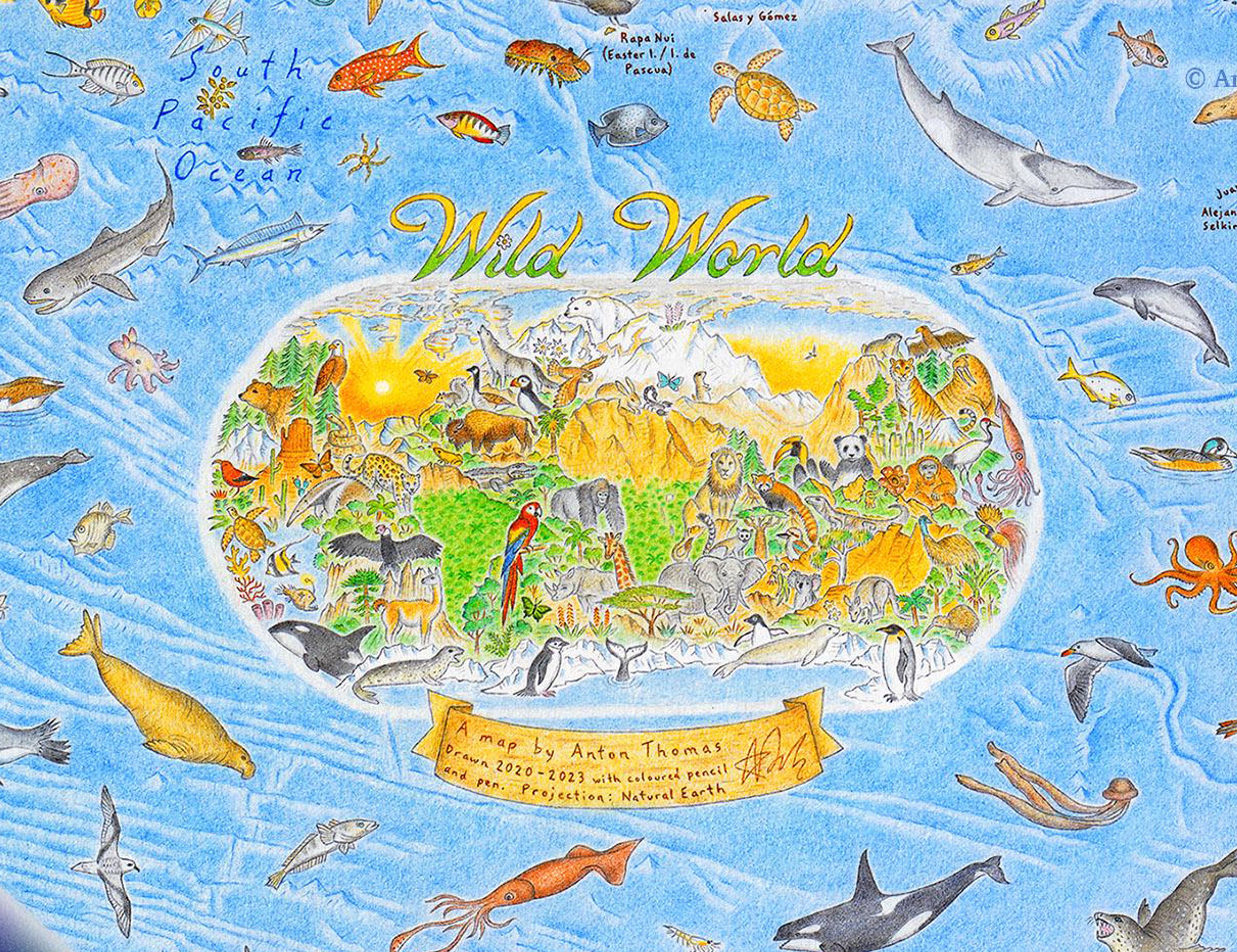
Anton's pictorial map centres the animal kingdom, celebrating over 1,600 animals across a world without the familiar borders we know.
This intricate, detailed piece emerged from Anton’s deep-rooted passion for mapping, which reaches back to childhood, reflecting his belief in the profound connection between humans and nature.
Anton walks Jerry through the artistic and cartographic choices he made whilst drawing Wild World. We hear about how Anton wanted to shape the viewer’s experience, turning the map into a celebration of biodiversity while instilling a sense of optimism amid today’s environmental concerns.
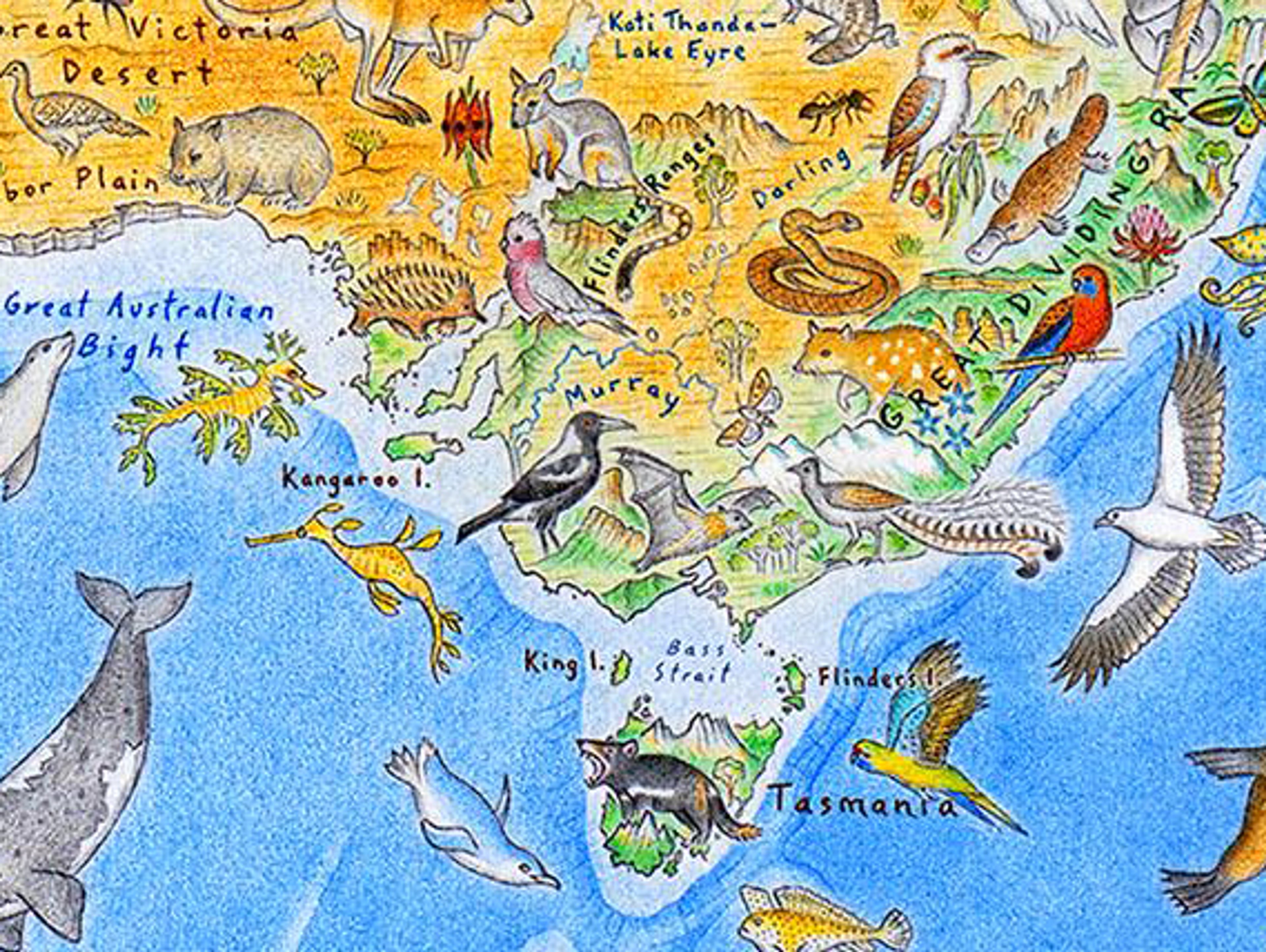
Explore Anton's Wild World map below:
©Anton Thomas
This vibrant map is bursting with life! Animals, birds, sea-life and insects adorn every corner of the globe. Each species, including the native flora Anton has chosen to feature, is set against a background depicting their natural habitat: from a more familiar countryside landscape to dramatic mountain ranges and lush rainforests, vast deserts and icy polar tundra - all connected by the deep blue ocean.
In order for a species to be deemed important enough to feature on one of his hand-drawn maps, it needs to meet three essential criteria: the animal must be wild, it must be native to the country it features on, and it must be extant (in existence) as opposed to extinct.
Anton researches each country's wildlife thoroughly, looking at animals that symbolically represent a nation - such as North America's Bald Eagle and China's Giant Panda. He is particularly drawn to animals with incredible facts. Some of his favourites include the Asiatic Lion, which lives only in the Indian state of Gujarat and the world's most venomous species, the Inland Taipan (or Fierce Snake), found in the Australian Outback. Others have a much more emotional connection, such as a personal suggestion from his mother to include the Tree Kangaroo native to Papua New Guinea where she grew up.


Images: Wild World © Anton Thomas. Photographs: Asiatic Lion by Bernard Gagnon, CC BY-SA 3.0, Tree Kangaroo: Photograph by Eric Gropp CC BY 2.0, and Inland Taipan: Photography by XLerate, CC BY-SA 3.
For a great many of his studies, he has to rely on online natural history encyclopaedia. However, where he lives in Melbourne, he is lucky that he can also draw from life and his own photographs - adding the Grey-Headed Flying Fox to the map from his neighbouring Yarra Bend Park.
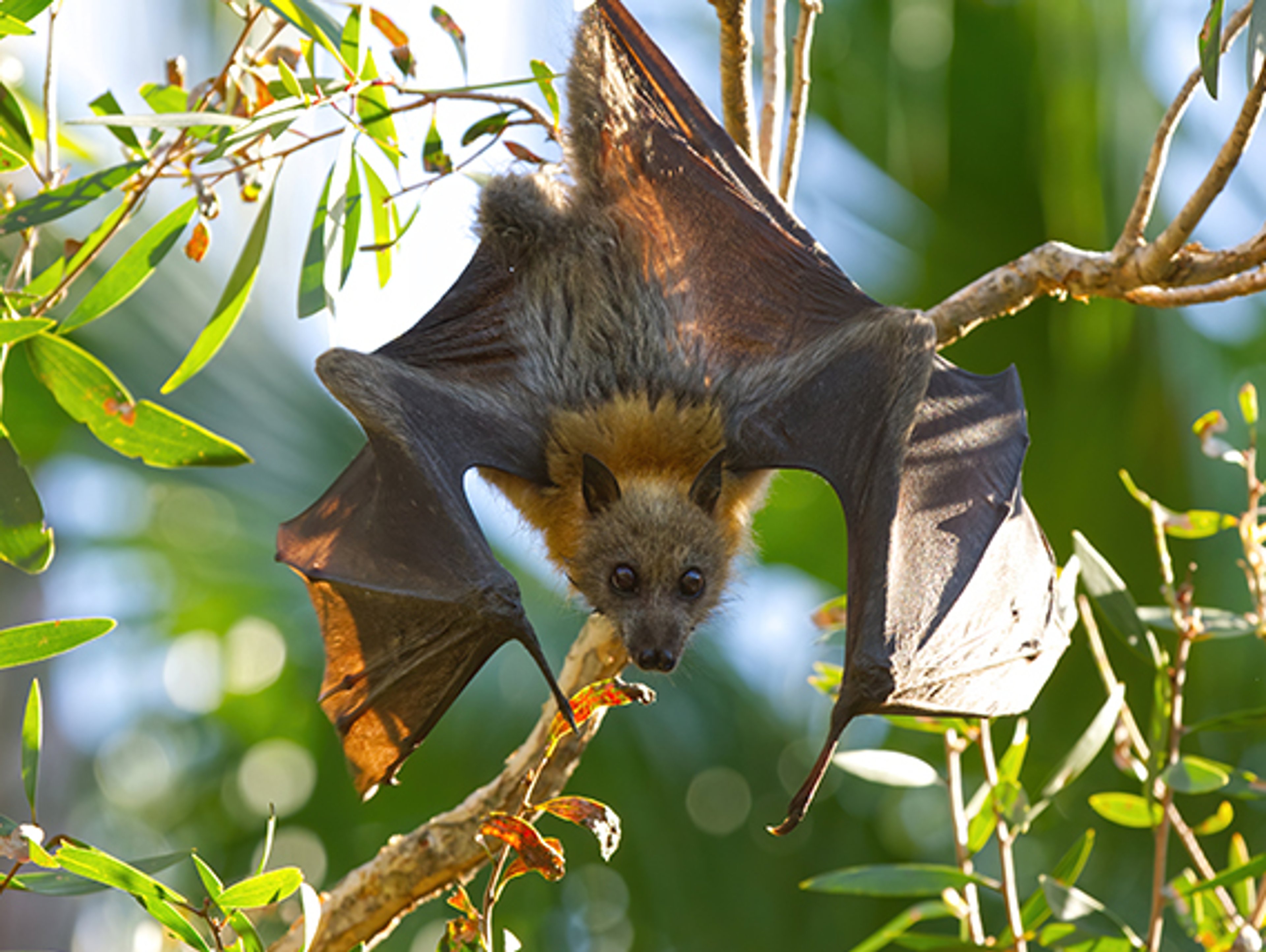
Close up of south-eastern Australia on Anton's map, and a photograph of Flying Fox by Andrew Mercer, CC BY-SA 4.0.
When Anton embarked on this illustrative journey around the world, he began by drawing the top left corner of the sheet of paper, where Alaska and the Northwest Pacific naturally falls on a traditional map projection. The first animal to arrive on this particular map was the Grizzly Bear ‘with a mouth full of Salmon’.
Anton is also careful to depict the fine details of the physical Earth on his maps and in Wild World you can even see the details of deep trenches and ridges on the sea floor. He notes that the ‘[natural] landscapes are key to understanding the map’.
There is a process of elimination when it comes to what information Anton includes on his map so it is both detailed and legible. Like all cartographers, he has to strike the balance so as not to overwhelm the viewer! One of his decisions was to omit the geo-political borders: a powerful choice to remove the imaginary dividing lines we live by and show a united, natural world.
In the podcast, Jerry and Anton discuss how the need for maps has changed over history, and how they are so much more than a tool to get from A to B. Maps evolved as a depiction of ownership, status, and knowledge, but only more recently have they been used as an instrument for navigation. But transcending history, they are vessels for a more emotive journey, and act as a reminder of where we have come from or where we have been.
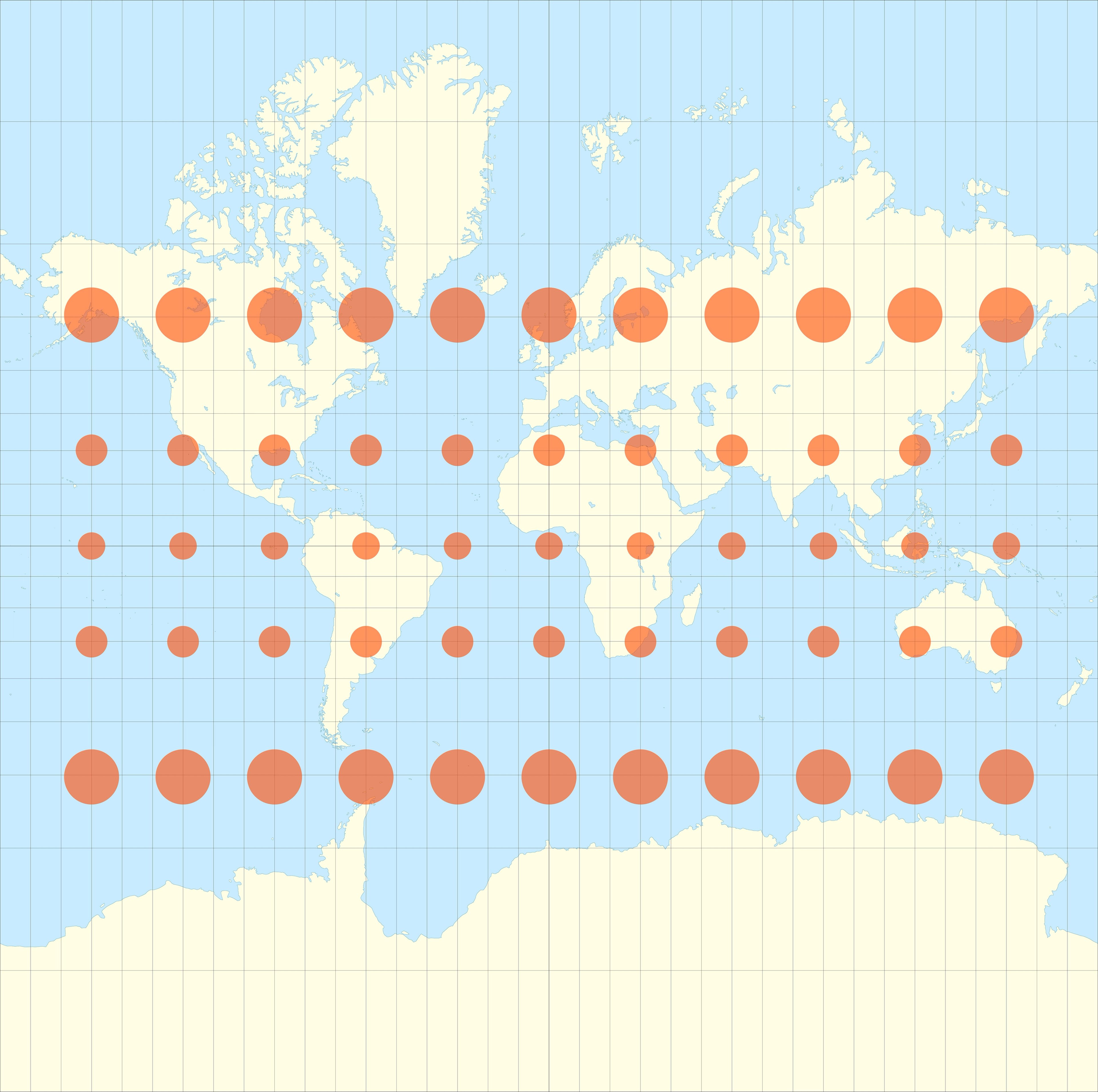
The projection Anton has chosen for his Wild World is the Natural Earth Projection designed by Tom Patterson (2008). It is a pseudo-cylindrical map projection which is halfway between an equal-area projection which correctly shows the countries in relation to each other but distorts the shapes of features - and a conformal projection like the Mercator Projection which may work perfectly well for smaller details, but distorts the shape and size of countries the further away they are from the equator. You can find out more about Map Projections here on Oculi Mundi.
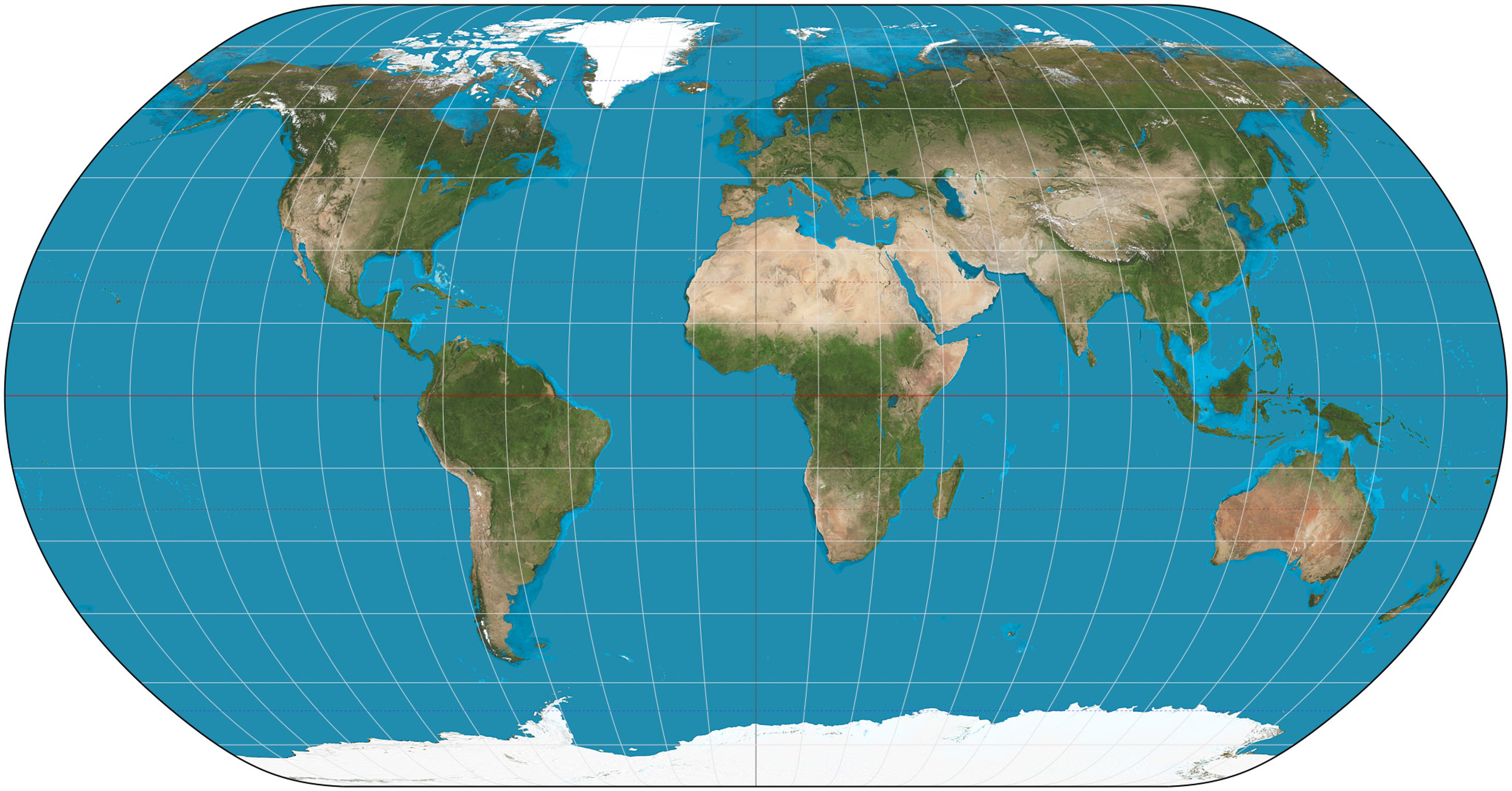
Natural Earth projection of the world by Strebe, CC BY-SA 3.0.
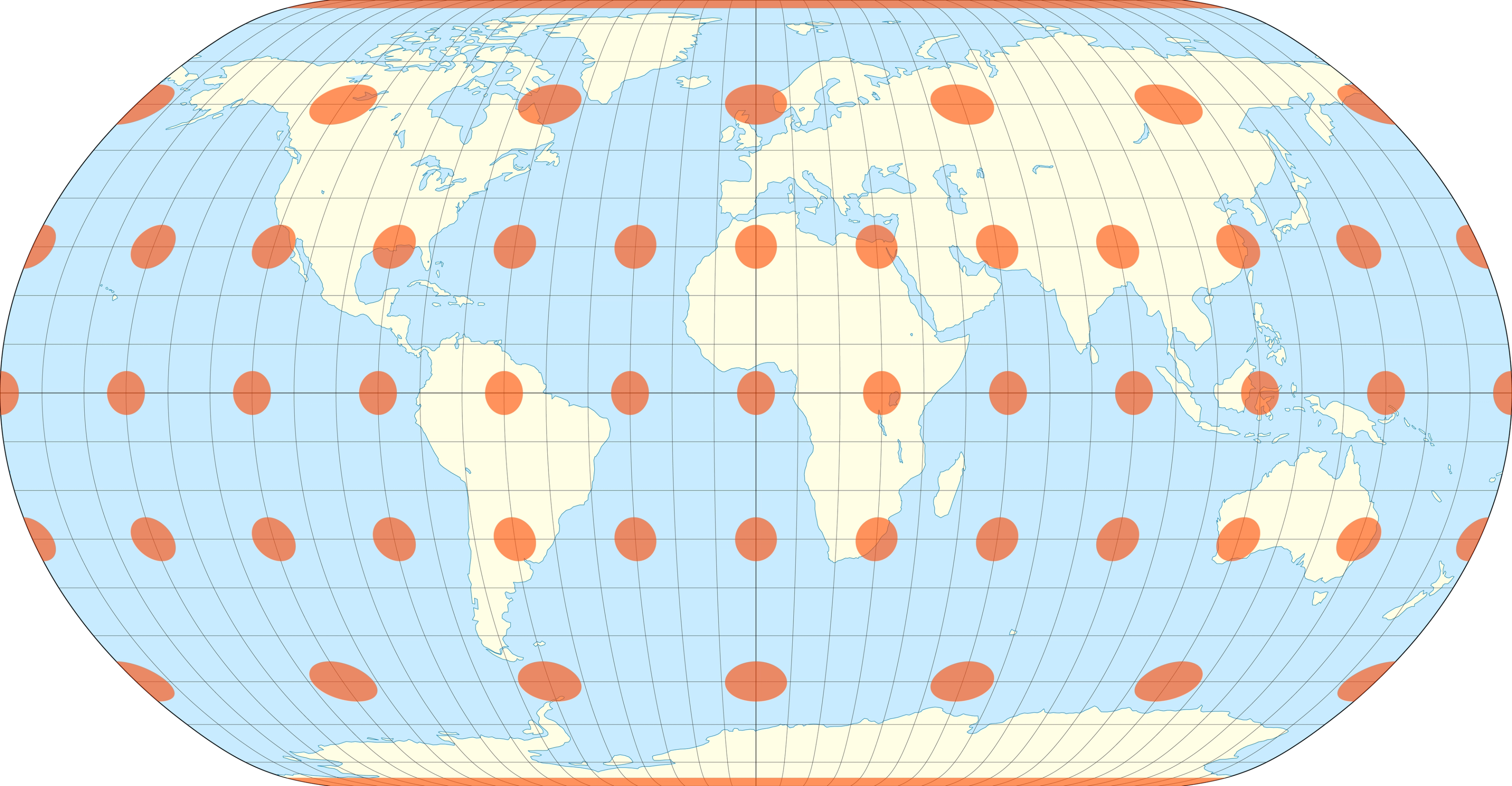
The Natural Earth projection with Tissot's indicatrix of deformation by Justin Kunimune - Own work, CC BY-SA 4.0.
Mercator Projection with Tissot's Indicatrix, by Eric Gaba (Sting - fr:Sting) using data from U.S. NGDC World Coast Line (Public Domain), CC BY-SA 4.0
To illustrate the distortion on the Natural Earth Projection, we can use Tissot's Indicatrix, a clever graphic device using circles at fixed intersections of longitude and latitude to highlight distortion on a map projection. This system was created in 1859 by French mathematician Nicolas Auguste Tissot (1824-1907).
Anton favours the Natural Earth projection because it is close to other more conformal projections without slicing off coastlines or countries, and despite coming from New Zealand and living in Australia, he dislikes the mental 'gymnastics’ of a south-at-the-top orientation.
However, as Anton explains, this is still a compromise as the most accurate projection is a globe. The Natural Earth Projection means there is only minimal exaggeration towards the poles, and it even gives Anton more space to draw in all of the different species he wishes to include.
Growing up in New Zealand’s South Island, Anton was surrounded by remarkable geography from a young age and as he tells Jerry, the Southern Alps are "in his soul". Like many artist-cartographers he was quite literally drawn to the colliding of the worlds of art and science. As well as being a great educational tool for young people and striking works of art, his maps are also a passionate call to look after our world.
About Anton Thomas
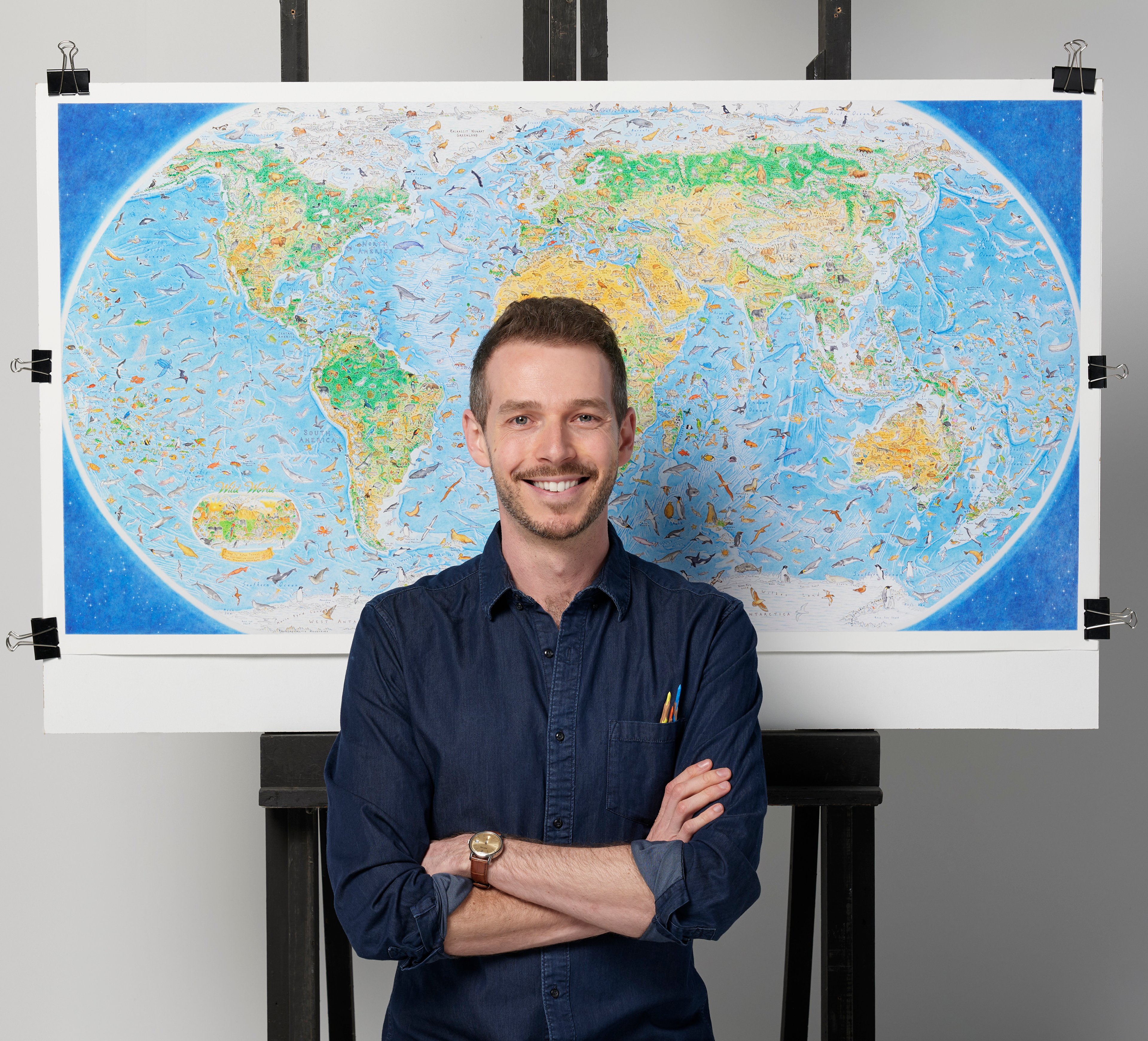
Anton Thomas is New Zealand-born artist-cartographer living in Melbourne, Australia. He specialises in hand-drawing detailed illustrated maps made with coloured pencil and pen.
© Anton Thomas
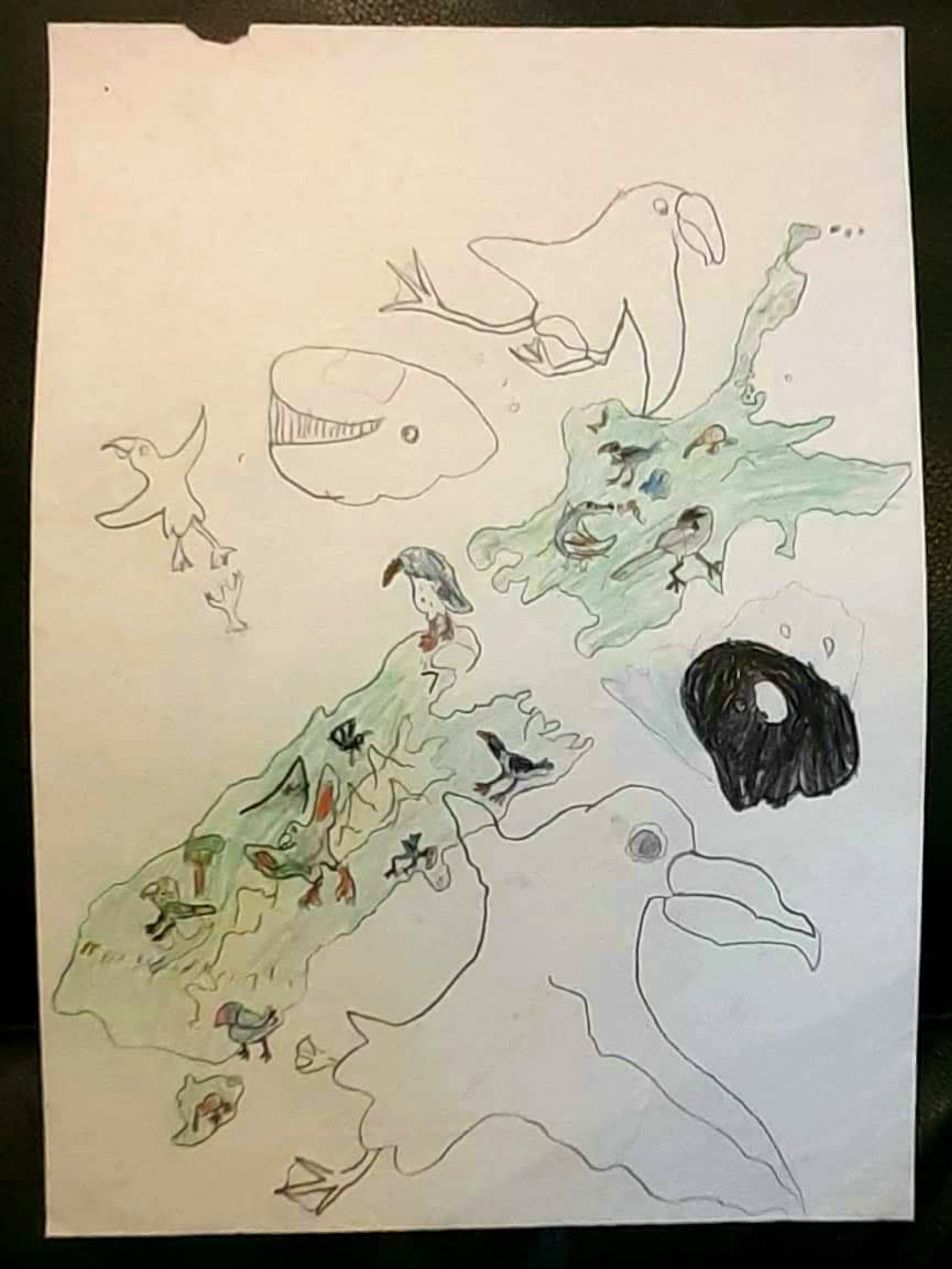
Anton's home of Aotearoa (the Māori name for New Zealand) was a huge source of geographic and artistic inspiration. This map - lovingly kept by his mother - was drawn when Anton was 4 or 5 years old. It shows a very early version of a Wild New Zealand!
As a child, he remembers obsessively drawing coastlines, and creating pictorial maps for his own imaginary worlds. But it wasn’t until Anton left his home country to explore the world for himself at the age of 21 that this passion started to become more than a hobby.
In mid-2020, Anton began sketching a map that he had dreamt about making since he was small: a international map of nature, 'Wild World'. This project would take three years to complete!
See other examples of Anton's work and find out more about his story on his website.
A new episode of WHAT'S YOUR MAP? will be available every two weeks. Why not continue your exploration of the wonderful world of maps by subscribing? That way you'll never miss an episode.
Feel free to let us know - What's YOUR Map?!

