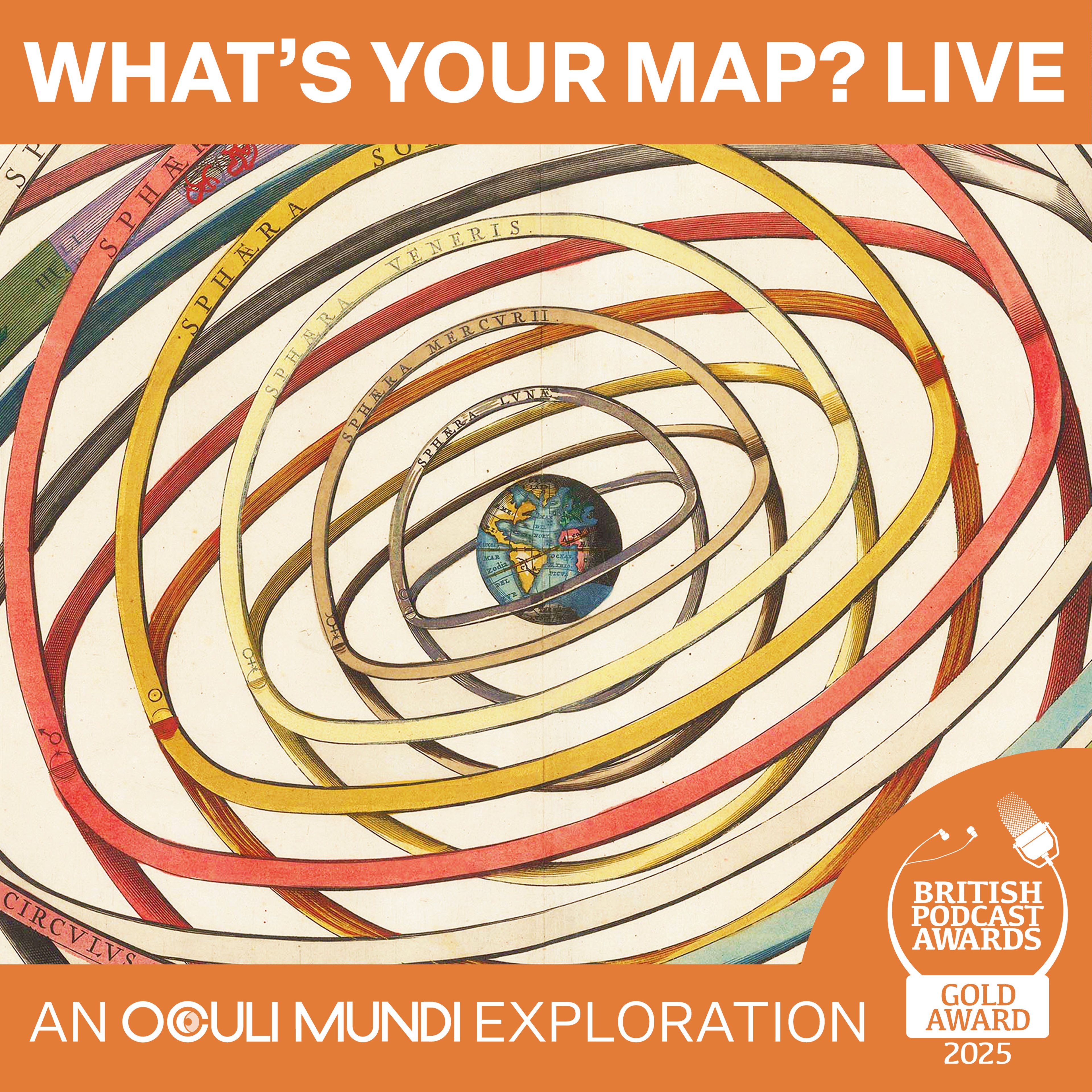
WHAT'S YOUR MAP? LIVE AT HAY FESTIVAL 2026
with David Olusoga, Emma Jane Unsworth, and Tim Marshall

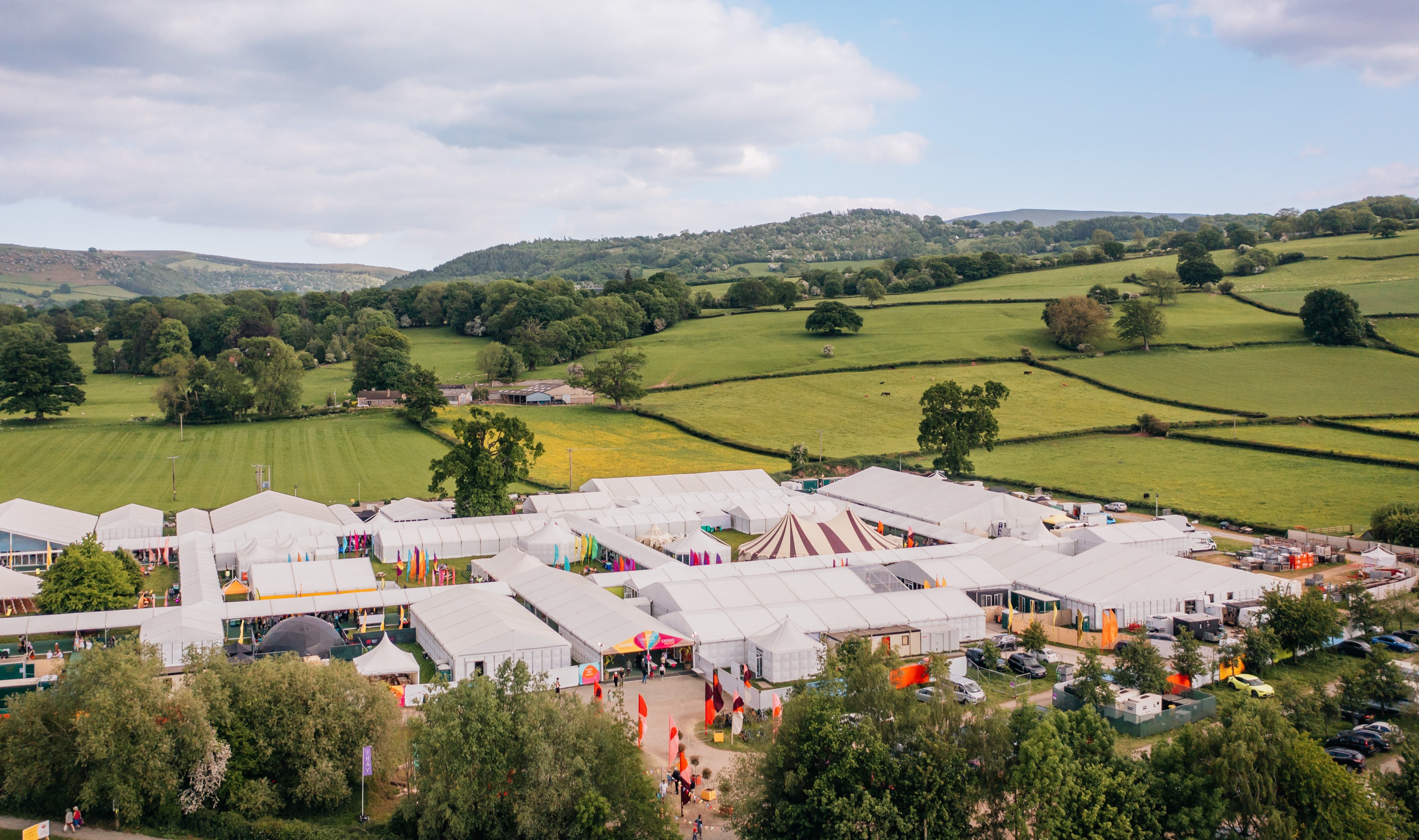
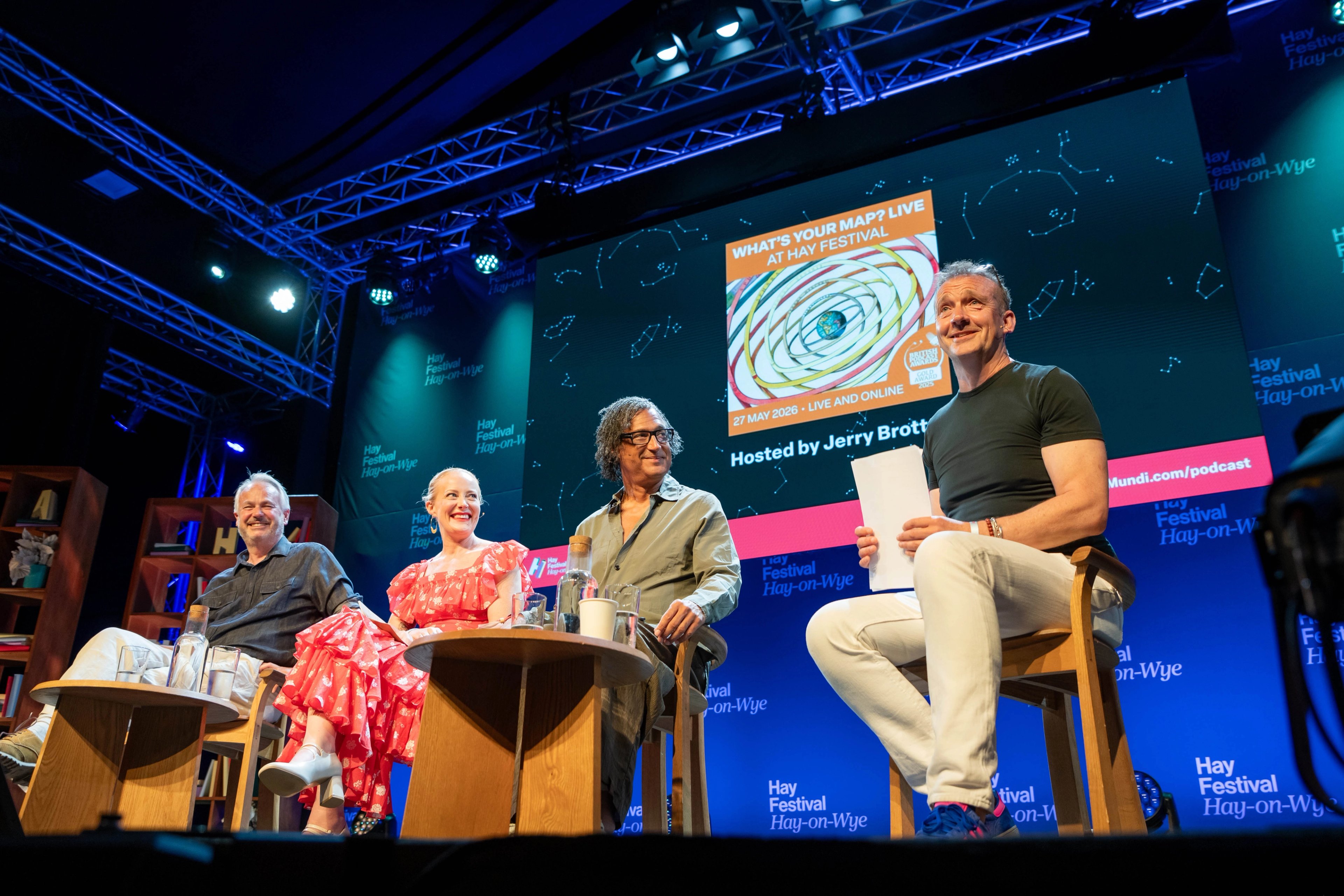
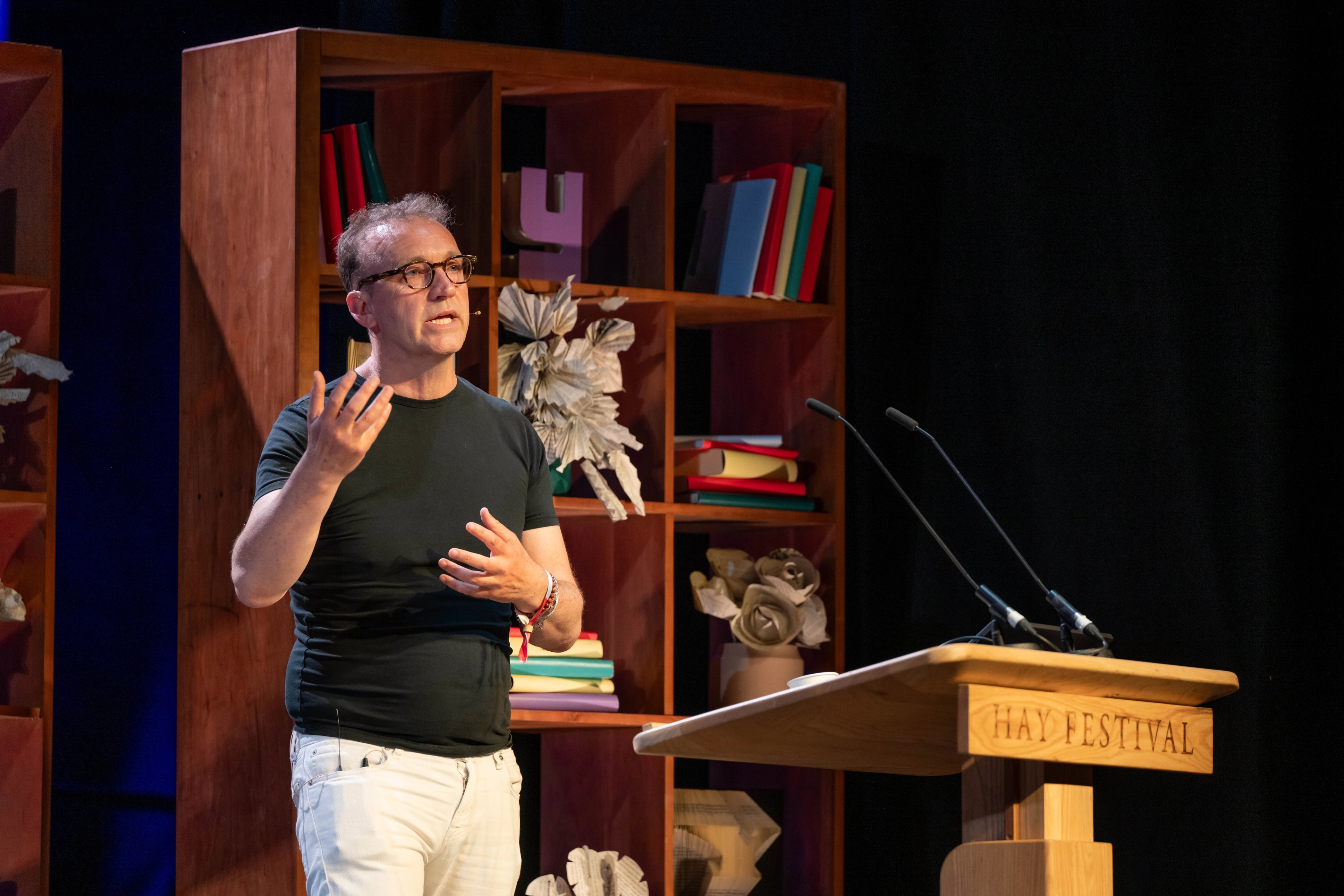
On 27 May 2026, WHAT’S YOUR MAP? LIVE debuted at the iconic Hay Festival in Hay-on-Wye.
Our host Jerry Brotton was joined by historian David Olusoga OBE, novelist Emma Jane Unsworth, and journalist Tim Marshall to explore their chosen maps and stories. From adventure to astropolitics - we explored a sixteenth century manuscript atlas fit for a Queen; took a road trip through the heart of Scotland; and were sent into orbit with a map of space showing satellites positions.
We were thrilled to be part of Hay’s diverse programme, which brings together voices from the worlds of art, literature, science, politics, music and comedy to listen, talk, debate and create.
Watch this live episode and audience Q&A below:
David Olusoga OBE & the Queen Mary Atlas

©David Olusoga
Our first guest was eminent British-Nigerian historian, author, presenter and Professor of Public History at University of Manchester David Olusoga OBE.
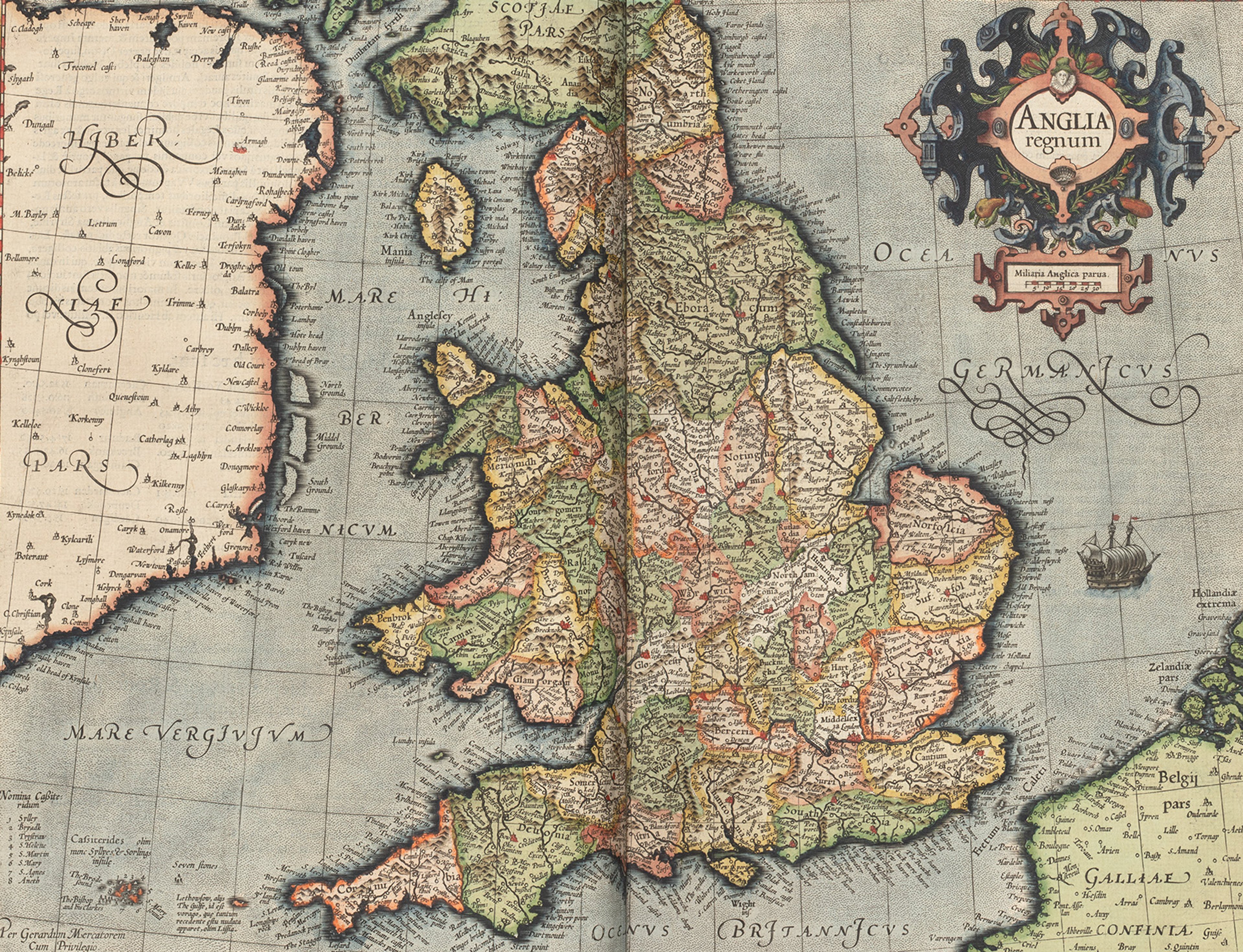
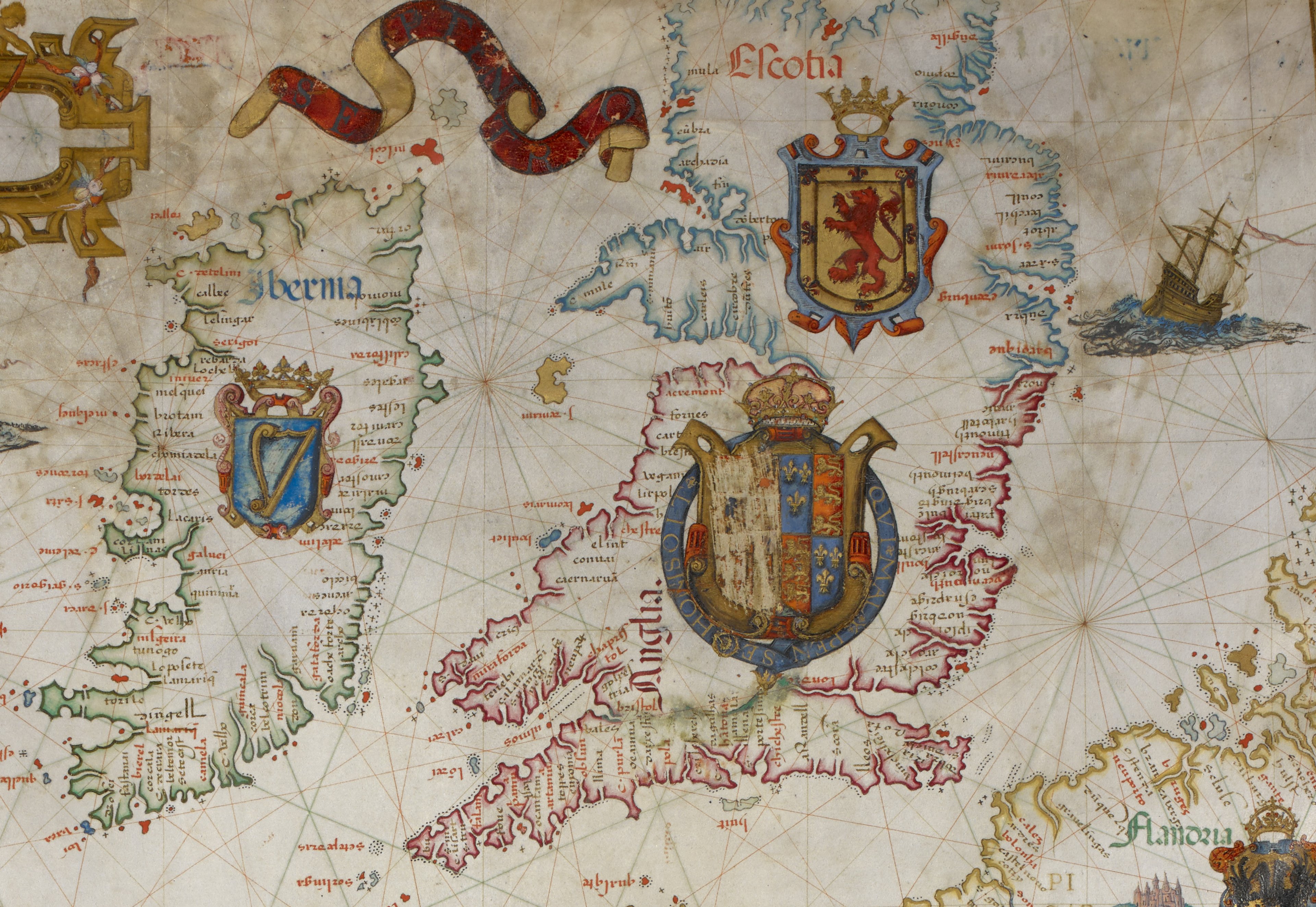
David’s map is an early sea-chart of the British Isles and western coast of Europe by Portuguese mapmaker Diogo Homem (1521–1576). It is one of nine hand-drawn maps that feature in the remarkable 1558 ‘Queen Mary Atlas’, which is held in the collections of the British Library.
The map is embellished with depictions of cities, banners, and heraldry. Striking illustrations of ships, animals and mountain ranges are brought to life using vibrant hues and gold accents.

Map of the British Isles and Western Europe from the Queen Mary Atlas by Diogo Homem (1558) © From the British Library Collection [Add 5415 A ff 9v-10]
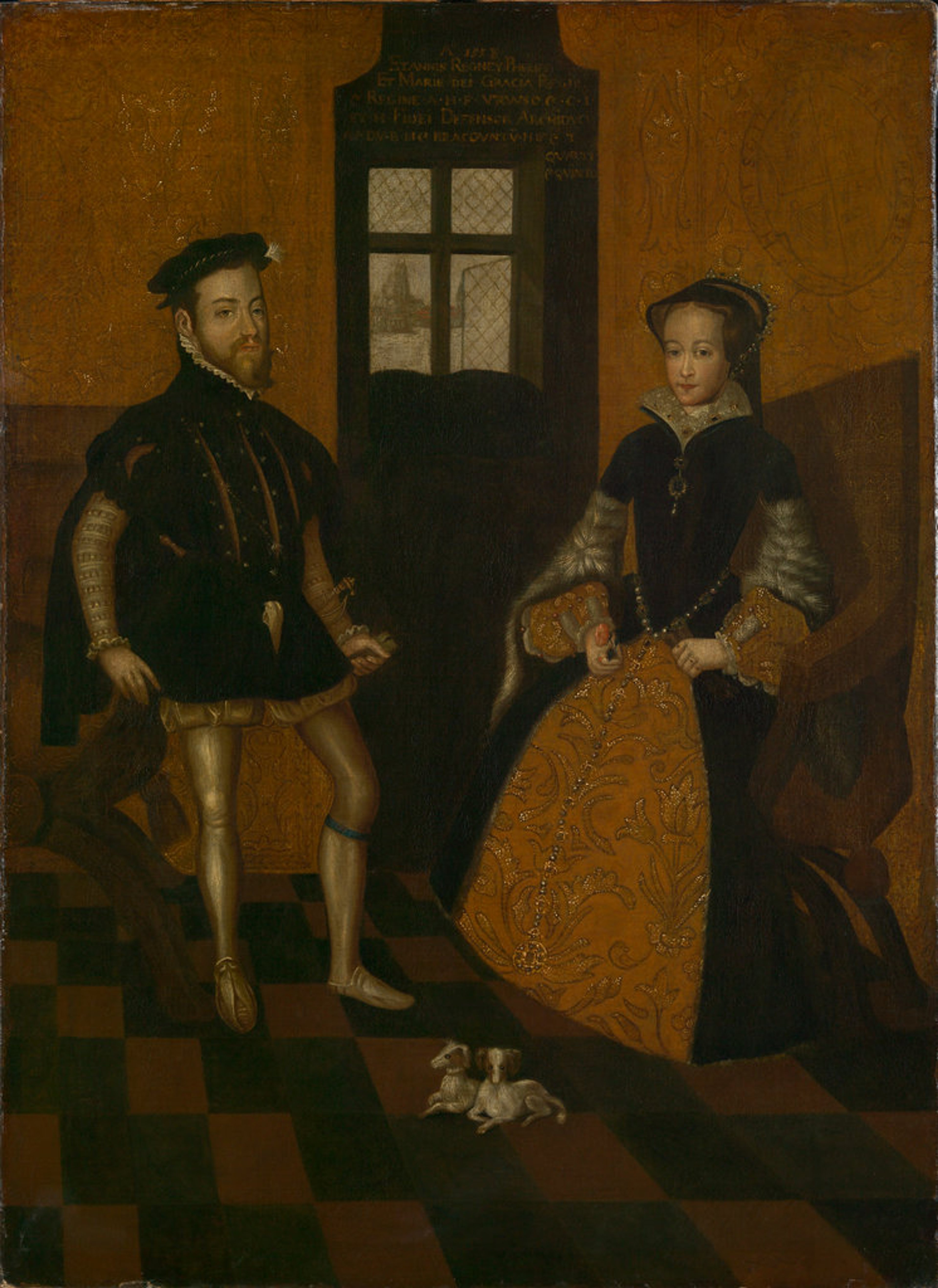
Double portrait of King Philip II of Spain and Queen Mary I attributed to Lucas de Heere (1558) ©National Maritime Museum, Greenwich, London
The atlas is named after Queen Mary I (reigned 1553–1558), who is said to have commissioned the work as a gift for her husband, King Philip II of Spain and Portugal (reigned 1556–1598).
Though the map serves as a geographical and informational tool, it is a display of power.
David and Jerry discussed how the map shows an oversized Spain to represent the scale of its dominant empire. This also explains why the Iberian Peninsula is depicted with significantly more ornamentation than other territories, and includes the presence of a dual Spanish-English coat of arms on the United Kingdom. At the time, Britain was not an imperial power.
Produced at the dawn of Britain’s age of navigation and exploration, this stunning manuscript atlas balances mystical elements like unfinished coastlines and sea monsters, with the more practical documentation of important port towns and navigational rhumb lines. It reflects an era of rapid geographical advancement and an expanding sixteenth-century worldview. The atlas details the New World - the Americas - and emphasizes the might of the Spanish Empire.
The atlas was completed after the death of Mary I in 1558, and was subsequently gifted to her half-sister, Queen Elizabeth I (who reigned from 1558 to 1603). When Elizabeth inherited the throne she quickly dismantled Mary’s Catholic restoration (also known as the Marian Restoration, for which she gained the nickname ‘Bloody Mary’) and returned England to Protestantism.
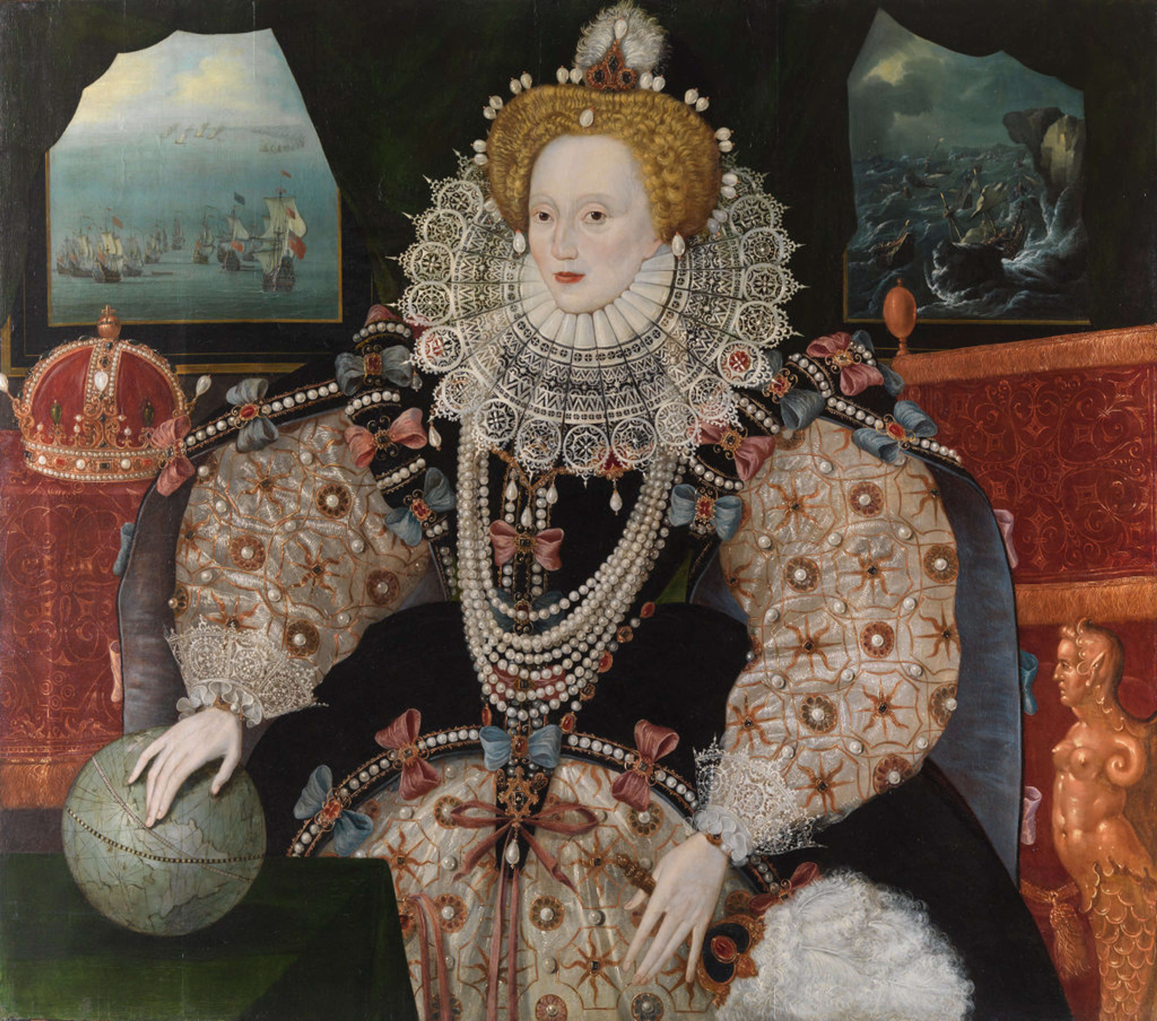
The ‘Armada Portrait’ of Queen Elizabeth I by an unknown artist (c.1590) ©National Maritime Museum, Greenwich, London
This geographical work served as a stark illustration of England's diminished standing relative to the dominant Spanish and Portuguese Empires of that era, and as David points out, the map was presented to Elizabeth when England's diplomatic ties with Spain were notably strained.
In 1570, Elizabeth I was ex-communicated by Pope Pius V because of her refusal to recognise Papal authority, and in 1588, King Philip II sent the Spanish Armada - a 130-strong fleet of ships - to invade England with the aim to overthrow the Protestant Queen and restore Catholicism. The failure of the invasion was brought about by bad weather conditions and the superior maritime strengths of the English Navy.
It is David’s theory is that a petty Queen Elizabeth defaced the atlas, scratching out the Spanish half of the dual arms of Spain and England on the United Kingdom in this map…
Emma Jane Unsworth & the Scottish Road Map

©Emma Jane Unsworth
The next guest was best-selling author and BAFTA-nominated screenwriter Emma Jane Unsworth. Emma’s second novel Adults (2020) was an instant Sunday Times bestseller. Her latest novel Slags (2025), a critically acclaimed success, is a frank and heartfelt exploration of sisterhood and a trip around Scotland in a campervan.
Emma shared a well-loved road map of Scotland that is particularly special to her, carrying many memories. The map shows only motorways and A-roads; it is peppered with place names and connecting transport links, but gives no information about physical geography.
Emma explained how this map holds deep personal importance for her and that it is imbued with layers of stories which are added to each time she uses it.

Modern road map of Scotland ©Scotland Info
Emma tells the audience about a month-long solo motorhome trip to Scotland that she made twenty years ago. Accompanied by a ‘sat-nav’ and a trusty paper map, her journey combined parts of Scotland's North Coast 500 and West Coast 200 routes. She shared her love for the freedom of the open road and recalled stories of her battling ‘frost-nip’ after a nights’ wild camping and digging her motorhome free from the ice using a rather unconventional tool!
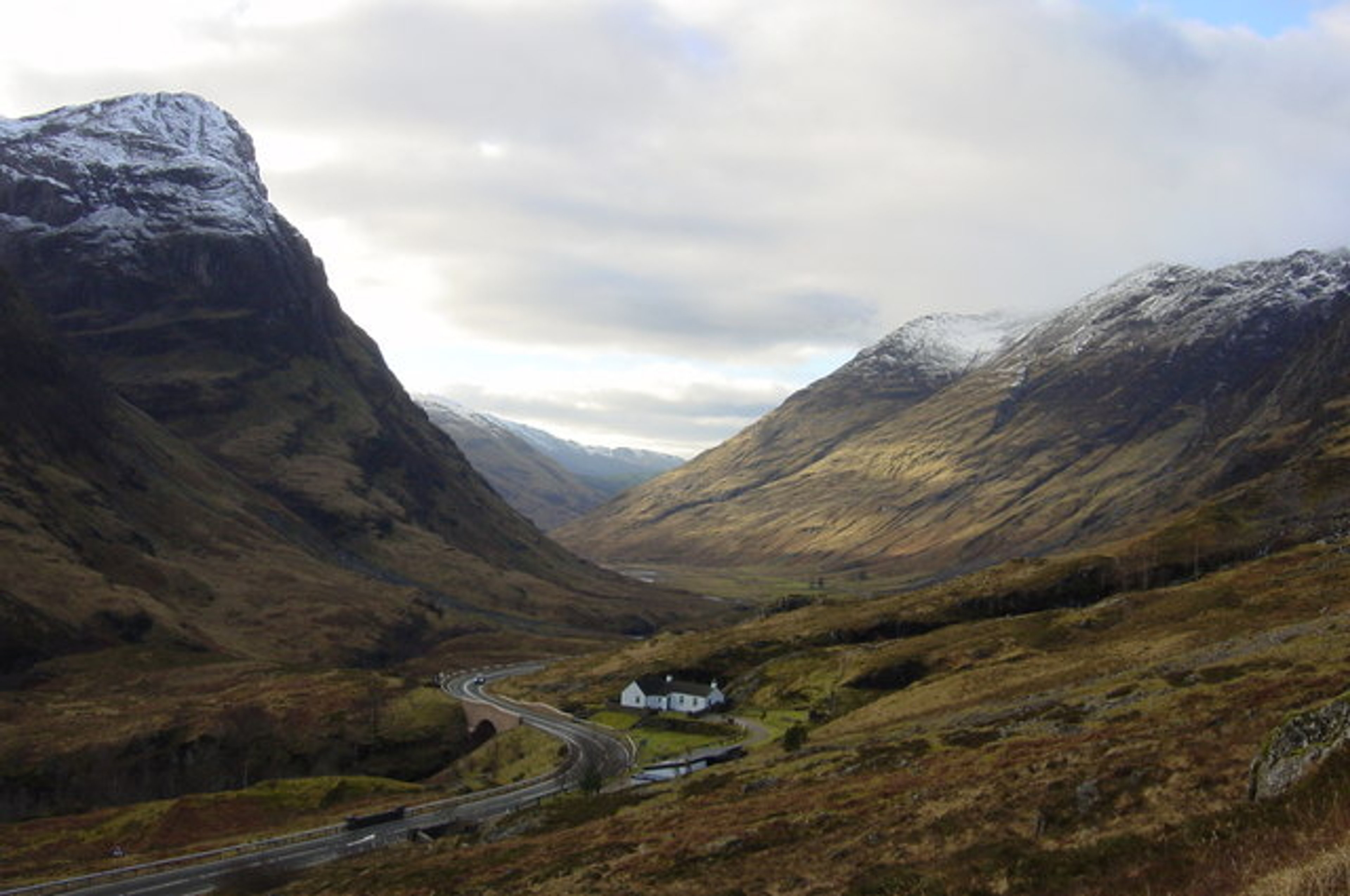
The A82 carving through Glen Coe ©Stuart MacInnes, via Wikimedia Commons
Emma also told the audience about her love for the road running through the centre of Scotland that captured her heart - the A82 - a 167-mile road from Glasgow to Inverness, via Fort William. It is celebrated as one of the most scenic drives in the world and passes through Loch Lomond, Glen Coe, and along to Loch Ness. Emma describes it as ‘the most beautiful road in the world.’
Using a road map as her reference, she guided the audience through the stunning Scottish Highlands - connecting these real-life landscapes and anecdotes from her own personal adventures to the wild journey at the centre of her novel Slags.
By weaving her own memories into the semi-autobiographical narrative, Emma established a dual-timeline for the sisters in the book, explaining that maps were central to the creation of the story and pinpointed decisive moments for the characters at meaningful locations.
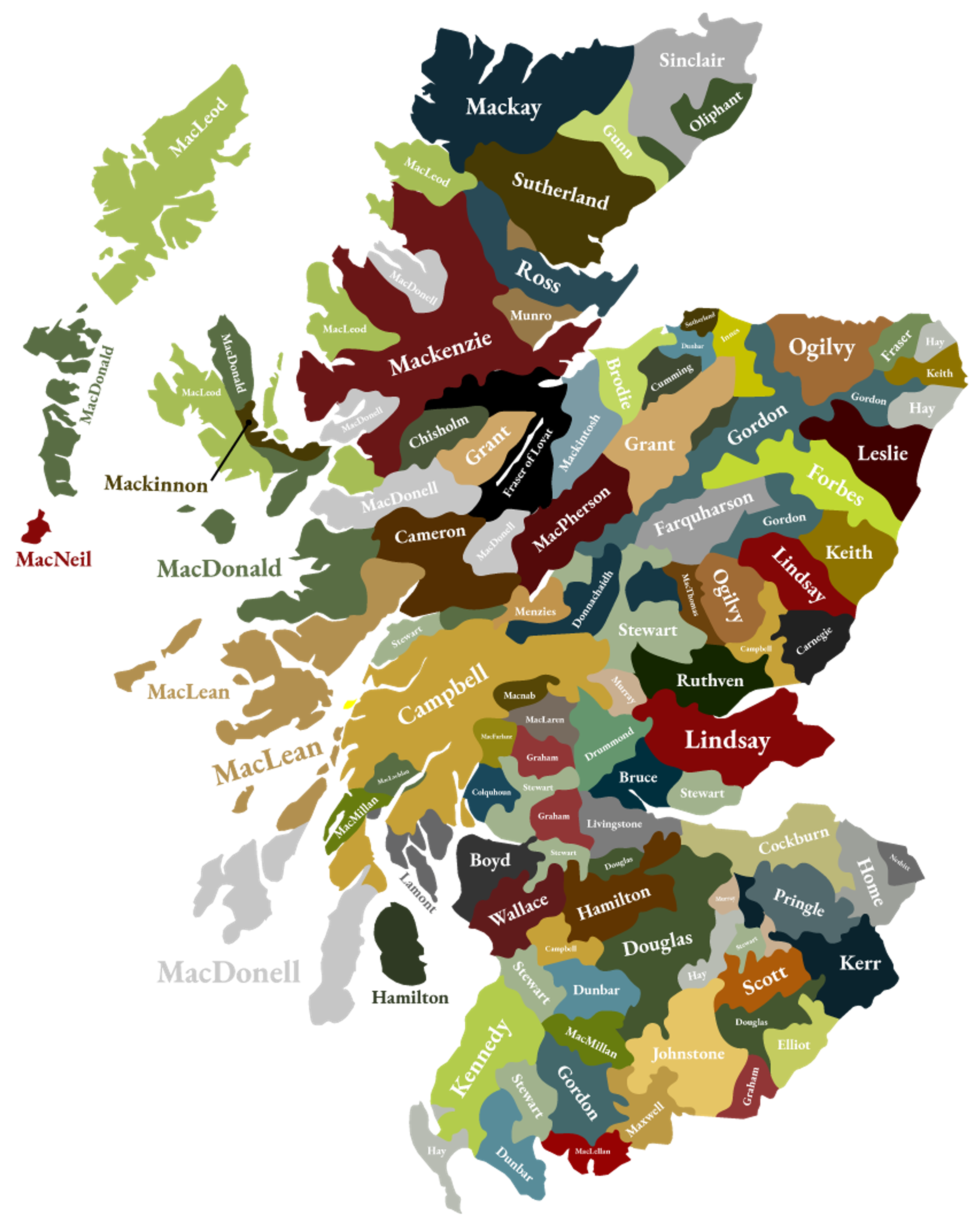
Map of Scottish Clans showing the Mackay Clan in northernmost Scotland ©Highland Titles
While drafting her novel, she researched the history of Scottish Clans along the north-western coast of the Highlands.
This investigation led to the serendipitous discovery of a profound personal link to the region: her own ancestral roots as a member of the Mackay Clan.
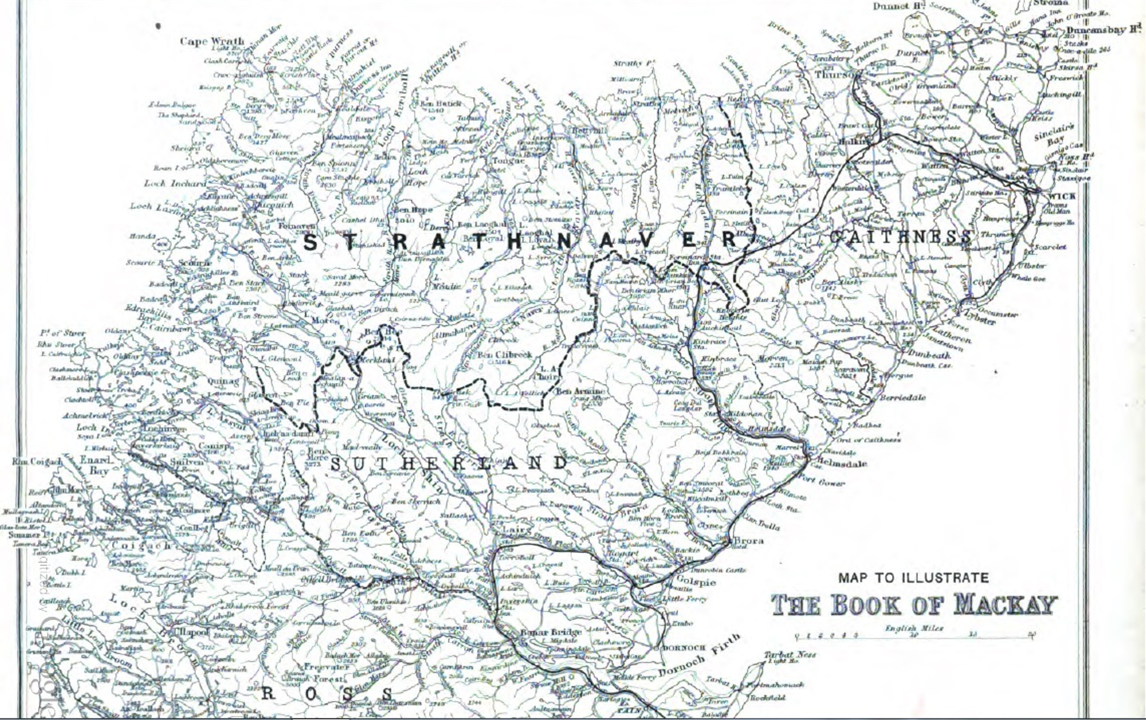
Map of northernmost Scotland from ‘The Book of Mackay’ by Angus Mackay (1906). Public Domain.
Tim Marshall & the Map of Satellite Orbits

©Tim Marshall
Jerry was then joined by journalist, author, and broadcaster Tim Marshall. Tim is an authority on foreign affairs and international diplomacy with more than 30 years of reporting experience. He was former Diplomatic Editor at Sky News, and prior to that worked for the BBC and LBC/IRN radio.
Tim shared a map from his book The Future of Geography (2023, Elliott & Thompson). It illustrates the position of satellites surrounding the Earth, and features in a chapter on ‘The Era of Astropolitics’ - the interdisciplinary analysis of civil, commercial, military, and intelligence space activities worldwide.
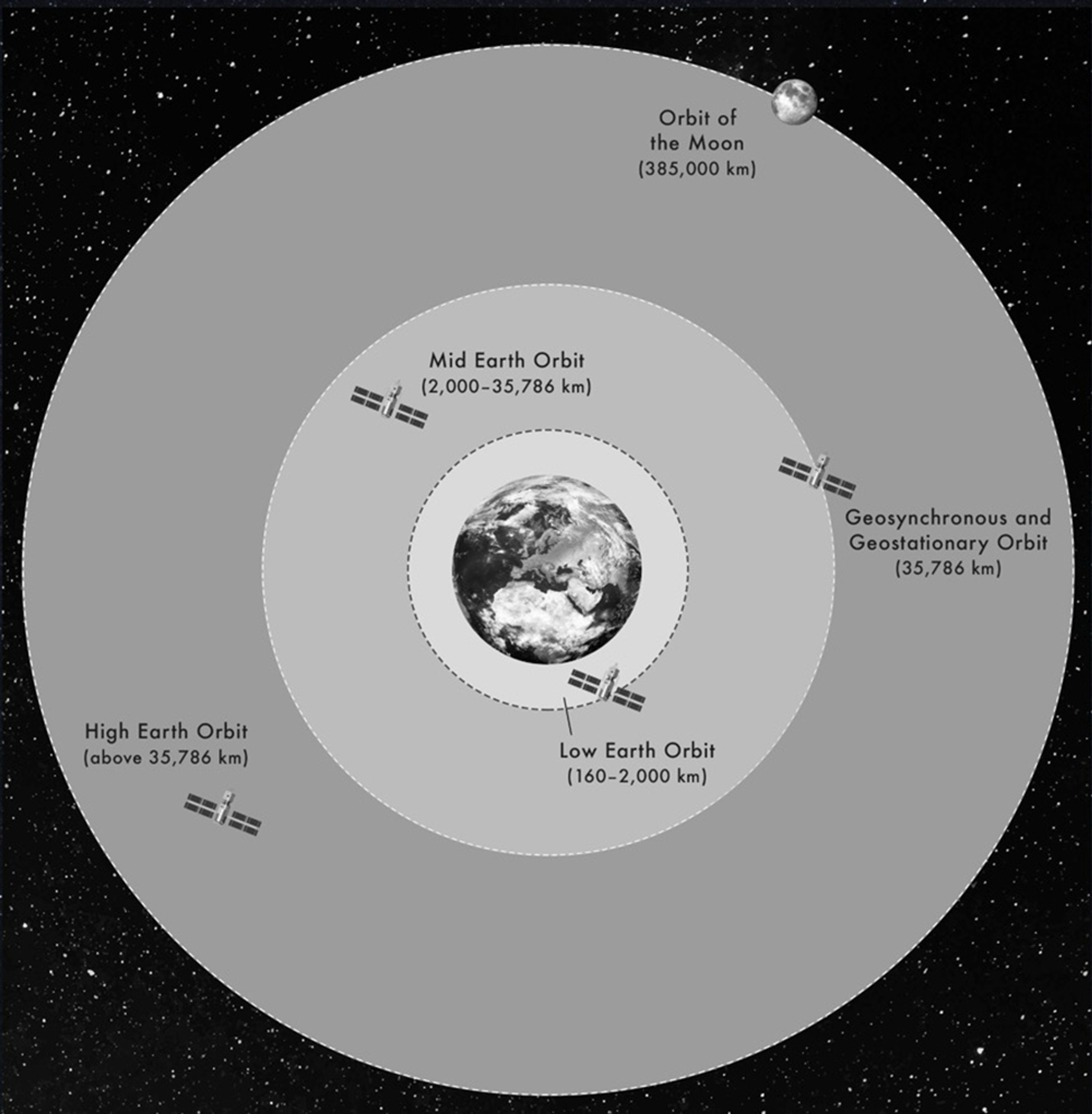
Map of satellite orbits ©Tim Marshall, courtesy of Elliott & Thompson. From ‘The Future of Geography’ (2023)
Tim notes that this map serves as a valuable tool for visualising the vast geography of Space, a concept often overlooked in comparison to our terrestrial understanding of the world.
The map shows the orbits and approximate distances of satellites surrounding the Earth from the realms of Low Earth Orbit, Mid Earth Orbit and High Earth Orbit, as well as the distance of geosynchronous (orbit in parallel with the rotation of the Earth) and geostationary satellites. This also illustrates the relative distance of the Earth’s only natural satellite - the Moon - at 385,000 km.
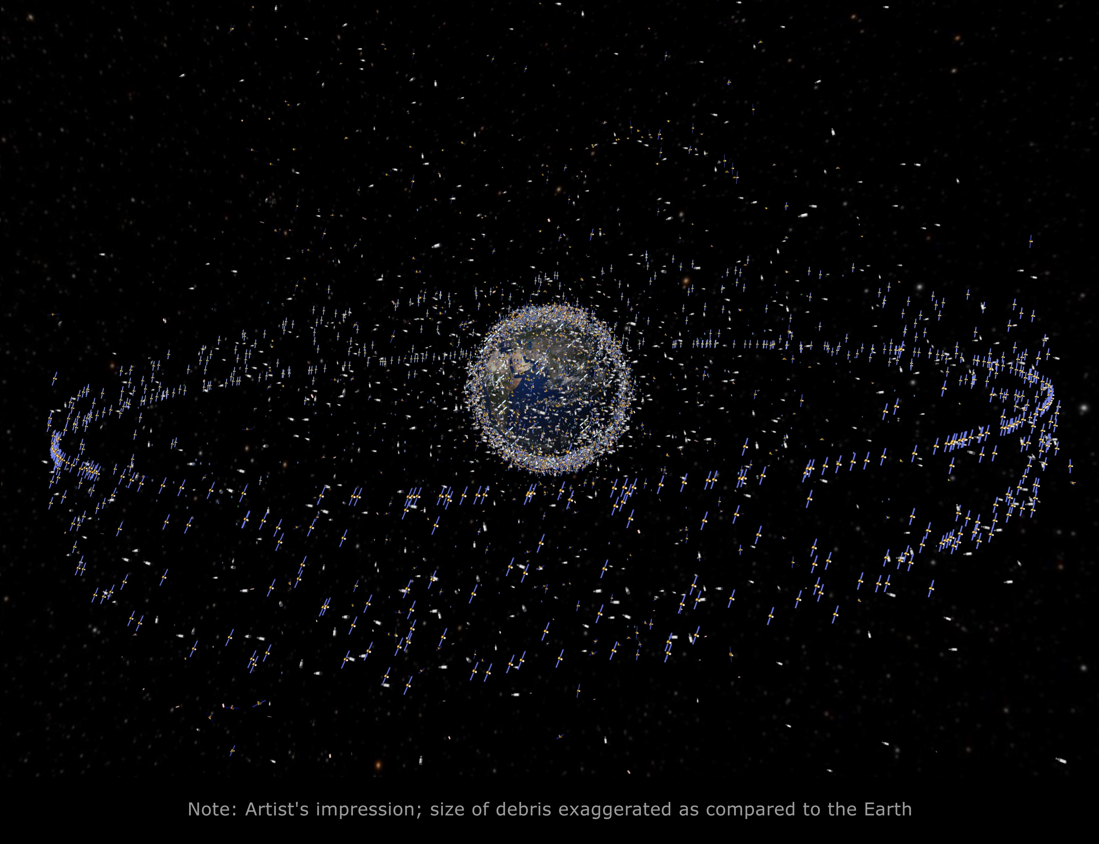
Artist’s impression of satellites in space ©European Space Agency
We learn about the requirement for West-East launch in order for rockets to enter orbit; that Low Earth Orbit territory is currently home to the majority of the 14,000 satellites circling the Earth - a number which is anticipated to reach at least 30,000 by 2030; and that the democratisation of Space means that companies can send satellites up for as little as £3,000!
Tim explained Lagrangian Points to Jerry, which are often referred to as gravitational ‘parking spots.’ These allow satellites and instruments, such as the James Webb Space Telescope, to maintain steady positions because the gravitational pull from the Sun and Earth are in equilibrium.
Tim highlighted the potential astropolitical consequences of satellite congestion and the colonialisation of the Moon, noting that expansive geopolitical treaties will be necessary to regulate the operations of various nations and commercial entities.
The only existing international contract to date is the Artemis Accords, a non-binding agreement established by NASA and the U.S. Department of State in 2020 to guide civil space exploration and the use of the Moon, Mars, and other celestial bodies. Tim explained that it is akin to the UN Convention of the Law of the Seas which are the ‘rules of the road’ when it comes to international maritime law.
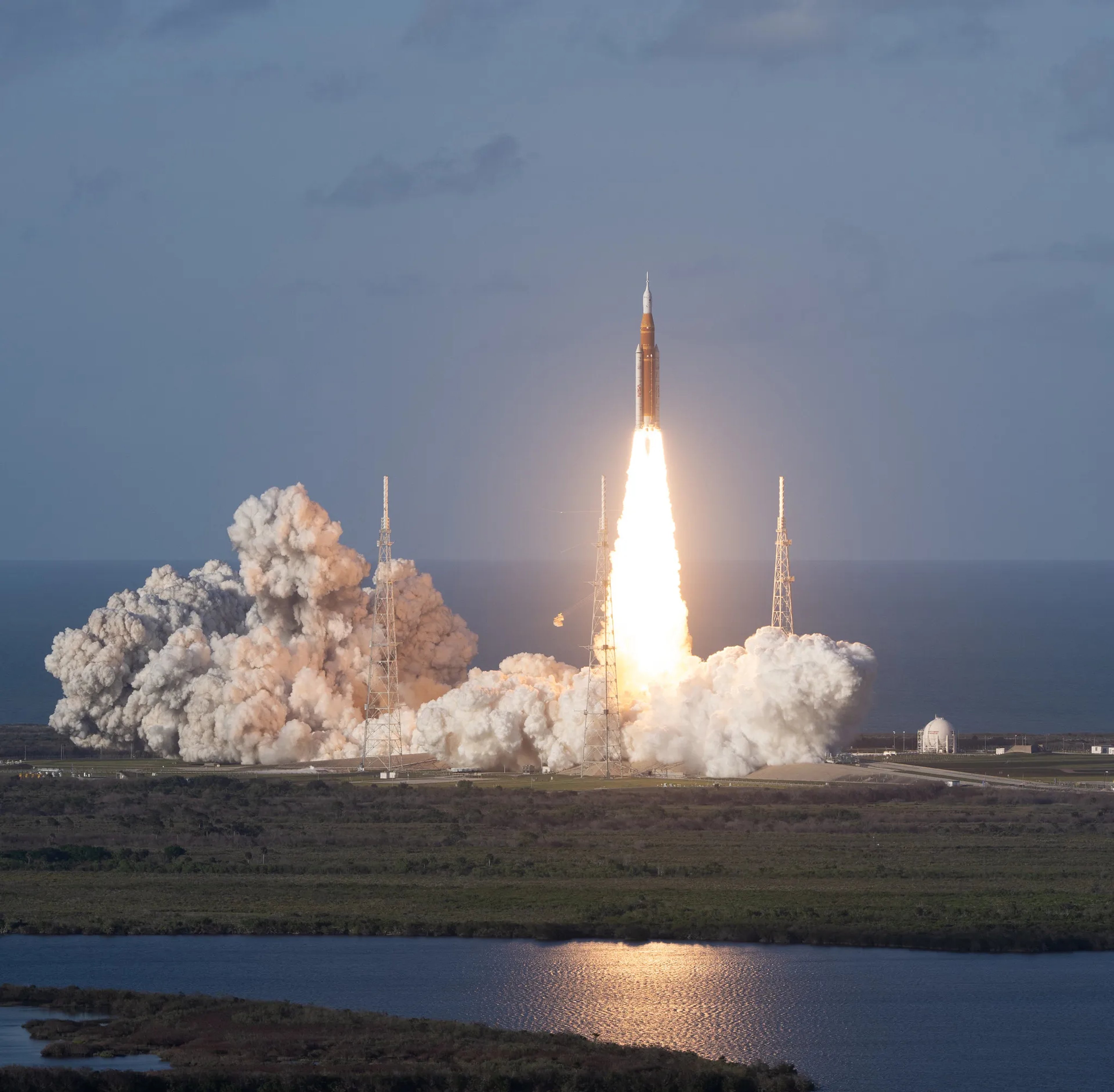
NASA’s Artemis II SLS rocket and Orion spacecraft lift off from Launchpad 39B at the Kennedy Space Center at Cape Canaveral, Florida (1 April 2026) © NASA/Joel Kowsky
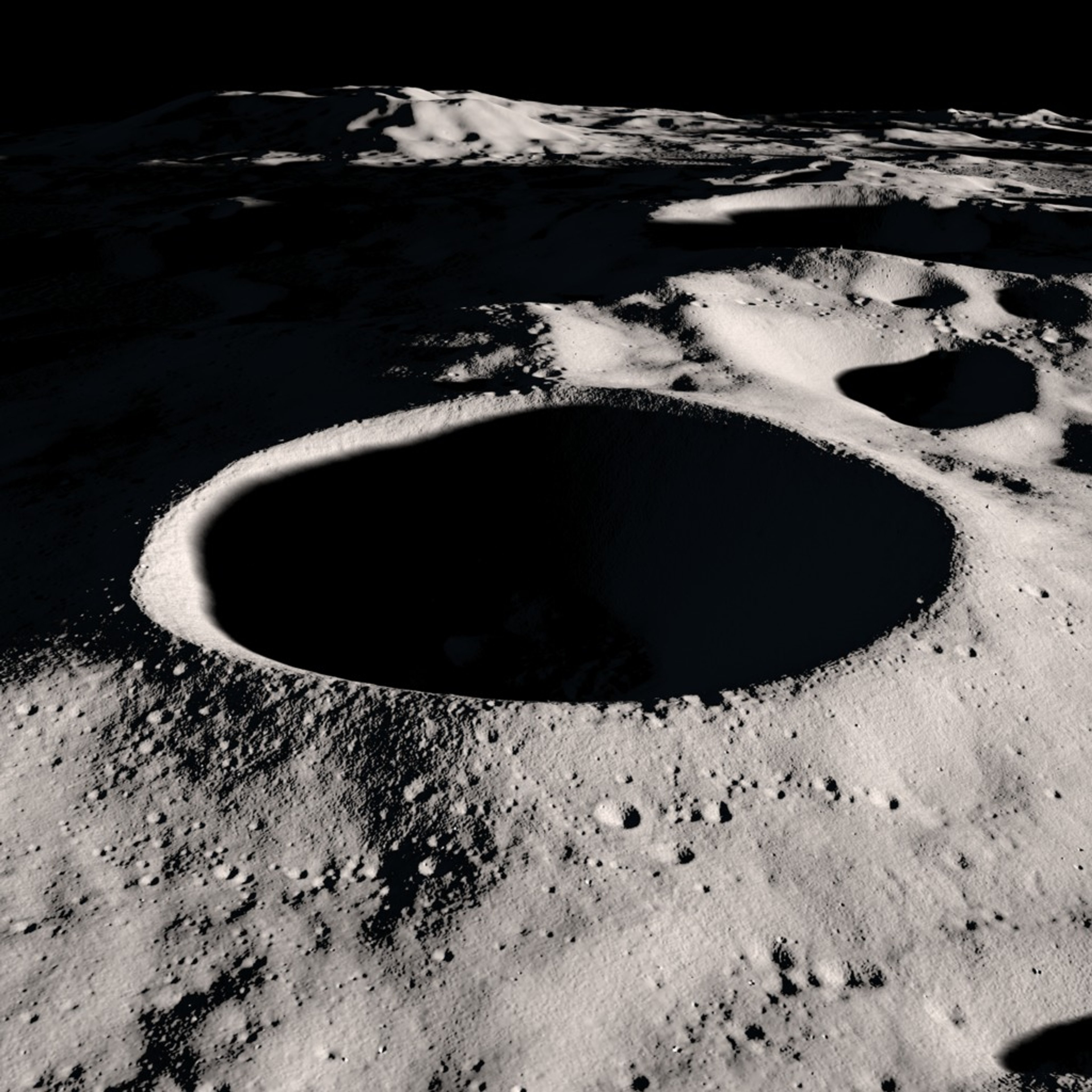
A rendering of the Shackleton Crater at the Moon’s south pole ©NASA Scientific Visualization Studio
With the recent launch and orbit of the Artemis II SLS and Orion Spacecraft in April 2026, there is a renewed focus on near future Moon landings and the colonisation of the Moon.
Tim told the audience that locations such as the Shackleton Crater on the Moon’s south pole, could become a hotspot for lunar landings due to the mining opportunities for critical resources such as lithium, titanium and cobalt - and for its optimal position for ‘leapfrog’ missions to Mars.
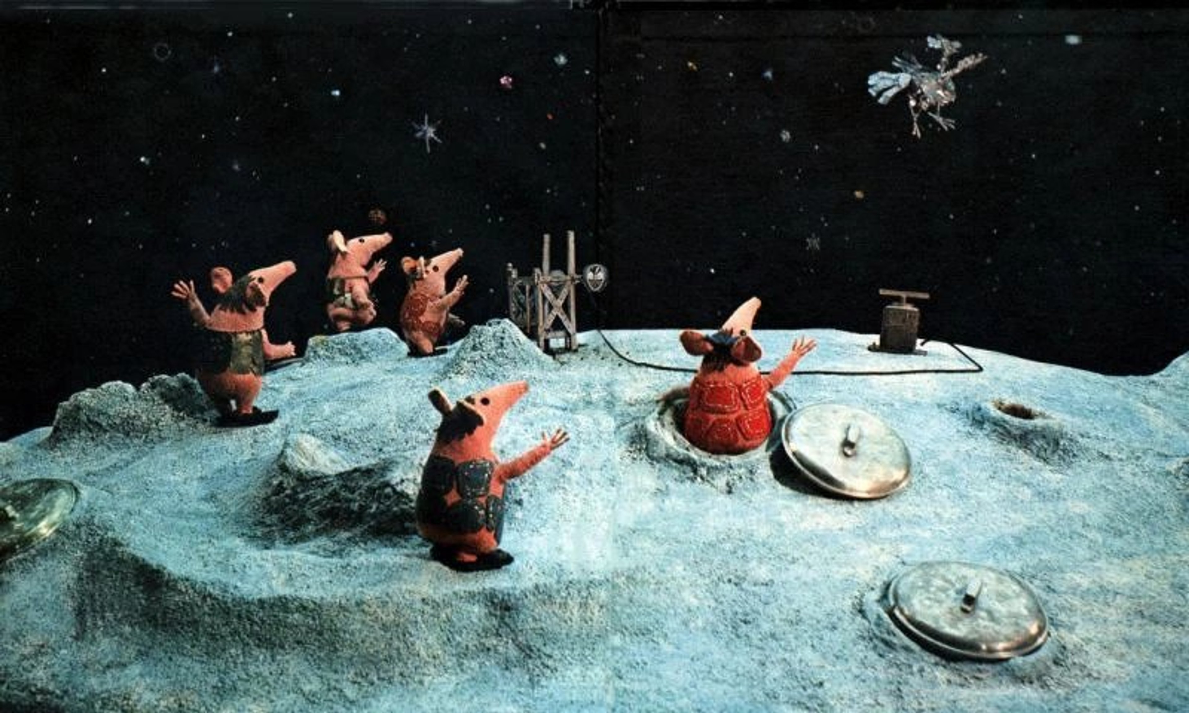
The Clangers (1969-1974) ©Channel 5
About Hay Festival
The Hay Festival - officially the Hay Festival of Literature & Arts - is an internationally renowned annual cultural event that takes place in Hay-on-Wye, Wales ever summer. Established in 1988, it brings together leading writers, scientists, politicians, and artists from around the world for 10 days of readings, debates, comedy, music and creativity.
Visit www.hayfestival.com to find out more about this iconic festival and its exciting programme.
The Sunderland Collection would like to extend its sincere thanks to our special podcast guests and the Hay Festival, in particular to Programme Director Helen Bagnall, Producer Emma Jones and the Technical Team Nia Thomson and Lewis Jones for their assistance, support, and coordinating this brilliant event.
Sign up to the Oculi Mundi newsletter to find out about future WHAT'S YOUR MAP? LIVE events:
Subscribe to WHAT'S YOUR MAP? - available on all major platforms.