World-Building and Cartography: Simon Bejer's Response to Maps
by Chet Van Duzer for the the exhibition, And Everything Under the Sun
World-building - that is, constructing a coherent imaginative environment in which meaning operates - is an essential part of most artistic processes, and what could be more natural than to draw inspiration for a new world from images of the existing one - namely, maps?
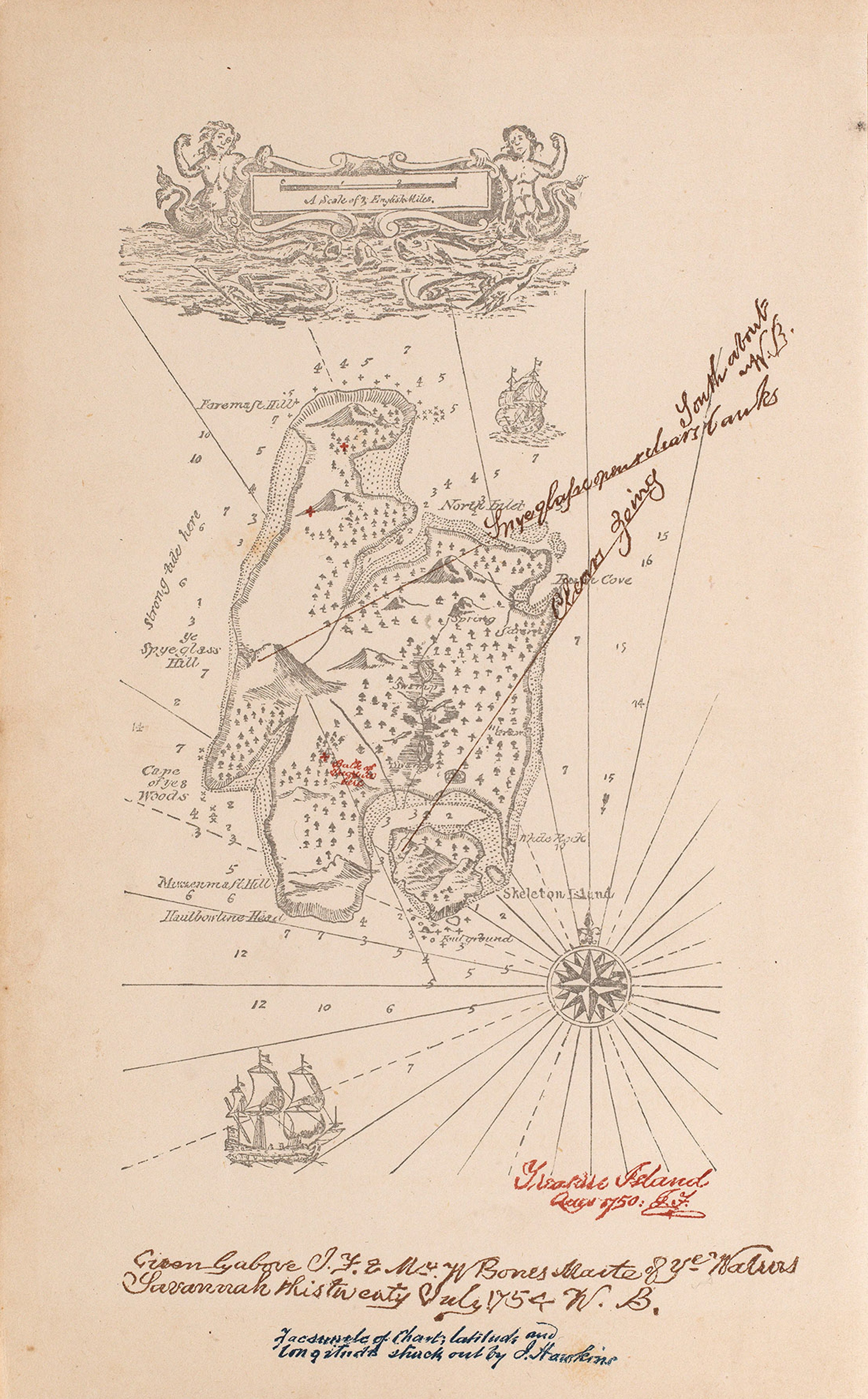
Map from Treasure Island (1883) by Robert Louis Stevenson ©Ex Carta
To cite just a couple of examples of this type of borrowing from maps, makers of medieval animal books copied some monsters from maps, and Robert Louis Stevenson developed both the characters and plot of Treasure Island (1883) based on a map of the imaginary island.
The artist Simon Bejer, born in Melbourne and based in London, has not only drawn specific images from maps in The Sunderland Collection in his most recent paintings, but has also employed cartographic conventions such as the cartouche and quasi-cartographic high oblique views.
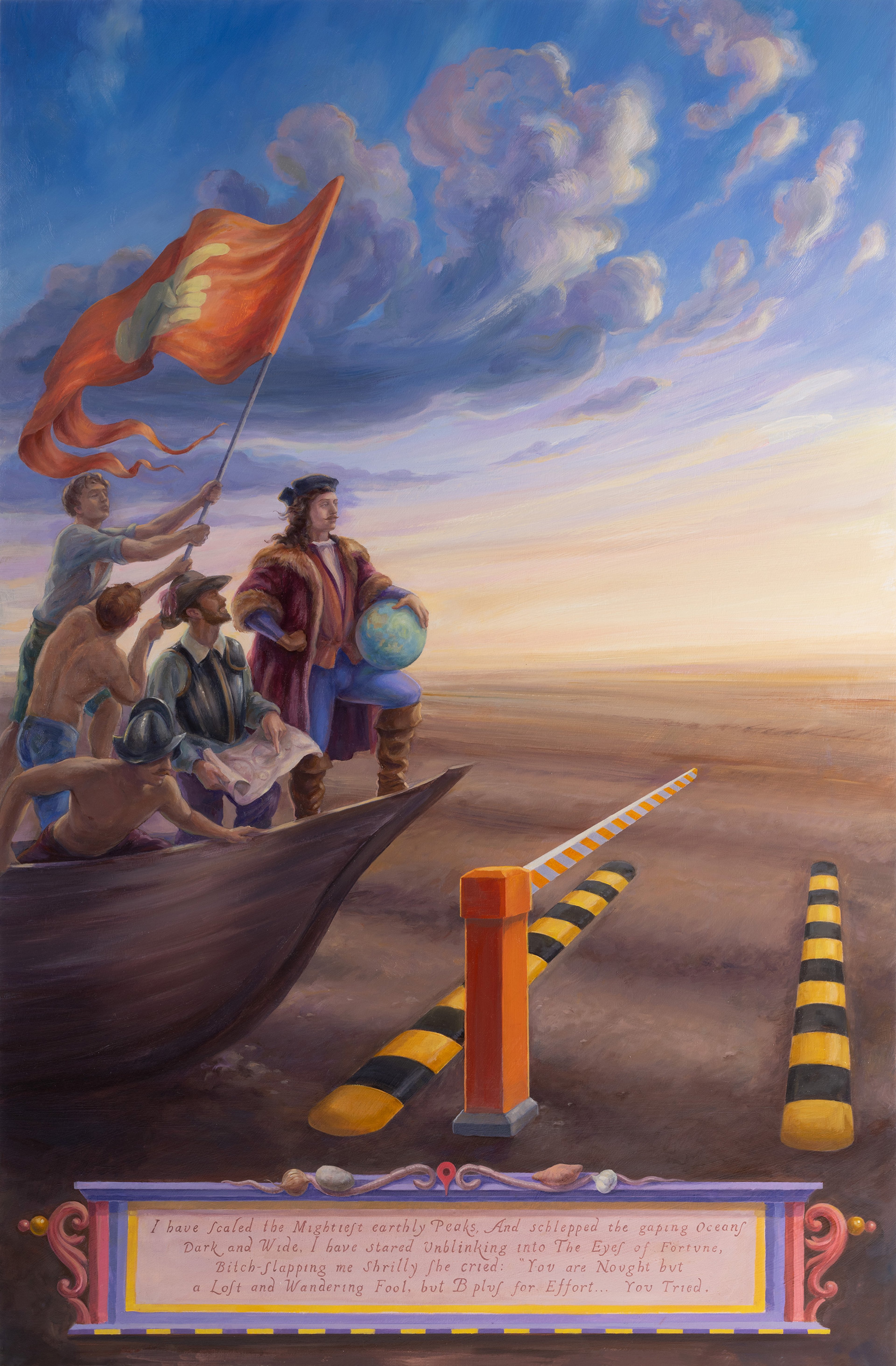
Four Elements, Earth (2026). Oil on birch-wood, 105x69cm ©Simon Bejer/The Sunderland Collection
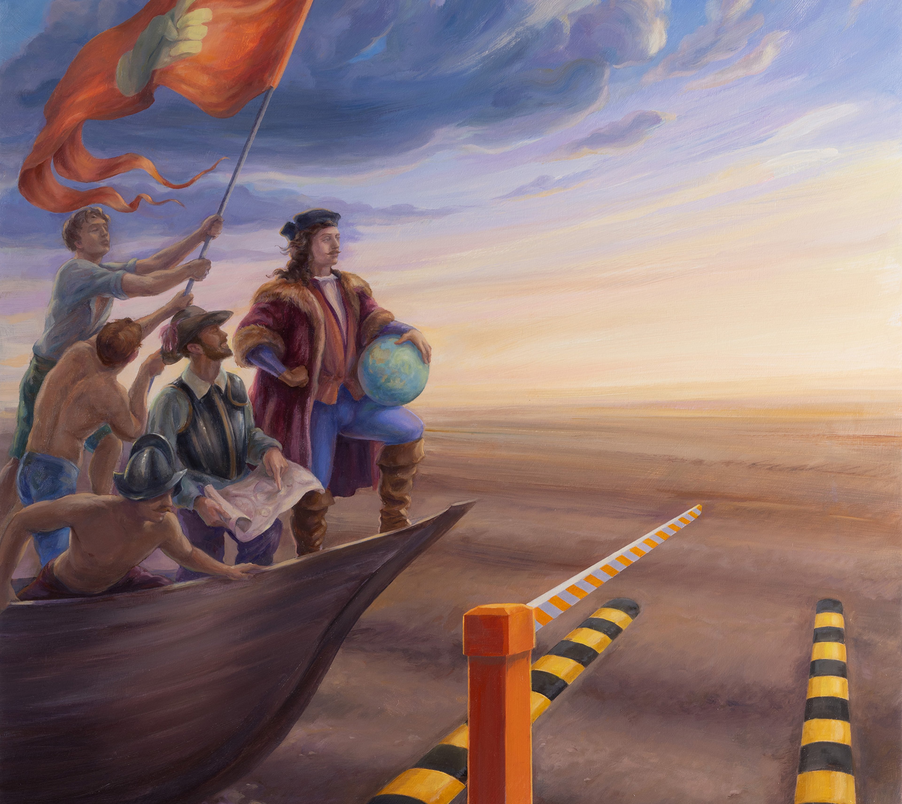
In his painting Earth, an explorer in the tradition of Columbus or Magellan sails in from the left, gazing towards the horizon ahead and holding a globe to indicate his role as a discoverer - and also the scope of his ambition. A member of his crew points to their exact location on a map, indicating confidence in their navigation, and at the same time, his hand on the map echoes the huge forward-pointing hand on the banner above them. But when we zoom out, we see that what seems to be an image of determination, vision, progress, and conquest at sea is actually a picture of confusion and failure.
The ship is not at sea, but in a desert, and it runs afoul of speedbumps and a crossing gate, modern terrestrial impediments. The painting reflects our doubts about the locational knowledge and purity of motive of early explorers.
This same doubt appears in the cartouche below. The frame consists of traditional strapwork decoration typical of sixteenth century maps, while the text is conspicuously rendered in dot matrix type typical of the 1980s and 90s. The explorer speaks in verse, boasting of his accomplishments and bravery, but when he quotes Fortune, her words undercut his claims:
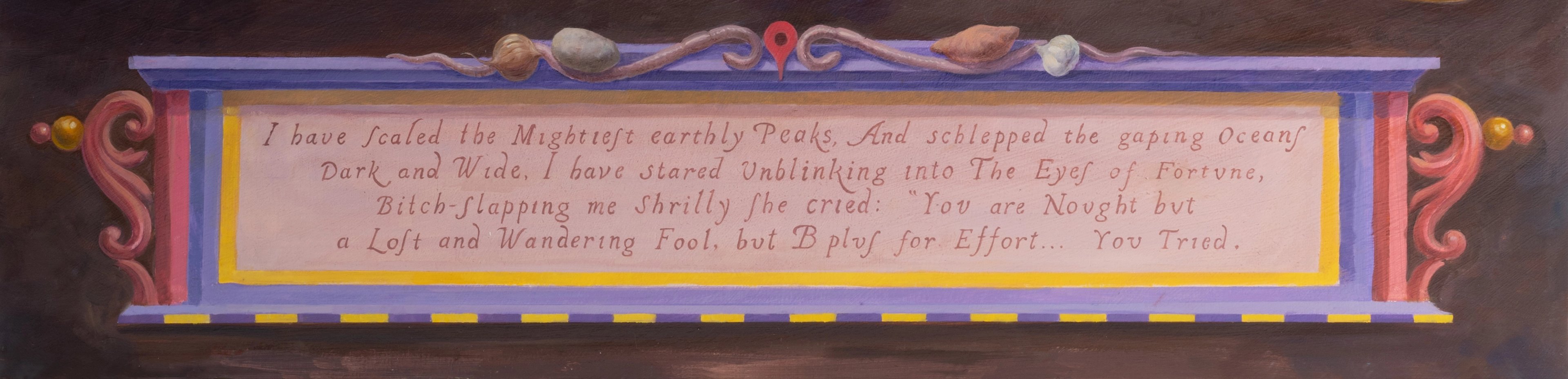
This descent, both visual and verbal, from epic grandeur to irony and comic deflation, and from the visual tropes of sixteenth-century cartography to dot matrix printing, is a classic mock-heroic manoeuvre.
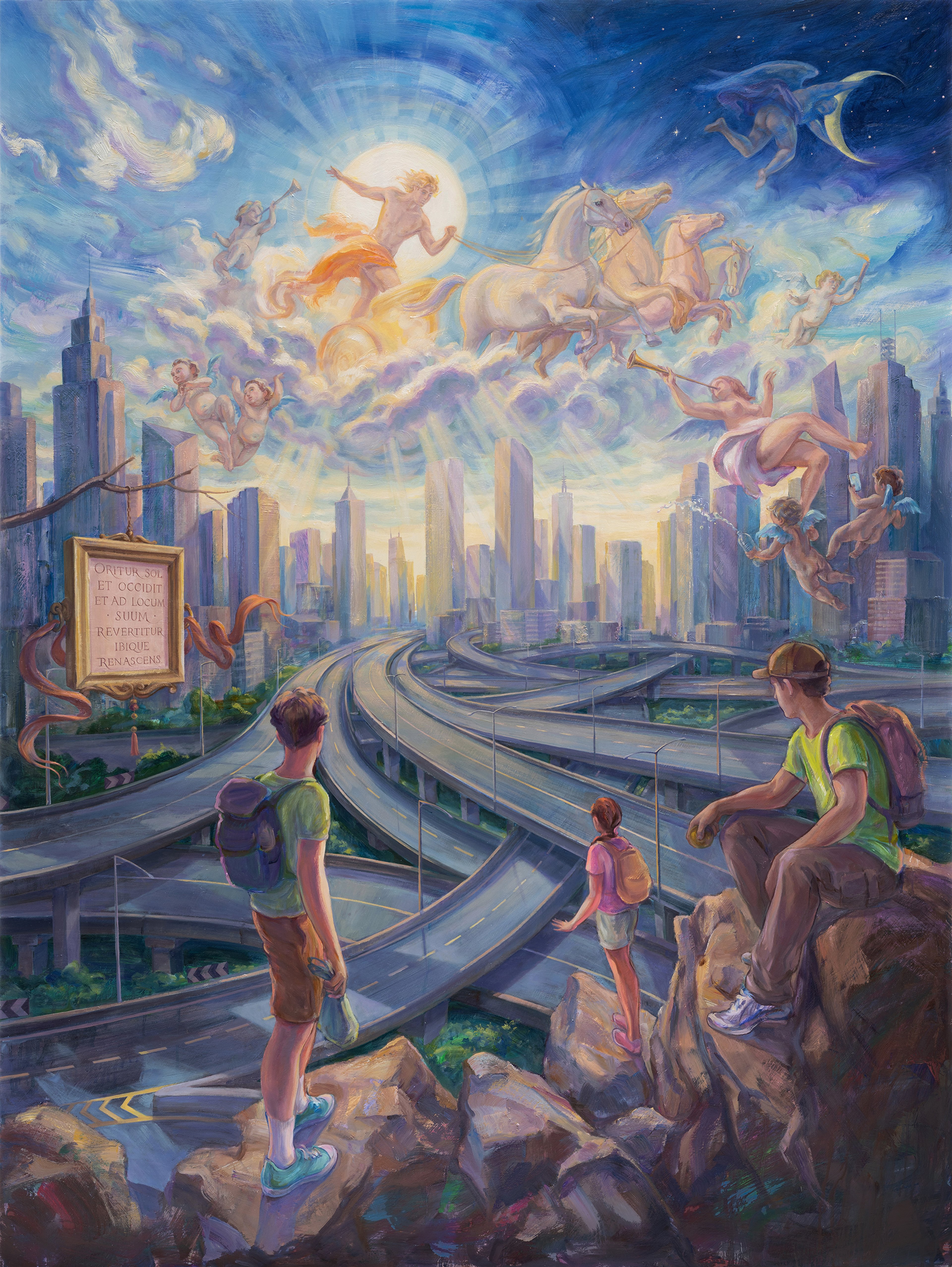
Oritur Sol (2026). Oil on birch-wood, 160x120cm ©Simon Bejer/The Sunderland Collection
Simon’s painting Oritur Sol is organized in two registers. Above we see a very dynamic scene of the bare-chested Sun, framed by the bright solar nimbus, racing across the sky in his chariot which is drawn by four steeds. A figure with a torch, Phosphorus, the “light-bearer,” precedes him, winged figures trumpet his arrival, another winged god moves the moon out of the way—and bright rays of light shine down through the clouds to the city below.
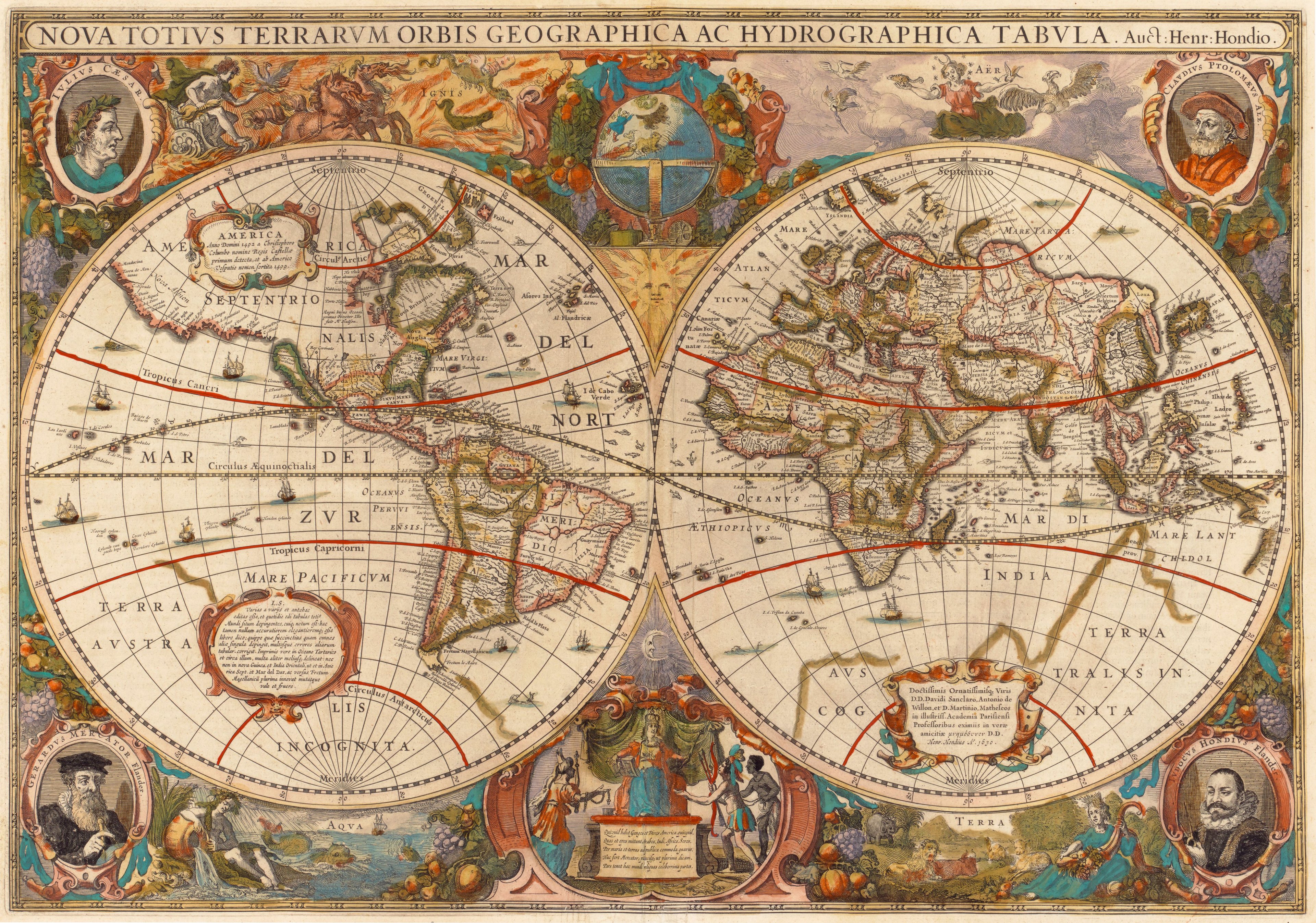
Double-hemisphere world map Nova Totius Terrarum Orbis Geographica ac Hydrographica Tabula (1633) by Henricus Hondius ©The Sunderland Collection
This part of the scene seems to have been inspired by the beautifully hand-coloured image of the Sun in his chariot on Henricus Hondius’s world map of c. 1633, or Frederik De Wit’s of 1660, in The Sunderland Collection. On these maps the image of the Sun in his chariot is part of an allegorical-cosmographical program depicting the four elements (fire, air, water, and Earth) - that is, part of an effort to make the map show the composition of the whole world.
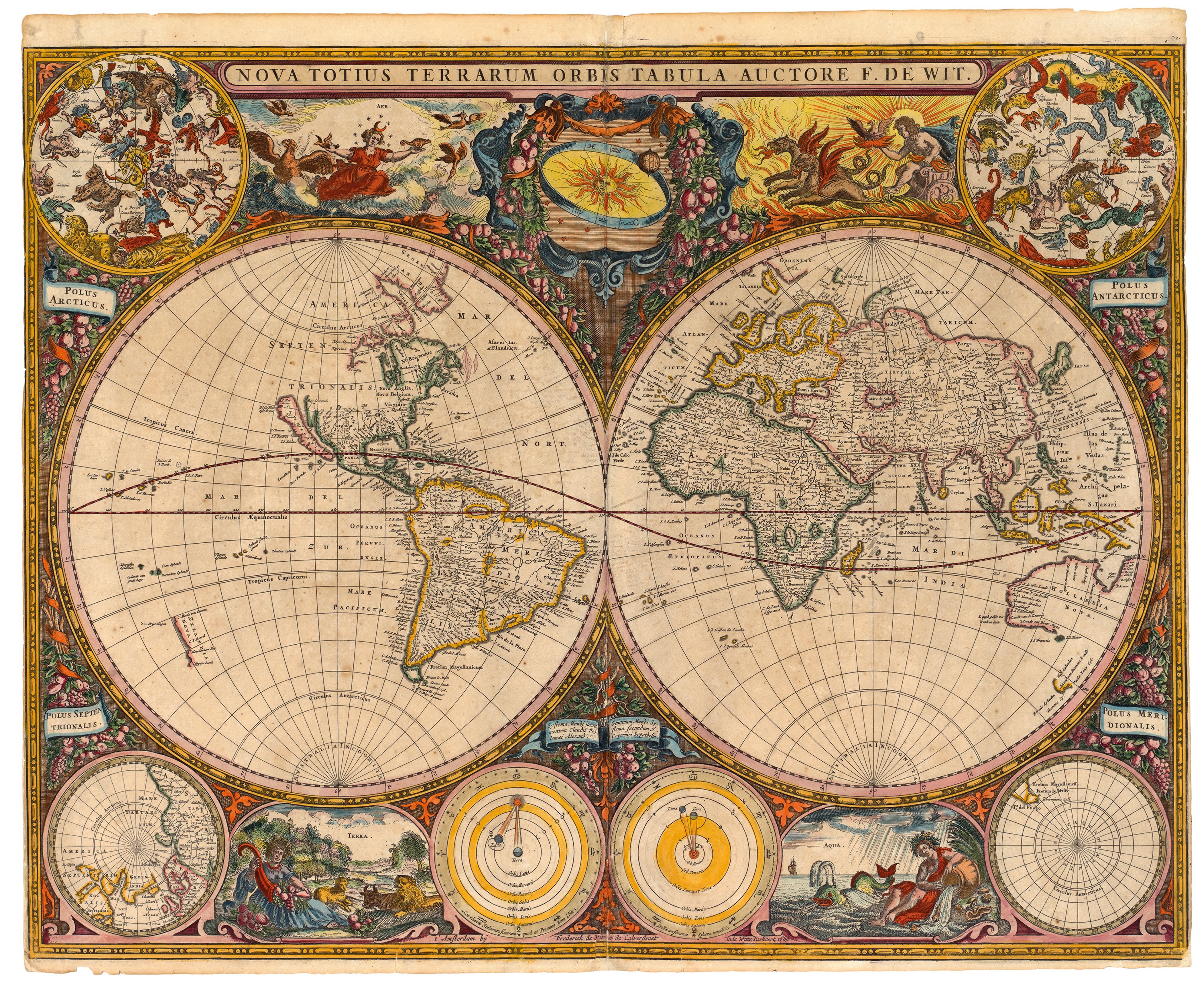
Double-hemisphere world map Nova Totius Terrarum Orbis Tabula (c1660) by Frederick de Wit ©The Sunderland Collection
Though the palette in the lower register of the painting is similar to that in the upper, the feeling is entirely different. While the upper register is all about ancient mythology and motion, the lower register is modern, realistic, and contemplative. In the foreground three young people wearing backpacks, ready for travel, stand on a high outcrop. This perch affords a cartographic perspective that we might see in a sixteenth-century city view, and they look out over the skyscrapers and the dense network of freeway overpasses. The absence of vehicles in motion on the freeways is essential to the static, contemplative atmosphere.
To the left a sixteenth-century styled cartouche is suspended from a tree branch; the Latin text reads: ORITUR SOL ET OCCIDIT ET AD LOCUM SUUM REVERTITUR IBIQUE RENASCENS, that is, “The sun rises and sets, and returns to its place, where it is born anew.” The line is from Ecclesiastes 1:5, and emphasises cyclical return and renewal.
The three young people look to the point where several of the overpasses snake together into the distance, and this creates the cycle to which the cartouche alludes. Below we have ribbons of concrete quietly disappearing into the distance, and just above that point, the dynamism and brightness of the birth of a new day.
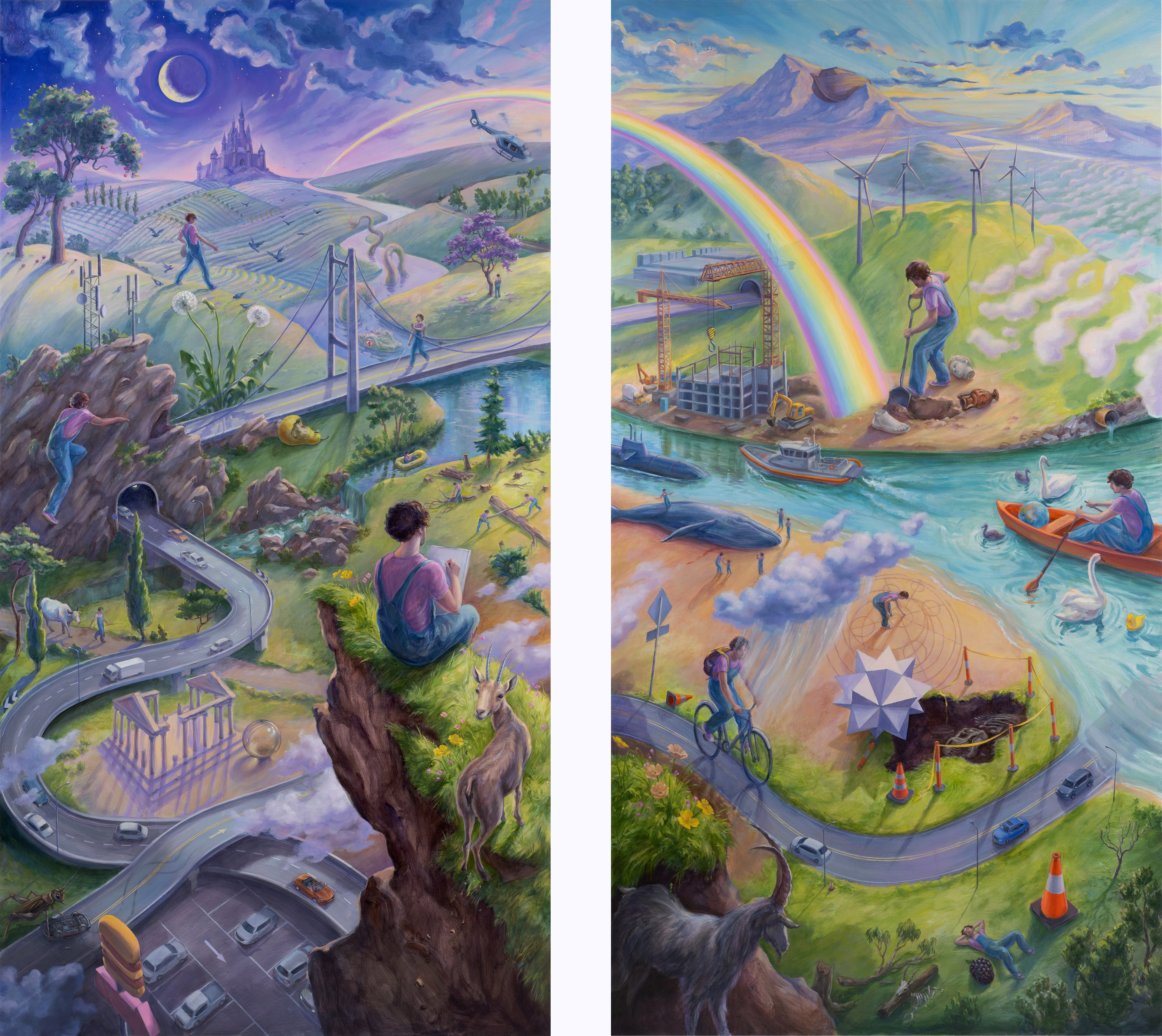
You Are Here (2026). Diptych, oil on birch wood, each panel 160x90cm. ©Simon Bejer/The Sunderland Collection.
Perhaps the most ambitious painting in this group - the one that creates the fullest vision of a world - is Simon’s You Are Here. The title itself alludes to cartographic positioning. Again the artist uses a crag in the foreground to afford a cartographic perspective, and he depicts himself seated on the crag, drawing the scene before him. In fact, all of the men in the scene are self-portraits, so that the painting is an exploration of the various ways in which the artist can interact with the world.
One of the ways that the painting achieves its richness is by incorporating opposites: the Sun and the Moon, of course, but also life and death (the live goats and the skeleton below, the sea monster and the dead whale), good fortune and bad (the rainbow and the cloudburst), old and new (the Greek temple and the building under construction; Noah’s ark on the mountain and the modern submarine), working and relaxing (on the two sides of the road), blindness and vision, etc. Homer employed this same technique to create an image of the world by depicting a city at war and a city at peace on Achilles’ shield in the Iliad.
In addition to its almost cartographic perspective and its mappy title, the painting engages with cartography in several other ways. Simon carries a globe in his rowboat (like the explorer in Earth mentioned above); the diagram that Simon draws in the sand is inspired by the spectacular volvelles (moveable diagrams) in Petrus Apianus’s Astronomicum Caesareum (“The Emperor’s Astronomy”) (1540).
The sea monster was perhaps inspired by the monstrous dolphin on Sebastian Münster’s world map titled Typus Orbis Universalis (1559), or the spouting monster in the lower margin of Frederick De Wit’s world map (1660). All three of these works are in The Sunderland Collection.
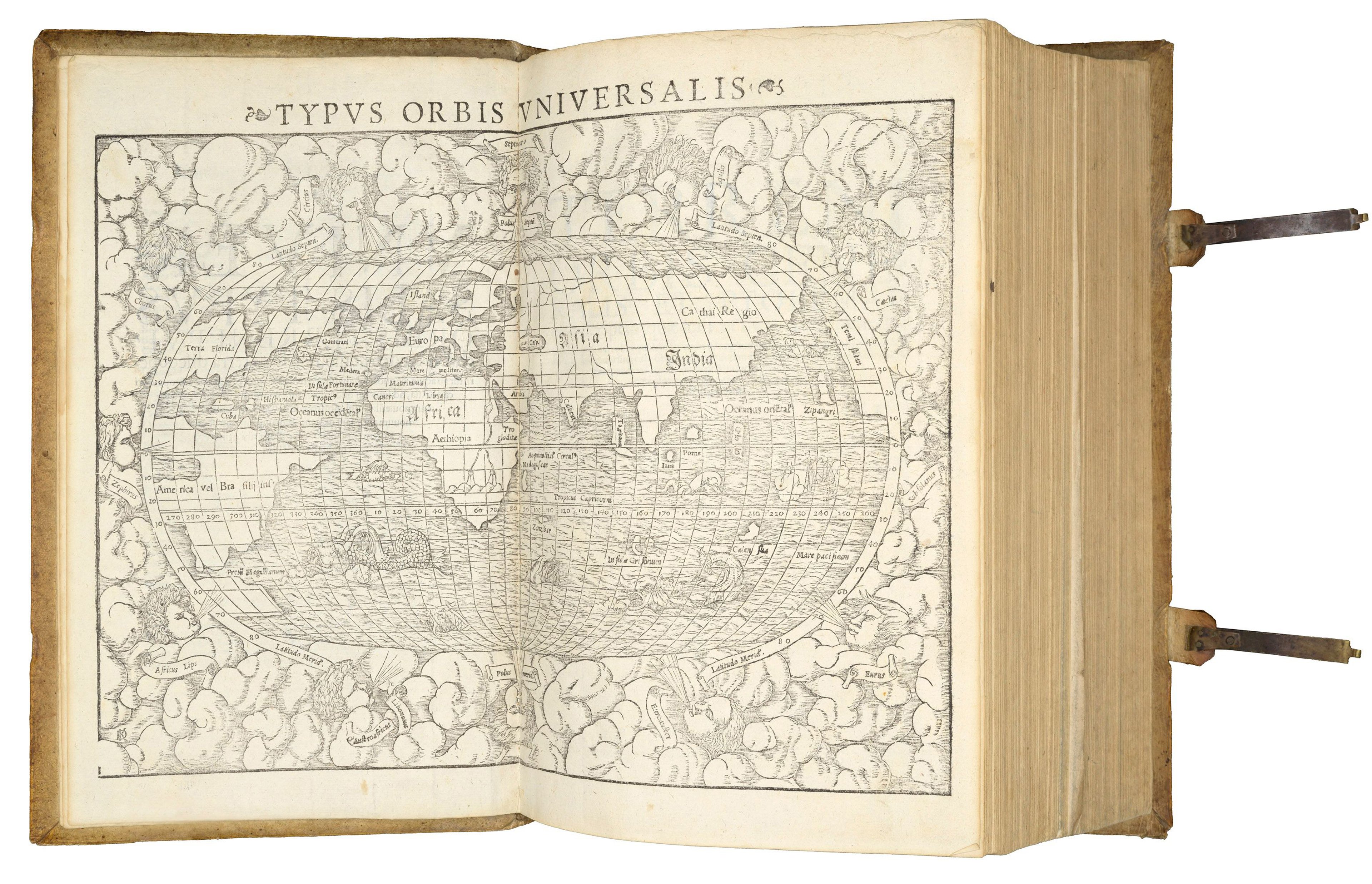
Oval world map from the Cosmographia Universalis (1540) by Sebastian Münster ©The Sunderland Collection
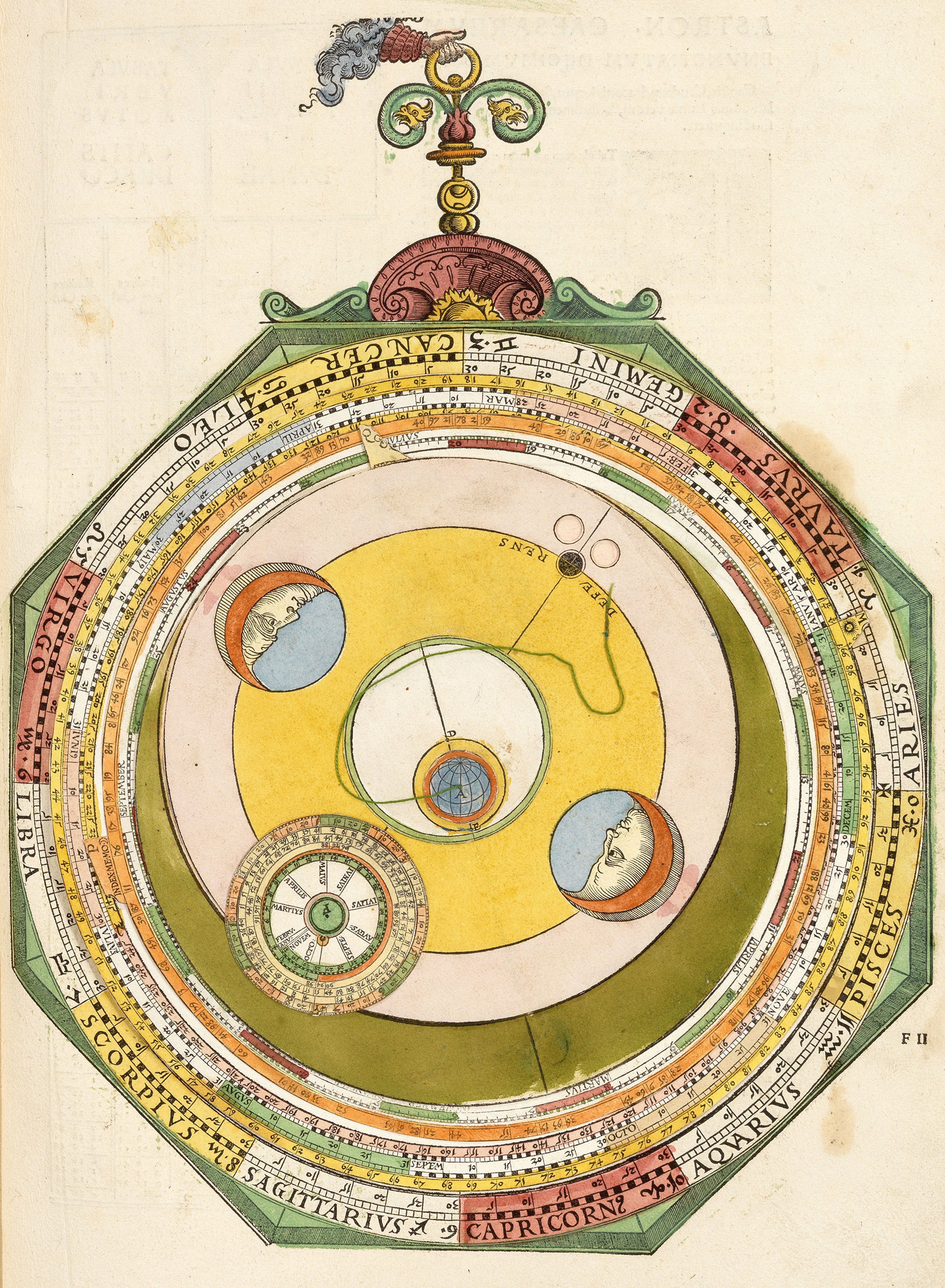
Volvelle from Astronomicum Caesareum (1540) by Petrus Apianus ©The Sunderland Collection
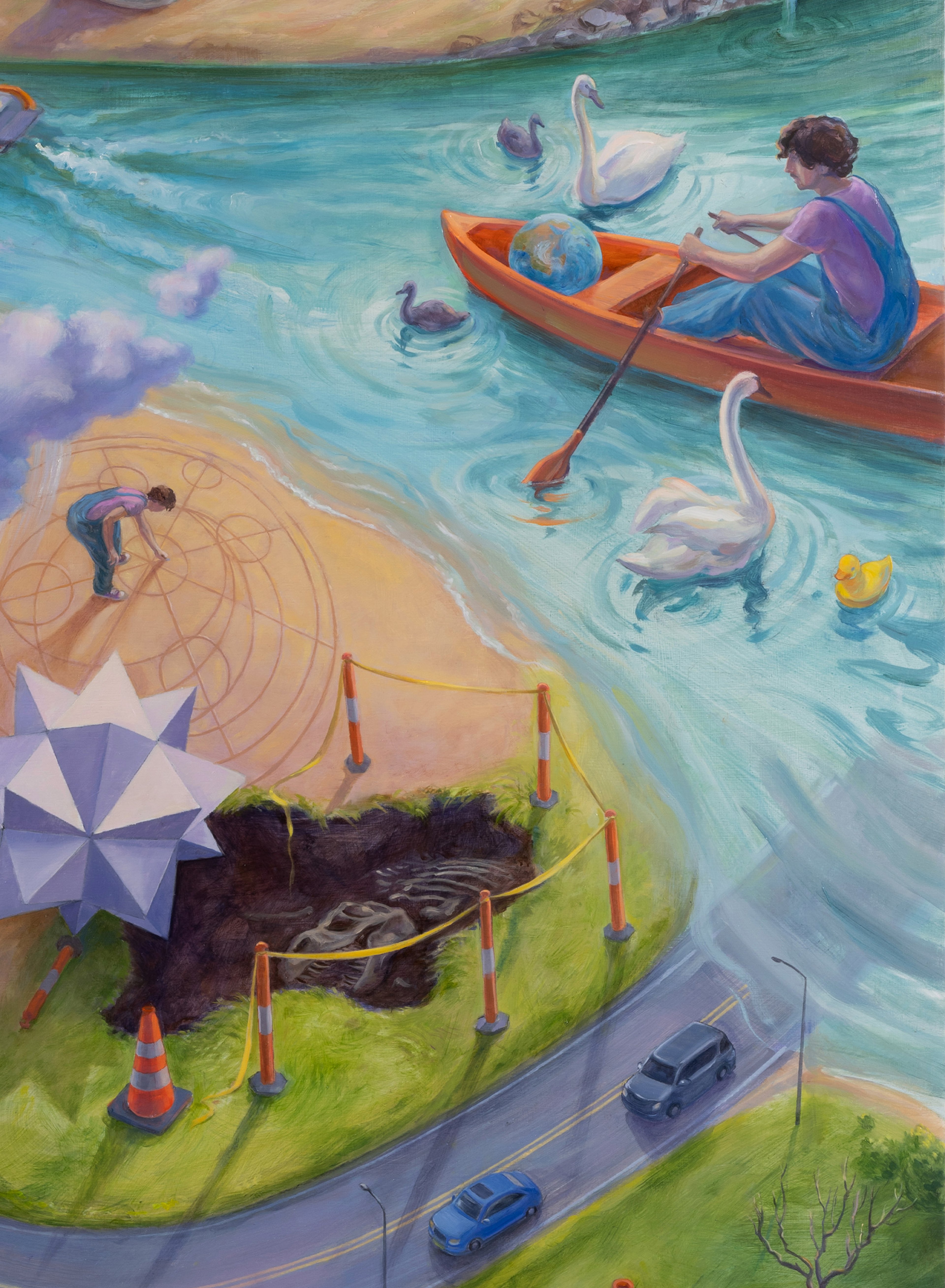
Detail from You Are Here (2026) ©Simon Bejer/The Sunderland Collection.
The painting is very playful in terms of its juxtapositions of different scales, and so while it draws inspiration from some cartographic conventions, it distorts others, creating a unique world that reflects the artist’s distinctive vision.
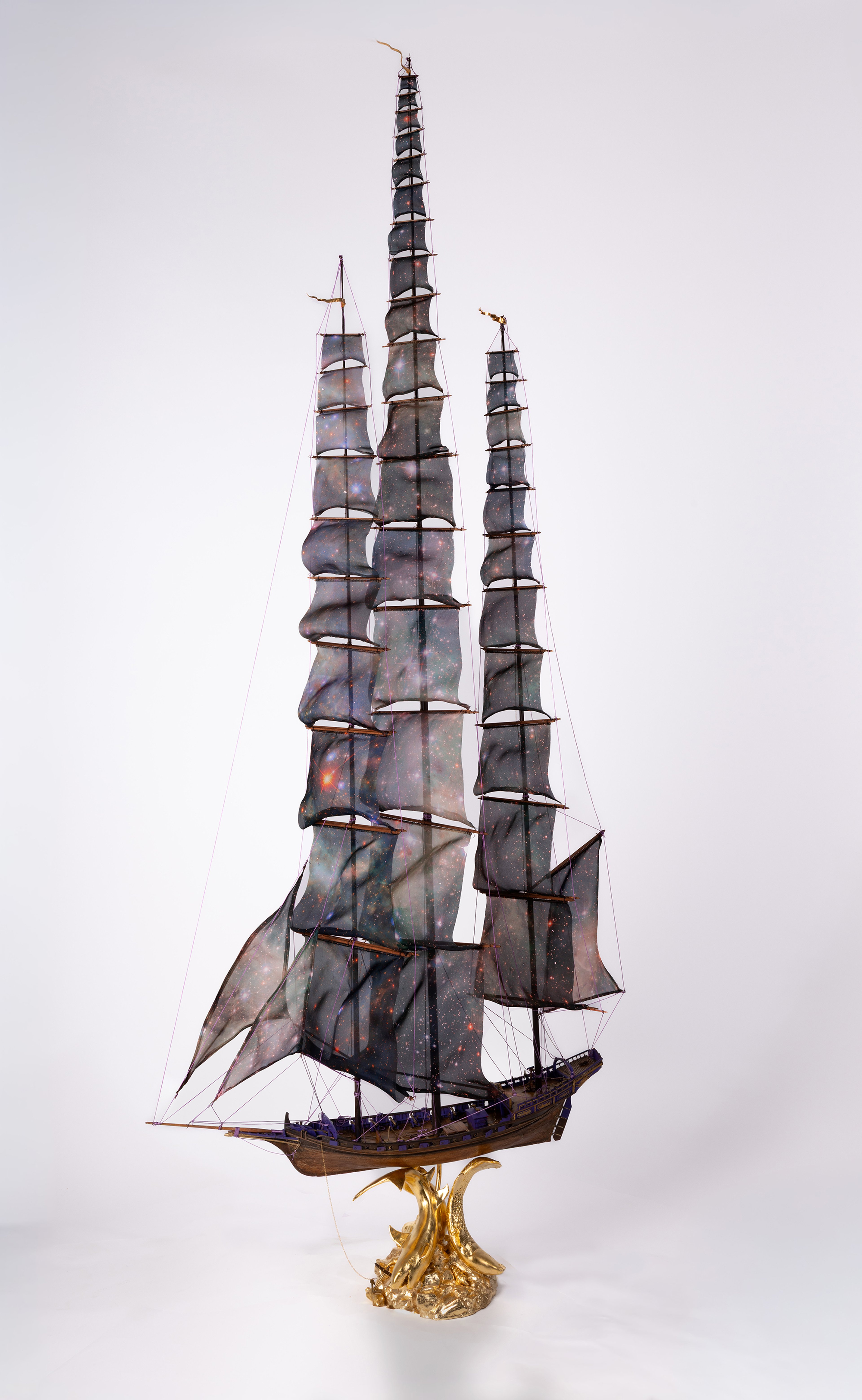
hope that these few words may provide some hints for exploring Simon’s other works. Just look at his sculpture of a historic sailing vessel, with its star-studded sails stretching up to the stars, and its base of golden sea monsters below. There is much to ponder and appreciate!
About Chet van Duzer
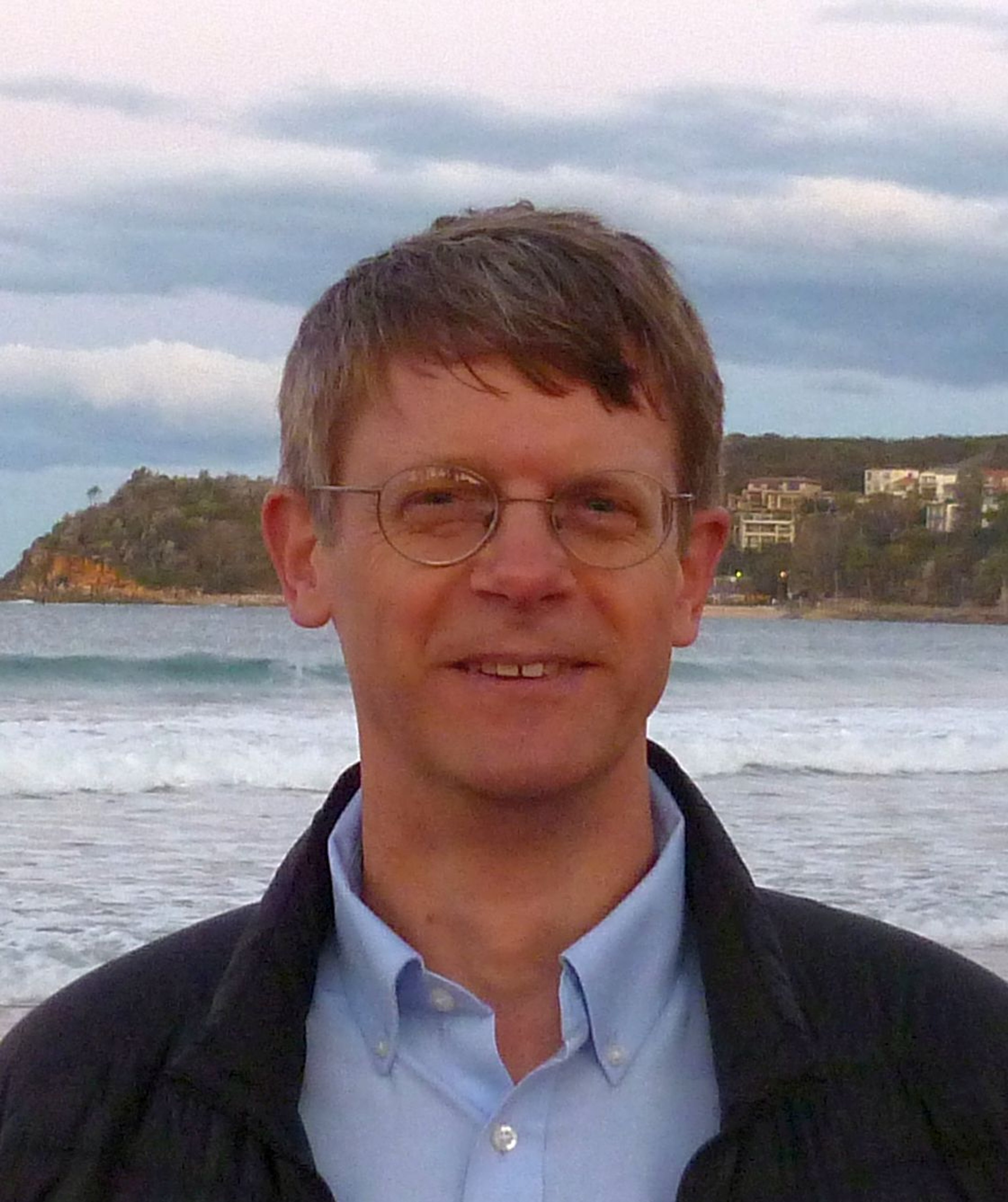
Chet Van Duzer is a historian of cartography. He is the Associate Director of the Lazarus Project at the University of Rochester, which brings multispectral imaging - a technology for recovering information from damaged manuscripts - to cultural institutions around the world. He runs the projects relating to maps and globes.
He has published extensively on medieval and Renaissance maps; his recent books include Henricus Martellus’s World Map at Yale (c. 1491): Multispectral Imaging, Sources, and Influence (Springer, 2019) and Martin Waldseemüller’s Carta marina of 1516: Study and Transcription of the Long Legends (Springer, 2020).
His book Frames that Speak: Cartouches on Early Modern Maps (Brill, 2023). His current projects are books about self-portraits by cartographers that appear on maps and the historical cartography of the Indian Ocean.
Selected Bibliography
Hardie, P. R., “Imago Mundi: Cosmological and Ideological Aspects of the Shield of Achilles”, Journal of Hellenic Studies 105 (1985), pp. 11-31.
Stevenson, Robert Louis, “My First Book—Treasure Island”, The Courier 21.2 (1986), pp. 77-88.
Van Duzer, Chet, Frames that Speak: Cartouches on Early Modern Maps (Leiden and Boston: Brill, 2023)
Van Duzer, Chet, “Monsters, Animals, Maps, and Sources”, in Elizabeth Morrison, ed., Book of Beasts: The Bestiary in the Medieval World (Los Angeles: J. Paul Getty Museum, 2019), pp. 274-280