Cultural Data Sculpting: A Partnership with EPFL
Proudly presenting student projects from Prof. Sarah Kenderdine's Cultural Data Sculpting Course at eM+ Lausanne
As part of its efforts to support the study of cartography, The Sunderland Collection is delighted to contribute high-resolution images of maps from the collection as a data set for Digital Humanities Masters students on the Cultural Data Sculpting course, taught by the pioneering Prof. Sarah Kenderdine at École Polytechnique Fédérale de Lausanne (EPFL).
The Cultural Data Sculpting course is located at EPFL’s Laboratory for Experimental Museology (eM+), a specialist research centre focused on experimentation in galleries, libraries, archives and museums.
The course teaches students how to approach and handle archive data sets and transform them into cutting-edge, immersive experiences for audiences engaging with cultural heritage objects.
We are proud to share what the students created in 2024 and 2025 below using data from the Sunderland Collection.
2024: Staring into the Belly of the Earth with Kircher
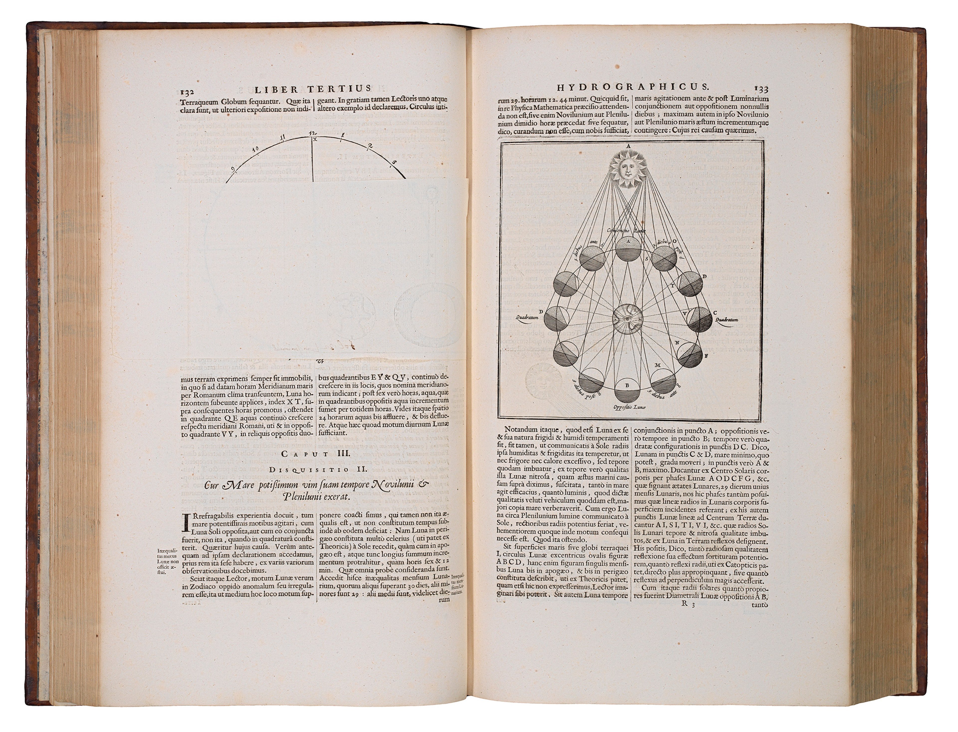
In 2024, the student group used two plates illustrating theories on underground water systems and volcanology from Athanasius Kircher’s 'Mundus Subterraneus' (1665). The students called their project ‘Staring into the Belly of the Earth with Kircher’.


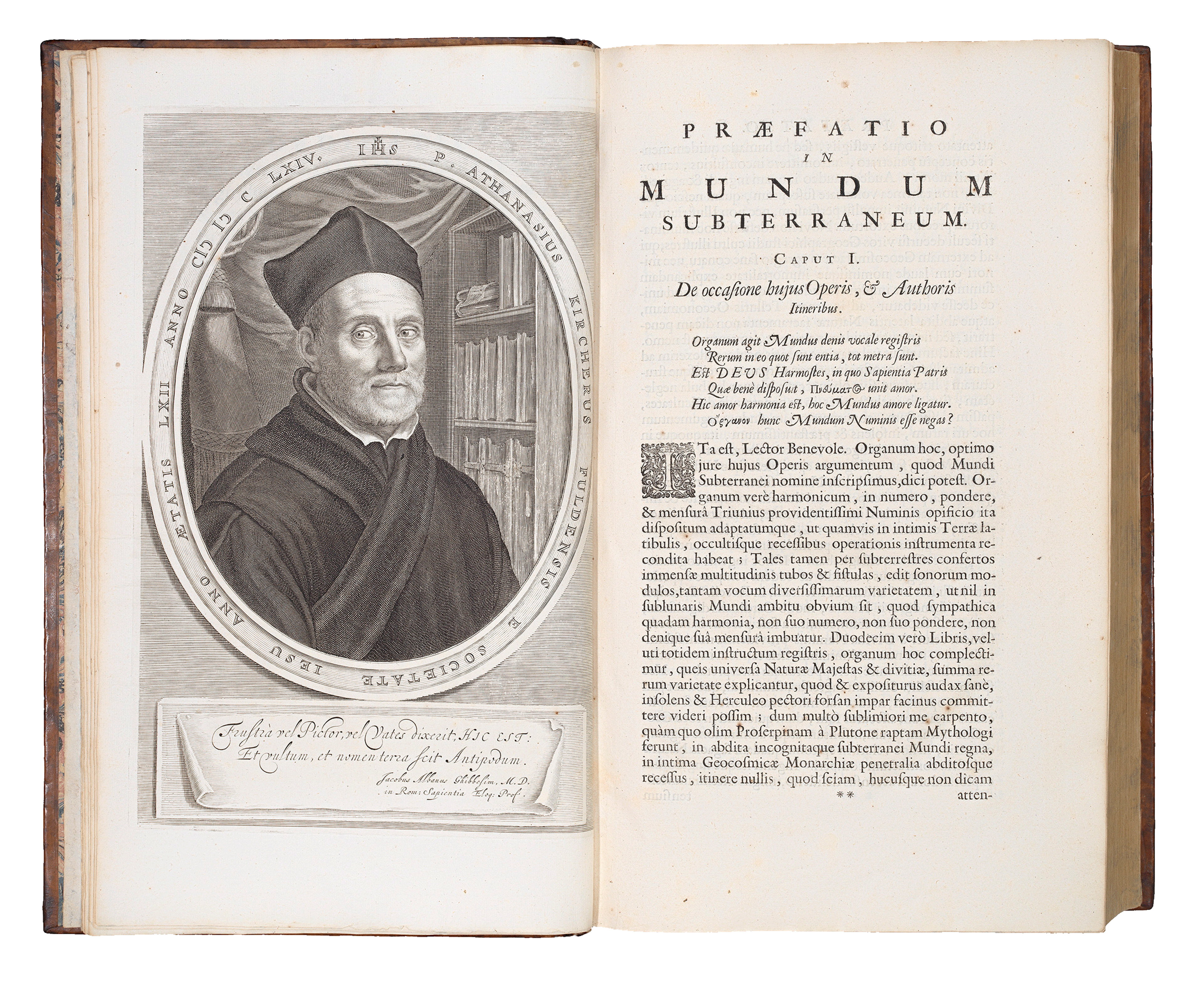
Portrait of Athanasius Kircher. Above, the two plates from his work used by students.
The students began by conducting research on the work of Jesuit priest and polymath Kircher, paying particular attention to his hypotheses on hydrology, volcanology, and astronomy. They also looked at the theologians and creators who had been influenced by Kircher, including sculptor Gian Lorenzo Bernini’s ‘Fountain of the Four Rivers’ (1651) in Rome, and author Jules Verne’s famous novel, ‘A Journey to the Centre of the Earth’ (1864).
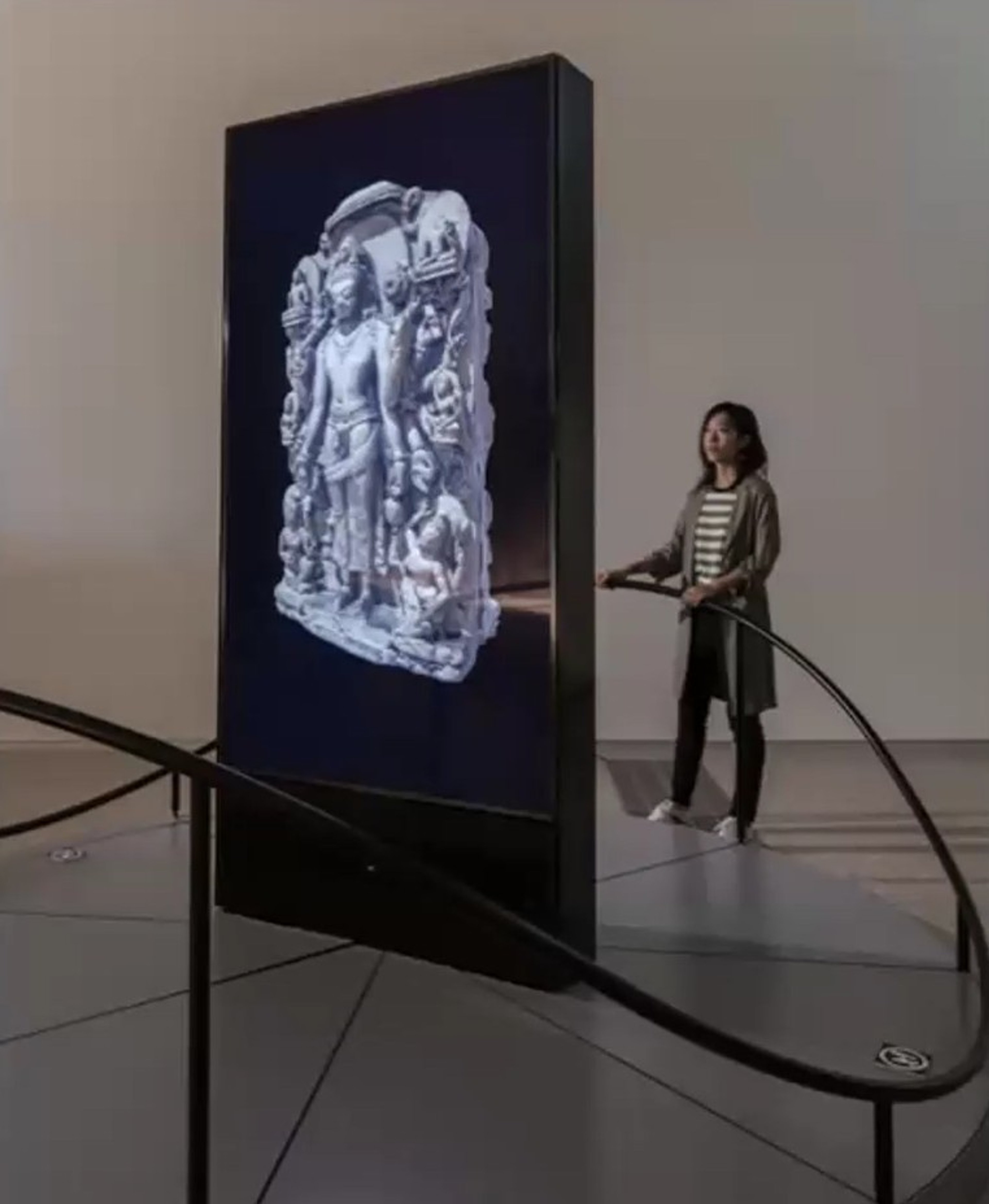
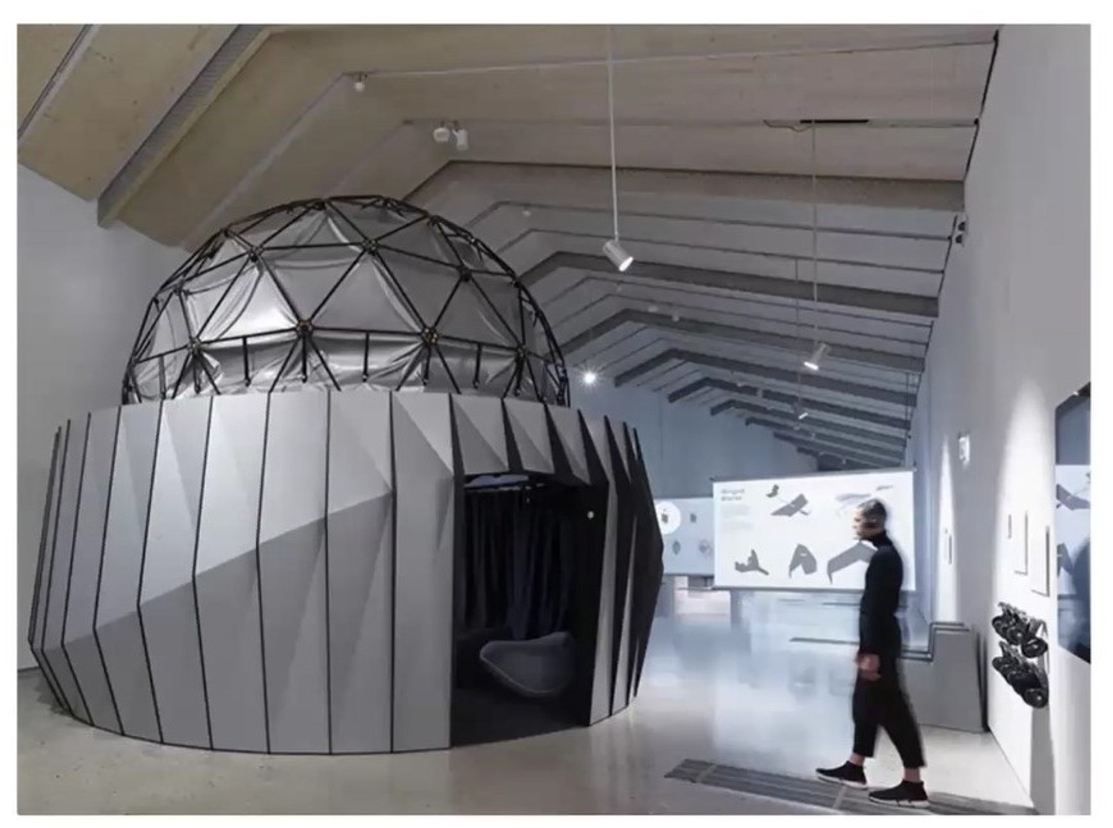
The Object Navigator © EPFL/eM+
The students selected the Object Navigator as their presentation device, to dynamically illustrate Kircher’s interconnected theories. The Navigator was developed by Prof. Sarah Kenderdine and her team at eM+. It features an interactive, high-resolution 85-inch LCD panel mounted onto a rotating platform that is turned by the viewer.
They then set about developing digital models of Kircher’s underground world using AI and software such as Blender and Adobe Substance, to illustrate how he believed subterranean fire and water behave. Below you can see an animated rendering of this model in the initial stages of development.
The digital models were accompanied by sound and animation to enhance the experience and immerse the user.

Animation for a 3D model of how Kircher imagined subterranean water and fire.
Staying true to Kircher’s theories and etchings, the team decided to use a stylised version of the original map for when the panel was static. This image would transition into an animated digital model when the panel was rotated by the viewer.
They were able to achieve this effect through frame interpolation, a technique which uses AI to generate new blending frames between existing ones in a video sequence.
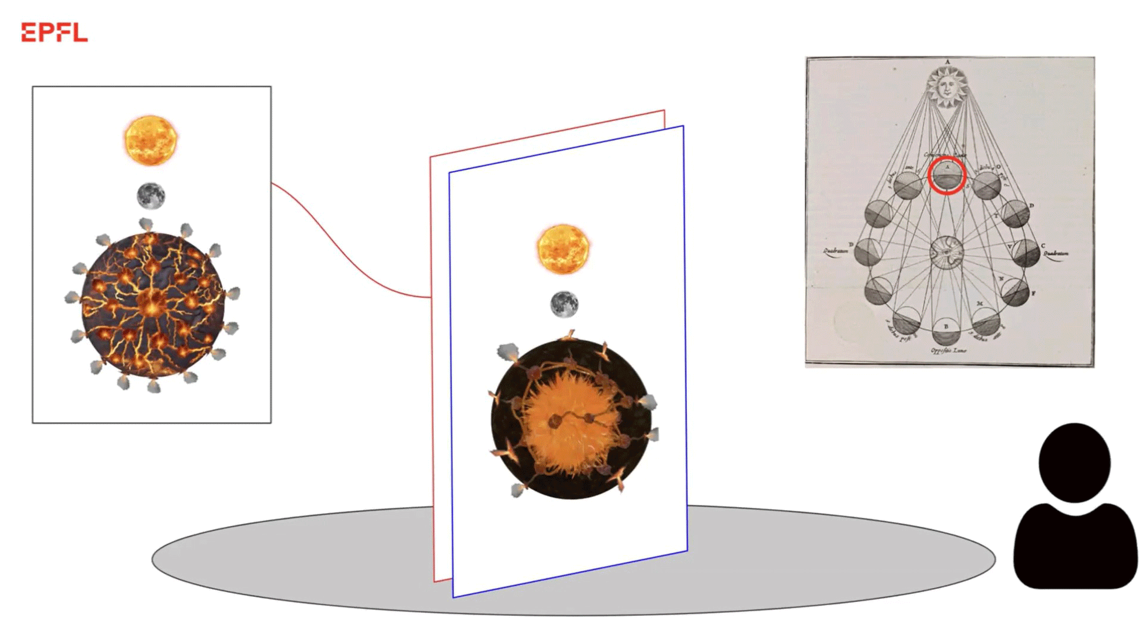
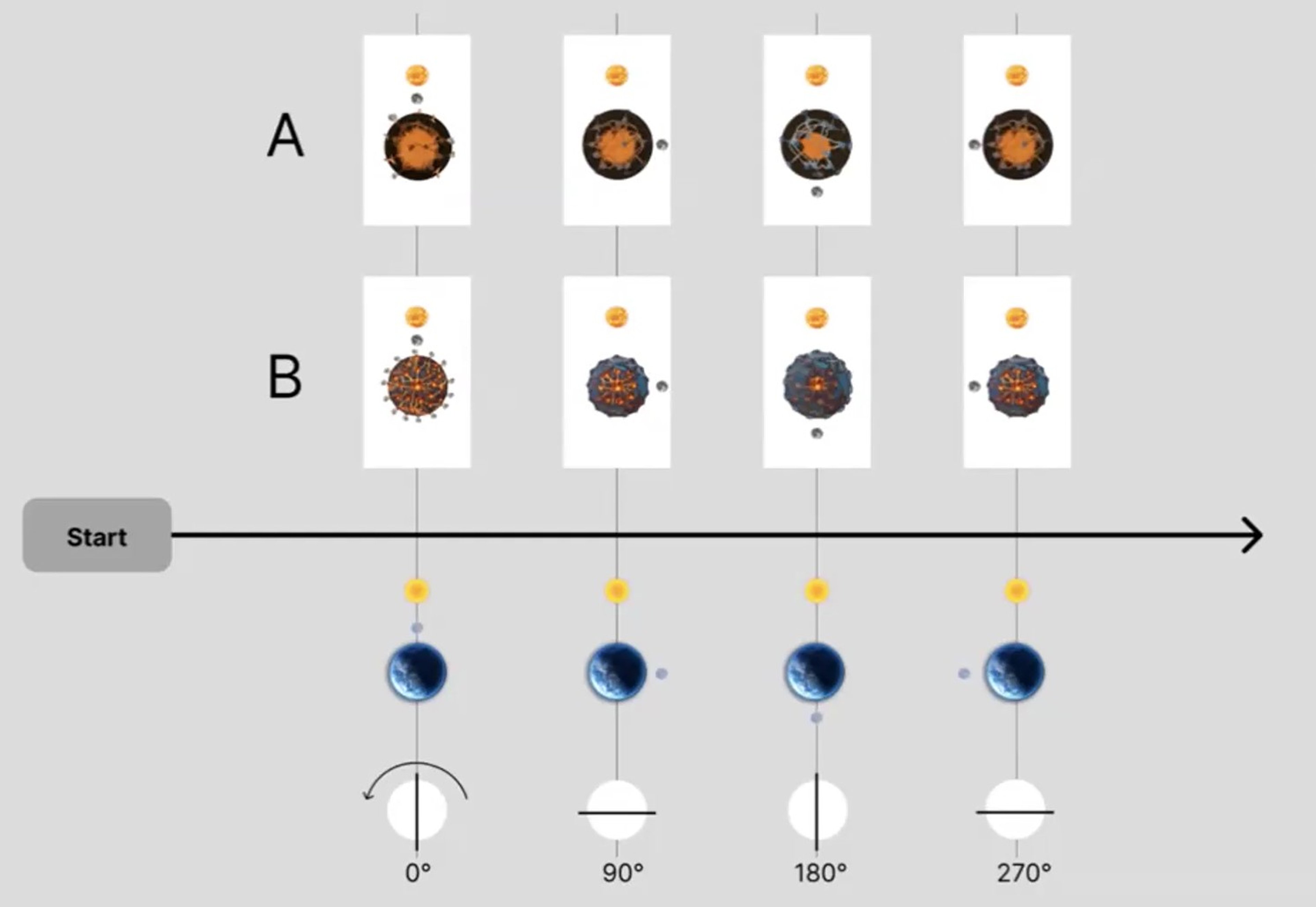
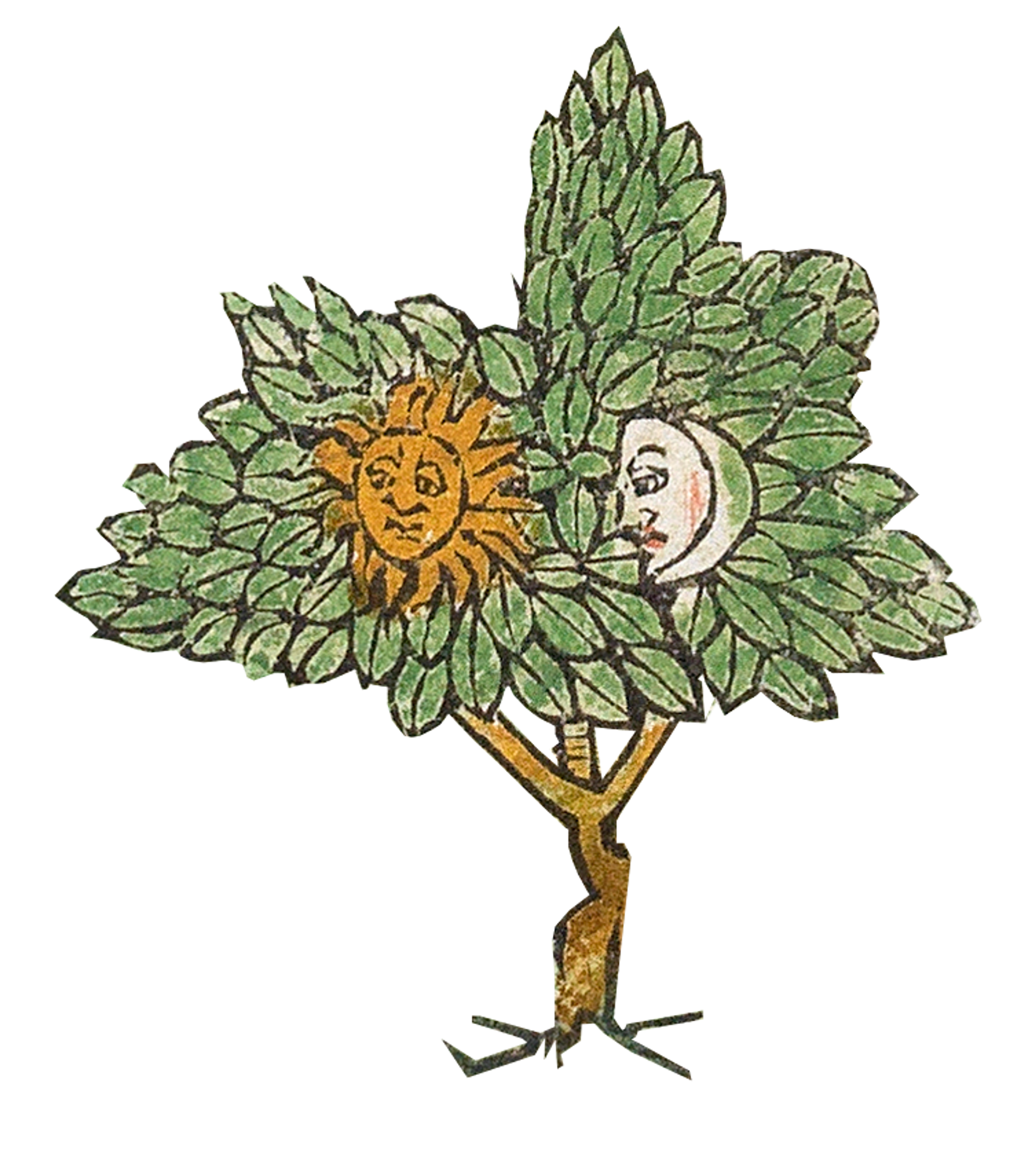
Sun and moon elements were carefully added to orbit the dynamic earth model as a variable, and illustrate the passage of time. This feature also brilliantly reflects Kircher's intertwining terrestrial and astronomical theories. Additional sound effects were added to pair with the intensity of volcano eruption visuals for a more immersive experience.
Kircher's theory of the movements of water and fire underground were depicted on opposing sides of the Navigator. As the viewer manually turns its rotating platform, their action would reveal animated fire-water dynamics theories paired with astronomical phenomena. This is illustrated in the diagram below and the animated technical drawing above.
©eM+
©The Sunderland Collection
While this installation was only built as digitally simulated prototype, one piece of feedback that the students received was that because the gamification element of their models is so strong, they may wish to consider adding more elements to increase viewer interaction, and lengthen the time that viewers are exposured to the original data sets. For example, they may wish to add further graphic devices alongside the sun and moon; or they could develop more animated segments to depict Kircher's other subterranean theories.
2025: An AI Adventure through the Rudimentum Novitiorum
The 'Rudimentum Novitiorum' is an important early European chronicle of the world that was published in 1475 by Lucas Brandis de Schass. In 2025, students transformed the world map from the Rudimentum into an immersive full-dome projection, with interactive historical highlights shown in video format using AI.
The world map in the Rudimentum was reissued in 1491 in the Mer des Hystories. This additional map example was provided as part of the dataset.


The world map from the Rudimentum Novitiorum (1475) and its re-issue in the Mer des Hystoires (1491) ©The Sunderland Collection
The Cupola at eM+, a 4.5m diameter wide, 6m tall space which has 4K full-dome projection capability. © EPFL/eM+
This project started with in-depth research into medieval mappamundi and T-O maps. The students were particularly inspired by the circular world map found in the Rudimentum, which resembles a cupola. They decided that this map was perfectly suited to a full-dome projection installation. The viewer could then be completely immersed in visuals and sounds, with an interactive element, much like an enhanced planetarium experience.
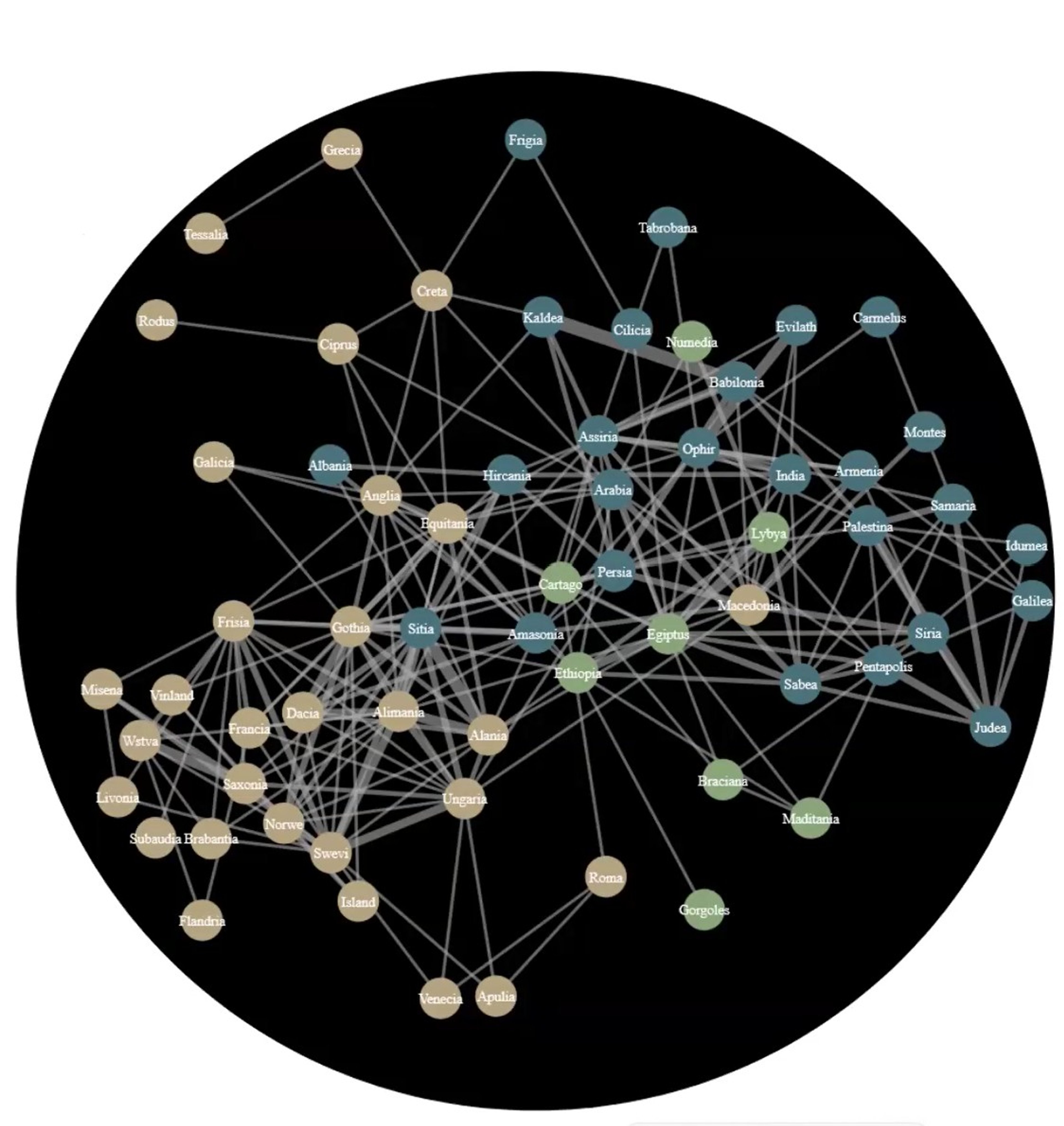
The students extracted text and images from the Rudimentum, which they used as subsets for their work. They then applied AI in combination with Optical Character Recognition (OCR) and Named-Entity Recognition (NER) to convert the printed text in images of the Rudimentum into editable text, after which they were translated from Latin to English.
This network diagram shows how the dataset began to look. It uses nodes to connect geographical regions and pair it with the information provided in the text, forming what the students called a ‘network of ideas’. The data was manually checked to ensure that no biases were introduced from the modern world. The visual expression of the dataset, with its labels and interconnecting lines, could then be used by viewers as a 'menu' in the full-dome experience.
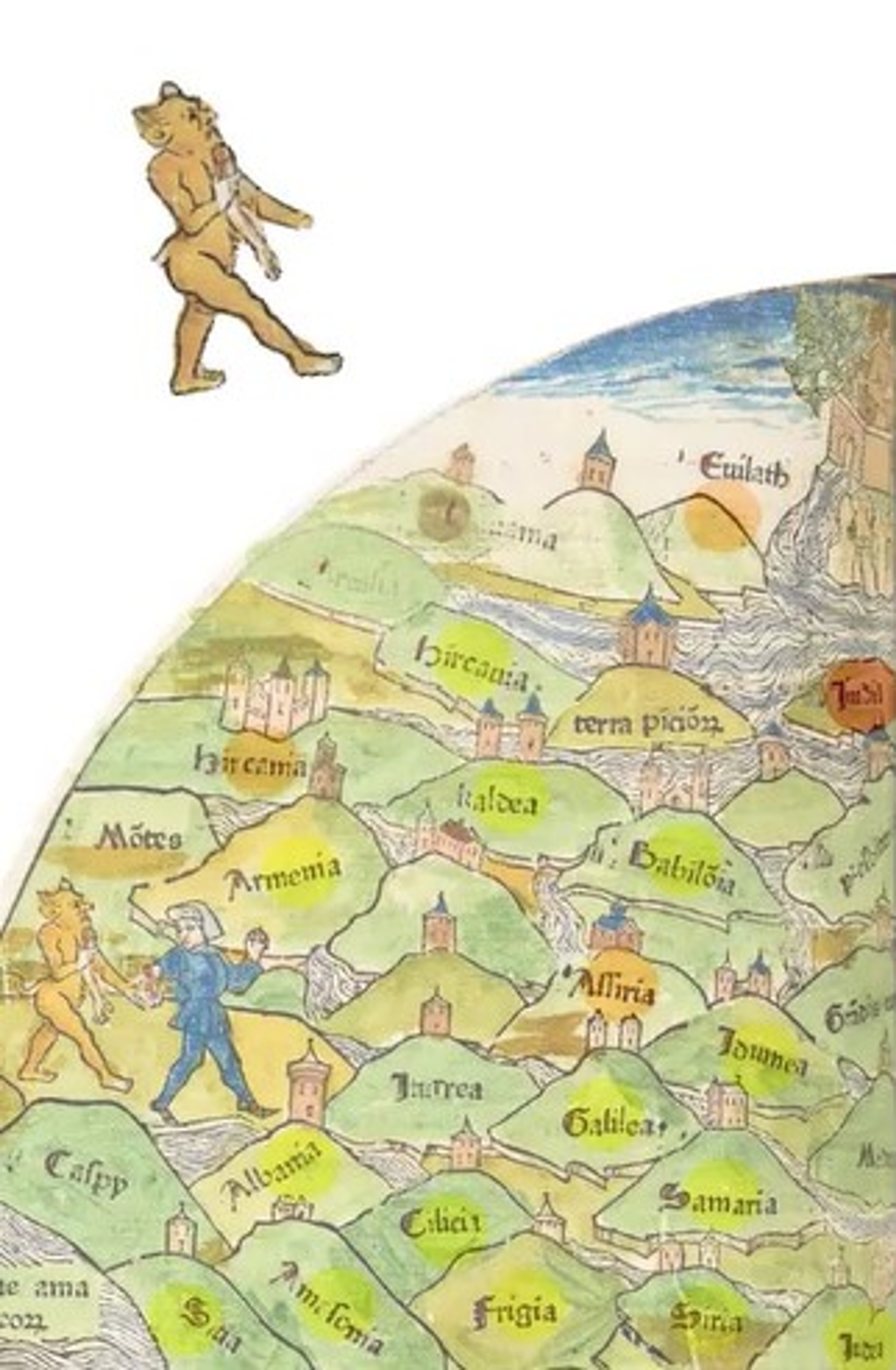
A physical wayfinding figurine - the devil from the Rudimentum world map - was created to help the viewer navigate around the physical map within the projection space.
The content created for the videos was generated using AI applications such as Sora and Elevenlabs. These were paired with a manually written script based directly on the description of the world provided in the Rudimentum.
The prototype created by the students anticipates that viewers would move through the experience by selecting nodes from the dataset menu. On selecting a node (such as a place), the viewer would then see a video and hear text and other sounds, describing that place in the Rudimentum world map using information from the book's text. Cleverly, when a video ends, the neighbouring regions to the node that was selected are left visible, in order to encourage the viewer to continue their journey onwards.
Here is an animated visualisation of the behind-the-scenes functionality of the programme:
The students tested the functionality using VR simulations in Meta Quest. Here is a brilliant visual VR-testing a real world scenario of using the physical character on the physical map, which launches the videos within the full-dome projection environment.

Here is a test animation of the full-dome experience, in which the viewer uses the wayfinder character to select a place on the map, thereby launching a video in the dome projection.
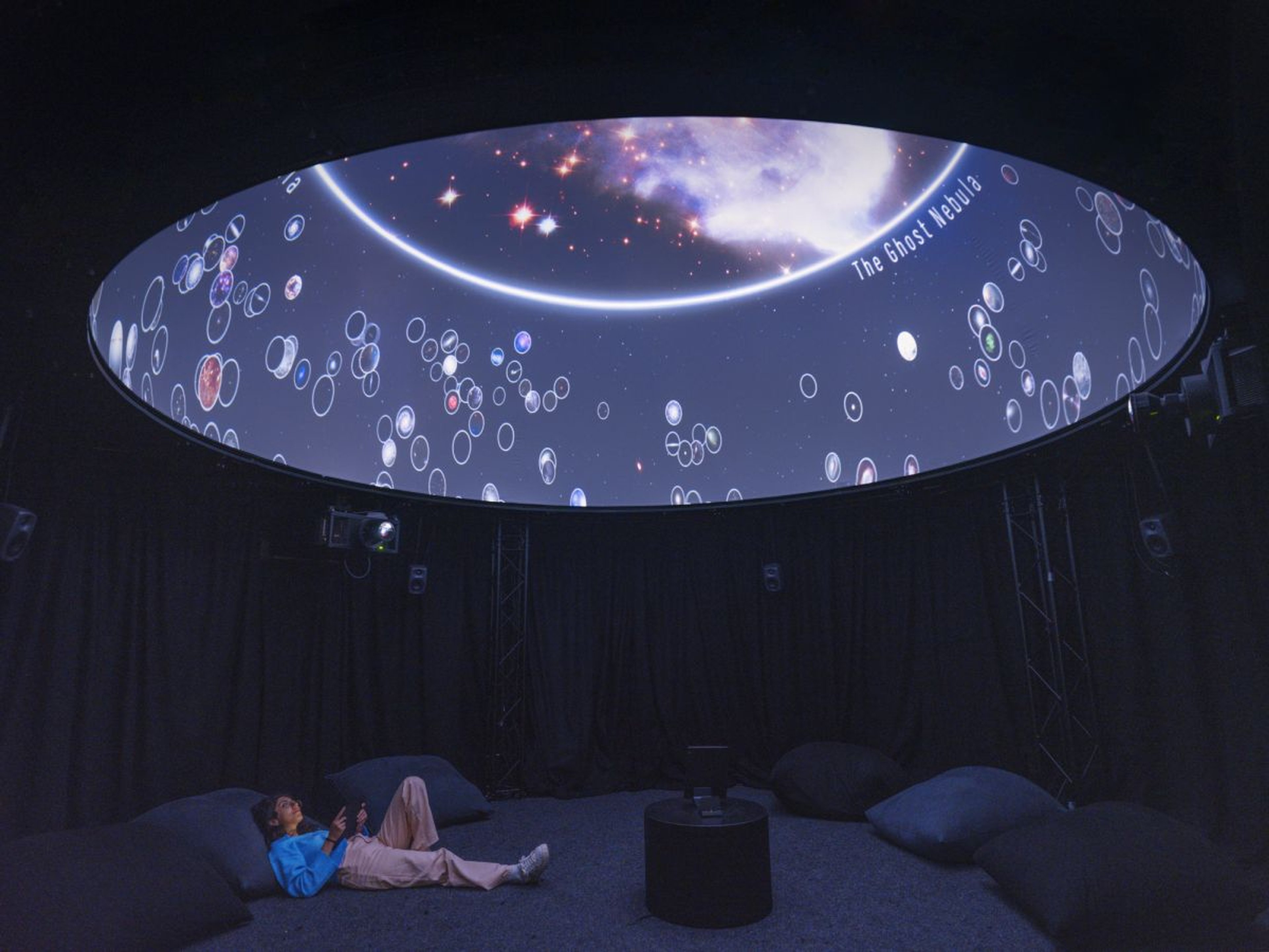
Interactive cupola (full-dome) in the exhibition Cosmic Collisions (2022) © eM+. Photo by Julien Gremaud.
This protype is based on a working model of a full-dome projection, and uses existing technology with custom interfaces developed and programmed by Professor Sarah Kenderdine and her team at eM+.
This interactive cupola was deployed in Cosmic Collisions, an astronomical collaboration with EPFL's Laboratory of Astrophysics (LASTRO); and in the award-winning travelling exhibition Songlines: Tracking the Seven Sisters that originated at the National Museum of Australia.
The Sunderland Collection is honoured to partner with eM+ and wishes to thank the brilliant Prof. Sarah Kenderdine for inviting us to submit data sets for her classes. We are inspired by the next generation of digital humanities innovators, and looking forward to seeing what they create next!
To find out more about Prof. Kenderdine's work, watch her presentation at 'Maps Are Too Exciting! Digital innovations in mapping", a Sunderland Collection Symposium held in October 2024 at the Bodleian Library.
All images courtesy of EPFL / eM+ and The Sunderland Collection.