The Instruments behind Impossible Measures
The Sunderland Collection Art Programme
Introduction to Impossible Measures
Kristina Chan's participation in the Sunderland Collection Art Programme lead to the body of work Habitable Climes - and thereby to the vast collections held in the Royal Geographical Society Archives.
The RGS is home to over two million maps, instruments, photographs, and artefacts spanning over 500 years of exploration.
Below, we introduce the fascinating historical instruments from the Archives that were referenced by Kristina in her work, and originally used by European explorers as they travelled the globe.
©Wai Wong
The Collaboration with the Royal Geographical Society
Thanks to the generosity and assistance of the Cartographic Collections Manager Dr. Katie Parker and her team, Kristina was able to examine in person the scientific and navigational instruments that measured some of European history’s most celebrated ‘discoveries’, along with photographic slides taken during these expeditions.
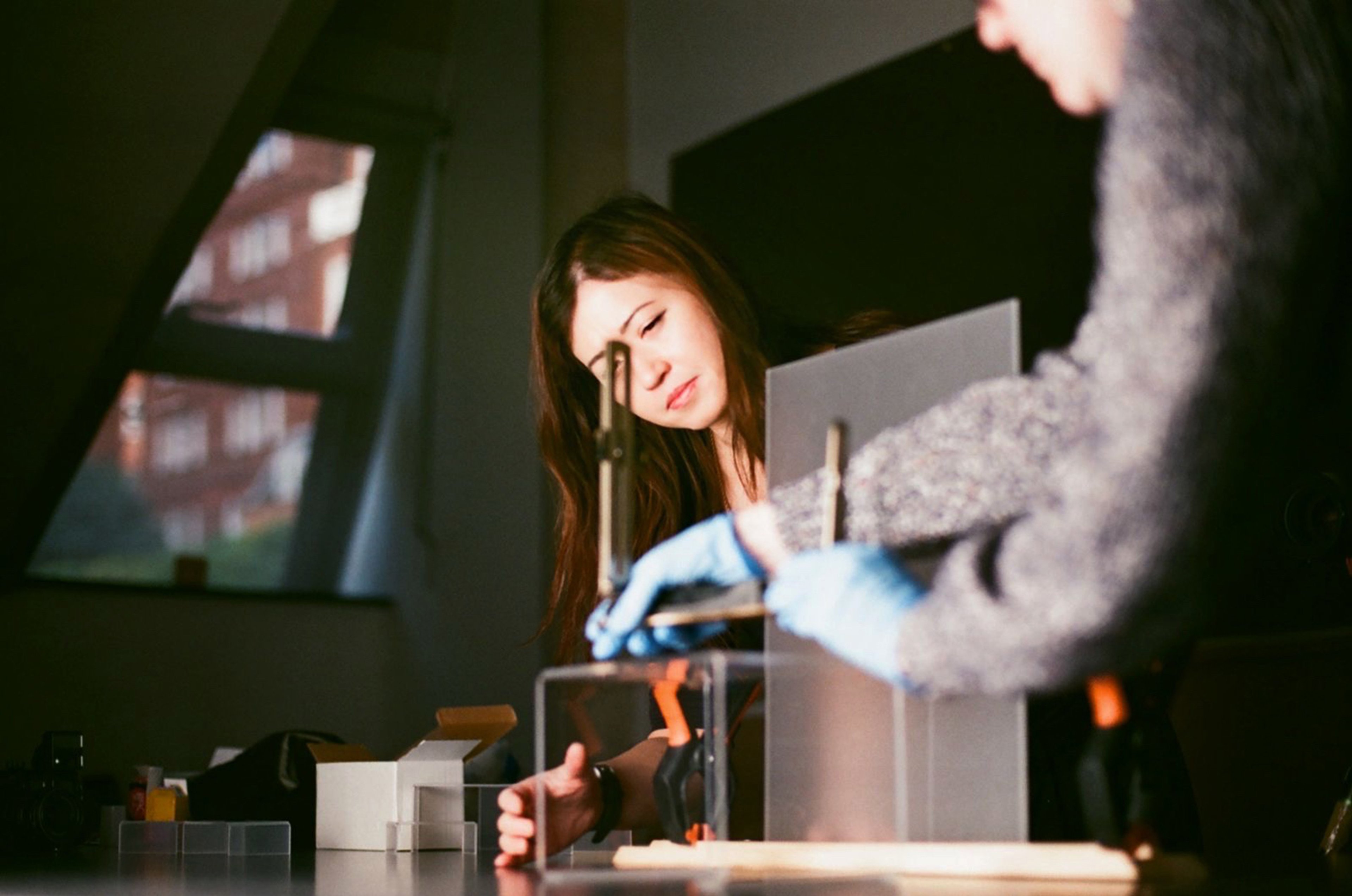
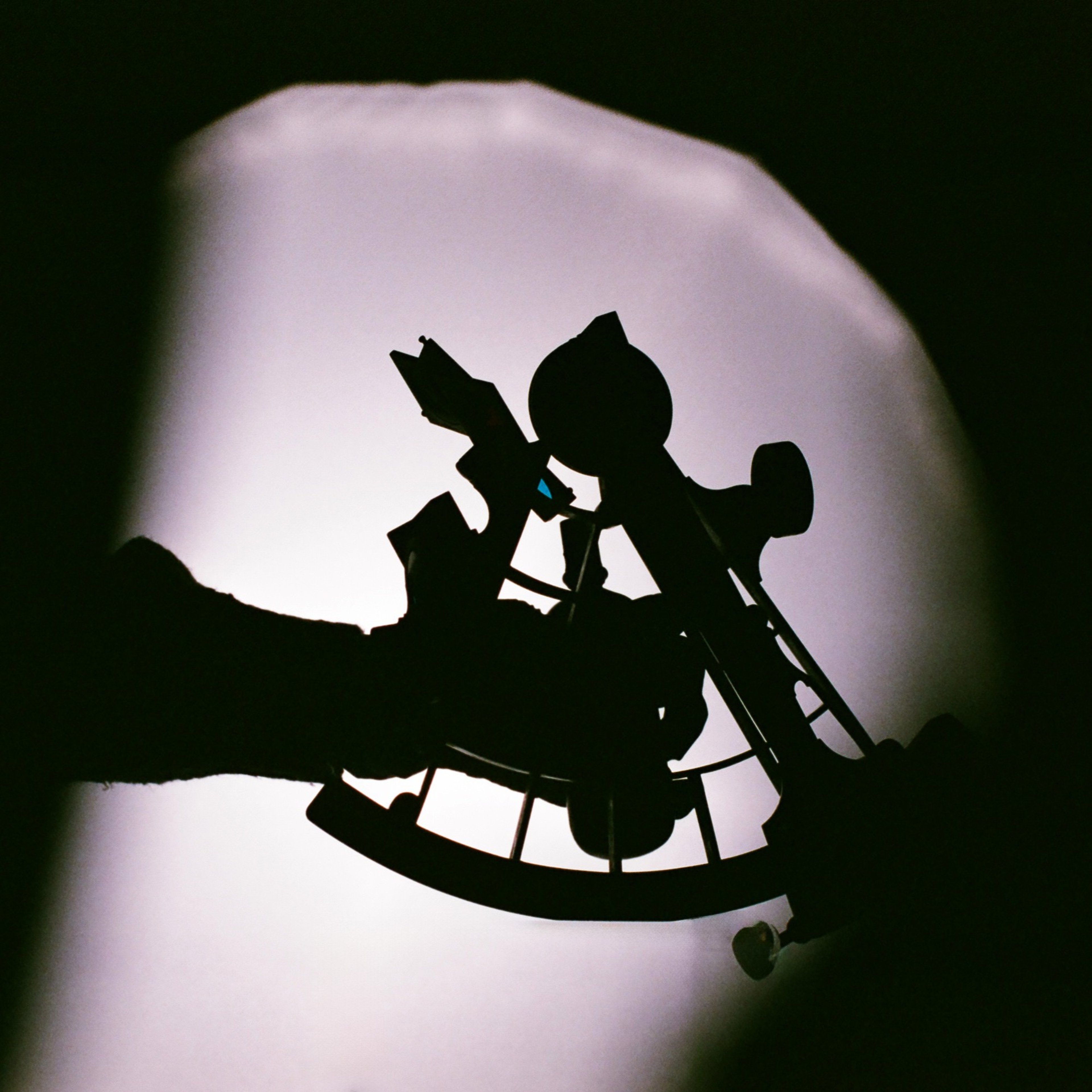
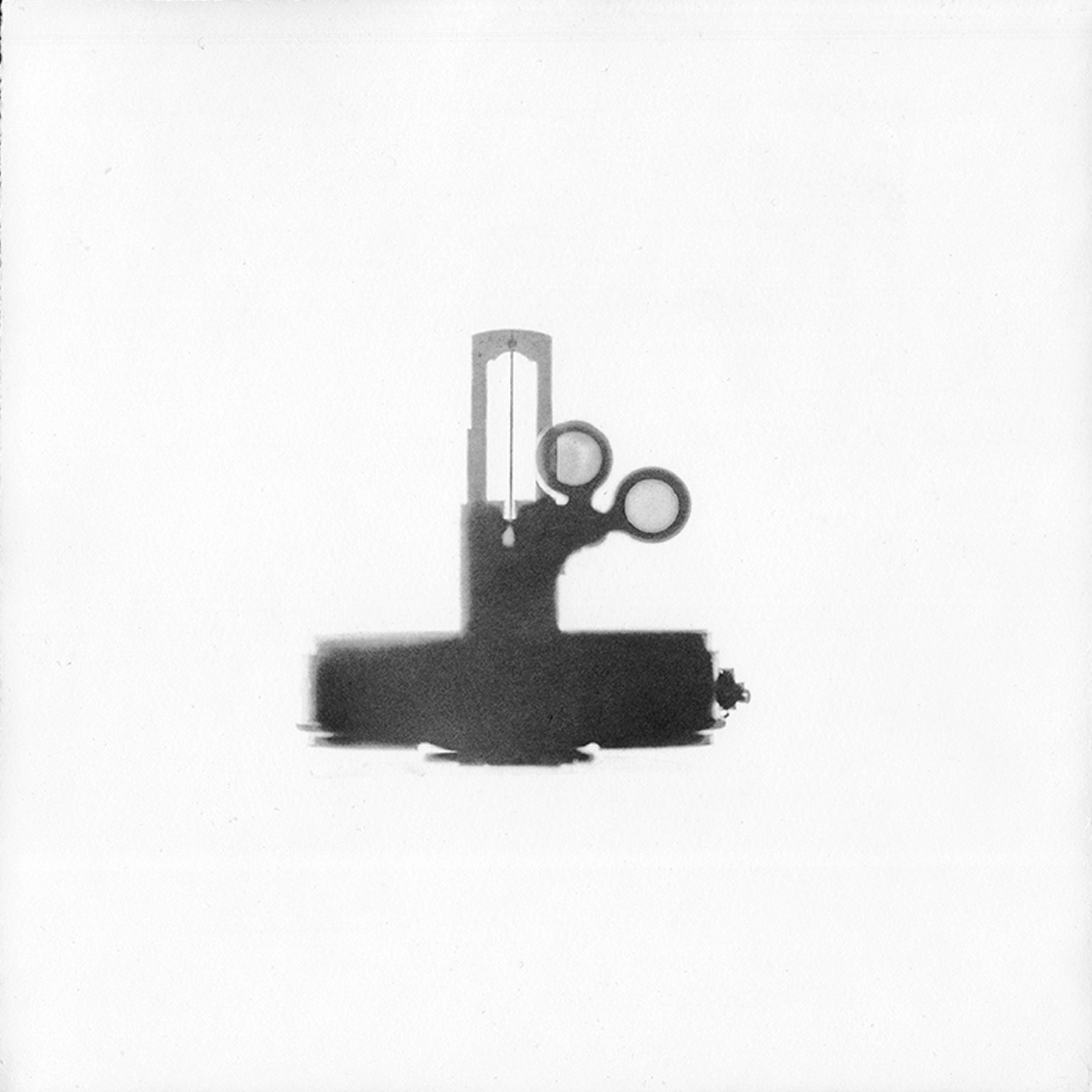
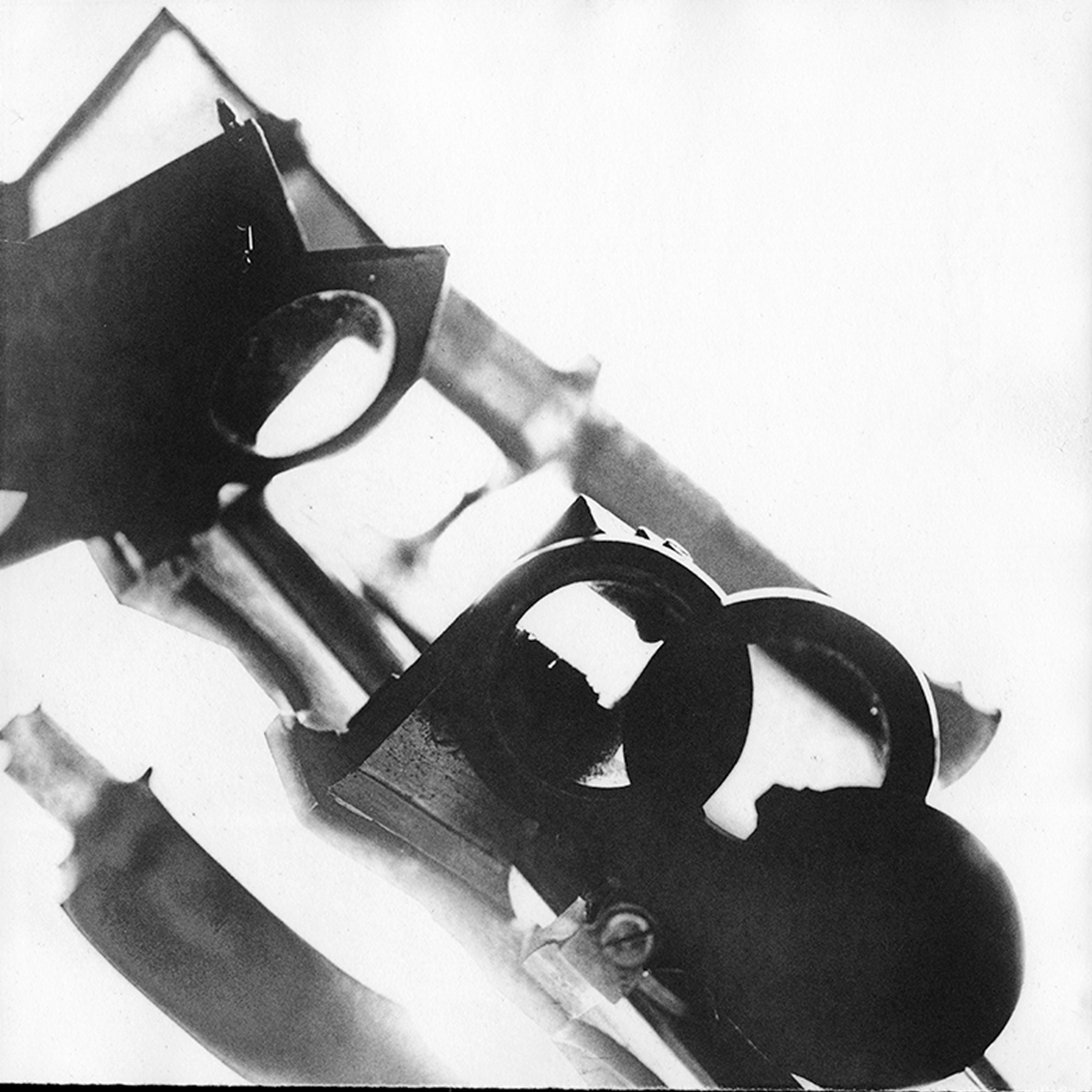
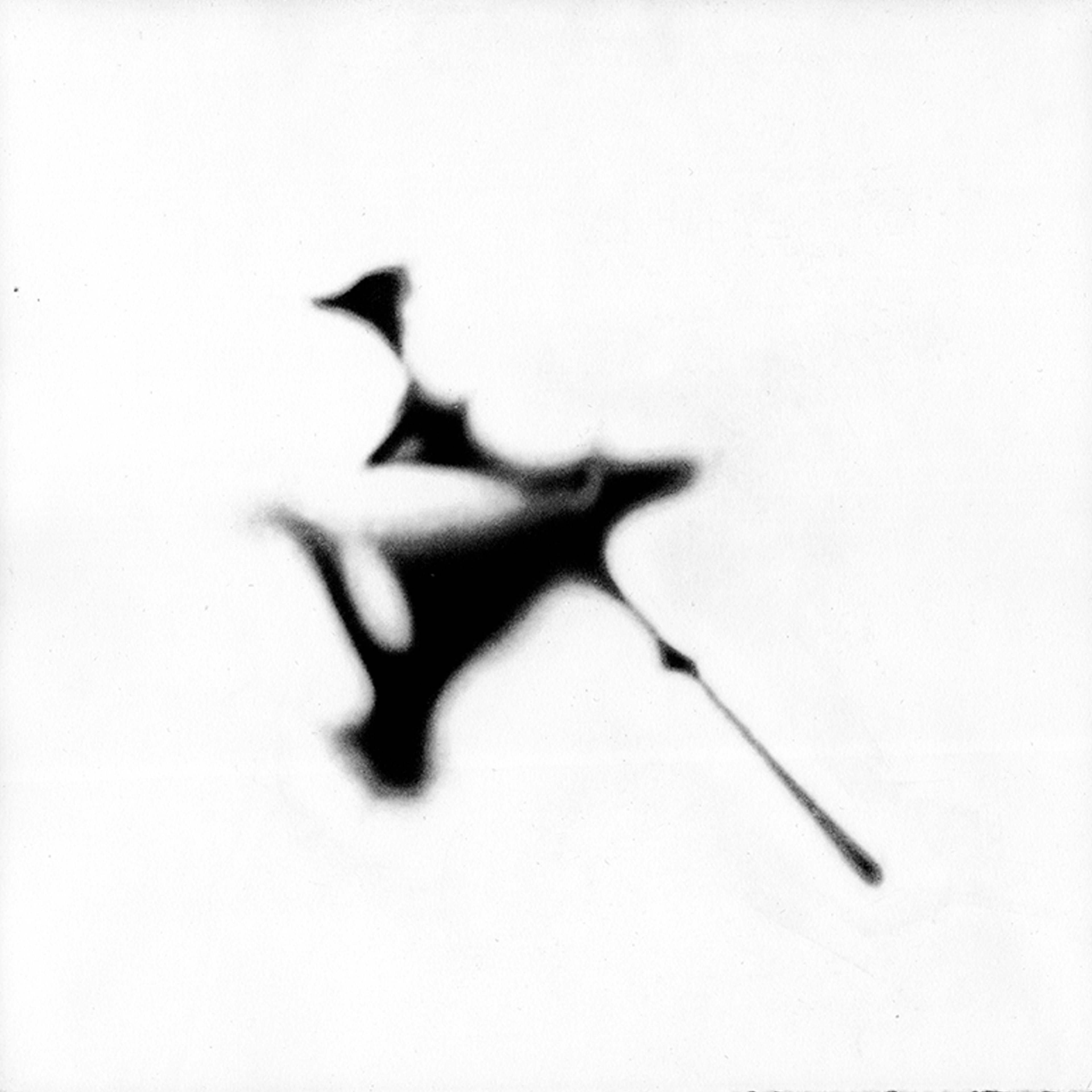
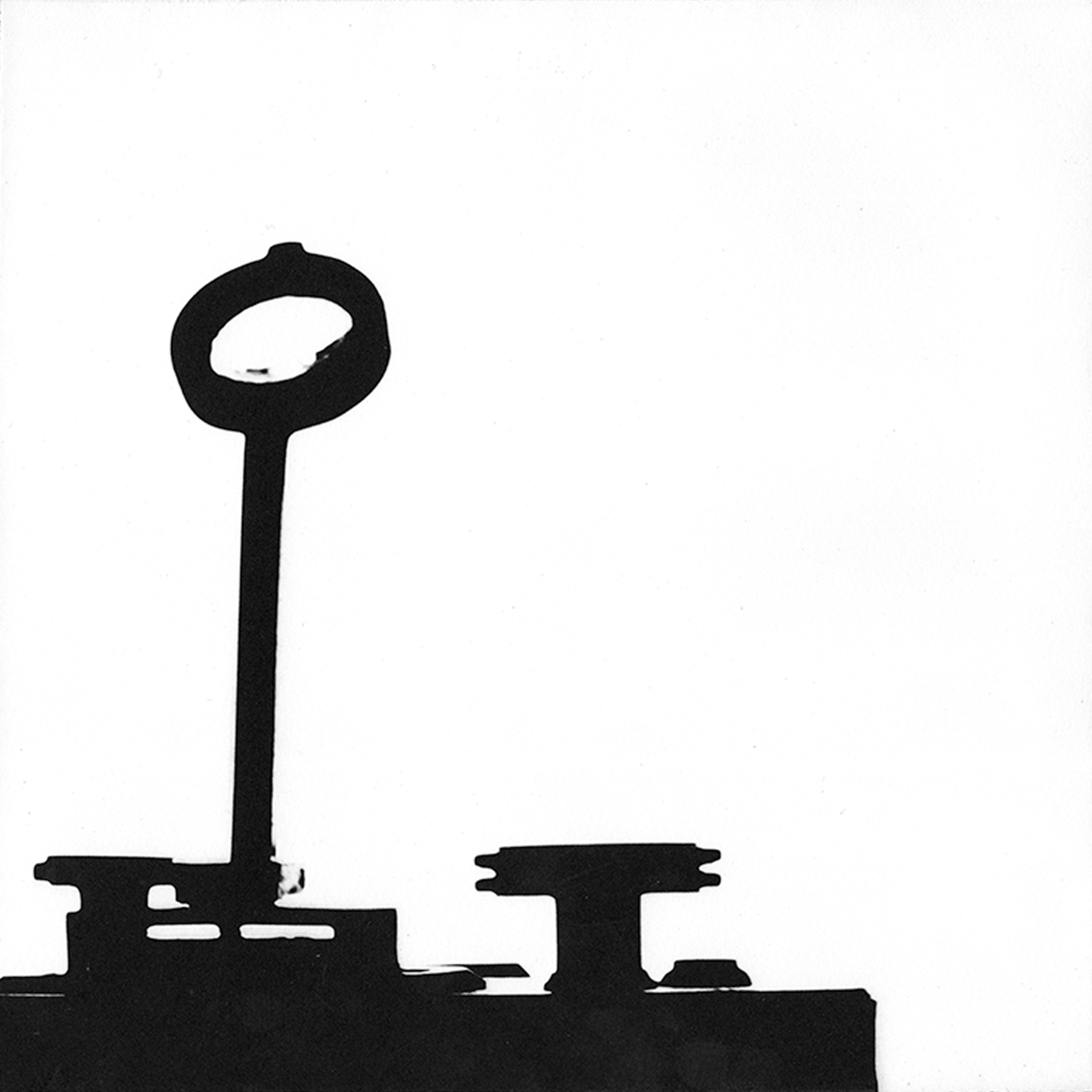
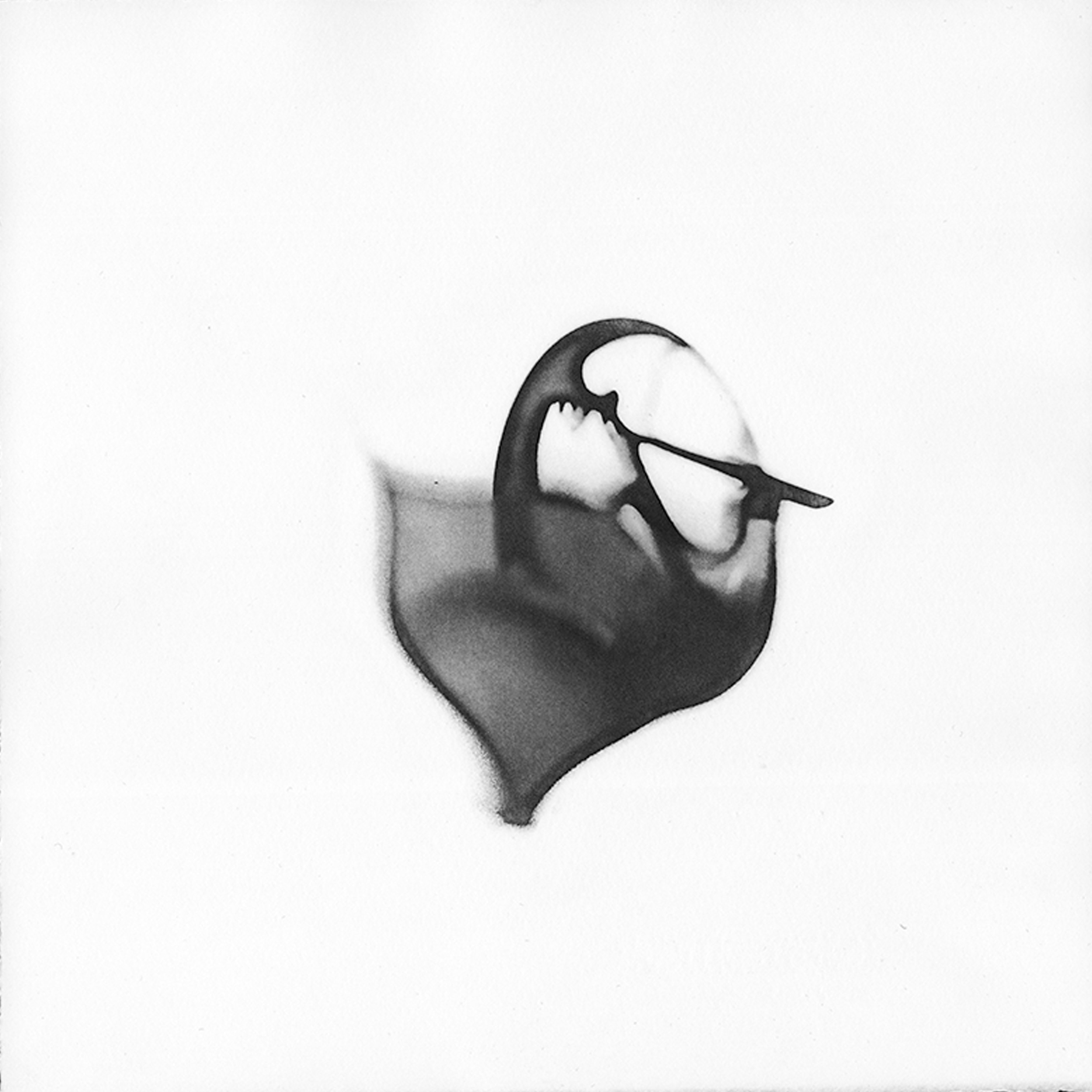
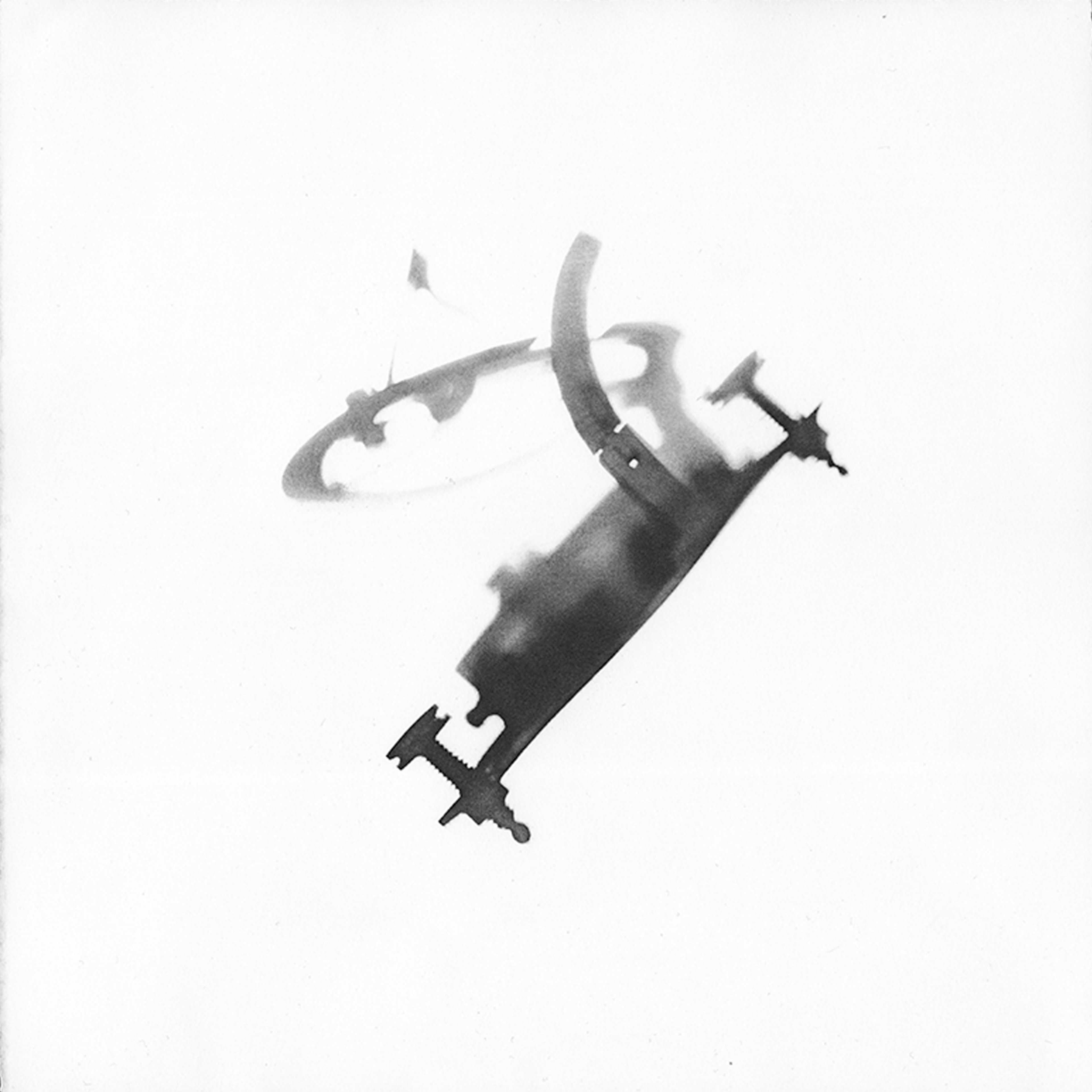
For the resulting series of artworks ‘Impossible Measures’, Kristina photographed a selection of historical instruments from the RGS through frosted glass, fully or partially obscuring them from view.
Impossible Measures (2025), Series of 16 etchings on Somerset satin white 300gsm, each 25 x 25 cm. Edition of 10. Sold separately.
In these 16 delicate, hand-printed studies, Kristina created a mix of soft silhouettes and considered moments of clarity, to pique the curiosity of the viewer and show off the intricacy of these innovative instruments.
The visual abstraction playfully suggests how the accuracy and meaning that these once important measuring tools have blurred over time, and perhaps how they were never that ‘truthful’ to begin with.
During a panel discussion with Kristina as part of Habitable Climes, Katie talked about her involvement in the process:
I think what I particularly love about this series of instruments is that you get some of the cloudiness that is involved in actually using those instruments: You have to know how to use them - they have to work - they can’t be broken - the climate has to be just perfect ... On the heritage side of things, [they] get collected through these sometimes very murky pathways that modern heritage professionals are still grappling with.
©Wai Wong
As Katie states, most of the historical figures linked to these artefacts are simultaneously celebrated for their accomplishments or ‘discoveries’, and denounced for their exploitative imperialist behaviours.
It is crucial to mention that the stories attached to these collection items omit the histories of those people without whom the expeditions would not have been possible, or whose lives would have been greatly impacted or marginalised as a result of their happening. They include local guides and indigenous communities.
The highlighted and hidden histories of each of objects in the Impossible Measures are intended to spark enquiry and stimulate discussion.
In her artist statement, Kristina said:
It is an exhibition that responds to a history of human ingenuity and curiosity, an era of scientific innovation, mathematical prowess, and cartographic evolution. It is a history of imposed borders, oversimplification and greed. It is a history of playful games of spinning globes and far off lands, of imagination and wanderlust. It is an exhibition of how we choose to see the world, its faults and wonder and their inherent co-existing contradictions.
The RGS Instruments
Let’s take a closer look at these instruments, learn about some of their past owners and the expeditions they were involved in.
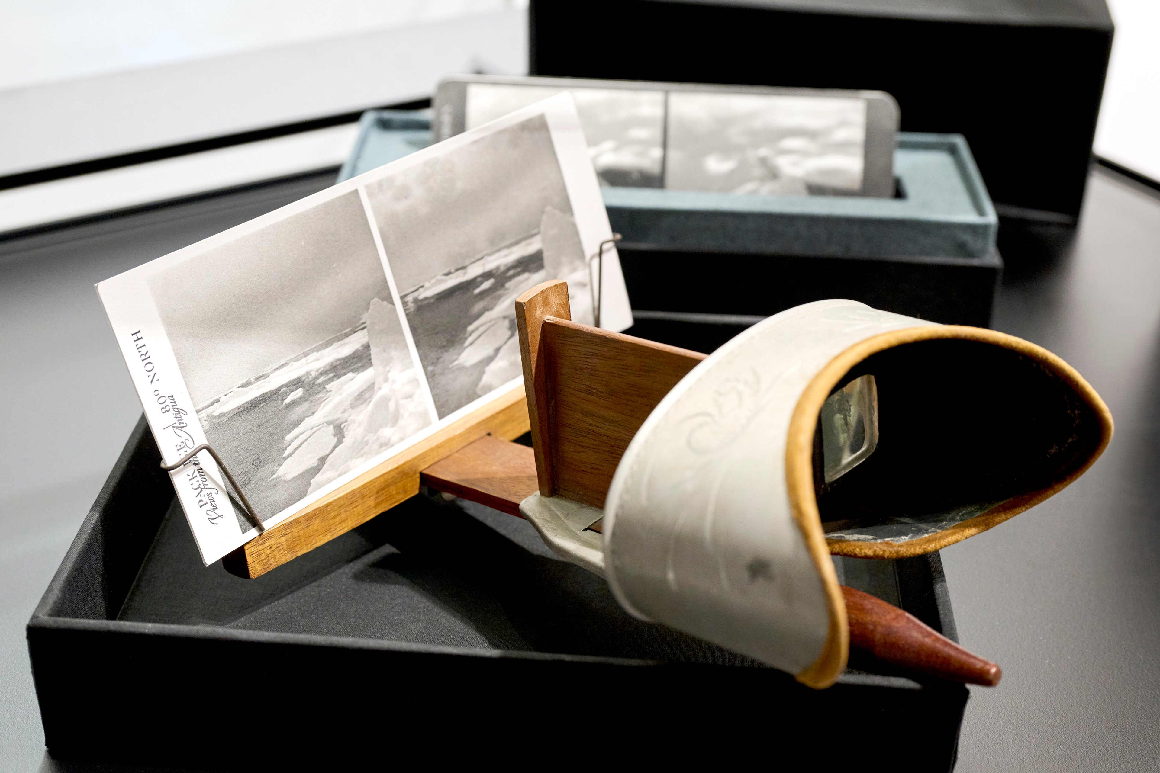
Stereoscope Viewfinder
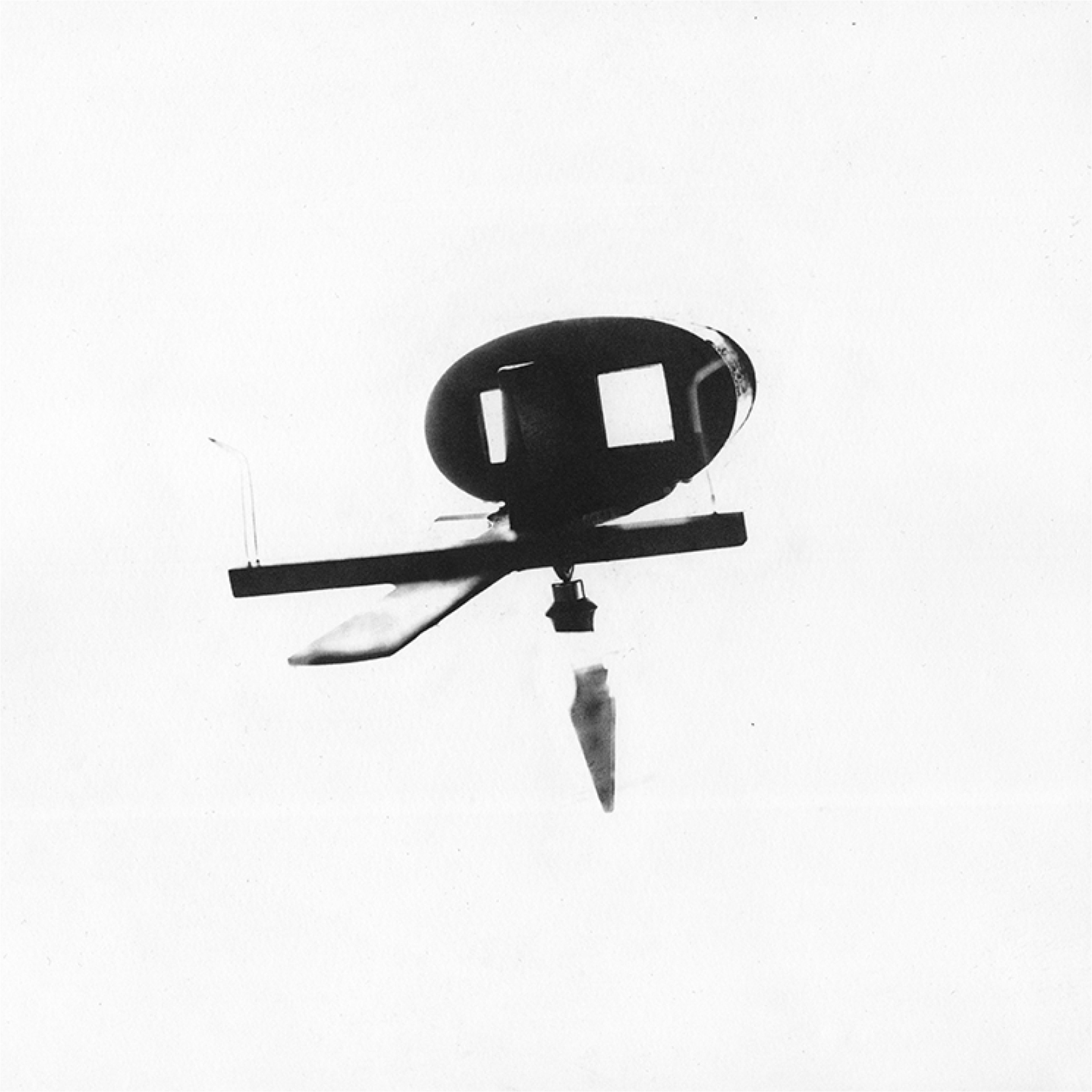
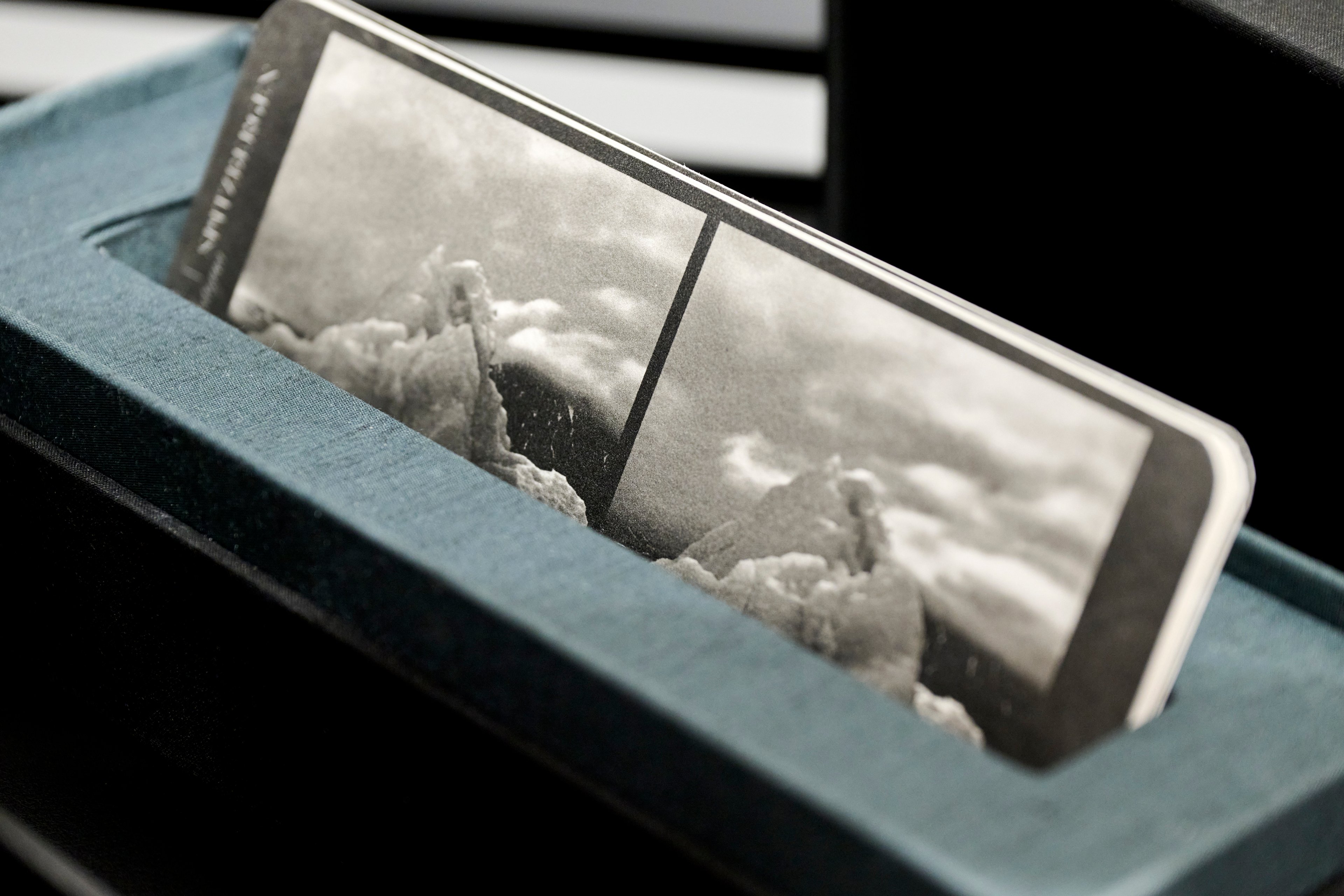
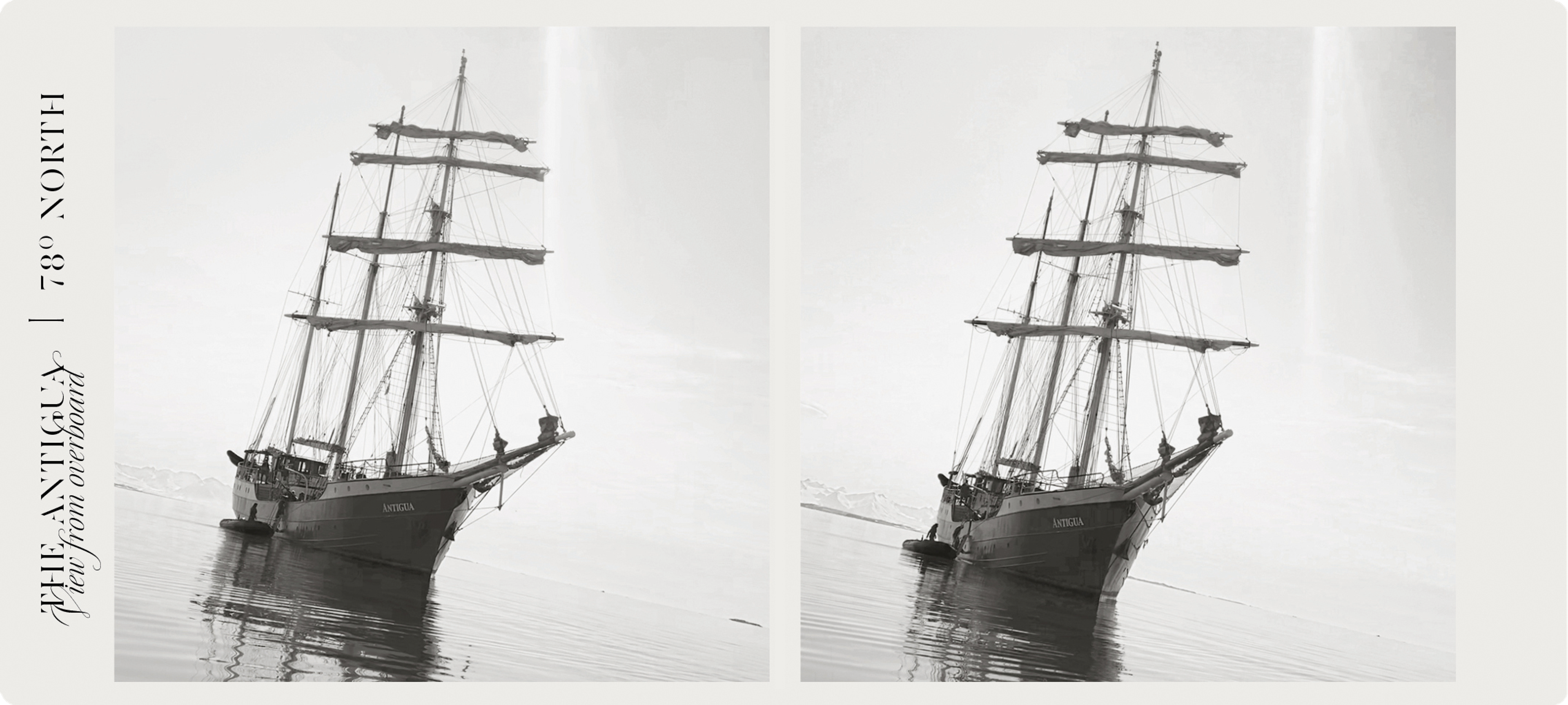
This is a handheld Perfectoscope Stereoscope. It creates a three-dimensional image by using binocular vision when viewing a photographic stereoscopic card - just like those in Kristina’s View Finding series.
A photographic stereoscope card featuring two near-identical images is placed at the end of the device. The viewer looks at the images in parallel through prismatic lenses and the brain is tricked into seeing them as a single three-dimensional image.
Stereoscope and View Finding works by Kristina Chan
©Kristof Jeney
Stereo-viewers were invented in 1832 by English physicist Sir Charles Wheatstone (1802-1875). With the increasing accessibility of making and sharing of photographic images, stereoscopes became a major form of entertainment in the late-19th and early-20th century.
This particular style of handheld stereoscope, known as a Perfectoscope, was invented circa 1861 by American physician, polymath and poet Oliver Wendell Holmes Sr. (1809-1894). Holmes deliberately did not patent his invention in order to make it more available.
The Perfectoscope held in the RGS archives was made and patented by New York firm Underwood & Underwood in around 1895 [RGSK259523]. Underwood were also major producers of stereoscope cards, like this one (below) made by Kristina as part of the View Finding series. You can see more from this series in the Habitable Climes Online Exhibition.
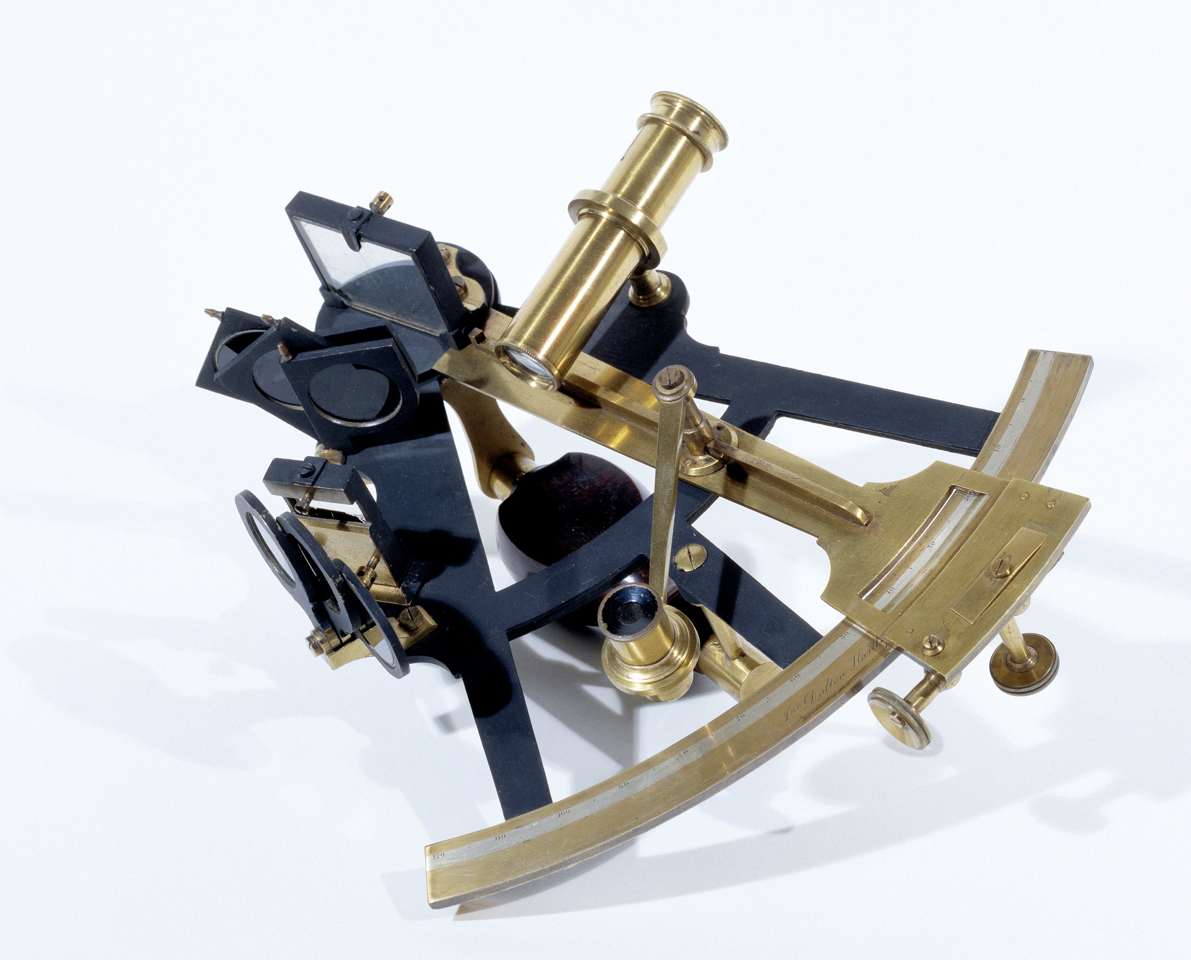
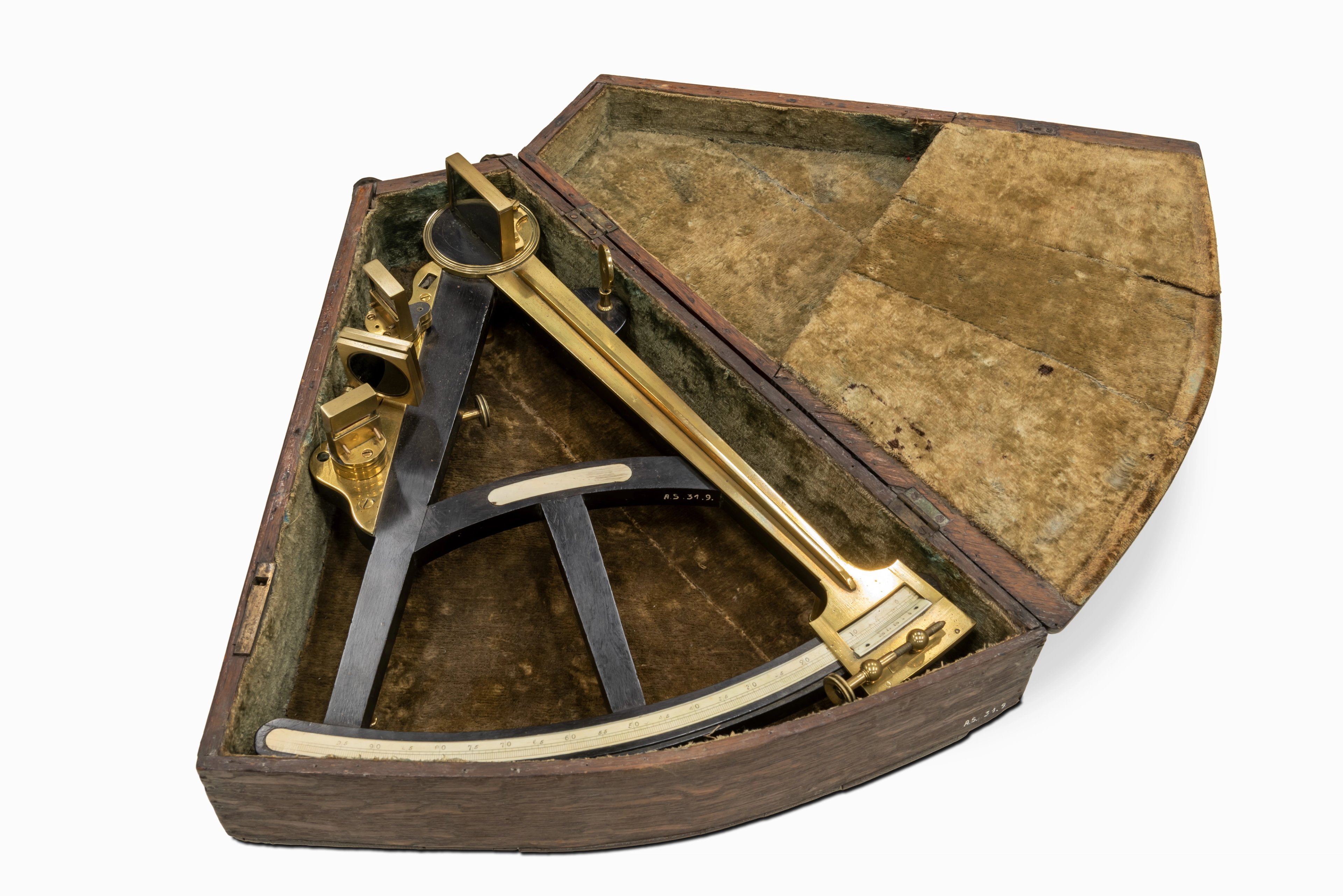
Hadley's Quadrant
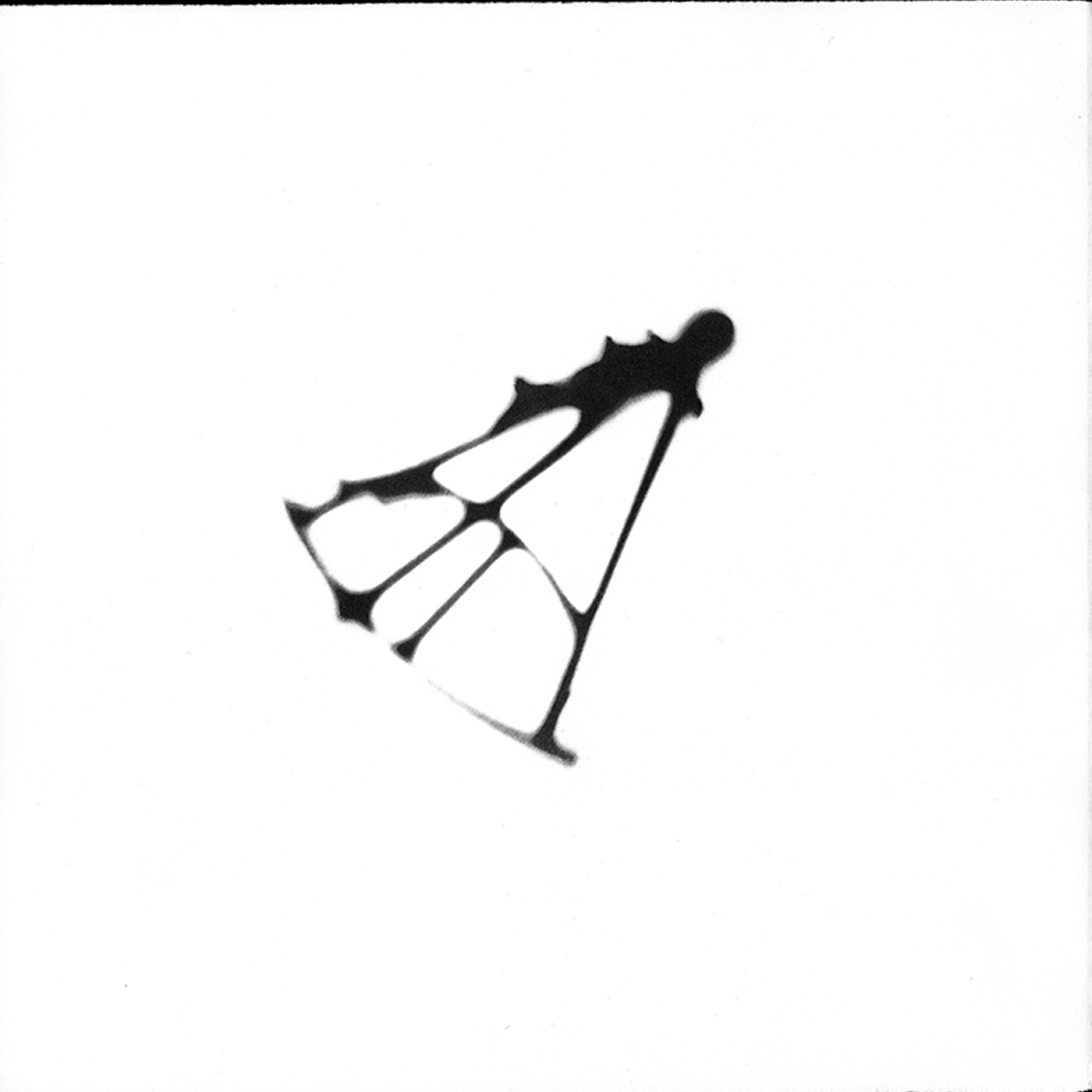
This is Hadley's Quadrant - more formally but less commonly known as an Octant. It is a hand-held instrument that was used to identify a vessel's latitudinal position when at sea.
The example from the RGS collection used for this artwork is dated to circa 1800 [RGS700703]. Below, you can see an example of an octant from a similar period which is held in the heritage institutional collections of Antwerp
©Collectie Stad Antwerpen, MAS. CC0
This device was invented by English mathematician John Hadley in 1731. It was quickly adopted by the British Admiralty due to its remarkable accuracy to within a few nautical miles!
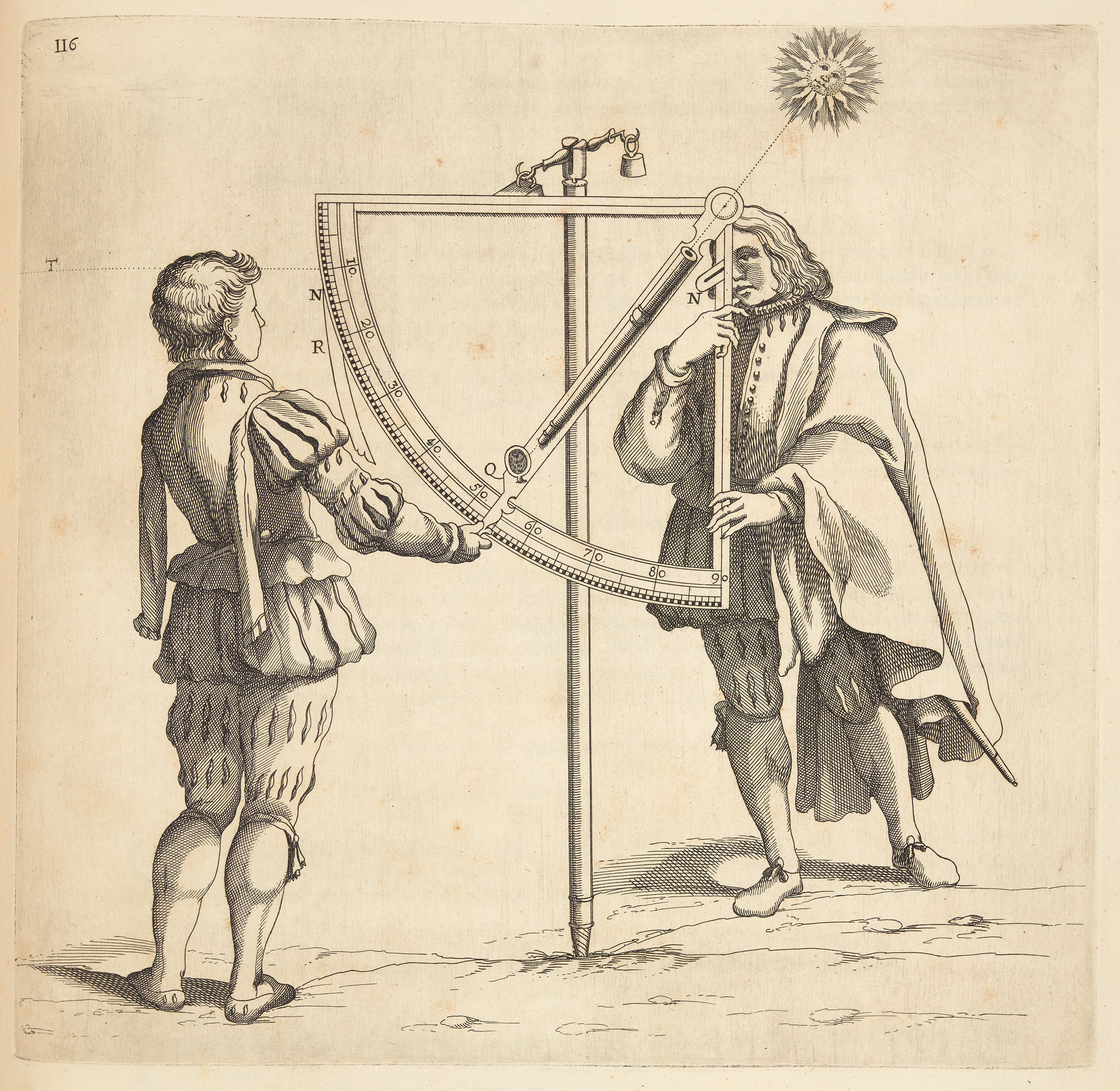
The octant would be used to align and measure the height of the sun or another celestial object from the sighted horizon. They were named ‘octant’ because of the 45° arc of the instrument - which is an eighth of a circle. You can watch a demonstration of how this device works at the History of Science Museum, Oxford Collections resources.
An illustration from Robert Dudley’s Dell’Arcano del Mare (1647) ©The Sunderland Collection.
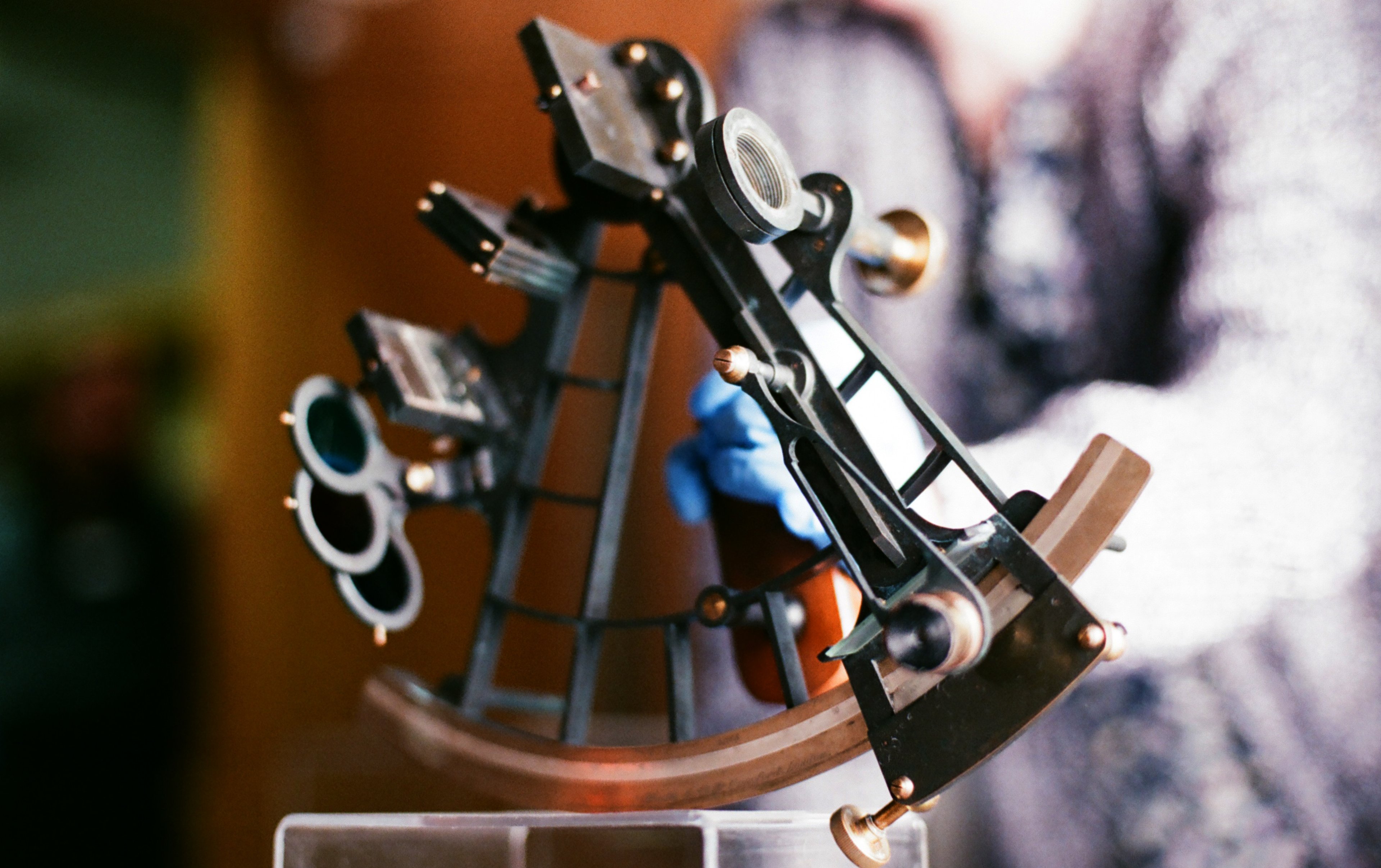
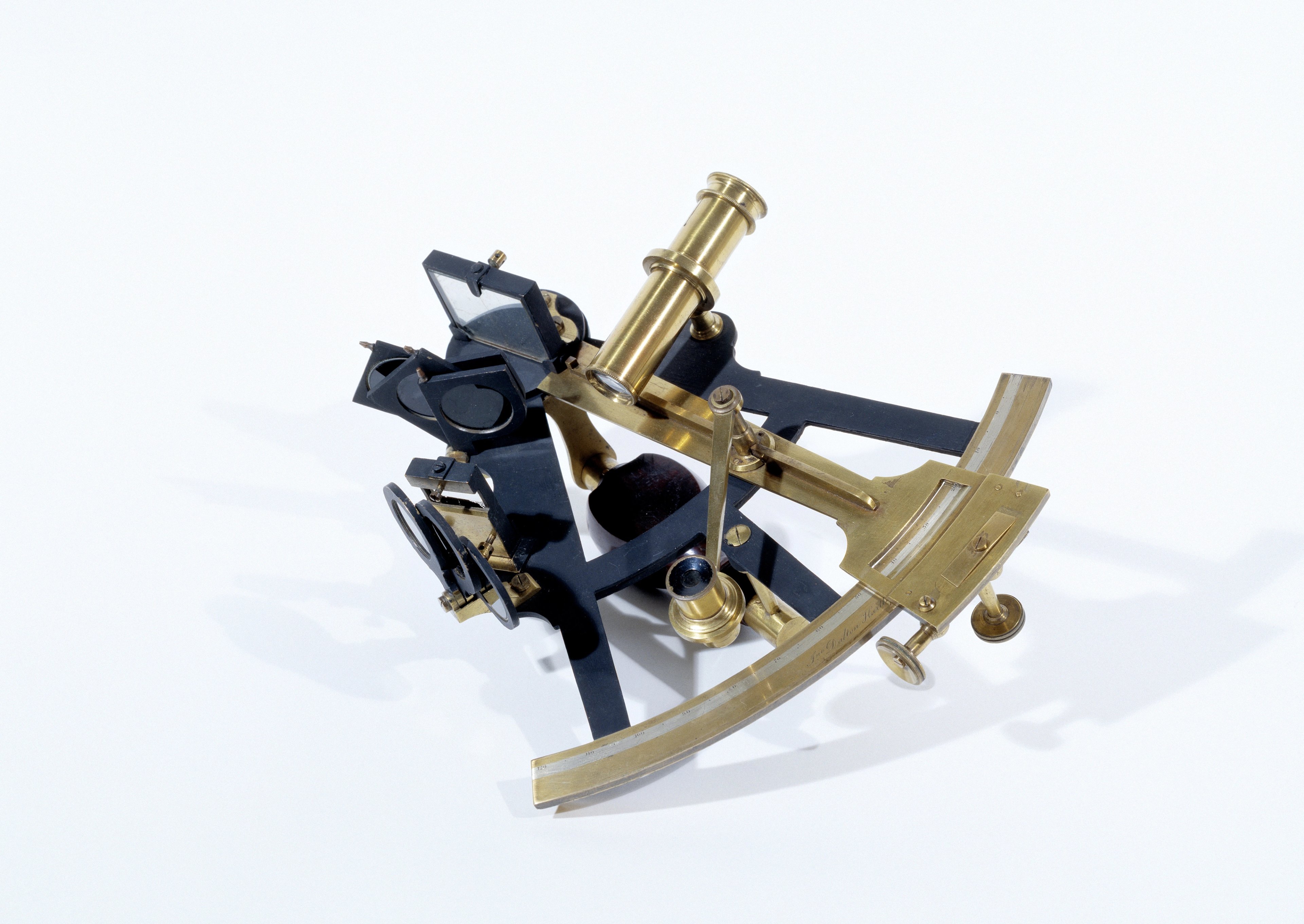
Sextants
A successor to the octant, there are a number of historic sextants featured in Kristina's work.

Much like an octant, a sextant allows the user to identify the angle between the horizon and a celestial body - such as a star, the Sun or the Moon - to assist in the determining of latitude and longitude. The name comes from the Latin sextus meaning 'one-sixth', as it has an arc spanning 60°, or one-sixth of a circle. These tools replaced octants around the mid- to late-18th century.
©Wai Wong
Several prominent figures from the annals of exploration have wielded some of the very sextants showcased in this work during their expeditions:
This close up by Kristina shows the Eight-Inch Sextant used by John Hanning Speke. It was manufactured by famous London-based instrument makers Troughton & Simms [RGS700659].
Speke (1827-1864) was a British East India Army officer and explorer who went on three major expeditions into the heart of Africa.
Oil painting of Speke by J. Watney Wilson. RGS700347 ©RGS-IBG
Speke, along with explorer Richard Burton (1821-1890) became some of the first Europeans to see Lake Nyanza in 1858. During this 'discovery', Speke solved the enduring mystery of the source of the River Nile. While this landmark find was disputed by his expedition partner Burton, he was awarded a Founder's Medal in 1861 by the RGS for his achievement and his geographical observations.
In this portrait of Speke - also held in the archives of the RGS - you can see this sextant depicted by his side.
In a curious turn of events, Speke died in an accident by his own gun on 15 September 1864. This was just one day before a scheduled live debate over the true source of the River Nile with Burton which was to be held at the British Science Association in Bath. You can find out more about Speke here.
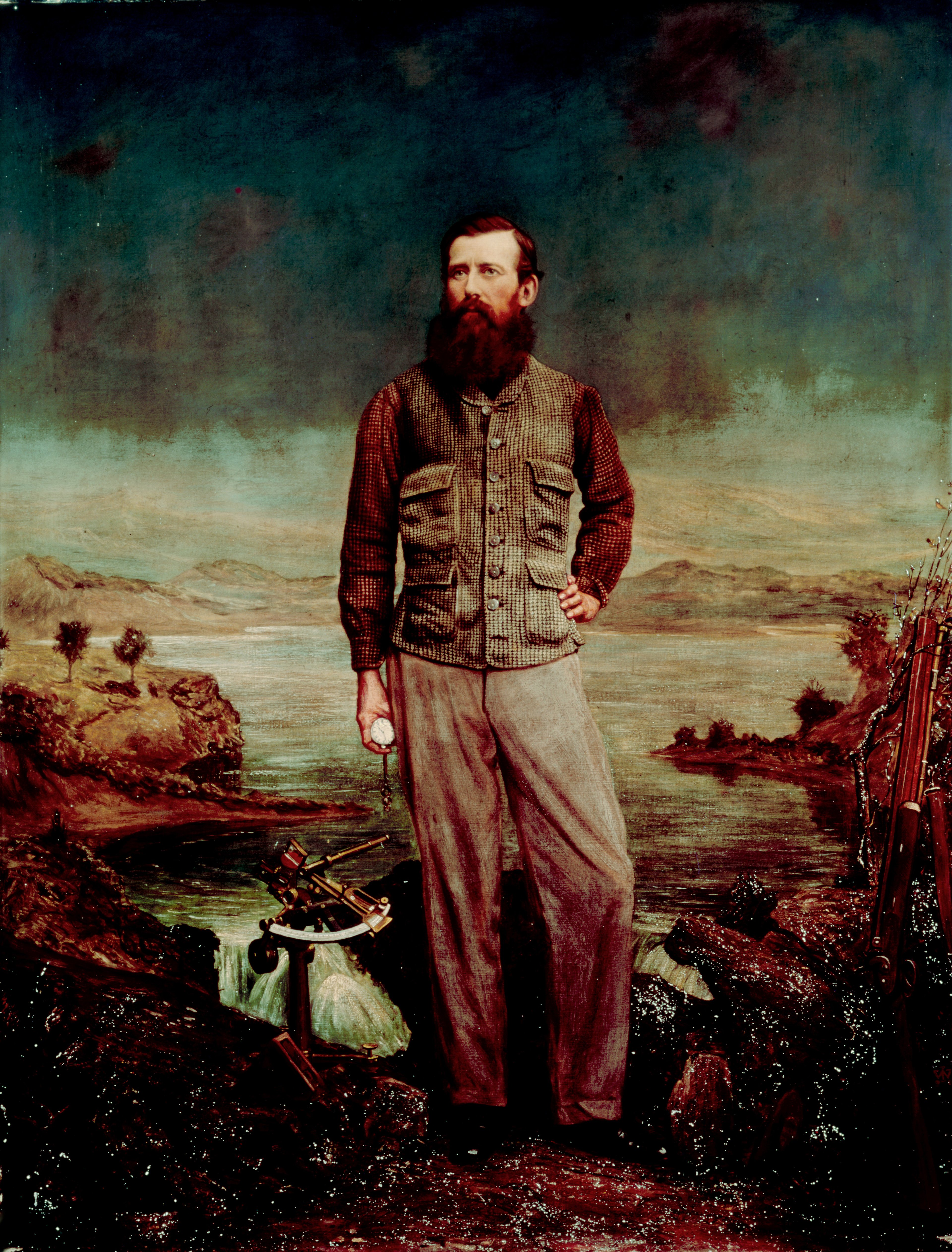
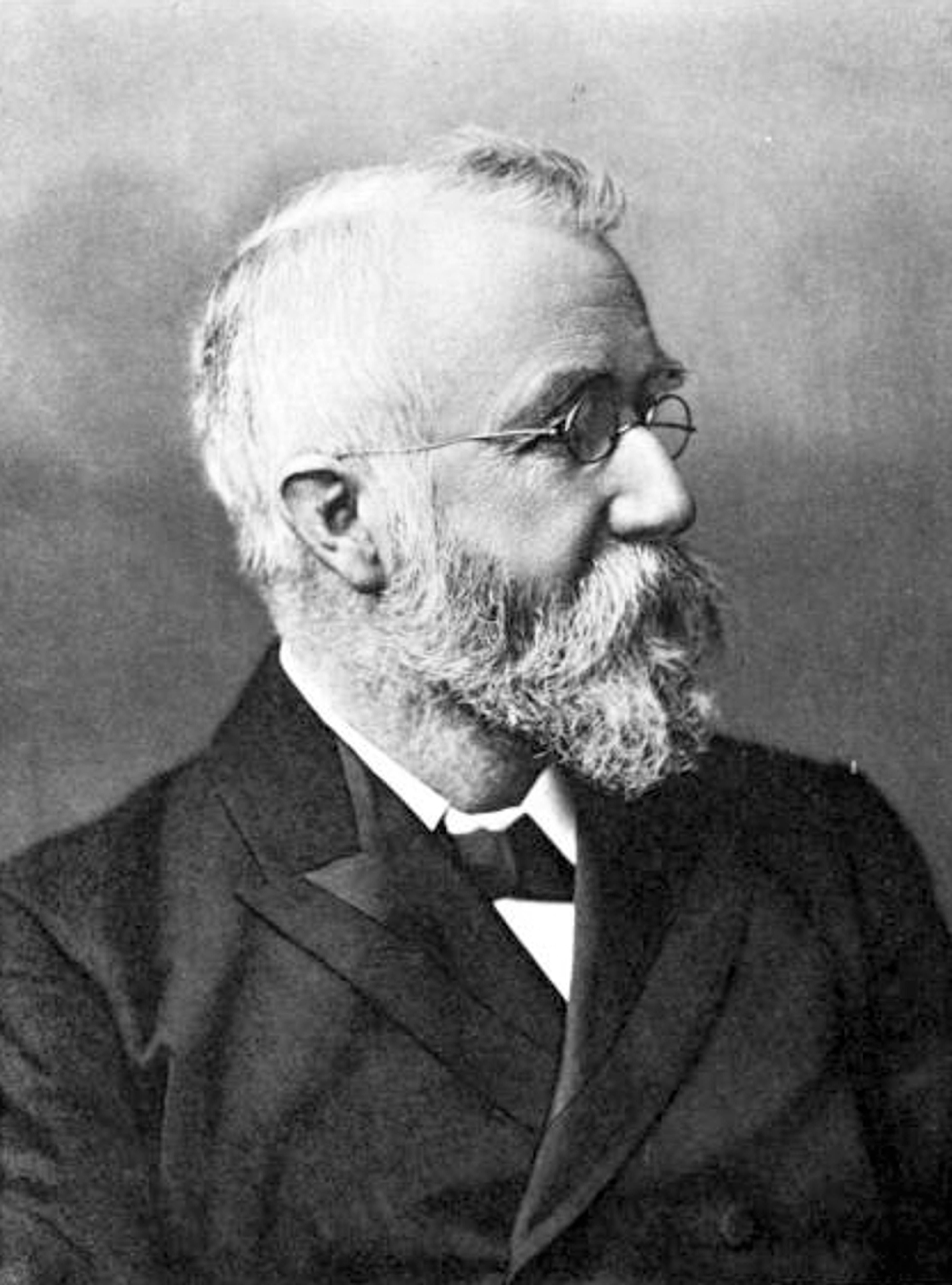
This eight-inch sextant accompanied the eminent Dr. David Livingstone during his final journey in Africa. It was made by chemist and instrument maker John Dalton in Hartlepool, circa This instrument is listed as RGS, No. 5 [RGS700706].
It's acquisition record reads: "It belonged to Dr Livingstone and was taken by Lieut. Cameron from the party who were bringing the Dr's body to Zanzibar; it was carried by Lieut. Cameron across Africa, used by him in taking his lunars and handed to the Society on his return to England".
Livingstone's sextant [S0000070] ©RGS-IBG
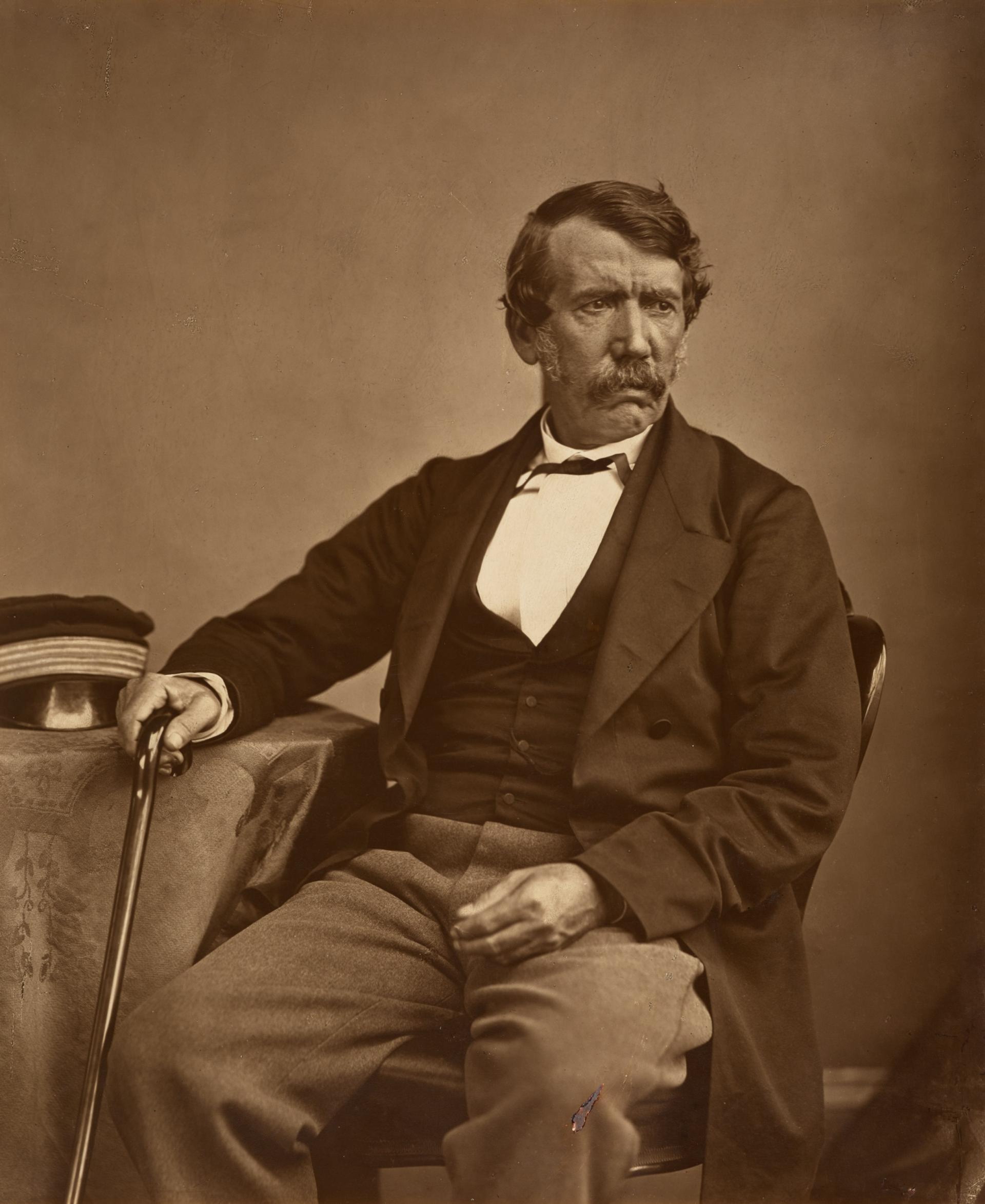
Livingstone (1813-1873) would gain a reputation as a dedicated Christian missionary and explorer, and - following his witness to the atrocities of the slave trade during his travels - a passionate antislavery advocate. This would become a keen focus of his latter expeditions.
His early journeys were spent in southern Africa: from 1841 he travelled between Cape Colony (modern Cape Town), the Orange Free State and Transvaal Republics (two independent Boer territories) and the Kalahari desert (modern-day Botswana). Livingstone would successfully go on to cross the southern part of Africa. Starting in Luanda, Angola on the Atlantic Coast in 1853, and arriving in Quelimane, on the Mozambique coast in 1856. For this achievement, the RGS awarded him a Gold Medal. During this expedition, in 1855, he encountered a spectacular waterfall on the Zambezi River, naming it ‘Victoria Falls’ in honour of the British Queen.
Photographic portrait of Dr Livingstone in 1864 by Thomas Annan. Public Domain, via Wikimedia Commons/National Galleries of Scotland
He went on to explore the Zambezi River (1858-1864), and later in 1866 would lead another expedition to explore central Africa to abolish the slave trade on the East coast. This expedition would introduce a new objective: to discover the source of the River Nile. While he never found the source of the Nile, Livingstone would instead ‘discover’ Lake Mwreu (1867).
In 1873, he died of dysentery in Old Chitambo (modern-day Zambia). His heart was removed, preserved and buried under a tree on the shore of Lake Bangweulu. His body was returned to England and buried at Westminster Abbey. A section of the Mpundu tree where his heart was buried is on display at the RGS. You can find out more here.
This six-inch Sextant was produced by Henry Hughes of London [RGS700646]. It belonged to another religious missionary and explorer, Reverend George Grenfell, during his time in the Congo.
Heavily influenced by the likes of David Livingstone, Grenfell (1849-1906) was an English Baptist missionary, who arrived in Cameroon in 1874.
George Grenfell. Public domain, via Wikimedia Commons
Grenfell moved from Cameroon to the Congo in 1878 to establish new mission stations, and spent his time working to abolish the slave trade in the region. Aboard a small steam vessel, he made exploratory journeys up the River Congo between 1884–87.
He was awarded the Founder’s Medal by the RGS in 1887 for his astute observations of the environment he encountered. It is likely he would have used this sextant during these journeys.
You can find out more about Grenfell here
This Box Sextant with Telescope was used by British diplomat Claudius James Rich (c1787-1821) during his travels in the West Asia and North Africa. [RGS233582].
In 1803, he became a military cadet in the British East India Company Army, first travelling to Constantinople and Smyrna in Turkey a year later. From a young age, he was a gifted linguist, and as well as modern European languages, he was fluent in Hebrew, Persian, Syriac, Latin and Greek. As he would travel, he would collect and become fluent in the local language. This talent granted him a writership and he was soon appointed assistant to the British Consul General in Alexandria.
He mastered both Turkish and Arabic, unlocking further opportunities to work and travel, and soon would venture to the Persian Gulf disguised as a Mamluk soldier, allowing him to visit holy cities such as Damascus as a Western man.
His expedition and study of the site of Babylon in 1811 is considered a pivotal moment in the European study of Mesopotamian archaeology. He regularly visited the locations of ancient Mesopotamian cities to study, collect manuscripts, and remove antiquities or fragments thereof. In 1825, his collection was purchased by the British Museum and became the foundation of Mesopotamian antiquarian studies in England.
He eventually died of cholera in Basra in 1821 and his posthumously published "Narrative of a Residence in Koordistan and on the site of Ancient Ninevah", based on his final journey in 1820.
Perhaps one of the most exciting histories to in the artwork series is the sextant carried by Charles Darwin during his voyage on the H.M.S. Beagle in 1831-1836. [RGS700695, S0025692, S0025693 ©RGS-IBG]
The inscription on its brass casing reads: "Charles Darwin's sextant. Taken on the voyage of H.M.S. Beagle and given by him in 1868 to his son Leonard Darwin, who presented it to the R.G.S. in 1912."
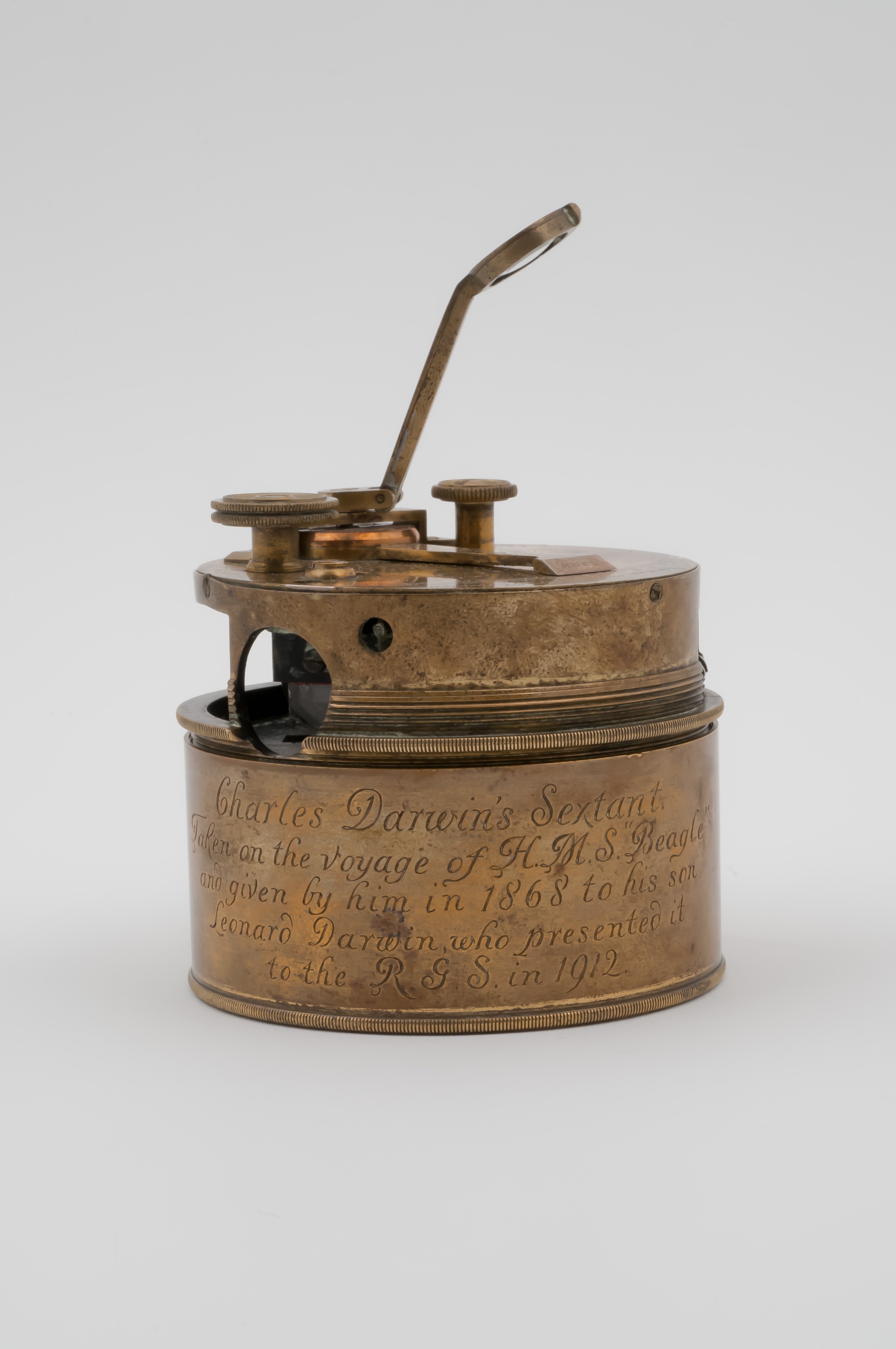
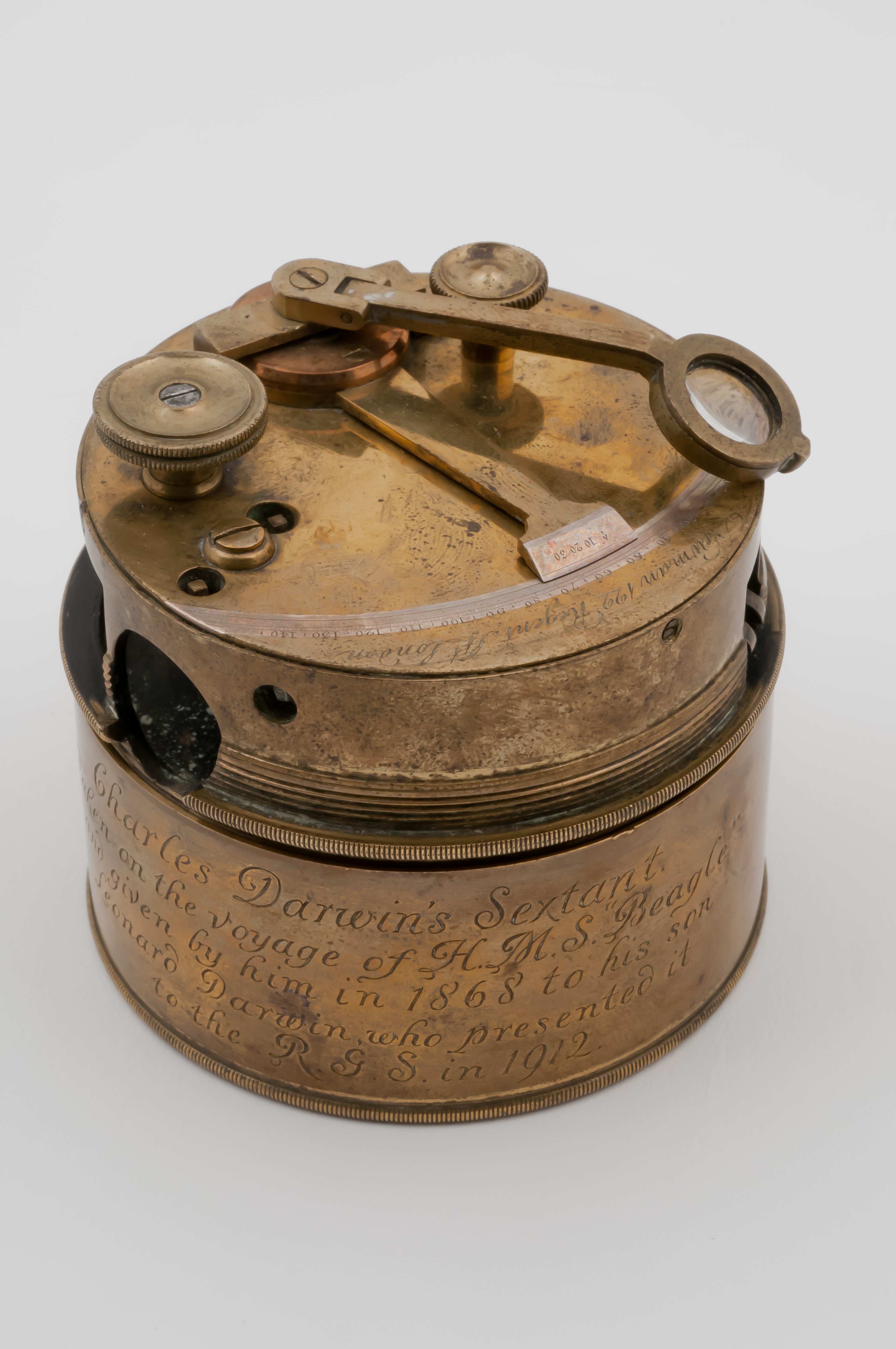
Darwin (1809-1882) is most famous for being the author of the fundamental work evolutionary biology, 'On the Origin of Species', (1859). It was his observations during his explorations of Atlantic and Pacific islands and on the east and west coasts of South America that laid the scientific foundation for this magnum opus. The voyage of the Beagle is largely thought of as an oceanic expedition, however, Darwin only spent around 18 months at sea and the majority of his time - more than 3 years - was spent exploring the land and recording his findings. This pocket sextant would have formed an integral part of that work.
You can find out more about Charles Darwin and his voyages to the Galapagos here.
Katie added “One of the instruments in the series is the sextant used by naturalist Charles Darwin on HMS Beagle - which is very exciting. That sextant was then given to his son, who then gave it to the RGS. His son was also the President of the British Eugenics Society. So there is a lot wrapped up in that object beyond Charles Darwin, and finches, and the Galapagos that can be accessed through the cloudiness that [Kristina] has decided to show or not show that object."
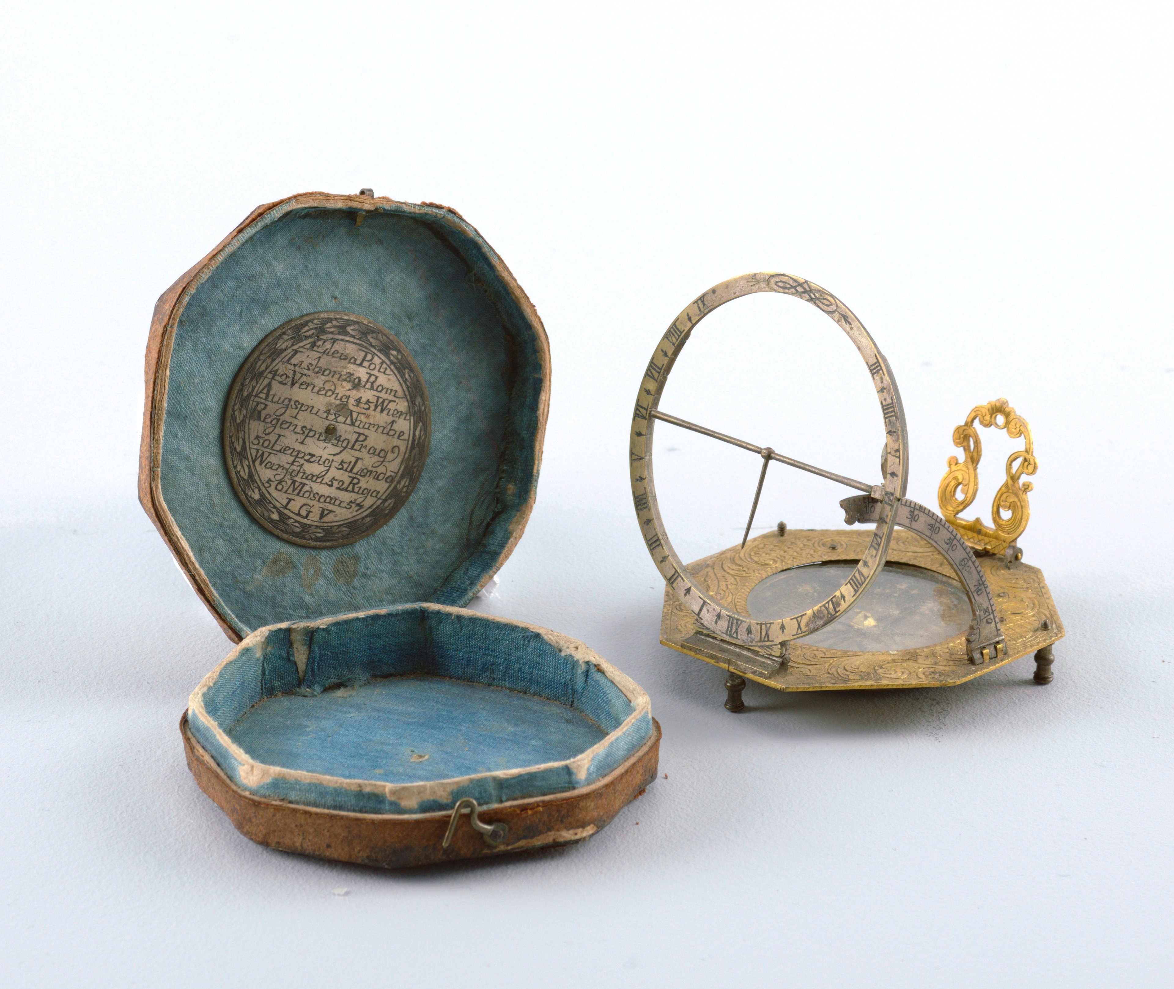
Sundial Compasses
Kristina's series also features two pocket sundial compasses. These instruments would have been used by explorers to tell the time anywhere in the world.
The user orients the whole object to magnetic north according to the inset compass. Some devices had a component to account for the time of year, which would need to be adjusted if it was present. The gnomon - the part of the sundial that casts the shadow to indicate time - is then set according to latitude using the sliding scale. Where the shadow of the gnomon falls on the hour markings on the dial indicates the time. Some portable compasses included adjustable feet for additional accuracy.
This is an example of an 18th century pocket sundial compass, hailing from the Cooper Hewitt Smithsonian Design Museum Collection:
©Cooper Hewitt Smithsonian Design Museum Collection, CC0
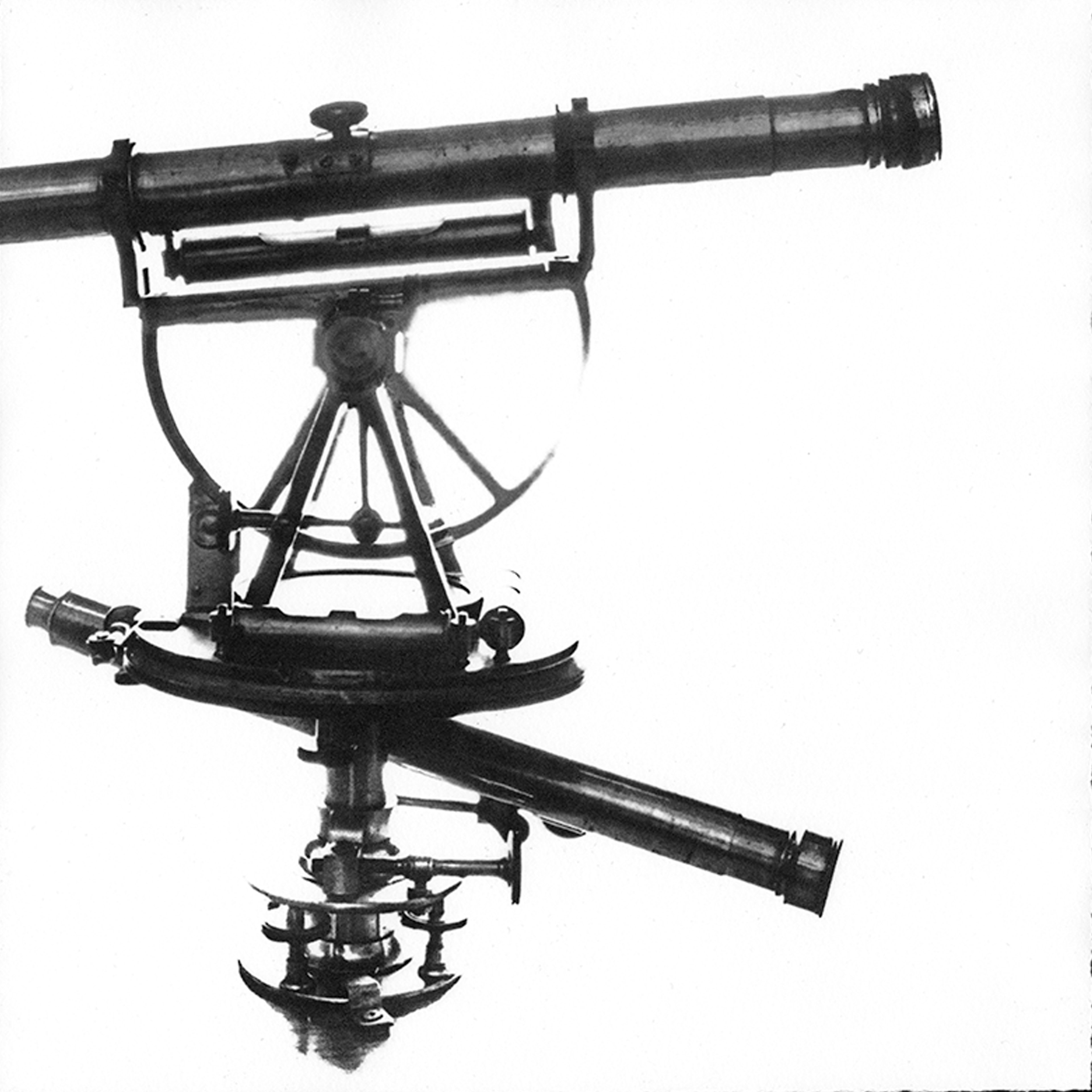
Theodolites
This is a 3-inch theodolite [RGS700617] from the RGS collection. It is an optical instrument used to capture precise angle measurements for triangulation in surveying and mapping. It consists of a mounted telescope that can be adjusted up and down, left and right on graduated circles to carefully measure both horizontal and vertical angles between two points, or planes. The device features a spirit level and inset compass for accurate positioning. Its practical size means that it is portable for use on expeditions.
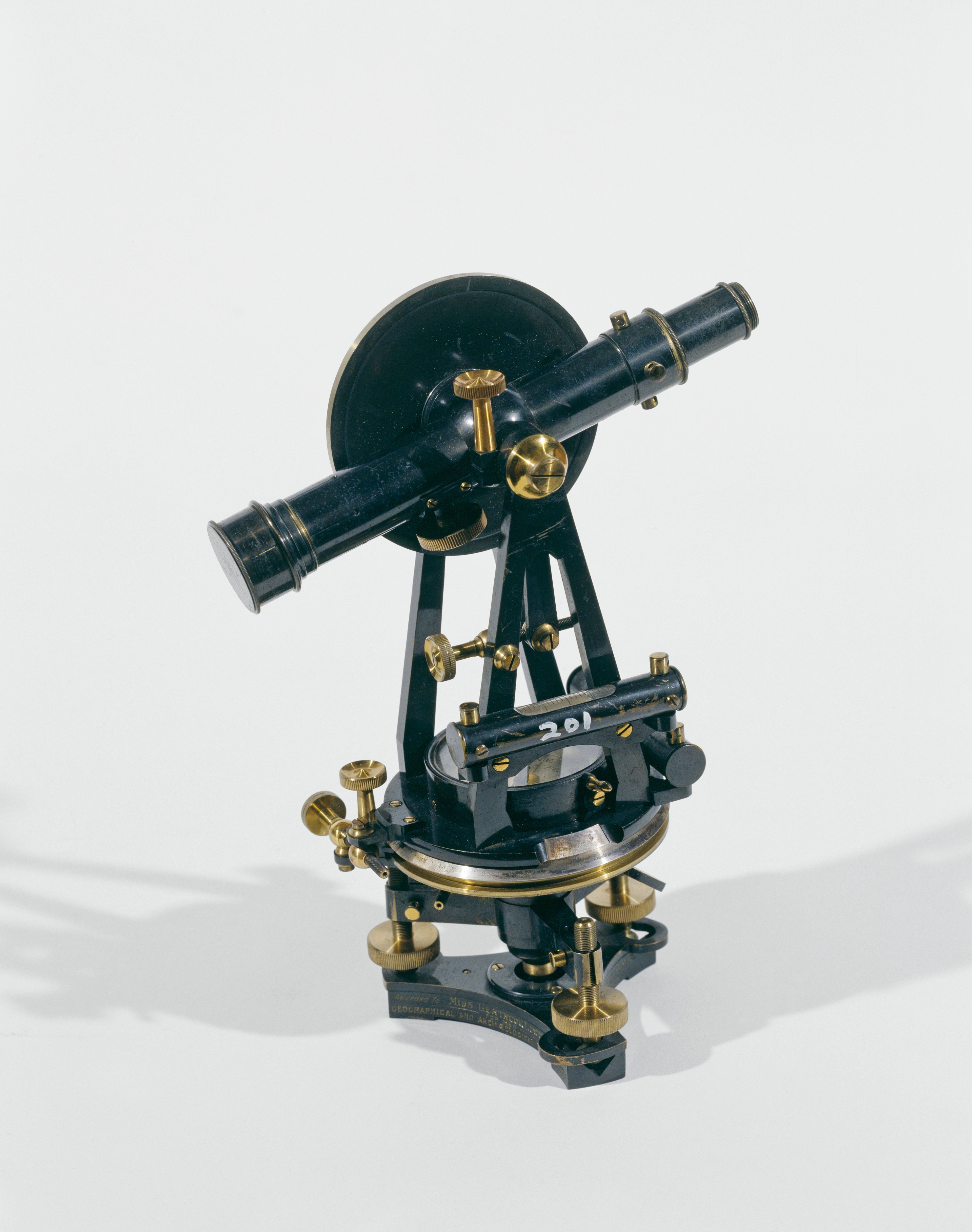
RGS700617 / S0015024 ©RGS-IBG
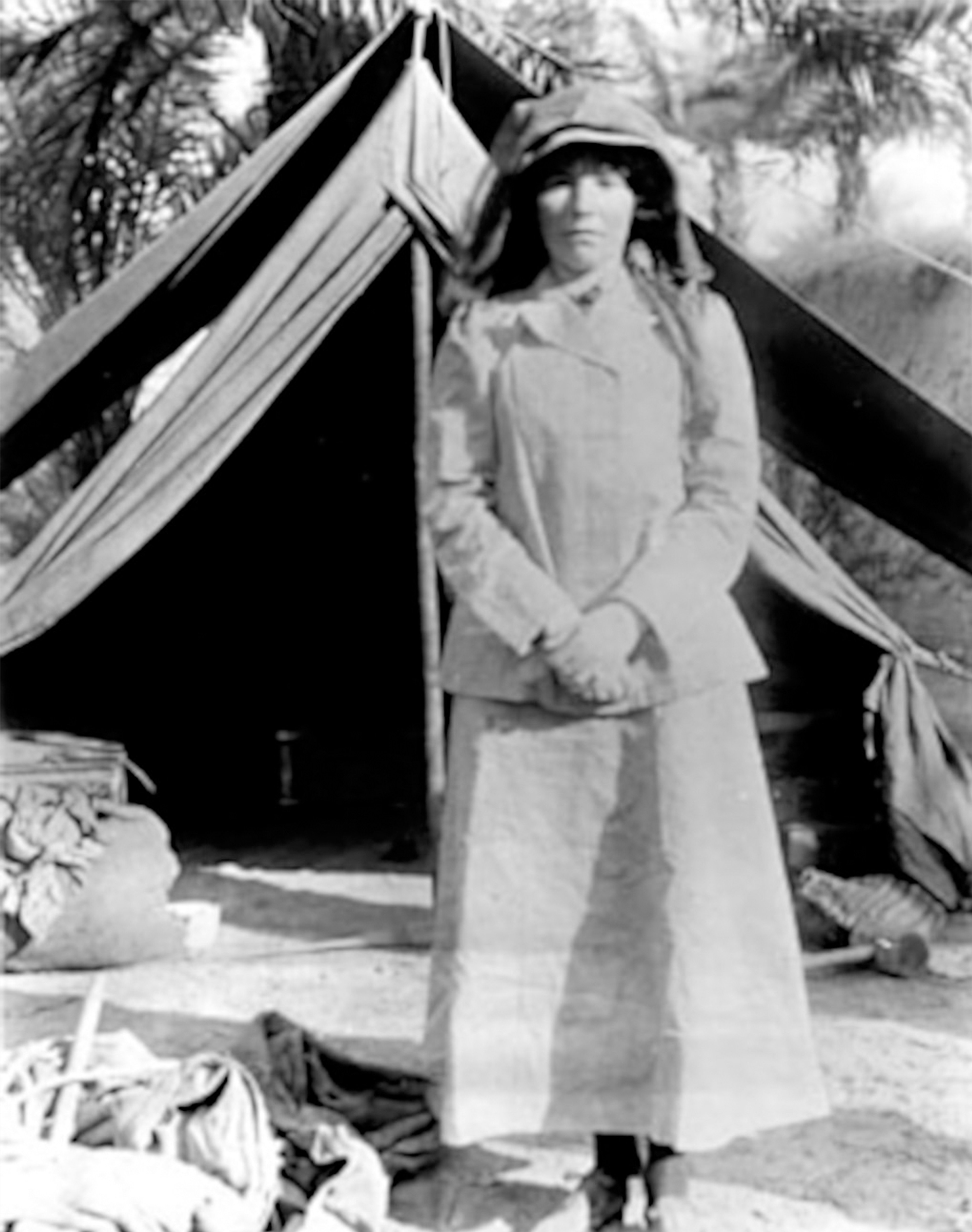
Bell, 1909 in Iraq. Public Domain, via Wiki Commons
Gertrude Bell (1868-1926) was a British archaeologist, explorer, historian, writer and political administrator. She was the first woman to graduate with a first-class pass in History at Oxford University in 1888 - the equivalent of a Modern History degree today.
As well as completing two around-the-world trips at the turn of the 20th century, she travelled extensively through West Asia and North Africa. Along the way she meticulously documented her journeys and archaeological findings in countries such as Syria, Turkey, and Mesopotamia (now modern-day Iraq). In 1913-14 she undertook an extraordinary journey into uncharted Arabia, visiting the capital of Hail, Shammar and returning across the Syrian desert to Damascus.
Her extensive knowledge on these regions attracted the attention of the British Government during the First World War and she was employed as a political officer at the Arab Intelligence Bureau in Cairo alongside T. E. Lawrence - also known as ‘Lawrence of Arabia’. She would later go on to establish the Iraq Museum. You can find out more about Bell here.
As Dr. Parker explains “Gertrude Bell is celebrated as an intrepid female explorer, while also being very criticized by many imperial historians - many from the modern Middle East - for the establishment of the archaeological practice in Iraq which has resulted in the denuding of a lot of archaeological objects.”
Another theodolite featured in Impossible Measures was owned by Field-Marshal Horatio Herbert Kitchener. Prior to his appointment as 1st Earl Kitchener, he served in the Royal Engineers in West Africa and East Asia. He was an important figure in the surveying of western Palestine (1871-1877), and carried out the first full triangulated survey of the island of Cyprus just as the country fell under British control in 1878.
He used this theodolite [RGS700881] made by Cox of London during his survey of Cyprus.
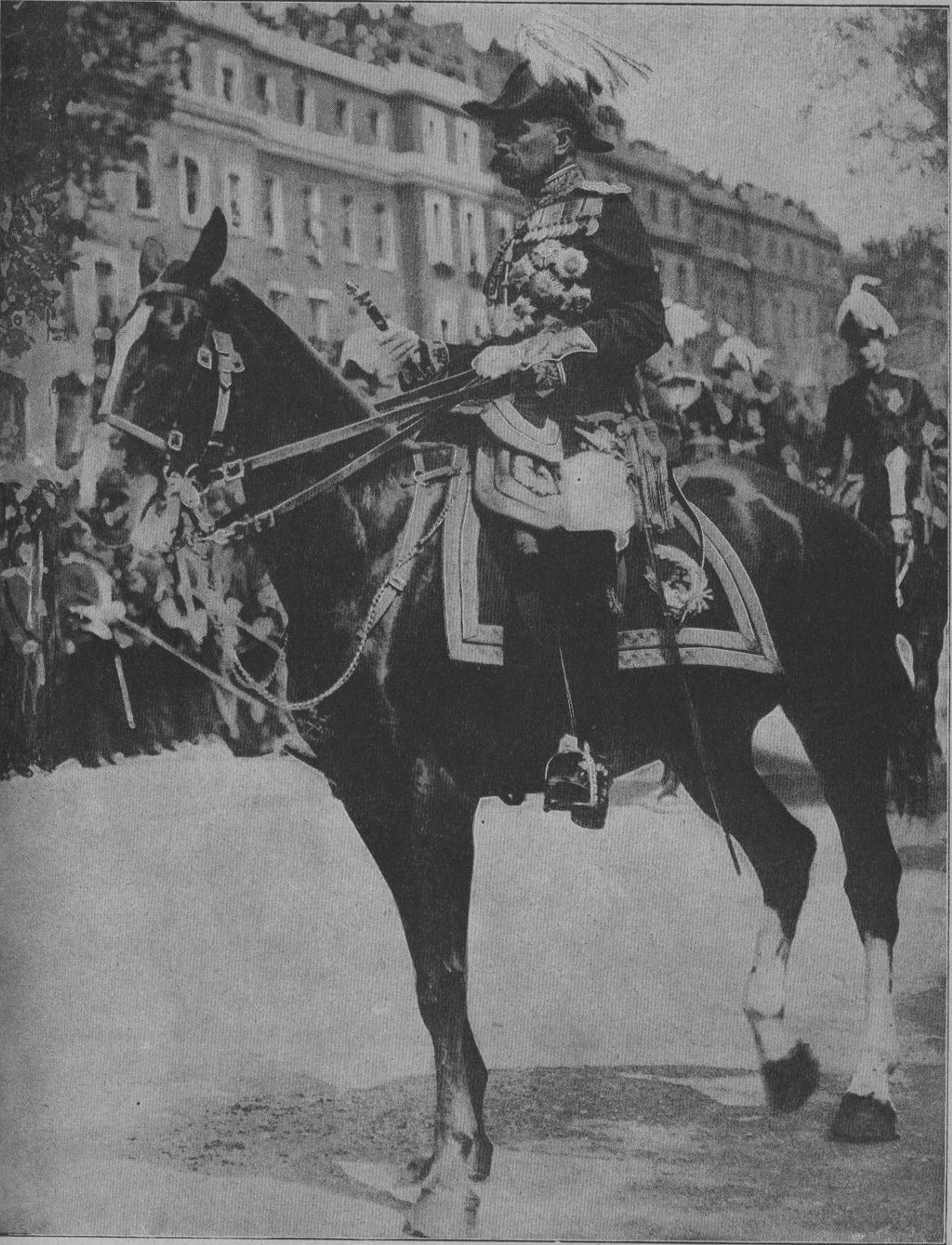
Portrait of Field-Marshal Kitchener, 1914. Public domain, via Wikimedia Commons. CC0
Kitchener (1850-1916) was a British Field Marshal and imperial administrator. He served as Commander in Chief during the Second Boer War (1899-1902), and Secretary of State for War at the start of the First World War (1914-1918). His image was famously used in a recruitment campaign advertising poster designed by Alfred Leete - “Lord Kitchener Wants You” - in 1914, which encouraged thousands of volunteers to enlist in the British Army.
Kitchener is a popular British military leader who led many important international campaigns. However in recent history he has been heavily criticised for his role in implementing brutal strategies - particularly during the Anglo-Boer War - that would be classified as war crimes by contemporary standards.
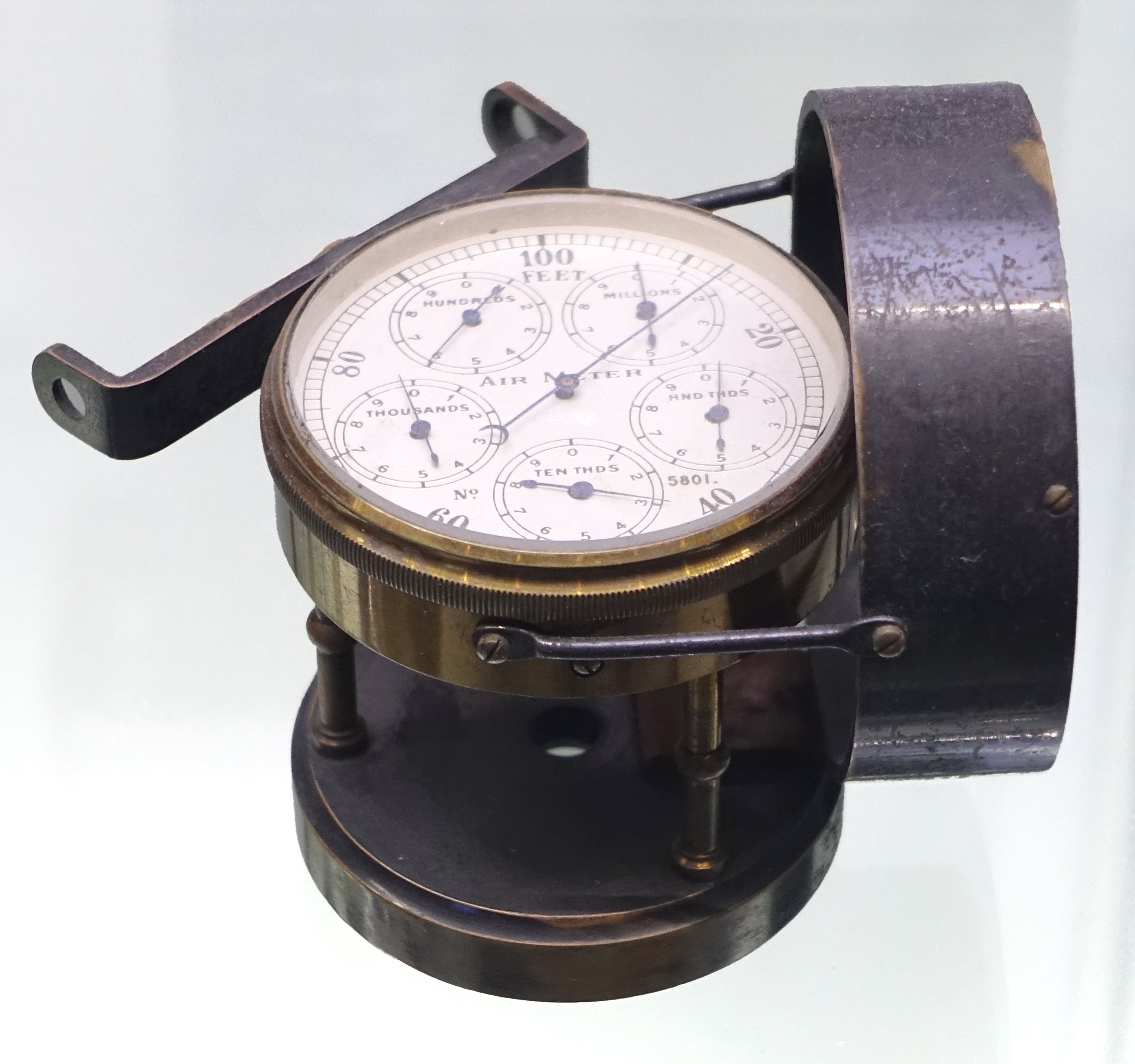
and finally, an Anemometer
An anemometer is a device to measure the wind speeds and wind pressure. It was invented by Italian architect Leon Battista Alberti in 1450. The name anemometer is derived from the Greek word anemos, meaning 'wind'.
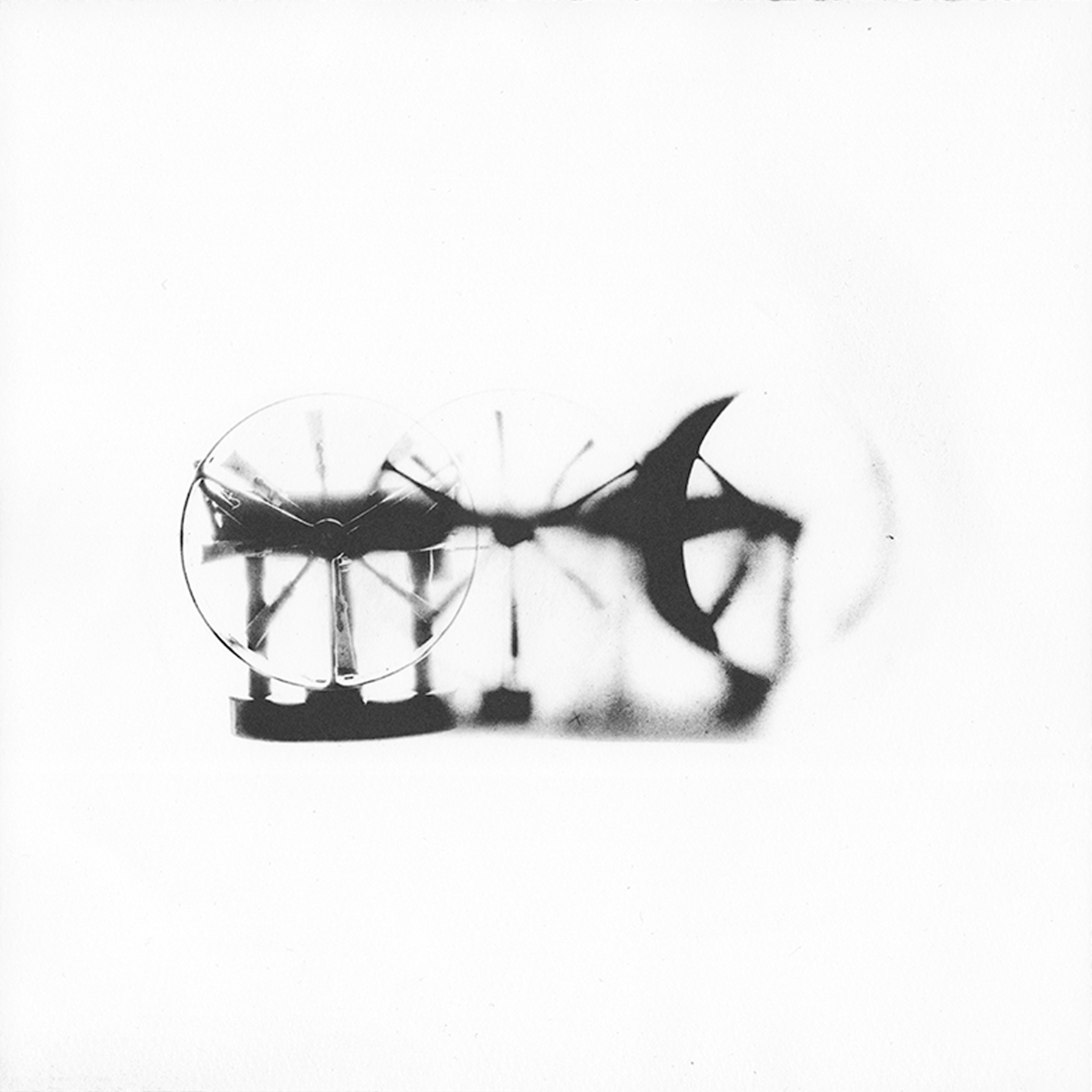
The example in the RGS collection [RGS243997] was produced in June 1880 by London-based instrument maker William Carey who also made surveying equipment, mechanical calculators, telescopes and microscopes. It works when it is placed perpendicular to the wind direction, the wind spins the flat turbine plates, and the angle of inclination of plates and the speed of the spinning disk momentarily reveals the winds’ speed and pressure.
©Wai Wong
©Museum of Science and Industry, Chicago. CC0, via Wiki Commons
Katie has said of the collaboration for this series:
I really appreciate that we can continue to tell a breadth of stories through [Kristina’s] art, which then gets us to the object, which themselves have a lot of these stories. So I appreciated the degree to which you’re allowing heritage professionals to continue to nuance these things by way of the processes you have used that can be brought up by people accessing [Kristina’s] art, and that’s something I’m very grateful for having participated in this process.
Explore the full body of work for Habitable Climes in an immersive online exhibition here.
For a list of works, enquiries and acquisitions, please email arts@sunderland-collection.com
©Wai Wong
Acknowledgements
Founder of The Sunderland Collection, Dr. Neil V. Sunderland FRGS, and Director Helen Sunderland-Cohen FRGS, together with The Sunderland Collection Art Programme, would like to extend their heartfelt thanks to the RGS for its support and enthusiasm.
A special thank you to Dr. Katie Parker for her participation and insight in facilitating access and study of these extraordinary instruments.
You can explore the RGS' wonderful resources, research, upcoming events, and collections at RGS.org.

